East London, South Africa

Last updated

East London
East London, Eastern Cape, South Africa (20323340150).jpg
East London, looking toward the sea
South Africa Eastern Cape location map.svg
Red pog.svg
East London
South Africa adm location map.svg
Red pog.svg
East London
Africa location map.svg
Red pog.svg
East London
Coordinates: 33°01′03″S27°54′17″E / 33.01750°S 27.90472°E / -33.01750; 27.90472
Country Flag of South Africa.svg  South Africa
Province Flag of the Eastern Cape Province.png  Eastern Cape
Municipality Buffalo City
Established1847;177 years ago (1847) [1]
Area
[2]
   City 168.86 km2 (65.20 sq mi)
  Metro
2,536 km2 (979 sq mi)
Population
 (2011) [2]
   City 267,007
  Density1,600/km2 (4,100/sq mi)
   Metro
755,200
  Metro density300/km2 (770/sq mi)
Racial makeup (2011)
[2]
   Black African 70.1%
   Coloured 11.6%
   Indian/Asian 1.8%
   White 16.0%
  Other0.5%
First languages (2011)
[2]
   Xhosa 61.8%
   English 21.2%
   Afrikaans 13.3%
  Other3.8%
Time zone UTC+2 (SAST)
Postal code (street)
5200
PO box
5201–5499
Area code 043

East London (Xhosa : eMonti; Afrikaans : Oos-Londen) is a city on the southeastern coast of South Africa, [3] in the Buffalo City Metropolitan Municipality, Eastern Cape Province. The city lies on the Indian Ocean coast, largely between the Buffalo River and the Nahoon River, and hosts the country's only river port. As of 2011, East London had a population of over 267,000 with over 755,000 in the surrounding metropolitan area. [4]

Contents

History

Early history

John Bailie, one of the 1820 Settlers, surveyed the Buffalo River mouth and founded the town in 1836. There is a memorial on Signal Hill commemorating the event. [5] The city formed around the only river port in South Africa and was originally known as Port Rex. Later it was renamed London in honour of the capital city of the United Kingdom, hence the name East London. This settlement on the West Bank was the nucleus of the town of East London, which was elevated to city status in 1914.[ citation needed ]

During the early to mid-19th century frontier wars between the British settlers and the local Xhosa inhabitants, East London served as a supply port to service the military headquarters[ citation needed ] at nearby King William's Town, about 50 km (31 mi) away. A British fort, Fort Glamorgan, was built on the West Bank in 1847, and annexed to the Cape Colony that same year. This fort is one of a series of British-built forts, including Fort Murray, Fort White, Fort Cox, Fort Hare, Fort Jackson and Fort Beaufort, in the border area that became known as British Kaffraria.

With later development of the port came the settlement of permanent residents, including German settlers, most of whom were bachelors. These settlers were responsible for German names of some towns in the vicinity of East London such as Stutterheim and Berlin. Today, German surnames such as Gehring, Salzwedel and Peinke are still common in East London, but the descendants of the settlers rapidly became Anglicised.[ citation needed ]

The existing port, in the mouth of the Buffalo River, adjoining the Indian Ocean, began operating in 1870. [6] [7] In 1872, the Cape Colony, under the leadership of its first Prime Minister John Molteno, attained a degree of independence from Britain. The new government merged the three neighbouring settlements of East London, East London East and Panmure in 1873, forming the core of the current municipality, and in 1876 it began construction on the region's railway lines, commencing on the river's east bank. At the same time, it began construction of the East London harbour. This new infrastructure rapidly accelerated development of the area into today's thriving city of East London. [8] [9]

East London City Hall on Oxford Street City Hall Oxford Street.jpg
East London City Hall on Oxford Street

The unusual double-decker bridge over the Buffalo River was completed in 1935, and to this day is the only bridge of its type in South Africa. Modern day attractions include the Gately House, City Hall, Cape Railways, Nahoon Museum, East London Museum housing the coelacanth, a prehistoric fish, thought to be extinct, discovered live at the Chalumna River mouth near East London by fishermen in 1938, [10] and numerous memorial statues.

Apartheid era

In 1948, the National Party came to power in South Africa, and began to implement the policy of apartheid. Apartheid as a doctrine envisaged the total segregation of races in South Africa, and East London was no different. In 1950, the Group Areas Act was placed upon the statute books making absolute segregation in all urban areas mandatory. In 1951, the Land Tenure Advisory Board, the body created to enforce the act, conducted initial investigations into the reallocation of space along racial lines in East London. Residential segregation had long been practised in East London prior to the advent of apartheid. In 1941, the East London Municipality moved residents from East Bank townships to the newly built township of Duncan Village. [11]

In 1951, all inter-racial property exchanges were prohibited in East London. In 1955, the Amalinda area was zoned as a White Group Area by Government Gazette Proclamation number 21. This meant that the municipality's plans to extend the area in order to accommodate the Black African population were abandoned. [11] In 1953, residents in the East Bank were forcibly moved to the new township of Mdantsane. [12] In February 1966, the South African government defined Mdantsane as a separate homeland township. In 1956, Prime Minister Henrik Verwoerd, who was the architect of apartheid, forbade the East London municipality from extending the existing Duncan Village township and sanctioned the building of Mdantsane. [11]

In 1961, these plans provided for the allocation of a distinct wedge of the city for Asian and Coloured residence, which "incorporated the areas of North End and the recently proclaimed Buffalo Flats location. This plan occasioned tremendous resentment in the city prompting petitions and letters of complaint from numerous organisations including the Black Sash, trade unions and various Black community groups. In 1967, the East London Municipality proclaimed the majority of the city an area for White occupancy, with the exception of a broad sector of land encompassing the Parkside, Parkridge and Buffalo Flats areas which was zoned for Coloured residence. Certain parts of Duncan Village were abolished and its African residents removed, new coloured and Asian locations were built and proclaimed upon land in 1973. In the same year, the newly constructed location of Braelynn was proclaimed an Indian area while Buffalo Flats Extension and Pefferville were proclaimed as Coloured areas. The construction/ extension of Coloured areas and the Duncan Village were suspended in 1983. [11]

Post-apartheid

At the end of apartheid in 1994, East London became part of the province of Eastern Cape. In 2000, East London became part of Buffalo City Metropolitan Municipality, also consisting of Qonce, Bhisho and Mdantsane and is the seat of the Metro.

Geography and climate

East London
Climate chart (explanation)
J
F
M
A
M
J
J
A
S
O
N
D
 
 
69
 
 
26
18
 
 
92
 
 
26
19
 
 
105
 
 
25
18
 
 
83
 
 
24
15
 
 
52
 
 
23
13
 
 
40
 
 
21
11
 
 
47
 
 
21
10
 
 
78
 
 
21
11
 
 
80
 
 
21
12
 
 
102
 
 
22
14
 
 
110
 
 
23
16
 
 
63
 
 
25
17
Average max. and min. temperatures in °C
Precipitation totals in mm
Source: SAWS [13]
Imperial conversion
JFMAMJJASOND
 
 
2.7
 
 
79
64
 
 
3.6
 
 
79
66
 
 
4.1
 
 
77
64
 
 
3.3
 
 
75
59
 
 
2
 
 
73
55
 
 
1.6
 
 
70
52
 
 
1.9
 
 
70
50
 
 
3.1
 
 
70
52
 
 
3.1
 
 
70
54
 
 
4
 
 
72
57
 
 
4.3
 
 
73
61
 
 
2.5
 
 
77
63
Average max. and min. temperatures in °F
Precipitation totals in inches

East London has an oceanic climate (Köppen Cfb), bordering on a humid subtropical climate (Köppen Cfa), with the warm temperatures and moderation typical of the South African coastline. Although it has no true dry season, there is a drying trend in the winter, with the wettest times of year being spring and autumn. There is also a shorter and lesser dry period in December and January.

The all-time record low is 3 °C (37.4 °F), and the all-time record high is 44 °C (111.2 °F) on 13 March 2021. [14] The hottest temperatures have been recorded in springtime and autumn, rather than the summer months, due to violent berg (foehn) winds. Temperatures above 38 °C (100 °F) have only been recorded early in the season, from August to December. Berg winds contribute to these high temperatures, as already warm air from the arid interior is further heated through compression as it drops over the escarpment to sea level. Although temperatures have never dropped below freezing since records began, East London has recorded snowfall in 1985 and 1989. [15]

Climate data for East London (1991–2020, extremes 1939–1990)
MonthJanFebMarAprMayJunJulAugSepOctNovDecYear
Record high °C (°F)36.4
(97.5)
42.6
(108.7)
44.0
(111.2)
35.9
(96.6)
37.0
(98.6)
32.8
(91.0)
34.3
(93.7)
37.5
(99.5)
41.7
(107.1)
40.9
(105.6)
40.3
(104.5)
38.2
(100.8)
44.0
(111.2)
Mean daily maximum °C (°F)25.9
(78.6)
26.3
(79.3)
25.5
(77.9)
24.0
(75.2)
23.2
(73.8)
21.9
(71.4)
21.5
(70.7)
21.6
(70.9)
21.6
(70.9)
22.4
(72.3)
23.4
(74.1)
24.7
(76.5)
23.5
(74.3)
Daily mean °C (°F)22.1
(71.8)
22.5
(72.5)
21.5
(70.7)
19.6
(67.3)
18.0
(64.4)
16.3
(61.3)
15.9
(60.6)
16.3
(61.3)
17.0
(62.6)
18.2
(64.8)
19.4
(66.9)
21.0
(69.8)
19.0
(66.2)
Mean daily minimum °C (°F)18.3
(64.9)
18.7
(65.7)
17.5
(63.5)
15.1
(59.2)
12.8
(55.0)
10.7
(51.3)
10.2
(50.4)
11.0
(51.8)
12.3
(54.1)
14.0
(57.2)
15.3
(59.5)
17.2
(63.0)
14.4
(57.9)
Record low °C (°F)9.0
(48.2)
11.0
(51.8)
10.3
(50.5)
7.2
(45.0)
4.4
(39.9)
2.6
(36.7)
1.8
(35.2)
3.1
(37.6)
5.0
(41.0)
5.9
(42.6)
8.5
(47.3)
8.4
(47.1)
1.8
(35.2)
Average precipitation mm (inches)89
(3.5)
72
(2.8)
93
(3.7)
89
(3.5)
39
(1.5)
32
(1.3)
42
(1.7)
55
(2.2)
56
(2.2)
81
(3.2)
98
(3.9)
76
(3.0)
822
(32.4)
Average precipitation days (≥ 1.0 mm)9.08.28.27.43.62.93.35.05.38.18.99.079
Average relative humidity (%)80828278726667717778808076
Mean monthly sunshine hours 221.3203.8212.6210.1224.9223.5229.3238.3221.3211.5211.8214.42,622.8
Source 1: NOAA (humidity 1961-1990), [16] [17] Deutscher Wetterdienst (extremes) [18]
Source 2: South African Weather Service [13] [19]

Demographics

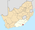
East London is the second-largest city in the Eastern Cape with a population of 474,000 as of 2016. English is the first spoken language in the city and Xhosa is the second language spoken.

GenderPopulation
Male140,505
Female155,400
RacePopulation
Black African 211,581
White 42,780
Coloured 35,090
Asian 4,732
Other groups1,632
LanguagesPopulation
Zulu 1,663
Xhosa 179,600
English 54,504
Afrikaans 34,742
Northern Sotho 558
Tswana 618
Sotho 1,234
Tsonga 379
Venda 168
Ndebele 869
Sign Language 1,680
Other languages3,200

Economy

King Phalo Airport East London Airport, South Africa.jpg
King Phalo Airport

East London is the second largest industrial centre in the province. The motor industry is the dominant employer. A major Daimler plant is located next to the harbour, manufacturing Mercedes-Benz and other vehicles for the local market, as well as exporting to the United States and Brazil. Other industries include clothing, textiles, pharmaceuticals and food processing. [20]

The period of international sanctions that followed in the 1980s damaged the economy of East London's harbour. Enormous investment in recent years, by corporations such as Daimler AG, has resulted in the harbour being developed to include a new car terminal.

From the 1960s until the 1990s, the apartheid government created tax and wage incentives to attract industries to the then black "independent states", including nearby Ciskei. Investment thus flowed into surrounding areas such as Fort Jackson and Dimbaza, leaving East London in relative isolation. Transport infrastructure deteriorated and port activity wound down.[ citation needed ]

East London International Convention Centre East London ICC (13402094144).jpg
East London International Convention Centre

To encourage investment in East London, the East London Industrial Development Zone (IDZ) was established on the West Bank in 2004, close to both the port and airport. 1500ha of land has been made available, and the site is one of four duty-free development areas in South Africa. [21]

Suburbs

Sports

Cricket is popular around East London. A combined Border/Eastern Province cricket side known as the Warriors take part in the top provincial competition. Former Proteas wicketkeeper Mark Boucher who as of July 2023 holds the Test record for most dismissals by a wicketkeeper [22] hails from East London. Buffalo Park Stadium in East London hosted a match during the ICC Cricket World Cup in 2003 and two matches of the 2009 Indian Premier League.

The Buffalo Road Running Club of East London has created two established events that have gained international recognition. They are the Old Mutual Buffalo 42,2 km marathon, which is held in February/March each year, and South Africa's oldest 160 km extreme ultra marathon, the Washie, over a picturesque and undulating coastal route from Port Alfred to the city.

Triathlon is a popular sport and in particular hosted the a world-famous Ironman 70.3 South African event which took place annually in January from 2012 to 2021. [23] Ironman 70.3 events follow a race format which consists of a 1.9 km swim, 90 km of cycling and a 21.1 km road run. The event started and finished at the Orient Beach in East London. In November 2021, the Buffalo City Ironman 70.3 event was cancelled in favour of the new Mossel Bay Ironman 70.3 event. [24]

Rugby is popular in East London. The provincial team, the Border Bulldogs, currently plays in the First Division of the Currie Cup competition. Most national games in East London are played at the Buffalo City Stadium, which holds around 15000 people and was a host stadium during the 1995 Rugby World Cup. East London schools have produced many fine rugby players, including (in recent times) André Vos, Keith and Mark Andrews, Christiaan Scholtz, Brent Russell, Rory Kockott, Akona Ndungane and Odwa Ndungane.

Football is also very popular in the city. East London was home to the Blackburn Rovers, prior to its sudden dissolution in 2014.

Motocross is also popular and many national events are held in the area surrounding East London, due to the challenging terrain there and in Transkei. East London is home to the ELMCC (East London Motor Cycle Club), which organises most of the motorcycle events in the area.

East London is home to the Prince George Race Circuit, opened in 1959 (renamed East London Grand Prix Circuit), a historic motor racing track that hosted three Formula One South African Grand Prix during the 1930s and 1960s. The circuit is run and managed by Border Motor Sport Club on a shoestring budget. South Africa's only Formula One World Drivers' Champion, Jody Scheckter, started his motor racing career with a Renault Gordini on this track.

Golf is another favoured pastime in and around East London. East London Golf Club is a highly regarded championship golf course and is currently ranked No 12 in Golf Digest's Top 100 courses. Some of the other golf clubs in the region are the West Bank Golf Club, Gonubie Golf Club, Olivewood Golf Estate and Fish River Sun Country Club (a Gary Player-designed golf course). East London has also hosted the Africa Open tournament multiple times. Golfers can also hone their skills at the East London Golf Club Driving Range.

Rowing is on the Buffalo River. The annual Buffalo Regatta began in 1881 and has become the largest in South Africa: in 2018 there were 1000 competitors participating in 200 events over three days. [25]

Surfski is ideally suited to East London. The Port Elizabeth to East London Challenge organized by East London's Border Canoe club is 244 km long, often in extremely challenging conditions, [26] takes place every second year, attracting competitors from around the world. It began in 1972 [27] to see who was faster, ultra-distance runner John Ball over land, or surf lifesaver John Woods over water. John Ball won.

East London Esplanade East london beach1.jpg
East London Esplanade

Surfing is popular in East London. It is home to some of South Africa's top surfers, including Greg Emslie, former World Championship Tour surfer, ISA World Masters Champion, five-time South African Men’s Champion [28] and coach to Olympic silver medalist Bianca Buitendag, [29] Andre Malherbe, [30] and up-and-comer Zoe Steyn. [31] Nahoon Reef, located in the suburb of Nahoon is a famous South African surf spot and is the site of the annual Nahoon Surf Pro [32] (formerly Buffalo City Surf Pro). The city has also hosted the South African Surfing Championships on numerous occasions [33] and even the ISA World Surfing Championship. [34]

Education

Secondary education

Tertiary education

There are also a few private colleges.

Points of interest

Other points of interest include:

Transport

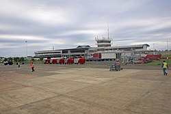
East London is serviced by two national roads: the coastal N2 highway connects it to Qonce, Makhanda, Gqeberha and Cape Town to the west and Mthatha and Durban to the east. It is the southern end of the N6, which runs north via Komani and Aliwal North to Bloemfontein. Older sections of the N2 have been renumbered the R102. The R72 is an alternative route to Port Elizabeth, via Port Alfred. The R346 is an alternative route to King William's Town. East London, like South Africa's other major cities, uses Metropolitan (or M) routes as a third tier for its major intra-city roads.

East London railway station offers long-distance passenger services to Cape Town and Johannesburg via Springfontein, and local services.

King Phalo Airport is a commercial airport with service to other large South African metropolitan areas. [35]

Notable people

Coat of arms

The East London municipality assumed a coat of arms on 29 August 1892. [40] [41] The arms were : Argent, a cross Gules between in the first and fourth quarters a garb and in the second and third quarters a fleece Or; on a chief Azure a demi-sun Or. A golden anchor was placed behind the shield, no doubt to show that the town was a seaport. The motto was Animo et fide.

The arms were improved in the 1950s by the town clerk, H.H. Driffield. He changed the shield from silver to ermine, removed the anchor and devised a crest consisting of two crossed anchors and a mural crown. Heraldist Ivan Mitford-Barberton added two buffalo as supporters. [42] The improved design was granted by the College of Arms on 15 December 1959. It was registered with the Cape Provincial Administration in 1960, [43] and at the Bureau of Heraldry in 1967. [44]

Related Research Articles

<span class="mw-page-title-main">Bloemfontein</span> City in South Africa

Bloemfontein, also known as Bloem, is the capital and the largest city of the Free State province in South Africa. It is often, and has been traditionally, referred to as the country's "judicial capital", alongside the legislative capital Cape Town and administrative capital Pretoria, although the highest court in South Africa, the Constitutional Court, has been in Johannesburg since 1994.

<span class="mw-page-title-main">KwaZulu-Natal</span> Province in South Africa

KwaZulu-Natal is a province of South Africa that was created in 1994 when the Zulu bantustan of KwaZulu and Natal Province were merged. It is located in the southeast of the country, with a long shoreline on the Indian Ocean and sharing borders with three other provinces and the countries of Mozambique, Eswatini and Lesotho. Its capital is Pietermaritzburg, and its largest city is Durban. It is the second-most populous province in South Africa, with slightly fewer residents than Gauteng.

<span class="mw-page-title-main">Bhisho</span> Place in Eastern Cape, South Africa

Bhisho formely Bisho is the capital of the Eastern Cape province in South Africa. The Office of the Premier, Provincial Legislature and many other government departments are headquartered in the town. The town, three kilometres from Qonce and 70 kilometres from East London, is also part of Buffalo City.

<span class="mw-page-title-main">Eastern Cape</span> Province in South Africa

The Eastern Cape is one of the nine provinces of South Africa. Its capital is Bhisho, but its two largest cities are East London and Gqeberha. Due to its climate and nineteenth century towns, it is a common location for tourists. It is also known for being home to many anti-apartheid activists, the most famous being Nelson Mandela hailing from the province.

<span class="mw-page-title-main">Uitenhage</span> Place in Eastern Cape, South Africa

Uitenhage, officially renamed Kariega, is a South African town in the Eastern Cape Province. It is well known for the Volkswagen factory located there, which is the biggest car factory on the African continent. Along with the city of Port Elizabeth and the small town of Despatch, it forms the Nelson Mandela Bay Metropolitan Municipality.

<span class="mw-page-title-main">Strand, Western Cape</span> Seaside town in the Western Cape, South Africa

Strand is a seaside resort town in the Western Cape, South Africa. It forms part of the Eastern Suburbs of the City of Cape Town Metropolitan Municipality, situated on the north-eastern edge of False Bay and near the foot of the Helderberg Mountains. Its geographical position is between Somerset West and Gordon's Bay, and is about 50 km southeast of Cape Town City Bowl. Strand has a population of approximately 50,000. Strand's main attraction is the beach; 5 km of white sandy beach off False Bay.

<span class="mw-page-title-main">Great Fish River</span> River in the Eastern Cape, South Africa

The Great Fish River is a river running 644 kilometres (400 mi) through the South African province of the Eastern Cape. The coastal area between Port Elizabeth and the Fish River mouth is known as the Sunshine Coast. The Great Fish River was originally named Rio do Infante, after João Infante, the captain of one of the caravels of Bartolomeu Dias. Infante visited the river in the late 1480s.

<span class="mw-page-title-main">R72 (South Africa)</span>

The R72 is a provincial route in Eastern Cape, South Africa that connects the N2 north-east of Gqeberha with East London via Port Alfred. It provides an alternative to the N2 for travel between Gqeberha and East London.

<span class="mw-page-title-main">Gqeberha</span> City in Eastern Cape, South Africa

Gqeberha, previously named Port Elizabeth, and colloquially referred to as P.E., is a major seaport and the most populous city in the Eastern Cape province of South Africa. It is the seat of the Nelson Mandela Bay Metropolitan Municipality, South Africa's second-smallest metropolitan municipality by area. It is the sixth-most populous city in South Africa and is the cultural, economic and financial hub of the Eastern Cape.

<span class="mw-page-title-main">Buffalo City Metropolitan Municipality</span> Metropolitan municipality in Eastern Cape, South Africa

The Buffalo City Metropolitan Municipality is a metropolitan municipality situated on the east coast of the Eastern Cape province of South Africa. It includes the towns of East London, Bhisho and Qonce, as well as the large townships of Mdantsane and Zwelitsha.

<span class="mw-page-title-main">N2 (South Africa)</span> National road in South Africa

The N2 is a national route in South Africa that runs from Cape Town through George, Gqeberha, East London, Mthatha, Port Shepstone and Durban to Ermelo. It is the main highway along the Indian Ocean coast of the country. Its current length of 2,255 kilometres (1,401 mi) makes it the longest numbered route in South Africa.

<span class="mw-page-title-main">Qonce</span> Place in Eastern Cape, South Africa

Qonce, or King William's Town, is a town in the Eastern Cape province of South Africa along the banks of the Buffalo River. The town is about 60 kilometres (37 mi) northwest of the Indian Ocean port of East London. It has a population of around 35,000 inhabitants and forms part of the Buffalo City Metropolitan Municipality.

<span class="mw-page-title-main">Mdantsane</span> Township in the Eastern Cape, South Africa

Mdantsane is a South African urban township situated 15 km away from East London and 37 km away from Qonce in the Eastern Cape. It is the second largest township in South Africa after Soweto in Gauteng.

<span class="mw-page-title-main">Nahoon River</span> River in the Eastern Cape, South Africa

The Nahoon River is situated in the city of East London on the east coast of South Africa.

<span class="mw-page-title-main">Cradock, South Africa</span> Place in Eastern Cape, South Africa

Cradock is a town in the Eastern Cape Province of South Africa, in the upper valley of the Great Fish River, 250 kilometres (160 mi) by road northeast of Port Elizabeth. The town is the administrative seat of the Inxuba Yethemba Local Municipality in the Chris Hani District of the Eastern Cape.

<span class="mw-page-title-main">Milnerton</span> Seaside town in the Western Cape, South Africa

Milnerton is a seaside town on Table Bay and is located north of Cape Town in South Africa. It is located 11 kilometres to the north of the city's centre.

<span class="mw-page-title-main">N6 (South Africa)</span> National road in South Africa

The N6 is a national route in South Africa that connects East London with Bloemfontein, via Komani and Maletswai. It runs roughly from north to south, connecting the N1 with the N2.

<span class="mw-page-title-main">Duncan Village</span> Township in Eastern Cape, South Africa

Duncan Village is a township in the Buffalo City Metropolitan Municipality in the Eastern Cape province of South Africa. The township is located about five kilometres away from the East London central business district (CBD). Duncan Village is divided into six wards, with each headed by a ward councillor. There are no clear divisions between the informal and formal parts of the township since most shacks are planted on the open spaces within formal houses.

Tsholomnqa is a rural area and village situated in Eastern Cape in South Africa in the Mdantsane District.

<span class="mw-page-title-main">2022 Eastern Cape floods</span> Deadly floods in East London, South Africa

In early January 2022, the Eastern Cape province in South Africa experienced heavy rain and flooding following a thunderstorm that swept away homes, personal belongings and loved ones. These flash floods have left hundreds homeless, especially in township of Mdantsane which is situated on a floodplain making it more vulnerable to these types of natural disasters. Scientists believe that climate change is responsible for the droughts and floods along the eastern coastline. There were 20 casualties from this disaster, including a police rescue diver who, after saving three lives, got caught on a rope and drowned.

References

  1. Robson, Linda Gillian (2011). "Annexure A" (PDF). The Royal Engineers and settlement planning in the Cape Colony 1806–1872: Approach, methodology and impact (PhD thesis). University of Pretoria. pp. xlv–lii. hdl:2263/26503.
  2. 1 2 3 4 "Main Place East London". Census 2011. Archived from the original on 1 February 2016. Retrieved 22 March 2019.
  3. "South Africa Cities". Wwp.greenwichmeantime.com. 15 April 2011. Archived from the original on 14 May 2011. Retrieved 15 May 2011.
  4. Census 2011 — Metropolitan Municipality “Buffalo City” Archived 18 October 2013 at the Wayback Machine . Census2011.adrianfrith.com. Retrieved on 18 October 2015.
  5. The Story of the British Settlers of 1820 in South Africa – H. E. Hockly (Juta & Co., 1948)
  6. Eastern Cape Heritage Mirrored in its Port Terminals (PDF). Transnet. n.d.
  7. "Port of East London". ports.co.za. Retrieved 4 June 2023.
  8. Burman, Jose (1984). Early Railways at the Cape. Cape Town. Human & Rousseau, p.81. ISBN   0-7981-1760-5
  9. Bond J.: They were South Africans. London: Oxford University Press. 1956. Chapter 19, The Makers of Railways: John Molteno. p.170.
  10. "Historical Highlights". The South African Institute for Aquatic Biodiversity. 14 September 2008. Archived from the original on 18 September 2008. JLB Smith, a Chemistry Professor at Rhodes University, publishes his description of Latimeria chalumnae
  11. 1 2 3 4 The Making of Territorial Apartheid : The Case of East London's Locations (PDF). Archived (PDF) from the original on 7 June 2022. Retrieved 29 November 2017.
  12. Mdantsane (PDF). Archived from the original on 27 June 2022. Retrieved 29 November 2017.
  13. 1 2 "Climate data for East London". South African Weather Service. Archived from the original on 4 March 2012. Retrieved 7 March 2010.
  14. "68858: East London (South Africa)". ogimet.com. OGIMET. 14 March 2021. Retrieved 19 March 2021.
  15. "East London Historical Weather Records". TuTiempo.net. Archived from the original on 26 July 2012. Retrieved 25 February 2012.
  16. "East London Climate Normals 1961–1990". National Oceanic and Atmospheric Administration. Retrieved 29 November 2013.
  17. "Climate Normals 1991-2020". NOAA . Retrieved 18 September 2018.
  18. "Klimatafel von East London (Oos-Londen), Prov. Eastern Cape / Südafrika" (PDF). Baseline climate means (1961–1990) from stations all over the world (in German). Deutscher Wetterdienst. Archived (PDF) from the original on 24 February 2020. Retrieved 7 February 2016.
  19. "68858: East London (South Africa)". ogimet.com. OGIMET. 14 March 2021. Archived from the original on 3 October 2021. Retrieved 21 March 2021.
  20. "Buffalo City Metropolitan Municipality | Business". www.buffalocity.gov.za. Retrieved 4 June 2023.
  21. "East London IDZ SOC Ltd - Industrial Development Zone". www.elidz.co.za. 9 November 2020. Retrieved 4 June 2023.
  22. "Test matches - Wicketkeeping records - Most dismissals in career". ESPNcricinfo. Retrieved 12 July 2023.
  23. "IRONMAN 70.3 South Africa - Anything is Possible". Ironman. Retrieved 4 June 2023.
  24. Tsotsi, Athenkosi. "Buffalo city loses Ironman 70.3 to Mossel Bay". DispatchLIVE. Retrieved 4 June 2023.
  25. "Buffalo Regatta". 9 August 2016. Archived from the original on 27 June 2022. Retrieved 22 April 2019.
  26. "toughest surf ski race in the world spans 155 miles of the South African Coast". 22 March 2017. Archived from the original on 20 October 2020. Retrieved 2 April 2020.
  27. "(2015 ☆ ARCHIVED) Oscar Chalupsky – South Africa | 2018 Nominees | World Paddle Awards | The Global Awards for Canoe, Kayak and other Paddlesports". www.worldpaddleawards.com. Archived from the original on 22 April 2019. Retrieved 22 April 2019.
  28. "2019 MERCEDES-BENZ SA SURFING CHAMPS". Zigzag.
  29. Tsotsi, Athenkosi. "Joy for EL coach Emslie as Buitendag surfs to Olympic silver". Dispatch Live. Retrieved 18 July 2021.
  30. "SA surfers second at ISA World Masters". Brand South Africa. Retrieved 16 April 2013.
  31. "Surfing South Africa announces the South African Surfing Team for the International Surfing Association World Surfing Games in El Salvador in 2023". Surfing South Africa.
  32. "Buffalo City To Host 2023 Nahoon Pro". World Surf League. Retrieved 10 March 2023.
  33. "All roads lead to Nahoon for SA Championships". Team South Africa.
  34. "2019 MERCEDES-BENZ SA SURFING CHAMPS". Zigzag.
  35. "East London Airport". www.airports.co.za. Retrieved 4 June 2023.
  36. "Anthony Allison". Legacy.com. Archived from the original on 6 September 2018. Retrieved 1 January 2018.
  37. Smith, Anthony (21 May 2004). "Obituary: Marjorie Courtenay-Latimer". the Guardian. Archived from the original on 28 October 2021. Retrieved 23 March 2022.
  38. Devroop, Chatradari (2007). Unsung: South African Jazz Musicians under Apartheid. Sun Press. p. 20. ISBN   978-1020109669.
  39. "BWF". bwf.tournamentsoftware.com. Archived from the original on 23 March 2022. Retrieved 23 March 2022.
  40. Western Cape Archives : East London Municipal Minutes (29 August 1892)
  41. Daily Despatch (31 August 1892).
  42. Western Cape Archives : files 3/ELN 1587 (50/1151) and 1783 (1151/1).
  43. Cape of Good Hope Official Gazette 3040 (5 August 1960)
  44. "National Archives of South Africa (NASA) Database Selection". www.national.archsrch.gov.za. Archived from the original on 25 July 2009. Retrieved 4 January 2016.