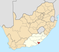
Bhisho

Last updated

Bhisho
Bisho
Bisho Massacre Memorial Site.jpg
Bisho Massacre Memorial Site
South Africa Eastern Cape location map.svg
Red pog.svg
Bhisho
South Africa adm location map.svg
Red pog.svg
Bhisho
Africa location map.svg
Red pog.svg
Bhisho
Coordinates: 32°50′58″S27°26′17″E / 32.84944°S 27.43806°E / -32.84944; 27.43806
Country South Africa
Province Eastern Cape
Municipality Buffalo City
Area
[1]
  Total8.08 km2 (3.12 sq mi)
Elevation
435 m (1,427 ft)
Population
 (2011) [1]
  Total11,192
  Density1,400/km2 (3,600/sq mi)
Racial makeup (2011)
[1]
   Black African 98.3%
   Coloured 1.0%
   Indian/Asian 0.2%
   White 0.2%
  Other0.2%
First languages (2011)
[1]
   Xhosa 92.0%
   English 4.0%
  Other4.1%
Time zone UTC+2 (SAST)
Postal code (street)
5605
PO box
5605
Area code 040

Bhisho or Bisho [2] is the capital of the Eastern Cape province in South Africa. The Office of the Premier, Provincial Legislature and many other government departments are headquartered in the town. The town, three kilometres from Qonce and 70 kilometres from East London, is also part of Buffalo City.

Contents

History

Bhisho derives its name from the Xhosa word for buffalo, which is also the name of the river (Buffalo River) that runs through this town. Bhisho was named after the song by Ben Tyazashe, who wrote of his longing for his home, Bisho, his name for King William's Town [3] however, it has also been claimed that the name was invented by Ciskei leader Lennox Sebe, after his unsuccessful bid to incorporate King William's Town into Ciskei, as Qonce (the Xhosa version of the Khoikhoi name for the Buffalo River; it means “buffalo”) was already used as the native name for King William's Town. [4]

Capital of Ciskei

When the bantustan of Ciskei was nominally granted independence in 1981, although this was never recognised outside South Africa, Bisho served as its capital city. During the early 1980s under the leadership of Lennox Sebe, Bisho underwent a period of intense development.

Its location six kilometres north of King William's Town on the main road linking the Cape to the Transkei and Natal has been described as the result of the Ciskei government wanting to place an "economic stranglehold" upon the white community of King William's Town [5] who united across political lines against incorporation into the homeland, in the face of a 1979 recommendation by the South African government. [4]

In 1983, at the height Ciskei government, Bisho signed a sister-city agreement with the settlement of Ariel in the Israeli-occupied West Bank. [6] This saw the construction of two hospitals (one on a floodplain) [5] including Bisho Hospital and up to 10 firms around the capital by Israeli entrepreneurs and technicians. In 1985, when Bisho ended its relationship with the West Bank, there were 200 Israelis in the Ciskei. [7]

Bisho Massacre

On 7 September 1992, Bisho became the scene of what is known as the Bisho massacre, when about 80–100,000 people marched on Bisho calling for the dismantling of Ciskei, which still maintained a measure of independence, and removal of the homeland's leader Brigadier Oupa Gqozo. The Ciskei Defence Force opened fire, shooting dead 28 or 29 people, and wounding 100. The massacre came at a critical time when negotiations towards democracy were underway.

Post-Apartheid Era

Bisho was reincorporated into South Africa on 12 August 1994, following the first democratic elections in the country in April the same year. In October 1994, the then Eastern Cape Premier Raymond Mhlaba announced that Bisho had been selected as the capital city of the Eastern Cape due to its infrastructure, accessibility to major roads and space for further development. [8]

The department of Arts and Culture published a correction of spelling of Bisho to Bhisho in their government notice No. 830 of Gazette No. 26552 on 16 July 2004.

Bhisho today

Bhisho's major structures include the Eastern Cape government offices (including office of the Premier), a branch of the University of Fort Hare, Bhisho Hospital, Bisho massacre Memorial, Bhisho Stadium and an SABC radio station known as trufm. Bhisho is dependent on the nearby King Williams Town and East London. The majority of the town's population who are employed are public service workers. The town of Bhisho is surrounded by residential areas; Bhisho Central, Tyutyu North, Bhisho Gardens, Balasi and Amatola View. [3]

Climate

Köppen-Geiger climate classification system classifies Bhisho's climate as cool semi-arid (BSk), although it borders closely on both a hot semi-arid climate (BSh) and a humid subtropical climate (Cfa).

Climate data for Bhisho
MonthJanFebMarAprMayJunJulAugSepOctNovDecYear
Mean daily maximum °C (°F)26.4
(79.5)
26.6
(79.9)
25.5
(77.9)
23.9
(75.0)
22.1
(71.8)
20.4
(68.7)
20.0
(68.0)
20.9
(69.6)
21.7
(71.1)
22.3
(72.1)
23.5
(74.3)
25.3
(77.5)
23.2
(73.8)
Daily mean °C (°F)21.1
(70.0)
21.3
(70.3)
20.3
(68.5)
18.2
(64.8)
15.8
(60.4)
13.9
(57.0)
13.4
(56.1)
14.2
(57.6)
15.4
(59.7)
16.7
(62.1)
18.1
(64.6)
19.8
(67.6)
17.4
(63.2)
Mean daily minimum °C (°F)15.8
(60.4)
16.1
(61.0)
15.1
(59.2)
12.5
(54.5)
9.6
(49.3)
7.4
(45.3)
6.9
(44.4)
7.5
(45.5)
9.2
(48.6)
11.2
(52.2)
12.8
(55.0)
14.4
(57.9)
11.5
(52.8)
Average rainfall mm (inches)65
(2.6)
71
(2.8)
72
(2.8)
43
(1.7)
22
(0.9)
19
(0.7)
17
(0.7)
28
(1.1)
47
(1.9)
80
(3.1)
76
(3.0)
70
(2.8)
610
(24.1)
Source: Climate-Data.org [9]

Related Research Articles

<span class="mw-page-title-main">East London, South Africa</span> City in Eastern Cape, South Africa

East London is a city on the southeastern coast of South Africa, in the Buffalo City Metropolitan Municipality, Eastern Cape Province. The city lies on the Indian Ocean coast, largely between the Buffalo River and the Nahoon River, and hosts the country's only river port. As of 2011, East London had a population of over 267,000 with over 755,000 in the surrounding metropolitan area.

<span class="mw-page-title-main">Eastern Cape</span> Province in South Africa

The Eastern Cape is one of the nine provinces of South Africa. Its capital is Bhisho, but its two largest cities are East London and Gqeberha.

<span class="mw-page-title-main">Ciskei</span> Former bantustan in South Africa (1981–94)

Ciskei, officially the Republic of Ciskei, was a Bantustan for the Xhosa people, located in the southeast of South Africa. It covered an area of 7,700 square kilometres (3,000 sq mi), almost entirely surrounded by what was then the Cape Province, and possessed a small coastline along the shore of the Indian Ocean.

<span class="mw-page-title-main">Lennox Sebe</span> Chief minister and first president of Ciskei (1926-1994)

Lennox Leslie Wongama Ngweyesizwe Sebe was the chief minister of the Xhosa bantustan of Ciskei after its self-rule in 1972, and the nominally independent country's first president from 1983. His praise name (isikhahlelo) was Ngweyesizwe.

Joshua Oupa Gqozo was the military ruler of the former homeland of Ciskei in South Africa.

Zwelitsha is a town in the Eastern Cape Province of South Africa. It forms part of the Buffalo City Metropolitan Municipality.

<span class="mw-page-title-main">Fengu people</span> Xhosa Tribe

The amaMfengu was a reference of Xhosa clans whose ancestors were refugees that fled from the Mfecane in the early-mid 19th century to seek land and protection from the Xhosa. These refugees were assimilated into the Xhosa nation and were officially recognized by the then king, Hintsa. The term derives from the Xhosa verb "ukumfenguza" which means to wander about seeking service.

<span class="mw-page-title-main">Buffalo City Metropolitan Municipality</span> Metropolitan municipality in Eastern Cape, South Africa

The Buffalo City Metropolitan Municipality is a metropolitan municipality situated on the east coast of the Eastern Cape province of South Africa. It includes the towns of East London, Bhisho and Qonce, as well as the large townships of Mdantsane and Zwelitsha.

<span class="mw-page-title-main">Qonce</span> Place in Eastern Cape, South Africa

Qonce, or King William's Town, is a town in the Eastern Cape province of South Africa along the banks of the Buffalo River. The town is about 60 kilometres (37 mi) northwest of the Indian Ocean port of East London. It has a population of around 35,000 inhabitants and forms part of the Buffalo City Metropolitan Municipality.

<span class="mw-page-title-main">Mdantsane</span> Township in the Eastern Cape, South Africa

Mdantsane is a South African urban township situated 15 km away from East London and 37 km away from Qonce in the Eastern Cape. It is the second largest township in South Africa after Soweto in Gauteng.

<span class="mw-page-title-main">British Kaffraria</span>

British Kaffraria was a British colony/subordinate administrative entity in present-day South Africa, consisting of the districts now known as Qonce and East London. It was also called Queen Adelaide's Province and, unofficially, British Kaffiria and Kaffirland.

<span class="mw-page-title-main">Ronnie Kasrils</span> South African politician (born 1938)

Ronald Kasrils is a South African politician, Marxist revolutionary, guerrilla and military commander. He was Minister for Intelligence Services from 27 April 2004 to 25 September 2008. He was a member of the National Executive Committee (NEC) of the African National Congress (ANC) from 1987 to 2007 as well as a member of the Central Committee of the South African Communist Party (SACP) from December 1986 to 2007.

<span class="mw-page-title-main">Bisho massacre</span> The 1992 apartheid massacre

The Bisho massacre occurred on 7 September 1992 in Bisho, in the then nominally independent homeland of Ciskei which is now part of the Eastern Cape in South Africa. Twenty-eight African National Congress supporters and one soldier were shot dead by the Ciskei Defence Force during a protest march when they attempted to enter Bisho to demand the reincorporation of Ciskei into South Africa during the final years of apartheid.

Chief Justice Thandathu Jongilizwe Mabandla known as Chief Justice Mabandla was a Xhosa chief from Alice in Eastern Cape.

<span class="mw-page-title-main">Ciskei Defence Force</span> Defence force of the Republic of Ciskei

The Ciskei Defence Force (CDF) was established during March 1981 from the 141 Battalion of the South African Defence Force (SADF). It was the defence force of Ciskei, a bantustan that was controlled by the apartheid regime of South Africa. The CDF functioned as part of the 21 Battalion based near Lenasia, outside Johannesburg.

The Rharhabe House is the second senior house of the Xhosa Kingdom. Its royal palace is in the former Ciskei and its counterpart in the former Transkei is the Gcaleka, which is the great house of Phalo.

<span class="mw-page-title-main">Transkei Defence Force</span> Defence force of the Republic of Transkei

The Transkei Defence Force (TDF) was established during March 1981, from the 141 Battalion of the South African Defence Force (SADF). It was the defence force of the Republic of Transkei, a nominally independent bantustan during the Apartheid era of South Africa.

Bhisho Airport, also known as Bulembu Airport, is a local airport in Eastern Cape, South Africa, which serves Bhisho and King William's Town. The airport lies on the right side of the N2 national road toward Peddie. The airport was the hub of the short lived Ciskei International Airways from 1986 to 1989.

<span class="mw-page-title-main">1990 Ciskei coup d'état</span> Bloodless military coup détat in Ciskei in 1990

The 1990 Ciskei coup d'état was a bloodless military coup in Ciskei, an unrecognised state and a nominally independent South African homeland for the Xhosa people, which took place on 4 March 1990. The coup was led by the then 37-year-old Brigadier Oupa Gqozo, the Chief of Staff Intelligence of the Ciskei Defence Force, against the government of President for Life Lennox Sebe (CNIP), who was on a state visit to Hong Kong at the time. The coup was followed by widespread rioting and looting, prompting Gqozo to request that the South African government send SADF troops to help restore order.

References

  1. 1 2 3 4 "Main Place Bhisho". Census 2011.
  2. Jenkins, Elwyn (2007), Falling into place: the story of modern South African place names, David Philip Publishers, p. 75
  3. 1 2 "Bisho and King Williams Town, Eastern Cape, South Africa". southafrica.co.za. Archived from the original on 4 August 2017. Retrieved 27 July 2017.
  4. 1 2 "The Creation of Tribalism in Southern Africa".
  5. 1 2 "BISHO: A Post-mordernist Mirage". South African History Online. Archived from the original on 27 July 2018. Retrieved 27 July 2017.
  6. Sasha Polakow-Suransky, The Unspoken Alliance: Israel's Secret Relationship with Apartheid South Africa, (New York: Pantheon Books), 2010, p. 157.
  7. Jane Haapiseva-Hunter (1987). Israel and Africa: The Problematic Friendship. British Academic Press. ISBN   9780896082854 . Retrieved 27 July 2017.
  8. Siyongwana, Pakima (January 2002). The selection of the capital city of the Eastern Cape province & The fall of a former capital city : Umtata. Benoˆıt Antheaume, Fr´ed´eric Giraut et Brij Maharaj. Rencontres scientifiques franco-Sud-Africaines de l’innovation territoriale. Grenoble-Avignon, France. Retrieved 27 July 2017.
  9. "Climate: Bhisho – Climate graph, Temperature graph, Climate table". Climate-Data.org. Retrieved 23 August 2013.