WikiMili
List of South African provincial capitals
Last updated
June 12, 2025
Map all coordinates using
OpenStreetMap
Download coordinates as:
KML
GPX (all coordinates)
GPX (primary coordinates)
GPX (secondary coordinates)
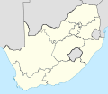
The following is a list of the capitals of the
provinces of South Africa
.
Province
Capital
Coordinates
Eastern Cape
Bhisho
32°51′12″S
27°26′10″E
/
32.85333°S 27.43611°E
/
-32.85333; 27.43611
(
Bhisho
)
Free State
Bloemfontein
29°06′58″S
26°12′51″E
/
29.11611°S 26.21417°E
/
-29.11611; 26.21417
(
Bloemfontein
)
Gauteng
Johannesburg
26°12′22″S
28°02′24″E
/
26.20611°S 28.04000°E
/
-26.20611; 28.04000
(
Johannesburg
)
KwaZulu-Natal
Pietermaritzburg
29°36′05″S
30°22′56″E
/
29.60139°S 30.38222°E
/
-29.60139; 30.38222
(
Pietermaritzburg
)
Limpopo
Polokwane
23°54′45″S
29°27′21″E
/
23.91250°S 29.45583°E
/
-23.91250; 29.45583
(
Polokwane
)
Mpumalanga
Nelspruit
25°26′15″S
30°58′19″E
/
25.43750°S 30.97194°E
/
-25.43750; 30.97194
(
Mbombela
)
North West
Mahikeng
25°50′03″S
25°36′42″E
/
25.83417°S 25.61167°E
/
-25.83417; 25.61167
(
Rustenburg
)
Northern Cape
Kimberley
28°44′10″S
24°46′08″E
/
28.73611°S 24.76889°E
/
-28.73611; 24.76889
(
Kimberley
)
Western Cape
Cape Town
33°55′27″S
18°25′07″E
/
33.92417°S 18.41861°E
/
-33.92417; 18.41861
(
Cape Town
)
References
"South Africa's provinces"
.
South African Government
. Retrieved
9 September
2021
.
v
t
e
Lists relating to the
provinces
of
South Africa
Ranked
by area
by population
by population density
by GDP
by GDP per capita
by poverty rate
by HDI
by life expectancy
by fertility rate
by highest point
Political
Capitals
Administrators
(1910–1994)
Premiers
(since 1994)
Legislatures
Districts
Municipalities
Other
ISO 3166-2 codes
Vehicle registration plates
This page is based on this
Wikipedia article
Text is available under the
CC BY-SA 4.0
license; additional terms may apply.
Images, videos and audio are available under their respective licenses.