List of South African provinces by population density

Last updated

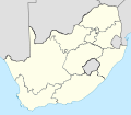
Since the election of 27 April 1994, South Africa has been divided into nine provinces. They vary widely in population density, from the highly urbanized Gauteng with nearly 700 people per square kilometre, to the mostly-desert Northern Cape with less than four people per square kilometre. The following table shows the provincial population density according to the Statistics South Africa Census. [1]

Contents

RankProvincePopulationArea (km²)Density (per km²)
1 Gauteng 15,099,422 ( census , 2022)  OOjs UI icon edit-ltr-progressive.svg 18,178.0 OOjs UI icon edit-ltr-progressive.svg 831 OOjs UI icon edit-ltr-progressive.svg
2 KwaZulu-Natal 12,423,907 ( census , 2022)  OOjs UI icon edit-ltr-progressive.svg 94,361.0 OOjs UI icon edit-ltr-progressive.svg 132 OOjs UI icon edit-ltr-progressive.svg
3 Mpumalanga 5,143,324 ( census , 2022)  OOjs UI icon edit-ltr-progressive.svg 76,495.0 OOjs UI icon edit-ltr-progressive.svg 67.2 OOjs UI icon edit-ltr-progressive.svg
4 Western Cape 7,113,776 ( est , 2021)  OOjs UI icon edit-ltr-progressive.svg 129,462.0 OOjs UI icon edit-ltr-progressive.svg 54.9 OOjs UI icon edit-ltr-progressive.svg
5 Limpopo 6,572,720 ( census , 2022)  OOjs UI icon edit-ltr-progressive.svg 125,754.0 OOjs UI icon edit-ltr-progressive.svg 52.3 OOjs UI icon edit-ltr-progressive.svg
6 Eastern Cape 7,230,204 ( census , 2022)  OOjs UI icon edit-ltr-progressive.svg 168,966.0 OOjs UI icon edit-ltr-progressive.svg 42.8 OOjs UI icon edit-ltr-progressive.svg
7 North West 3,804,548 ( census , 2022)  OOjs UI icon edit-ltr-progressive.svg 104,882 OOjs UI icon edit-ltr-progressive.svg 36.3 OOjs UI icon edit-ltr-progressive.svg
8 Free State 2,964,412 ( census , 2022)  OOjs UI icon edit-ltr-progressive.svg 129,825.0 OOjs UI icon edit-ltr-progressive.svg 22.8 OOjs UI icon edit-ltr-progressive.svg
9 Northern Cape 1,355,946 ( census , 2022)  OOjs UI icon edit-ltr-progressive.svg 372,889.0 OOjs UI icon edit-ltr-progressive.svg 3.64 OOjs UI icon edit-ltr-progressive.svg
South Africa62,027,503 ( census , 2022)  OOjs UI icon edit-ltr-progressive.svg 1,221,037 OOjs UI icon edit-ltr-progressive.svg 50.8 OOjs UI icon edit-ltr-progressive.svg

Historical data

Since the creation of the current provinces in 1994 there have been four censuses, in 1996, 2001, 2011, and 2022. The results from the 2022 Census are due to be released on 10 October 2023. [2]

ProvinceCensus 1996 [3] Census 2001 [3] Census 2011
Gauteng 432.0519.5675.1
KwaZulu-Natal 91.4102.3108.8
Mpumalanga 35.239.352.8
Western Cape 30.635.045.0
Limpopo 39.842.643.0
Eastern Cape 37.238.038.8
North West 28.831.533.5
Free State 20.320.921.1
Northern Cape 2.32.33.1
South Africa33.336.842.4

See also

Related Research Articles

<span class="mw-page-title-main">Demographics of North Korea</span>

The demographics of North Korea are determined through national censuses and international estimates. The Central Bureau of Statistics of North Korea conducted the most recent census in 2008, where the population reached 24 million inhabitants. The population density is 199.54 inhabitants per square kilometre, and the 2014 estimated life expectancy is 69.81 years. In 1980, the population rose at a near consistent, but low, rate. Since 2000, North Korea's birth rate has exceeded its death rate; the natural growth is positive. In terms of age structure, the population is dominated by the 15–64-year-old segment (68.09%). The median age of the population is 32.9 years, and the gender ratio is 0.95 males to 1.00 female. Since the early 1990s, the birth rate has been fairly stable, with an average of 2 children per woman, down from an average of 3 in the early 1980s.

<span class="mw-page-title-main">Garfield County, Montana</span> County in Montana, United States

Garfield County is a county located in the U.S. state of Montana. As of the 2020 census, the population was 1,173. Its county seat is Jordan.

<span class="mw-page-title-main">Zamboanga del Norte</span> Province in Zamboanga Peninsula, Philippines

Zamboanga del Norte, officially the Province of Zamboanga del Norte, is a province in the Philippines situated within the Zamboanga Peninsula region in Mindanao. Its capital is Dipolog and the province borders Zamboanga del Sur and Zamboanga Sibugay to the south, Misamis Occidental to the east, and the Sulu Sea to the west.

<span class="mw-page-title-main">Demography of Wales</span>

Demographics of Wales include the numbers in population, place of birth, age, ethnicity, religion, and number of marriages in Wales.

<span class="mw-page-title-main">Kalinga (province)</span> Province in Cordillera, Philippines

Kalinga, officially the Province of Kalinga, is a landlocked province in the Philippines situated within the Cordillera Administrative Region in Luzon. Its capital is Tabuk and borders Mountain Province to the south, Abra to the west, Isabela to the east, Cagayan to the northeast, and Apayao to the north. Kalinga and Apayao are the result of the 1995 partitioning of the former province of Kalinga-Apayao which was seen to better service the respective needs of the various indigenous peoples in the area.

<span class="mw-page-title-main">Western Cape</span> Province of South Africa on the south-western coast

The Western Cape is a province of South Africa, situated on the south-western coast of the country. It is the fourth largest of the nine provinces with an area of 129,449 square kilometres (49,981 sq mi), and the third most populous, with an estimated 7 million inhabitants in 2020. About two-thirds of these inhabitants live in the metropolitan area of Cape Town, which is also the provincial capital. The Western Cape was created in 1994 from part of the former Cape Province. The two largest cities are Cape Town and George.

<span class="mw-page-title-main">Drumheller</span> Town in Alberta, Canada

Drumheller is a town on the Red Deer River in the badlands of east-central Alberta, Canada. It is located 110 kilometres (68 mi) northeast of Calgary and 97 kilometres (60 mi) south of Stettler. The Drumheller portion of the Red Deer River valley, often referred to as Dinosaur Valley, has an approximate width of 2 kilometres (1.2 mi) and an approximate length of 28 kilometres (17 mi).

<span class="mw-page-title-main">Population of Canada</span>

Canada ranks 37th by population among countries of the world, comprising about 0.5% of the world's total, with 40 million Canadians. Despite being the second-largest country by area, the vast majority of the country is sparsely inhabited, with most of its population south of the 55th parallel north. Just over 60 per cent of Canadians live in just two provinces: Ontario and Quebec. Though Canada's overall population density is low, many regions in the south, such as the Quebec City–Windsor Corridor, have population densities higher than several European countries. Canada has six population centres with more than one million people: Toronto, Montreal, Vancouver, Calgary, Edmonton and Ottawa.

<span class="mw-page-title-main">Nipissing District</span> District in Ontario, Canada

Nipissing District is a district in Northeastern Ontario in the Canadian province of Ontario. It was created in 1858. The district seat is North Bay.

<span class="mw-page-title-main">Lagawe</span> Capital of Ifugao, Philippines

Lagawe, officially the Municipality of Lagawe is a 4th class municipality and capital of the province of Ifugao, Philippines. According to the 2020 census, it has a population of 18,876 people.

<span class="mw-page-title-main">High Prairie</span> Town in Alberta, Canada

High Prairie is a town in northern Alberta, Canada within Big Lakes County. It is located at the junction of Highway 2 and Highway 749, approximately 89 km (55 mi) northeast of Valleyview and 118 km (73 mi) west of Slave Lake.

<span class="mw-page-title-main">Swan Hills</span> Town in Alberta, Canada

Swan Hills is a town in northern Alberta, Canada. It is in the eponymous Swan Hills, approximately 80 km (50 mi) north of Whitecourt and 62 km (39 mi) northwest of Fort Assiniboine. The town is at the junction of Highway 32 and Grizzly Trail, and is surrounded by Big Lakes County.

<span class="mw-page-title-main">Municipal District of Ranchland No. 66</span> Municipal district in Alberta, Canada

The Municipal District of Ranchland No. 66 is a municipal district (MD) in southwest Alberta, Canada. Containing no urban communities of any kind, its municipal office is located in Chain Lakes Provincial Park, approximately 38 km (24 mi) southwest of the Town of Nanton. Ranchland's rugged foothill terrain is unsuited for the crop agriculture practiced elsewhere in Alberta, and ranching remains the single livelihood of its inhabitants. With a 2016 population of 92, it is the least populated municipal district in Alberta, and its population density of 29 square kilometres for every resident is almost exactly equal to that of the Northwest Territories.

Cayley is a hamlet in southern Alberta, Canada within the Foothills County. It is also recognized as a designated place by Statistics Canada.

<span class="mw-page-title-main">Cadomin</span> Hamlet in Alberta, Canada

Cadomin is a hamlet in the west-central Alberta, Canada within Yellowhead County. It is located along the McLeod River in the foothills of the Rocky Mountains, approximately 50 kilometres (31 mi) south of Hinton near the Bighorn Highway. It is served by a spur of the Canadian National Railway.

A designated place (DPL) is a type of community or settlement identified by Statistics Canada that does not meet the criteria used to define municipalities or population centres. DPLs are delineated every 5 years for the Canadian census as the statistical counterparts of incorporated places such as cities, towns, and villages.

<span class="mw-page-title-main">Thembelihle Local Municipality</span> Local municipality in Northern Cape, South Africa

Thembelihle Municipality, formerly known as Oranje-Karoo Municipality, is a local municipality within the Pixley ka Seme District Municipality, in the Northern Cape province of South Africa. Thembelihle is a Xhosa word meaning "good hope".

<span class="mw-page-title-main">Regions of Uganda</span> Subdivision of Uganda

The regions of Uganda are known as Central, Western, Eastern, and Northern. These four regions are in turn divided into districts. There were 56 districts in 2002, which expanded into 111 districts plus one city (Kampala) by 2010.

References

  1. Africa, Statistics South. "Statistics South Africa" . Retrieved 2 March 2022.
  2. https://www.statssa.gov.za/?p=16639
  3. 1 2 Census 2001: Census in brief (PDF). Statistics South Africa. 2003. pp. 2–6. ISBN   0-621-34293-9. Archived from the original (PDF) on 5 May 2005. Retrieved 15 January 2011.