North West (South African province)

Last updated • 6 min readFrom Wikipedia, The Free Encyclopedia

27°S26°E / 27°S 26°E / -27; 26

Contents

North West
North West arms.svg
Motto(s): 
Kagiso le Tswelelopele (Peace and Prosperity)
North West in South Africa.svg
Location of North West in South Africa
Country Flag of South Africa.svg South Africa
Established27 April 1994
Capital Mahikeng
Largest city Rustenburg [1] [2]
Districts
Government
  Type Parliamentary system
   Premier Lazzy Mokgosi (ANC)
  Legislature North West Provincial Legislature
Area
[3] :9
  Total
104,882 km2 (40,495 sq mi)
  Rank 6th in South Africa
Highest elevation
1,805 m (5,922 ft)
Population
 (2022) [4]
  Total
3,803,679
  Rank 7th in South Africa
  Density36/km2 (94/sq mi)
   Rank 7th in South Africa
Population groups (2022)
[4]
   Black 93.7%
   White 4.5%
   Coloured 1.6%
   Indian or Asian 0.1%
Languages (2022)
[4]
   Tswana 72.8%
   Sesotho 5.9%
   Afrikaans 5.2%
   Xhosa 4.8%
   Tsonga 3.1%
   Pedi 2.1%
   Zulu 1.6%
   English 1.0%
Time zone UTC+2 (SAST)
ISO 3166 code ZA-NW
HDI (2019)0.672 [5]
medium · 8th of 9
GDP US$26.9 billion [6]
Website www.NWPG.gov.za
North West (South African province)
ZuluiNyakatho-Ntshonalanga
XhosaiMntla-Ntshona
AfrikaansNoordwes
SepediLeboa-Bodikela
SesothoLeboya Bophirimela
SetswanaBokone Bophirima
XitsongaNwalungu-Vupeladyambu
VendaDevhula-Vhukovhela

North West (Tswana : Bokone Bophirima; Afrikaans : Noord-Wes [nuərtˈvɛs] ) is a province of South Africa. Its capital is Mahikeng. The province is located to the west of the major population centre and province of Gauteng and south of Botswana.

History

North West was incorporated after the end of apartheid in 1994, and includes parts of the former Transvaal Province and Cape Province, as well as most of the former bantustan of Bophuthatswana. It was the scene of political violence in Khutsong, Merafong City Local Municipality in 2006 and 2007, after cross-province municipalities were abolished and Merafong Municipality was transferred entirely to North West. Merafong has since been transferred to Gauteng province in 2009. [7] [8] [9]

This province is the birthplace of prominent political figures: Lucas Mangope, Moses Kotane, Ahmed Kathrada, Abram Onkgopotse Tiro, Ruth Mompati, J. B. Marks, Aziz Pahad, and Essop Pahad, among others.

Law and government

The Provincial Government consists of a premier, an executive council of ten ministers, and a legislature. The provincial assembly and premier are elected for five-year terms, or until the next national election. Political parties are awarded assembly seats based on the percentage of votes each party receives in the province during the national elections. The assembly elects a premier, who then appoints the members of the executive council.

The premier of North West Province as of 14 June 2024 is Lazzy Mokgosi of the African National Congress. [10]

Geography

Hamerkop Kloof between Rustenburg and Pretoria on north-facing slopes of Magaliesberg Magaliesberg02.jpg
Hamerkop Kloof between Rustenburg and Pretoria on north-facing slopes of Magaliesberg

Much of the province consists of flat areas of scattered trees and grassland. The Magaliesberg mountain range in the northeast extends about 130 km (about 80 miles) from Pretoria to Rustenburg. The Vaal River flows along the southern border of the province.

Climate

Temperatures range from 17 to 31 °C (63 to 88 °F) in the summer and from 3 to 21 °C (37 to 70 °F) in the winter. Annual rainfall totals about 360 mm (about 14 in), with almost all of it falling during the summer months, between October and April.

Borders

North West borders the following districts of Botswana:

Domestically, it borders the following provinces:

North West Province is traversed by the northwesterly line of equal latitude and longitude.

Municipalities

North West Province districts and local municipalities Map of the North West with districts labelled (2011).svg
North West Province districts and local municipalities

The North West Province is divided into four district municipalities. The district municipalities are in turn divided into 18 local municipalities:

District municipalities

Cities and towns

Population 200,000+

Population 50,000+

Population 25,000+

Population 10,000+

Population < 10,000

Economy

The Bridge of Time facing the Entertainment Centre, Sun City Sun City.jpg
The Bridge of Time facing the Entertainment Centre, Sun City

The mainstay of the economy of North West Province is mining, which generates more than half of the province's gross domestic product and provides jobs for a quarter of its workforce. The chief minerals are gold, mined at Orkney and Klerksdorp; uranium, mined at Klerksdorp; platinum, mined at Rustenburg and Brits; and diamonds, mined at Lichtenburg, Christiana, and Bloemhof. About 85% of all money-making activities take place between Klerksdorp and Potchefstroom. The economic heart of the province is Klerksdorp. The northern and western parts of the province have many sheep farms and cattle and game ranches. The eastern and southern parts are crop-growing regions that produce maize (corn), sunflowers, tobacco, cotton, and citrus fruits. The entertainment and casino complex at Sun City and Lost City also contributes to the provincial economy.

Demographics

Population density in the North West
.mw-parser-output figure[typeof="mw:File/Thumb"] .image-key>ol{margin-left:1.3em;margin-top:0}.mw-parser-output figure[typeof="mw:File/Thumb"] .image-key>ul{margin-top:0}.mw-parser-output figure[typeof="mw:File/Thumb"] .image-key li{page-break-inside:avoid;break-inside:avoid-column}@media(min-width:300px){.mw-parser-output figure[typeof="mw:File/Thumb"] .image-key,.mw-parser-output figure[typeof="mw:File/Thumb"] .image-key-wide{column-count:2}.mw-parser-output figure[typeof="mw:File/Thumb"] .image-key-narrow{column-count:1}}@media(min-width:450px){.mw-parser-output figure[typeof="mw:File/Thumb"] .image-key-wide{column-count:3}}
.mw-parser-output .legend{page-break-inside:avoid;break-inside:avoid-column}.mw-parser-output .legend-color{display:inline-block;min-width:1.25em;height:1.25em;line-height:1.25;margin:1px 0;text-align:center;border:1px solid black;background-color:transparent;color:black}.mw-parser-output .legend-text{}
<1 /km2
1-3 /km2
3-10 /km2
10-30 /km2
30-100 /km2
100-300 /km2
300-1000 /km2
1000-3000 /km2
>3000 /km2 North West population density map.svg
Population density in the North West
  •   <1 /km²
  •   1–3 /km²
  •   3–10 /km²
  •   10–30 /km²
  •   30–100 /km²
  •   100–300 /km²
  •   300–1000 /km²
  •   1000–3000 /km²
  •   >3000 /km²
Dominant home languages in the North West
Tswana
Afrikaans
English
Ndebele
Xhosa
Zulu
Pedi
Sotho
Tsonga
No language dominant North West dominant language map.svg
Dominant home languages in the North West

The majority of the province's residents are Tswana people who speak Tswana, as in neighbouring Botswana. Smaller groups include Afrikaans, Sotho, and Xhosa speaking people. English is spoken primarily as a second language. Most of the population belong to Christian denominations. (Figures according to Census 2001 released in July 2003).

According to the 2007 community survey 90.8% of the province's population was Black (mostly Tswana-speaking), 7.2% as White (mostly Afrikaans speaking), 1.6% as Coloured and 0.4% as Asian. The 2007 community survey showed the province had a population of just over 3 million. The province's white population is very unevenly distributed. In the southern and eastern municipalities, the white percentage in double figures such as the Tlokwe and Matlosana where the white percentages were 27% and 12% respectively.

The province has the lowest number of people aged 35 years and older (5.9%) who have received higher education. Since 1994 the number of people receiving higher education has increased. After the disbanding of the bantustans, many people migrated to the economic centres of Cape Town and Gauteng. [11]

Education

The province had two universities: the North-West University, which was formerly called the University of Bophuthatswana (founded in 1979), in Mmabatho; and Potchefstroom University for Christian Higher Education (founded in 1869; became a constituent college of the University of South Africa in 1921 and an independent university in 1951). These two universities have now merged and the new institution is called North-West University.

As part of the Department of Education's proposed plans for higher education, the existing four higher learning institutions will be merged to form two. During 2003, as part of the Year of Further Education and Training project, three mega institutions, Taletso, ORBIT and Vuselela, were established to provide technical and vocational training to the youth. These institutions have been incorporated into many of the former education and technical colleges and manpower centres.

Sports

See also

Related Research Articles

<span class="mw-page-title-main">Mafikeng</span> Capital city of the North-West Province, South Africa

Mahikeng, formerly known as Mafikeng and alternatively known as Mafeking, is the capital city of the North West province of South Africa.

Mmabatho is the former capital of the North-West Province of South Africa. During the apartheid era, it was the capital of the former "Bantustan" of Bophuthatswana, separated from the adjacent Mafeking which temporarily remained outside Bophuthatswana.

<span class="mw-page-title-main">Bophuthatswana</span> Former bantustan in South Africa (1977–94)

Bophuthatswana, officially the Republic of Bophuthatswana, and colloquially referred to as the Bop and by outsiders as Jigsawland was a Bantustan that was declared (nominally) independent by the apartheid regime of South Africa in 1977. However, like the other Bantustans of Ciskei, Transkei and Venda, its independence was not recognized by any country other than South Africa.

<span class="mw-page-title-main">Transvaal (province)</span> 1910–1994 province of South Africa

The Province of the Transvaal, commonly referred to as the Transvaal, was a province of South Africa from 1910 until 1994, when a new constitution subdivided it following the end of apartheid. The name "Transvaal" refers to the province's geographical location to the north of the Vaal River. Its capital was Pretoria, which was also the country's executive capital.
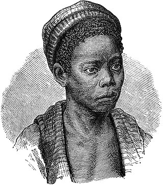
<span class="mw-page-title-main">Tswana people</span> Bantu ethnic group in Southern Africa

The Tswana are a Bantu ethnic group native to Southern Africa. Ethnic Tswana made up approximately 85% of the population of Botswana in 2011.

<span class="mw-page-title-main">Lucas Mangope</span> South African politician (1923–2018)

Kgosi Lucas Manyane Mangope was the leader of the Bantustan (homeland) of Bophuthatswana. The territory he ruled over was distributed between the Orange Free State – what is now Free State – and North West Province. He was also the founder and leader of the United Christian Democratic Party, a political party based in the North West of South Africa.

<span class="mw-page-title-main">Potchefstroom</span> Place in North West, South Africa

Potchefstroom, colloquially known as Potch, is an academic city in the North West Province of South Africa. It hosts the Potchefstroom Campus of the North-West University. Potchefstroom is on the Mooirivier, roughly 120 km (75 mi) west-southwest of Johannesburg and 45 km (28 mi) east-northeast of Klerksdorp.

<span class="mw-page-title-main">Klerksdorp</span> City in North West, South Africa

Klerksdorp is located in the North West Province, South Africa. Klerksdorp is located 165 km (103 mi) southeast of Mahikeng, the provincial capital. Klerksdorp was also the first capital of the then Transvaal Republic and used to be the home of the first Stock Exchange in the region. It became an important trading town linking Kimberley to Johannesburg. It became home to a mix of farmers, miners and immigrants servicing the two industries.It was then located there because of availability of water and climate change.

<span class="mw-page-title-main">West Rand District Municipality</span> District municipality in Gauteng, South Africa

The West Rand District Municipality is one of the districts of the Gauteng province of South Africa, that covers the West Rand area, with the exception of Roodepoort. The seat of the district municipality is Randfontein. As of 2011, the most spoken language among its population of 820,995 is Tswana. The district code is CBDC8.

<span class="mw-page-title-main">Rustenburg</span> City in North West province, South Africa

Rustenburg is a city at the foot of the Magaliesberg mountain range. Rustenburg is the most populous city in North West province, South Africa. In 2017, the city's Gross Domestic Product (GDP) reached ZAR 63.8 billion, accounting for 21.1% of the GDP of the North West Province, and 1.28% of the GDP of South Africa. Rustenburg was one of the official host cities of the 2010 FIFA World Cup, being in close proximity to Phokeng, the capital of the Royal Bafokeng Nation, where the Royal Bafokeng Stadium is located. The England national football team also used this as their base camp for the tournament.

<span class="mw-page-title-main">Dr Kenneth Kaunda District Municipality</span> District municipality in North West, South Africa

The Dr Kenneth Kaunda District Municipality, formerly the Southern District Municipality, is one of the 4 districts of the North West province of South Africa. The seat of the municipality is Klerksdorp. As of 2016, a plurality of its 742,821 residents speak Setswana. The majority of its residents live in the City of Matlosana. The district code is DC40. The district was formerly known as the Southern District Municipality. It is named after Kenneth Kaunda, the first President of Zambia.

<span class="mw-page-title-main">N12 (South Africa)</span> National road in South Africa

The N12 is a national route in South Africa which runs from George through Beaufort West, Kimberley, Klerksdorp and Johannesburg to eMalahleni.

<span class="mw-page-title-main">Rustenburg Local Municipality</span> Local municipality in North West, South Africa

Rustenburg Municipality is a local municipality within the Bojanala Platinum District Municipality, in the North West province of South Africa. Rustenburg is situated at the foot of the Magalies mountain range. Rustenburg was proclaimed a township in 1851. The city of Rustenburg is situated some 112 km northwest from both Johannesburg and Pretoria. It is a malaria-free area. Rustenburg is the fastest growing municipality in South Africa, with the population rising from 387,096 in 2001 to 449,776 in 2007. It is the most populous municipality in the North West province.
<span class="mw-page-title-main">Merafong City Local Municipality</span> Local municipality in Gauteng, South Africa

Merafong City Municipality is a local municipality in the West Rand District Municipality, in the Gauteng province of South Africa. Its boundaries encloses some of the richest gold mines in the world. It is situated about 65 km from Johannesburg and is serviced by a number of major roads, including the N12 from Johannesburg to Kimberley and the N14.

The North West Division of the High Court of South Africa is a superior court of law with general jurisdiction over the western part of North West province of South Africa. The division sits at Mahikeng.

<span class="mw-page-title-main">City of Matlosana</span> Local municipality in North West, South Africa

The City of Matlosana, formerly the City Council of Klerksdorp, is a local municipality within the Dr Kenneth Kaunda District Municipality, in the North West province of South Africa.

<span class="mw-page-title-main">Mamusa Local Municipality</span> Local municipality in North West, South Africa

Mamusa Municipality is a local municipality within the Dr Ruth Segomotsi Mompati District Municipality, in the North West province of South Africa. The seat of the municipality is Schweizer-Reneke.

<span class="mw-page-title-main">Star FM (South Africa)</span> Radio station in Klerksdorp

Star FM (102.9 MHz) is a South African community radio station based in Klerksdorp, City of Matlosana, Dr KK District Municipality DC40,(formerly Southern District municipality) named after Kenneth Kaunda the first President of Zambia, one of the four districts of the North West Province of the Republic of South Africa.

References

  1. "Rustenburg, South Africa Metro Area Population 1950-2023".
  2. "Rustenburg Local Municipality (NW373)". Municipalities of South Africa.
  3. Census 2011: Census in brief (PDF). Pretoria: Statistics South Africa. 2012. ISBN   9780621413885. Archived (PDF) from the original on 13 May 2015.
  4. 1 2 3 "Statistical Release - Census 2022" (PDF). statssa.gov.za. Retrieved 22 August 2024.
  5. "Sub-national HDI - Area Database - Global Data Lab". hdi.globaldatalab.org. Retrieved 13 September 2018.
  6. "Provincial gross domestic product:experimental estimates, 2013–2022" (PDF), www.statssa.gov.za
  7. "Bophuthatswana". South African History Online. Retrieved 22 September 2019. In March 1994 Bophuthatswana was placed under the control of two administrators, Tjaart van der Walt and Job Mokgoro. The small, widespread pieces of land were reincorporated into South Africa on 27 April 1994. Bophuthatswana is part of the North West Province under Premier Edna Molewa.
  8. "North West". South African History Online. Retrieved 22 September 2019.
  9. "Merafong City Local Municipality (GT484)". municipalities.co.za. Retrieved 22 September 2019.
  10. OFM. "Northwest Provincial Legislature members sworn in". OFM. Retrieved 19 June 2024.
  11. "Internal Migration to the Gauteng Province" (PDF). University of Cape Town. Retrieved 12 August 2020.