Maquassi Hills Local Municipality

Last updated

Maquassi Hills
Maquassi Hills CoA.png
Map of the North West with Maquassi Hills highlighted.svg
Location in the North West
Coordinates: 27°15′S26°0′E / 27.250°S 26.000°E / -27.250; 26.000
Country South Africa
Province North West
District Dr Kenneth Kaunda
Seat Wolmaransstad
Wards 11
Government
[1]
  Type Municipal council
  MayorZandisile Mweli
Area
  Total4,643 km2 (1,793 sq mi)
Population
 (2011) [2]
  Total77,794
  Density17/km2 (43/sq mi)
Racial makeup (2011)
[2]
   Black African 88.7%
   Coloured 2.3%
   Indian/Asian 0.4%
   White 8.2%
First languages (2011)
[2]
   Tswana 72.5%
   Afrikaans 10.7%
   Sotho 6.6%
   Xhosa 4.1%
  Other6.1%
Time zone UTC+2 (SAST)
Municipal codeNW404

Maquassi Hills Municipality (Tswana : Mmasepala wa Maquassi Hills; Afrikaans : Maquassi Hills Munisipaliteit) is a local municipality within the Dr Kenneth Kaunda District Municipality, in the North West province of South Africa.

Contents

Main places

The 2001 census divided the municipality into the following main places: [3]

PlaceCodeArea (km2)PopulationMost spoken language
Kareeboom 62001 5.3466 Tswana
Kgakala 62002 1.649,961Tswana
Lebaleng 62003 0.988,417Tswana
Leeudoringstad 62004 2.691,492 Afrikaans
Makwassie 62005 7.283,486Tswana
Rulaganyang 62007 0.371,269Tswana
Tswelelang 62008 2.2920,101Tswana
Witpoort 62009 17.78374Afrikaans
Wolmaransstad 62010 7.132,607Afrikaans
Remainder of the municipality 62006 4,598.8120,662Tswana

Politics

The municipal council consists of twenty-two members elected by mixed-member proportional representation. Eleven are elected by first-past-the-post voting in eleven wards, while the remaining eleven are chosen from party lists so that the total number of party representatives is proportional to the number of votes received. In the election of 1 November 2021 the African National Congress (ANC) won a majority of thirteen seats on the council.

The following table shows the results of the 2021 election. [4]

PartyWardListTotal
seats
Votes%SeatsVotes%Seats
African National Congress 10,62862.70119,87758.59213
Economic Freedom Fighters 2,61615.4302,64315.6844
Democratic Alliance 1,88711.1301,82610.8322
South African Political Association 6483.8207864.6611
Freedom Front Plus 5973.5206253.7111
Forum for Service Delivery 3432.0203181.8911
African Independent Congress 5523.2700
African Freedom Revolution 1771.0401610.9600
African Transformation Movement 100.060410.2400
United Christian Democratic Party 150.090280.1700
Independent candidates 300.1800
Total16,951100.001116,857100.001122
Valid votes16,95197.5716,85797.28
Invalid/blank votes4232.434722.72
Total votes17,374100.0017,329100.00
Registered voters/turnout36,60247.4736,60247.34

Related Research Articles

<span class="mw-page-title-main">Ubuntu Local Municipality</span> Local municipality in Northern Cape, South Africa

Ubuntu Municipality is a local municipality within the Pixley ka Seme District Municipality, in the Northern Cape province of South Africa. Its seat is Victoria West. Other towns in the municipality are Richmond, Loxton and two small railway villages Hutchinson and Merriman.

<span class="mw-page-title-main">Siyathemba Local Municipality</span> Local municipality in Northern Cape, South Africa

Siyathemba Municipality is a local municipality within the Pixley ka Seme District Municipality, in the Northern Cape province of South Africa.

<span class="mw-page-title-main">Kareeberg Local Municipality</span> Local municipality in Northern Cape, South Africa

Kareeberg Municipality is a local municipality within the Pixley ka Seme District Municipality, in the Northern Cape province of South Africa. The name originates from a mountain range in the region, the Karee Mountains.

<span class="mw-page-title-main">Pixley ka Seme Local Municipality</span> Local municipality in Mpumalanga, South Africa

Pixley Ka Seme Local Municipality is a South African local municipality situated in the Gert Sibande District Municipality, of Mpumalanga. Volksrust is the seat of the municipality.

<span class="mw-page-title-main">Ratlou Local Municipality</span> Local municipality in North West, South Africa

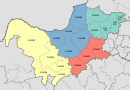
Ratlou Municipality, formerly Setla-Kgobi Municipality, is a local municipality within the Ngaka Modiri Molema District Municipality, in the North West province of South Africa.

<span class="mw-page-title-main">Kgatelopele Local Municipality</span> Local municipality in Northern Cape, South Africa

Kgatelopele Municipality is a local municipality within the ZF Mgcawu District Municipality, in the Northern Cape province of South Africa. Kgatelopele is a Setswana name meaning "progress".

<span class="mw-page-title-main">Kopanong Local Municipality</span> Local municipality in Free State, South Africa

Kopanong Local Municipality is an administrative area in the Xhariep District of the Free State in South Africa. The name is a Sesotho word meaning "meeting place or where people are invited". The name earmarks unity and seeks to encourage co-operation.

eMadlangeni Local Municipality Local municipality in KwaZulu-Natal, South Africa

eMadlangeni Local Municipality, previously known as Utrecht Local Municipality, is an administrative area in the Amajuba District of KwaZulu-Natal in South Africa.

uMdoni Local Municipality Area in KwaZulu-Natal, South Africa

uMdoni Local Municipality is an administrative area in the Ugu District of KwaZulu-Natal in South Africa. Umdoni is an isiZulu name for the indigenous tree, Mdoni.

<span class="mw-page-title-main">Blue Crane Route Local Municipality</span> Local municipality in Eastern Cape, South Africa

Blue Crane Route Local Municipality is an administrative area in the Sarah Baartman District of the Eastern Cape in South Africa.

<span class="mw-page-title-main">Mpofana Local Municipality</span> Local municipality in KwaZulu-Natal, South Africa

Mpofana Local Municipality is an administrative area in the UMgungundlovu District of KwaZulu-Natal in South Africa.

<span class="mw-page-title-main">Ngqushwa Local Municipality</span> Local municipality in Eastern Cape, South Africa

Ngqushwa Local Municipality is an administrative area in the Amatole District of the Eastern Cape in South Africa.

<span class="mw-page-title-main">Greater Kokstad Local Municipality</span> Local municipality in KwaZulu-Natal, South Africa

Greater Kokstad Local Municipality is an administrative area in the Harry Gwala District of KwaZulu-Natal in South Africa. Kokstad is derived from Dutch, and it means "town of Kok". It was named after Adam Kok III.

uMuziwabantu Local Municipality Local municipality in KwaZulu-Natal, South Africa

uMuziwabantu Local Municipality is an administrative area in the Ugu District of KwaZulu-Natal in South Africa.

<span class="mw-page-title-main">Impendle Local Municipality</span> Local municipality in KwaZulu-Natal, South Africa

Impendle Local Municipality is an administrative area in the UMgungundlovu District of KwaZulu-Natal in South Africa.

<span class="mw-page-title-main">Masilonyana Local Municipality</span> Local municipality in Free State, South Africa

Masilonyana Municipality is a local municipality within the Lejweleputswa District Municipality, in the Free State province of South Africa. Masilonyana is a Setswana word meaning "freedom".

<span class="mw-page-title-main">Mohokare Local Municipality</span> Local municipality in Free State, South Africa

Mohokare Local Municipality is an administrative area in the Xhariep District of the Free State in South Africa. The name is a Sesotho word for Caledon River, which runs through the municipality.

<span class="mw-page-title-main">Nketoana Local Municipality</span> Local municipality in Free State, South Africa

Nketoana Local Municipality is an administrative area in the Thabo Mofutsanyane District of the Free State in South Africa.

<span class="mw-page-title-main">ǃKheis Local Municipality</span> Local municipality in Northern Cape, South Africa

ǃKheis Municipality is a local municipality within the ZF Mgcawu District Municipality, in the Northern Cape province of South Africa. ǃKheis is a Khoikhoi name meaning "a place where you live, or a home". The municipality is named in recognition of the Khoekhoe people who were the first permanent dwellers of the area.

The Maquassi Hills Local Municipality council consists of twenty-two members elected by mixed-member proportional representation. Eleven councillors are elected by first-past-the-post voting in eleven wards, while the remaining eleven are chosen from party lists so that the total number of party representatives is proportional to the number of votes received. In the election of 1 November 2021 the African National Congress (ANC) won a majority of thirteen seats.

References

  1. "Contact list: Executive Mayors". Government Communication & Information System. Archived from the original on 14 July 2010. Retrieved 22 February 2012.
  2. 1 2 3 "Statistics by place". Statistics South Africa. Retrieved 27 September 2015.
  3. Lookup Tables - Statistics South Africa [ permanent dead link ]
  4. "Election Result Table for LGE2021 — Maquassi Hills". wikitable.frith.dev. Retrieved 4 December 2021.

Website: https://web.archive.org/web/20170621102351/http://maquassihills.org/