Blouberg Municipality is a local municipality within the Capricorn District Municipality, in the Limpopo province of South Africa, bordering Botswana. It takes its name from the Blouberg, a mountain range located to the west of the western end of the Soutpansberg mountain range, north west of the town of Vivo. Blouberg is home to some of the most spectacular rock climbing in South Africa. The rock climbing destination is famous for its big wall natural climbing with route lengths up to 350m. The vegetation ranges from sub-tropical savanna at the base, to alpine near the summit.
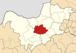
Tswaing Municipality is a local municipality within the Ngaka Modiri Molema District Municipality, in the North West province of South Africa. It consists of the towns of Delareyville, Sannieshof and Ottosdal.

Albert Luthuli Municipality is a local municipality within the Gert Sibande District Municipality, in the Mpumalanga province of South Africa. It was named after Albert Luthuli. Carolina is the seat of the municipality.

Msukaligwa Municipality is a local municipality within the Gert Sibande District Municipality, in the Mpumalanga province of South Africa. Ermelo is the seat of the municipality.

Molemole Municipality is a local municipality within the Capricorn District Municipality, in the Limpopo province of South Africa. The seat is Mogwadi.

Lephalale Municipality is a local municipality within the Waterberg District Municipality, in the Limpopo province of South Africa. The seat is Lephalale.

Musina Municipality is a local municipality within the Vhembe District Municipality, in the Limpopo province of South Africa. It is the northernmost local municipality in South Africa. It borders Botswana, Mozambique and Zimbabwe. The seat is Musina.
Greater Tzaneen Municipality is a local municipality within the Mopani District Municipality, in the Limpopo province of South Africa. The seat of the municipality is Tzaneen.

Greater Letaba Municipality is a local municipality within the Mopani District Municipality, in the Limpopo province of South Africa. The seat is Modjadjiskloof.
Fetakgomo Local Municipality was located in the Sekhukhune District Municipality of Limpopo province, South Africa. The seat of Fetakgomo Local Municipality was Apel. The local municipality was one of the four to have passed the 2009-10 audit by the Auditor-General of South Africa, who deemed it to have a clean administration. In 2016 it was merged with Greater Tubatse Local Municipality to form the Fetakgomo Tubatse Local Municipality.

Madibeng Municipality is a local municipality within the Bojanala Platinum District Municipality, in the North West province of South Africa. The seat of the municipality is Brits. The popular tourist area of Hartbeespoort is also located in the municipality.

Moqhaka Municipality is a local municipality within the Fezile Dabi District Municipality, in the Free State province of South Africa. In 2001, the population was 267,881 with a total area of 7925 km². The seat is Kroonstad. Moqhaka is the Sesotho word for "crown".

Elundini Municipality is a local municipality within the Joe Gqabi District Municipality, in the Eastern Cape province of South Africa. The name originates from isiZulu and refers to the Drakensberg Mountains.

Mtubatuba Municipality is a local municipality within the Umkhanyakude District Municipality, in the KwaZulu-Natal province of South Africa.

Jozini Municipality is a local municipality within the Umkhanyakude District Municipality, in the KwaZulu-Natal province of South Africa. Significant portions of the municipality have been neglected in terms of economic development. There is a great disparity between the level of service and infrastructure provision between settlement nodes, such as the towns of Mkuze and Jozini, and the surrounding rural areas. Most of the rural area is associated with a lack of development, poverty and poor service provision.

Emalahleni Municipality is a local municipality within the Chris Hani District Municipality, in the Eastern Cape province of South Africa. Emalahleni is an isiXhosa word meaning "a place of coal".
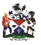
uMlalazi Local Municipality is an administrative area in the King Cetshwayo District of KwaZulu-Natal in South Africa. The municipality is named after the uMlalazi River.
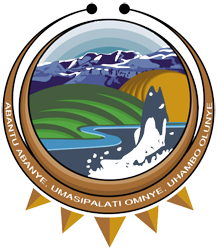
Senqu Municipality is a local municipality within the Joe Gqabi District Municipality, in the Eastern Cape province of South Africa. Senqu is the Sesotho name for the Orange River.

Kagisano–Molopo Municipality is a local municipality within the Dr Ruth Segomotsi Mompati District Municipality, in the North West province of South Africa. It was created at the local government elections of 18 May 2011 by merging the Kagisano and Molopo municipalities.
The Greater Taung Local Municipality council consists of forty-eight members elected by mixed-member proportional representation. Twenty-four councillors are elected by first-past-the-post voting in twenty-four wards, while the remaining twenty-four are chosen from party lists so that the total number of party representatives is proportional to the number of votes received. In the election of 1 November 2021 the African National Congress (ANC) won a majority of twenty-eight seats.


