City of Matlosana

Last updated
City of Matlosana
Matlosana CoA.png
Map of the North West with Matlosana highlighted.svg
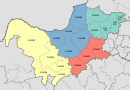
Location in the North West
Coordinates: 26°50′S26°30′E / 26.833°S 26.500°E / -26.833; 26.500
Country South Africa
Province North West
District Dr Kenneth Kaunda
Seat Klerksdorp
Wards 35
Government
[1]
  Type Municipal council
  MayorCllr Nonhlupheko Tsolela (ANC)
Area
  Total3,561 km2 (1,375 sq mi)
Population
 (2011) [2]
  Total398,676
  Density110/km2 (290/sq mi)
Racial makeup (2011)
[2]
   Black African 81.0%
   Coloured 3.5%
   Indian/Asian 0.8%
   White 14.5%
First languages (2011)
[2]
   Tswana 36.7%
   Sotho 20.3%
   Afrikaans 17.6%
   Xhosa 14.3%
  Other11.1%
Time zone UTC+2 (SAST)
Municipal codeNW403

The City of Matlosana (Tswana : Toropo ya Matlosana; Sotho : Toropo ya Matlosana; Afrikaans : Stad Matlosana; Xhosa : IsiXeko saseMatlosana), formerly the City Council of Klerksdorp, is a local municipality within the Dr Kenneth Kaunda District Municipality, in the North West province of South Africa.

Contents

Main places

The 2001 census divided the municipality into the following main places: [3]

PlaceCodeArea (km2)PopulationMost spoken language
Buffelsfontein 61901 0.241,825 Sotho
Dominionville 61903 6.24542 Afrikaans
Faan Meintjies Nature Reserve 61904 8.8618 Xhosa
GTC Village 61905 0.41445Sotho
Hartebeesfontein 61906 3.721,275Afrikaans
Hartebeestfontein Mine 61907 60.654,350Sotho
Jouberton 61908 15.74104,977 Tswana
Kanana 61909 9.9066,936Sotho
Khayalihle 61910 0.091,501Xhosa
Khuma 61911 7.0842,963Tswana
Klerksdorp 61912 115.1759,509Afrikaans
Margaret Mine 61913 56.230-
Orkney 61914 137.7015,539Afrikaans
Paballong Village 61915 0.24516Xhosa
Stilfontein Gold Mine 61917 0.32470Tswana
Stilfontein 61916 7.6314,713Afrikaans
Tigane 61918 1.2112,111Tswana
Vaal Reefs 61919 6.1511,345Xhosa
Remainder of the municipality 61902 3,125.0920,194Tswana

Politics

The municipal council consists of seventy-seven members elected by mixed-member proportional representation. Thirty-nine councillors are elected by first-past-the-post voting in thirty-nine wards, while the remaining thirty-eight are chosen from party lists so that the total number of party representatives is proportional to the number of votes received. In the election of 1 November 2021 the African National Congress (ANC) won a majority of forty seats in the council. [4] The following table shows the results of the election.

PartyWardListTotal
seats
Votes%SeatsVotes%Seats
African National Congress 38,84551.833139,80052.60940
Democratic Alliance 15,51120.69715,55220.55916
Economic Freedom Fighters 8,52811.3808,75011.5699
Freedom Front Plus 6,6708.9016,5718.6867
Forum for Service Delivery 1,7372.3201,8282.4222
Patriotic Alliance 1,3861.8501,5172.0022
African Christian Democratic Party 5100.6804760.6311
Independent candidates 9411.2600
6 other parties8251.1001,1781.5600
Total74,953100.003975,672100.003877
Valid votes74,95397.8275,67298.05
Invalid/blank votes1,6722.181,5041.95
Total votes76,625100.0077,176100.00
Registered voters/turnout181,90542.12181,90542.43

Languages

The 2011 census indicated the following prevalence of languages in this municipality: 36.0% Setswana; 19.9% Sesotho; 17.3% Afrikaans; 14.0% IsiXhosa; 4.3% English; 2.1% IsiZulu; 1.2% Xitsonga ... [5]

Related Research Articles

<span class="mw-page-title-main">Hessequa Local Municipality</span> Local municipality in Western Cape, South Africa

Hessequa Municipality, known before 24 June 2005 as Langeberg Municipality, is a local municipality within the Garden Route District Municipality, in the Western Cape province of South Africa. It is flanked by the lower Breede River to the west and the Gourits River to the east. As of 2011, the population was 52,642. Its municipality code is WC042. The name Hessequa, meaning "people of the trees", refers to the indigenous Khoikhoi people.

<span class="mw-page-title-main">Rustenburg Local Municipality</span> Local municipality in North West, South Africa

Rustenburg Municipality is a local municipality within the Bojanala Platinum District Municipality, in the North West province of South Africa. Rustenburg is situated at the foot of the Magalies mountain range. Rustenburg was proclaimed a township in 1851. The city of Rustenburg is situated some 112 km northwest from both Johannesburg and Pretoria. It is a malaria-free area. Rustenburg is the fastest growing municipality in South Africa, with the population rising from 387,096 in 2001 to 449,776 in 2007. It is the most populous municipality in the North West province.

<span class="mw-page-title-main">Mbhashe Local Municipality</span> Local municipality in Eastern Cape, South Africa

The Mbhashe Municipality is a rural outpost of the Eastern Cape of South Africa.

<span class="mw-page-title-main">Winnie Madikizela-Mandela Local Municipality</span> Local municipality in Eastern Cape, South Africa

Winnie Madikizela-Mandela Local Municipality is a local municipality in Alfred Nzo District Municipality in the Wild Coast Region of the Eastern Cape Province in South Africa.

<span class="mw-page-title-main">Emthanjeni Local Municipality</span> Local municipality in Northern Cape, South Africa

Emthanjeni Municipality is a local municipality within the Pixley ka Seme District Municipality, in the Northern Cape province of South Africa. Emthanjeni is a Xhosa word meaning "vein", symbolising the importance of an underground water supply system to the area. It is also a translation of the name of the municipality's seat, De Aar.

<span class="mw-page-title-main">Umsobomvu Local Municipality</span> Local municipality in Northern Cape, South Africa

Umsobomvu Municipality is a local municipality within the Pixley ka Seme District Municipality, in the Northern Cape province of South Africa.

<span class="mw-page-title-main">Renosterberg Local Municipality</span> Local municipality in Northern Cape, South Africa

Renosterberg Municipality is a local municipality within the Pixley ka Seme District Municipality, in the Northern Cape province of South Africa.

<span class="mw-page-title-main">Mogale City Local Municipality</span> Local municipality in Gauteng, South Africa

Mogale City Local Municipality is a local municipality within the West Rand District Municipality, in the Gauteng province of South Africa.

<span class="mw-page-title-main">Kgetlengrivier Local Municipality</span> Local municipality in North West, South Africa

Kgetlengrivier Municipality is a local municipality within the Bojanala Platinum District Municipality, in the North West province of South Africa.

<span class="mw-page-title-main">Emalahleni Local Municipality, Eastern Cape</span> Local municipality in Eastern Cape, South Africa

Emalahleni Local Municipality is an administrative area in the Chris Hani District of the Eastern Cape in South Africa. Emalahleni is an isiXhosa name meaning "a place of coal".

<span class="mw-page-title-main">Amahlathi Local Municipality</span> Local municipality in Eastern Cape, South Africa

Amahlathi Local Municipality is an administrative area in the Amatole District of the Eastern Cape in South Africa. Amahlati is an isiXhosa name that means "a place where many trees are grouped together, a forest". Forests are a key feature of the area.

<span class="mw-page-title-main">Umzimvubu Local Municipality</span> Local municipality in Eastern Cape, South Africa

Umzimvubu Local Municipality is an administrative area in the Alfred Nzo District of Eastern Cape in South Africa.

<span class="mw-page-title-main">Ntabankulu Local Municipality</span> Local municipality in Eastern Cape, South Africa

Ntabankulu Local Municipality is a local municipality in Alfred Nzo District Municipality in the Wild Coast Region of the Eastern Cape Province in South Africa.

<span class="mw-page-title-main">Port St. Johns Local Municipality</span> Local municipality in Eastern Cape, South Africa

Port St. Johns Local Municipality is an administrative area in the OR Tambo District of Eastern Cape in South Africa.

<span class="mw-page-title-main">Sakhisizwe Local Municipality</span> Local municipality in Eastern Cape, South Africa

Sakhisizwe Local Municipality is an administrative area in the Chris Hani District of the Eastern Cape in South Africa. Sakhisizwe is an isiXhosa name meaning "we are building the nation".

<span class="mw-page-title-main">Engcobo Local Municipality</span> Local municipality in Eastern Cape, South Africa

Engcobo Local Municipality is an administrative area in the Chris Hani District of the Eastern Cape in South Africa. Ngcobo is an isiXhosa name for a sweet grass found in the area.

<span class="mw-page-title-main">Masilonyana Local Municipality</span> Local municipality in Free State, South Africa

Masilonyana Municipality is a local municipality within the Lejweleputswa District Municipality, in the Free State province of South Africa. Masilonyana is a Setswana word meaning "freedom".

<span class="mw-page-title-main">Rand West City Local Municipality</span> Local municipality in Gauteng, South Africa

Rand West City Municipality is a local municipality in the Gauteng province of South Africa. It was established after the August 2016 local elections by merging the Randfontein and Westonaria local municipalities. It is a division of the West Rand District Municipality.

<span class="mw-page-title-main">JB Marks Local Municipality</span> Local municipality in North West, South Africa

JB Marks Municipality is a local municipality within the Dr Kenneth Kaunda District Municipality, in the North West province of South Africa. It was established after the August 2016 local elections by merging the Tlokwe and Ventersdorp municipalities. The merger of the municipalities was motivated by political interests as the African National Congress was losing support to the Democratic Alliance in Tlokwe.

The City of Matlosana Local Municipality council consists of seventy-seven members elected by mixed-member proportional representation. Thirty-nine councillors are elected by first-past-the-post voting in thirty-nine wards, while the remaining thirty-eight are chosen from party lists so that the total number of party representatives is proportional to the number of votes received. In the election of 1 November 2021 the African National Congress (ANC) won a majority of forty seats.

References

  1. "Contact list: Executive Mayors". Government Communication & Information System. Archived from the original on 14 July 2010. Retrieved 22 February 2012.
  2. 1 2 3 "Statistics by place". Statistics South Africa. Retrieved 27 September 2015.
  3. Lookup Tables - Statistics South Africa [ permanent dead link ]
  4. "Election Result Table for LGE2021 — City of Matlosana". wikitable.frith.dev. Retrieved 2021-12-04.
  5. "Local Municipality | Statistics South Africa".