Rustenburg Local Municipality

Last updated
Rustenburg Metropolitan
Rustenburg Local Municipality
Rustenburg CoA.png
Map of the North West with Rustenburg highlighted.svg
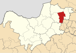
Location in the North West
Coordinates: 25°40′S27°20′E / 25.667°S 27.333°E / -25.667; 27.333
Country South Africa
Province North West
District Bojanala Platinum
Seat Rustenburg
Wards 45
Government
[1]
  Type Municipal council
  MayorSheila Mabale-Huma
Area
  Total3,423 km2 (1,322 sq mi)
Population
 (2011) [2]
  Total549,575
  Density160/km2 (420/sq mi)
Racial makeup (2011)
[2]
   Black African 88.5%
   Coloured 0.9%
   Indian/Asian 0.8%
   White 9.4%
First languages (2011)
[3]
   Tswana 53.9%
   Afrikaans 9.9%
   Xhosa 9.6%
   Tsonga 5.6%
  Other21%
Time zone UTC+2 (SAST)
Municipal codeNW373

Rustenburg Municipality (Tswana : Mmasepala wa Rustenburg; Afrikaans : Rustenburg Munisipaliteit) is a local municipality within the Bojanala Platinum District Municipality, in the North West province of South Africa. Rustenburg is situated at the foot of the Magalies mountain range. Rustenburg (meaning "town of rest" or "resting place" in Afrikaans) was proclaimed a township in 1851. The city of Rustenburg is situated some 112 km northwest from both Johannesburg and Pretoria. It is a malaria-free area. Rustenburg is the fastest growing municipality in South Africa, with the population rising from 387,096 in 2001 to 449,776 in 2007. It is the most populous municipality in the North West province.

Contents

Rustenburg is a Dutch name meaning "town (originally castle) of rest". [4]

Main places

The 2001 census divided the municipality into the following main places: [5]

PlaceCodeArea (km2)PopulationMost spoken language
Bafokeng 60301 1,040.98132,277 Tswana
Bakwena Ba Magopa 60302 297.7416,049Tswana
Baphalane 60303 2.853,399Tswana
Bapo Ba Ga Mogale 60304 29.418,412 Tswana
Boitekong 60305 2.1521,547Tswana
Hartebeesfontein 60306 5.8923,965Tswana
Magaliesberg Nature Reserve 60307 132.581,196Tswana
Mankwe 60308 1.501,463Tswana
Meriting 60309 1.8810,711Tswana
Monakato 60310 3.427,602Tswana
Paardekraal Platinum Mine 60312 0.3724Xhosa
Paardekraal 60311 1.917,215Tswana
Phatsima 60313 2.235,921Tswana
Rooikoppies 60314 0.463,670Tswana
Rustenburg Part 1 60315 183.3967,196 Afrikaans
Rustenburg Part 3 60320 2.584,662Tswana
Sunrise Park 60316 2.1410,312Tswana
Tlhabane 60317 5.1231,338Tswana
Waterval 60318 0.57979Afrikaans
Remainder of the municipality
(Rustenburg Part 2)
60319 1,774.5537,581Tswana

Politics

The municipal council consists of eighty-nine members elected by mixed-member proportional representation. Forty-five councillors are elected by first-past-the-post voting in forty-five wards, while the remaining forty-four are chosen from party lists so that the total number of party representatives is proportional to the number of votes received. In the election of 1 November 2021 no party won a majority on the council.

The following table shows the results of the election. [6]

PartyWardListTotal
seats
Votes%SeatsVotes%Seats
African National Congress 46,29145.513548,87547.96843
Economic Freedom Fighters 17,57417.28118,89618.541617
Democratic Alliance 14,32214.08714,01613.75613
Tsogang Civic Movement 7,8067.6718,1558.0067
Independent candidates 7,5257.4011
Freedom Front Plus 3,6143.5503,5143.4533
Arona 5400.5301,6031.5711
African Independent Congress 4080.4001,1931.1711
Forum for Service Delivery 4250.4201,1591.1411
African Christian Democratic Party 8140.8007570.7411
United Democratic Movement 5460.5406150.6011
Botho Community Movement 4700.4604330.4211
13 other parties1,3771.3502,6942.6400
Total101,712100.0045101,910100.004590
Valid votes101,71297.96101,91097.29
Invalid/blank votes2,1182.042,8362.71
Total votes103,830100.00104,746100.00
Registered voters/turnout288,34736.01288,34736.33

Related Research Articles

<span class="mw-page-title-main">Beaufort West Local Municipality</span> Local municipality in Western Cape, South Africa

Beaufort West Municipality is a local municipality located in the Western Cape province of South Africa. As of 2011, the population is 49,586. Its municipality code is WC053.

<span class="mw-page-title-main">Cape Agulhas Local Municipality</span> Local municipality in Western Cape, South Africa

Cape Agulhas Municipality is a municipality located in the Western Cape province of South Africa. As of 2011, it had a population of 33,038. Its municipality code is WC033. It is named after Cape Agulhas, the southernmost point of Africa. The largest town is Bredasdorp, which is the seat of the municipal headquarters. It also includes the villages of Napier, Struisbaai, Elim, Arniston and L'Agulhas, and the De Hoop Nature Reserve.

<span class="mw-page-title-main">Blouberg Local Municipality</span> Local municipality in Limpopo, South Africa

Blouberg Municipality is a local municipality within the Capricorn District Municipality, in the Limpopo province of South Africa, bordering Botswana. It takes its name from the Blouberg, a mountain range located to the west of the western end of the Soutpansberg mountain range, north west of the town of Vivo. Blouberg is home to some of the most spectacular rock climbing in South Africa. The rock climbing destination is famous for its big wall natural climbing with route lengths up to 350m. The vegetation ranges from sub-tropical savanna at the base, to alpine near the summit.

<span class="mw-page-title-main">Mbombela Local Municipality</span> Local municipality in Mpumalanga, South Africa

Mbombela Municipality is a local municipality within the Ehlanzeni District Municipality, in the Mpumalanga province of South Africa. Mbombela is a siSwati word meaning "a lot of people in a small space".

<span class="mw-page-title-main">Merafong City Local Municipality</span> Local municipality in Gauteng, South Africa

Merafong City Municipality is a local municipality in the West Rand District Municipality, in the Gauteng province of South Africa. Its boundaries encloses some of the richest gold mines in the world. It is situated about 65 km from Johannesburg and is serviced by a number of major roads, including the N12 from Johannesburg to Beaufort West and the N14.

<span class="mw-page-title-main">Kou-Kamma Local Municipality</span> Local municipality in Eastern Cape, South Africa

Kou-Kamma Municipality is a local municipality in South Africa. It is situated in the southwest corner of the Sarah Baartman District Municipality along the Indian Ocean coastline, in the southwestern sector of South Africa's Eastern Cape province. To the west lies the Western Cape. Kou-Kamma also borders the Dr Beyers Naudé Local Municipality in the north and the Kouga Local Municipality to the east. The geographical area of the municipality is 12,540 square kilometres.

<span class="mw-page-title-main">Mbhashe Local Municipality</span> Local municipality in Eastern Cape, South Africa

Mbhashe Municipality is a local municipality in the Eastern Cape province of South Africa. The municipality was constituted in terms of the Municipal Structures Act of 1998 and comprises the areas that previously formed the Elliotdale, Willowvale and Dutywa town councils. The municipality is located in the north eastern part of the Amathole District Municipality. The main administrative office is situated in Dutywa.

<span class="mw-page-title-main">Emalahleni Local Municipality, Mpumalanga</span> Local municipality in Mpumalanga, South Africa

Emalahleni Municipality is a local municipality within the Nkangala District Municipality, in the Mpumalanga province of South Africa. eMalahleni is a Nguni word meaning place of coal.

<span class="mw-page-title-main">Siyathemba Local Municipality</span> Local municipality in Northern Cape, South Africa

Siyathemba Municipality is a local municipality within the Pixley ka Seme District Municipality, in the Northern Cape province of South Africa.

<span class="mw-page-title-main">Thembelihle Local Municipality</span> Local municipality in Northern Cape, South Africa

Thembelihle Municipality, formerly known as Oranje-Karoo Municipality, is a local municipality within the Pixley ka Seme District Municipality, in the Northern Cape province of South Africa. Thembelihle is a Xhosa word meaning "good hope".

<span class="mw-page-title-main">Karoo Hoogland Local Municipality</span> Local municipality in Northern Cape, South Africa

Karoo Hoogland Municipality is a local municipality within the Namakwa District Municipality, in the Northern Cape province of South Africa. The municipality incorporates the towns of Williston, Fraserburg and Sutherland. Although the towns are separated by more than 100 km by road, they share many administrative tasks.

<span class="mw-page-title-main">Mogale City Local Municipality</span> Local municipality in Gauteng, South Africa

Mogale City Local Municipality is a local municipality within the West Rand District Municipality, in the Gauteng province of South Africa.

<span class="mw-page-title-main">Kgetlengrivier Local Municipality</span> Local municipality in North West, South Africa

Kgetlengrivier Municipality is a local municipality within the Bojanala Platinum District Municipality, in the North West province of South Africa.

<span class="mw-page-title-main">Mahikeng Local Municipality</span> Local municipality in North West, South Africa

Mahikeng Municipality is a local municipality within the Ngaka Modiri Molema District Municipality, in the North West province of South Africa. Mahikeng is a Setswana word meaning "place of rocks".

<span class="mw-page-title-main">City of Matlosana</span> Local municipality in North West, South Africa

The City of Matlosana, formerly the City Council of Klerksdorp, is a local municipality within the Dr Kenneth Kaunda District Municipality, in the North West province of South Africa.

<span class="mw-page-title-main">Moqhaka Local Municipality</span> Local municipality in Free State, South Africa

Moqhaka Municipality is a local municipality within the Fezile Dabi District Municipality, in the Free State province of South Africa. In 2001, the population was 267,881 with a total area of 7925 km². The seat is Kroonstad. Moqhaka is the Sesotho word for "crown".

<span class="mw-page-title-main">Kgatelopele Local Municipality</span> Local municipality in Northern Cape, South Africa

Kgatelopele Municipality is a local municipality within the ZF Mgcawu District Municipality, in the Northern Cape province of South Africa. Kgatelopele is a Setswana name meaning "progress".

<span class="mw-page-title-main">Khâi-Ma Local Municipality</span> Local municipality in Northern Cape, South Africa

Khâi-Ma Municipality is a local municipality within the Namakwa District Municipality, in the Northern Cape province of South Africa. Khâi-Ma is a Khoekhoe word meaning "to stand up".

<span class="mw-page-title-main">Dihlabeng Local Municipality</span> Local municipality in Free State, South Africa

Dihlabeng Municipality is a local municipality within the Thabo Mofutsanyane District Municipality, in the Free State province of South Africa. It was established after the first general local government elections on 5 December 2000, which heralded the final phase of local government reform as envisaged in 1994 at the onset of the process of democratisation and the end of apartheid. The seat is Bethlehem.

<span class="mw-page-title-main">ǃKheis Local Municipality</span> Local municipality in Northern Cape, South Africa

ǃKheis Municipality is a local municipality within the ZF Mgcawu District Municipality, in the Northern Cape province of South Africa. ǃKheis is a Khoikhoi name meaning "a place where you live, or a home". The municipality is named in recognition of the Khoekhoe people who were the first permanent dwellers of the area.

References

  1. "Rustenburg Local Municipality - South African Government". www.gov.za. Retrieved 2022-05-21.
  2. 1 2 "Statistics by place". Statistics South Africa. Retrieved 27 September 2015.
  3. "Statistics by place". Statistics South Africa. Retrieved 27 September 2015.
  4. South African Languages - Place names
  5. Lookup Tables - Statistics South Africa
  6. "Election Result Table for LGE2021 — Rustenburg". wikitable.frith.dev. Retrieved 2021-12-04.