
An unincorporated area is a region that is not governed by a local municipal corporation. Widespread unincorporated communities and areas are a distinguishing feature of the United States and Canada. Most other countries of the world either have no unincorporated areas at all or these are very rare. They are typically remote, outlying, sparsely populated or uninhabited areas.
Westonaria is a town in the west of Gauteng province of South Africa. It is situated in the Rand West City Local Municipality, part of the West Rand District Municipality. During the apartheid era, Africans lived outside town in Bekkersdal. The town is some 45 km west of Johannesburg and 18 km south of Randfontein.

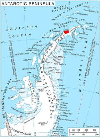
Rose Valley Glacier is a glacier on Varna Peninsula, eastern Livingston Island in the South Shetland Islands, Antarctica situated northeast of Saedinenie Snowfield, northwest of Debelt Glacier and north of Panega Glacier. It extends 5.2 km in southeast-northwest direction and 3.7 km in southwest-northeast direction, and drains the northeast slopes of Vidin Heights to flow into Lister Cove and McFarlane Strait between Pomorie Point and Inott Point.

Teteven Glacier is a glacier on Greenwich Island in the South Shetland Islands, Antarctica situated east of Yakoruda Glacier, west of Quito Glacier, northwest of Traub Glacier and north of Murgash Glacier. It extends 6.5 km in east-west direction and 3.8 km in north-south direction, and drains the north slopes of Dryanovo Heights into the Drake Passage in Haskovo Cove and Skaptopara Cove between Miletich Point and the ice-free area at Agüedo Point.
Yakoruda Glacier is a glacier on the west slopes of Dryanovo Heights, Greenwich Island in the South Shetland Islands, Antarctica situated west of Teteven Glacier and northwest of Murgash Glacier. It extends 3.5 km in north-south direction and 2.5 km in east-west direction, is bounded by Greaves Peak, Hrabar Nunatak and Crutch Peaks to the north, Lloyd Hill to the east and Kerseblept Nunatak to the south, and drains westwards into Berende Cove, McFarlane Strait.
Zheravna Glacier is a glacier on Greenwich Island, Antarctica situated east of Wulfila Glacier and west of Targovishte Glacier. It is bounded by Razgrad Peak to the west, Ilinden Peak and Momchil Peak to the north, and Viskyar Ridge to the east, extending 2 km in the east–west direction and 1.8 km in the north–south direction, and draining southwards into McFarlane Strait between Ephraim Bluff and Sartorius Point.

Berkovitsa Glacier is a glacier on Livingston Island, Antarctica situated east of Etar Snowfield, south of Medven Glacier, west-northwest of Tundzha Glacier and north-northeast of Verila Glacier. It is bounded by the southeastern slopes of Oryahovo Heights and the northwestern slopes of Snow Peak. It extends 4 km in southeast-northwest direction and 2.8 km in northwest-southeast direction, and drains northeastwards into Hero Bay between Avitohol Point and Remetalk Point.
Dalemead is a hamlet in southern Alberta under the jurisdiction of Rocky View County. It is approximately 35 km (21 mi) southeast of Downtown Calgary and 3.2 km (2.0 mi) south of Highway 22X along a Canadian Pacific Railway line.
Ardmore, Alberta is a hamlet in northern Alberta, Canada within the Municipal District of Bonnyville No. 87. It is located approximately 18 km (11 mi) east of Bonnyville along Highway 28 and has an elevation is 1,807 ft (551 m).
Sibelius Glacier is a glacier, 12 miles (19 km) long and 6 miles (10 km) wide, flowing south into the Mozart Ice Piedmont 10 miles (16 km) southwest of Mount Stephenson in the northern portion of Alexander Island, Antarctica. The glacier was first sighted from the air by the British Graham Land Expedition in 1937. Mapped from air photos taken by the Ronne Antarctic Research Expedition in 1947–48, by Searle of the Falkland Islands Dependencies Survey in 1960. This feature was named by the United Kingdom Antarctic Place-Names Committee for Jean Sibelius (1865-1957), Finnish composer.
Faust is a hamlet in northern Alberta within Big Lakes County, located 1 kilometre (0.62 mi) north of Highway 2, approximately 241 kilometres (150 mi) northwest of Edmonton.
Kasabova Glacier is the 6 km long and 3.5 km wide glacier on Davis Coast in Graham Land on the Antarctic Peninsula. Draining the slopes of Mount Bris, Chubra Peak, Sredorek Peak and Chanute Peak in Korten Ridge, the glacier flows northwestwards to enter Orléans Strait at the head of Lanchester Bay.

Sigmen Glacier is a 2.2 km long and 2 km wide glacier draining the northwest slopes of Brugmann Mountains on Liège Island in the Palmer Archipelago, Antarctica. It is situated northeast of Zbelsurd Glacier and southwest of Shterna Glacier, draining the west-southwest slopes of Vazharov Peak and the northwest slopes of Mount Kozyak, and flows northwestwards to enter Palakariya Cove.

Kleptuza Glacier is a 6 km long and 6 km wide glacier draining the east slopes of Mount Hector in the Trojan Range and the north slopes of Osterrieth Range on Anvers Island in the Palmer Archipelago, Antarctica. Situated southeast of Thamyris Glacier and west of Altimir Glacier. Flowing northwards to enter Fournier Bay east of Madzharovo Point and west of Studena Point.

Thamyris Glacier is a 3 km long and 2.8 km wide glacier draining the east slopes of the Trojan Range on Anvers Island in the Palmer Archipelago, Antarctica. Situated east of Iliad Glacier, south of Rhesus Glacier and northwest of Kleptuza Glacier. Flowing northeastwards into Fournier Bay south of Predel Point and north of Madzharovo Point.
Rhesus Glacier is a 7 km long and 2.5 km wide glacier draining the east slopes of the Trojan Range on Anvers Island in the Palmer Archipelago, Antarctica southeast of Paris Peak. Situated east of Iliad Glacier, south of Lipen Glacier and north of Thamyris Glacier. Flowing northeastwards into Fournier Bay south of Thompson Peninsula and north of Predel Point.
Lipen Glacier is a 5 km long and 3.5 km wide glacier draining the east slopes of the Trojan Range on Anvers Island in the Palmer Archipelago, Antarctica. Situated east of Iliad Glacier and north of Rhesus Glacier. Flowing northeastwards into the head of Patagonia Bay east of Gourdon Peninsula and west of Thompson Peninsula.

Samodiva Glacier is the 3.7 km long and 1.8 km wide glacier in the east part of Chavdar Peninsula in Graham Land on the Antarctic Peninsula. Situated east of Tumba Ice Cap and west of Pirin Glacier. Draining north-northeastwards east of Mount Pénaud to enter Curtiss Bay west of Seaplane Point.
Pirin Glacier is the 5.7 km long and 6 km wide glacier situated next east of Chavdar Peninsula on Davis Coast on the Antarctic Peninsula. Situated west of Wright Ice Piedmont, north of Gregory Glacier and east of Samodiva Glacier. Draining north-northwestwards from Boulton Peak to enter Curtiss Bay east of Seaplane Point.

Kopsis Glacier is a 7 nautical miles long and 2 nautical miles wide glacier on the east side of north-central Sentinel Range in Ellsworth Mountains, Antarctica that is draining northeastwards from Panicheri Gap, Voysil Peak and Mount Gozur to join Embree Glacier northwest of Mirovyane Peak.


