The Central African Republic is a landlocked nation within the interior of the African continent. It is bordered by the countries of Cameroon, Chad, Sudan, South Sudan, the Democratic Republic of the Congo and the Republic of the Congo. Much of the country consists of flat, or rolling plateau savanna, about 1,640 feet (500 m) above sea level. In the northeast are the Fertit Hills, and there are scattered hills in the southwestern part of the country. To the northwest are the Karre Mountains, a granite plateau with an altitude of 3,750 feet (1,143 m).

Tunisia is a country in Northern Africa, bordering the Mediterranean Sea, having a western border with Algeria (965 km) and south-eastern border with Libya (459 km) where the width of land tapers to the south-west into the Sahara. The country has north, east and complex east-to-north coasts including the curved Gulf of Gabès, which forms the western part of Africa's Gulf of Sidra. Most of this greater gulf forms the main coast of Libya including the city of Sirte which shares its root name. The country's geographic coordinates are 34°00′N9°00′E. Tunisia occupies an area of 163,610 square kilometres, of which 8,250 are water. The principal and reliable rivers rise in the north of the country with a few notable exceptions from north-east Algeria and flow through the northern plain where sufficient rainfall supports diverse plant cover and irrigated agriculture.

Benin, a narrow, key-shaped, north-south strip of land in West Africa, lies between the Equator and the Tropic of Cancer. Benin's latitude ranges from 6°30′ N to 12°30′ N and its longitude from 1° E to 3°40′ E. Benin is bounded by Togo to the west, Burkina Faso and Niger to the north, Nigeria to the east, and the Bight of Benin to the south.

Red Hill is a census-designated place (CDP) in Horry County, South Carolina, United States. The population was 13,223 at the 2010 census, up from 10,509 at the 2000 census.
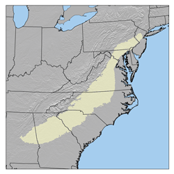
The Piedmont is a plateau region located in the Eastern United States. It sits between the Atlantic coastal plain and the main Appalachian Mountains, stretching from New Jersey in the north to central Alabama in the south. The Piedmont Province is a physiographic province of the larger Appalachian division which consists of the Gettysburg-Newark Lowlands, the Piedmont Upland and the Piedmont Lowlands sections.

The Volkswagen Caddy is a leisure activity vehicle (M-segment) produced by the Volkswagen Group since 1980. It is sold in Europe and in other markets around the world. The Volkswagen Caddy was first introduced in North America in 1980 and in Europe in 1982. The second generation also had a pick-up variant.

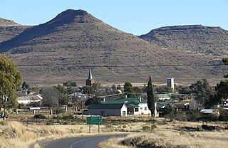
Delareyville is a maize and peanut farming town situated in North West Province of South Africa. The town is 96 km south-west of Lichtenburg, 82 km north-east of Vryburg, 114 km north-west of Wolmaransstad, and 61 km north of Schweizer-Reneke.

Wolmaransstad is a maize-farming town situated on the N12 between Johannesburg and Kimberley in North West Province of South Africa. The town lies in an important alluvial diamond-mining area and it is the main town of the Maquassi Hills Local Municipality.
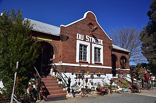
Swartruggens is a small farming town in North West Province, South Africa that was established in 1875.

Kabwe is the capital of the Zambian Central Province with a population estimated at 202,914 at the 2010 census. Named Broken Hill until 1966, it was founded when lead and zinc deposits were discovered in 1902. Kabwe also has a claim to being the birthplace of Zambian politics as it was an important political centre during the colonial period. It is an important transportation and mining centre.

Boston's diverse neighborhoods serve as a political and cultural organizing mechanism. The City of Boston's Office of Neighborhood Services has designated 23 Neighborhoods in the city:

Duduza is a township west of Nigel on the East Rand, Gauteng, South Africa. It was established in 1964 when Africans were resettled from Charterston because it was considered by the apartheid government to be too close to a white town. A local authority was established in 1983. Duduza experienced violent school, consumer, bus, and rent boycotts from 1984 to 1987. A state of emergency was imposed in July 1985 and the South African Army was called in as the violence peaked.
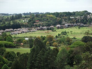
Botha's Hill is a small town outside Hillcrest in KwaZulu-Natal, South Africa.Remains a peaceful beautiful hill where regular country style food and craft markets are held.It is the gateway to the Valley of a Thousand Hills. Kearsney College moved to Botha's Hill in 1939. Alan Paton, a famous author who wrote novels such as Cry, the Beloved Country and Too Late the Phalarope moved here and resided here until his death on the 12th of April, 1988.

When the Second Boer War broke out on 11 October 1899, the Boers had a numeric superiority within Southern Africa. They quickly invaded the British territory and laid siege to Ladysmith, Kimberley and Mafeking. Britain meanwhile transported thousands of troops both from the United Kingdom itself and from elsewhere in the Empire and by the time the siege of Ladysmith had been lifted, had a huge numeric superiority.

Tsolo is a town in Mhlontlo Local Municipality in O.R.Tambo District of the Eastern Cape province of South Africa.

Impendle is a town in Umgungundlovu District Municipality in the KwaZulu-Natal province of South Africa.

Ndwedwe is a town in Ilembe District Municipality in the KwaZulu-Natal province of South Africa.
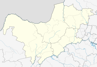
Rooikoppies, also known as Marikana, is a town in Rustenburg local municipality, Bojanala Platinum District Municipality district in the North West province of South Africa.

Karatara is a town in Knysna Local Municipality in the Western Cape province of South Africa.
