Xhariep District Municipality

Last updated
Xhariep
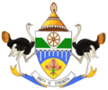
Xhariep CoA.png
Map of South Africa with Xhariep highlighted (2011).svg
Location of Xhariep District Municipality within Free State
Coordinates: 30°01′S25°46′E / 30.017°S 25.767°E / -30.017; 25.767
Country South Africa
Province Free State
Seat Trompsburg
Local municipalities
Government
[1]
  Type Municipal council
  MayorIrene Mehlomekhulu
Area
  Total37,674 km2 (14,546 sq mi)
Population
 (2011) [2]
  Total146,259
  Density3.9/km2 (10/sq mi)
Racial makeup (2011)
[2]
   Black African 78.5%
   Coloured 13.2%
   Indian/Asian 0.4%
   White 7.6%
First languages (2011)
[3]
   Sotho 45.3%
   Afrikaans 31.6%
   Xhosa 15.8%
   Tswana 3.5%
  Other3.8%
Time zone UTC+2 (SAST)
Municipal codeDC16

The Xhariep District Municipality (Sotho : Masepala wa Setereke wa Xhariep; Afrikaans : Xhariep-distriksmunisipaliteit; Xhosa : uMasipala weSithili sase Xhariep) is one of the 5 districts of the Free State province of South Africa. The municipality is the largest in the Free State geographically and is known for its vast land. It is home to the largest dam in the county, the Gariep Dam, and has two mines, situated in Jagersfontein and Koffiefontein. The natural resources and the geographical position of the municipality make it a site with good potential for investment and development. The seat is Trompsburg. As of 2011, the largest language group is Sotho who make up 45.3% of the total population of 146,259. The district code is DC16.
Contents

Geography

Welcoming sign where the Orange River is crossed in the direction of the Xhariep District Municipality Xhariepwelcome2.JPG
Welcoming sign where the Orange River is crossed in the direction of the Xhariep District Municipality

Neighbours

Xhariep is surrounded by:

Local municipalities

The district contains the following local municipalities:

Local municipalityPopulation%Dominant language
Kopanong 49 17133.6% Sotho, Afrikaans
Letsemeng 38 62826.4%Afrikaans
Mohokare 34 14623.4%Sotho
Naledi 24 31416.6%Sotho

Demographics

The following statistics are from the 2011 census.

LanguagePopulation%
Sotho 64 53645.32%
Afrikaans 44 94231.56%
Xhosa 22 51815.81%
Tswana 5 0003.51%
English 2 2821.60%
Sign language1 0830.76%
Zulu, Ndebele, Swati8740.60%
Other 6910.49%
Northern Sotho 2600.18%

Gender

GenderPopulation%
Female74 60051.01%
Male71 65848.99%

Ethnic groups

Ethnic groupPopulation%
Black African114 80678.49%
Coloured19 23913.15%
White11 1437.62%
Indian/Asian5530.38%

Age

AgePopulation%
000 - 00413 2169.77%
005 - 00914 64010.82%
010 - 01415 61311.54%
015 - 01914 96211.06%
020 - 02411 7088.66%
025 - 02910 5847.83%
030 - 03410 0027.40%
035 - 0398 9526.62%
040 - 0447 7425.72%
045 - 0496 4874.80%
050 - 0545 5344.09%
055 - 0594 1753.09%
060 - 0643 7842.80%
065 - 0693 0072.22%
070 - 0741 8981.40%
075 - 0791 2900.95%
080 - 0849700.72%
085 - 0894440.33%
090 - 0941570.12%
095 - 099620.05%
100 plus260.02%

Politics

Election results

Election results for Xhariep in the South African general election, 2004.

PartyVotes%
African National Congress 34 69780.54%
Democratic Alliance 4 36810.14%
Freedom Front Plus 1 0212.37%
African Christian Democratic Party 7491.74%
Pan African Congress 7181.67%
New National Party 4391.02%
Independent Democrats 3210.75%
United Democratic Movement 1830.42%
Inkhata Freedom Party 940.22%
United Christian Democratic Party 810.19%
Azanian People's Organisation 800.19%
UF 780.18%
NA 660.15%
SOPA 500.12%
EMSA 310.07%
CDP 280.06%
TOP 270.06%
PJC 270.06%
NLP 110.03%
Minority Front 70.02%
KISS 60.01%
Total43 082100.00%

Related Research Articles

<span class="mw-page-title-main">West Rand District Municipality</span> District municipality in Gauteng, South Africa

The West Rand District Municipality is one of the districts of the Gauteng province of South Africa, that covers the West Rand area, with the exception of Roodepoort. The seat of the district municipality is Randfontein. As of 2011, the most spoken language among its population of 820,995 is Tswana. The district code is CBDC8.

<span class="mw-page-title-main">Theewaterskloof Local Municipality</span> Local municipality in Western Cape, South Africa

Theewaterskloof Municipality is a local municipality located within the Overberg District Municipality, in the Western Cape province of South Africa. As of 2007, the population was 108,790. Its municipality code is WC031. The enormous Theewaterskloof Dam, which provides water for Cape Town and the surrounding areas, is located in this municipality.

<span class="mw-page-title-main">Sedibeng District Municipality</span> District municipality in Gauteng, South Africa

The Sedibeng District Municipality is one of the districts of the Gauteng province of South Africa. The administrative seat of the district is Vereeniging. As of 2011, the most widely spoken language among its 794,605 inhabitants was Sesotho.

<span class="mw-page-title-main">Thabo Mofutsanyana District Municipality</span> District municipality in Free State, South Africa

The Thabo Mofutsanyana District Municipality is one of the 5 districts of the Free State province of South Africa. The seat is Witsieshoek. As of 2011, a majority of its 725,932 residents spoke Sesotho. The district code is DC19

<span class="mw-page-title-main">Lejweleputswa District Municipality</span> District municipality in Free State, South Africa

The Lejweleputswa District Municipality is one of the 5 districts of the Free State province of South Africa. The seat of the municipality is Welkom. As of 2011, a majority of its 657,019 residents speak Sotho. The district code is DC18. Lejweleputswa is a Sesotho word meaning "grey rock".

<span class="mw-page-title-main">Frances Baard District Municipality</span> District municipality in Northern Cape, South Africa

The Frances Baard District Municipality, previously the Diamantveld District Municipality, is one of the 5 districts of the Northern Cape province of South Africa. The seat of the municipality is Kimberley. As of 2011, the majority of its 324,814 residents speak Setswana. The district code is DC9.

<span class="mw-page-title-main">Namakwa District Municipality</span> District municipality in Northern Cape, South Africa

The Namakwa District Municipality is one of the 5 districts of the Northern Cape province of South Africa. The seat of Namakwa is Springbok and the region is also known as Little Namaqualand. As of 2011, a majority of its 108,118 residents speak Afrikaans. The district code is DC6.

<span class="mw-page-title-main">ZF Mgcawu District Municipality</span> District municipality in Northern Cape, South Africa

The ZF Mgcawu District Municipality, known before 1 July 2013 as the Siyanda District Municipality, is one of the 5 districts of the Northern Cape province of South Africa. The seat of the municipality is Upington. As of 2011, the majority (76%) of its 236,783 residents speak Afrikaans. The district code is DC8.

<span class="mw-page-title-main">John Taolo Gaetsewe District Municipality</span> District municipality in Northern Cape, South Africa

The John Taolo Gaetsewe District Municipality, formerly the Kgalagadi District Municipality, is one of the five districts of the Northern Cape province of South Africa. The seat of the authority is Kuruman. As of 2011, the majority of its 176,899 residents speak Setswana. The district code is DC45.

<span class="mw-page-title-main">Joe Gqabi District Municipality</span> District municipality in Eastern Cape, South Africa

The Joe Gqabi District Municipality is one of the seven districts of the Eastern Cape province of South Africa. The seat is Barkly East. As of 2011, the majority of its 349,768 inhabitants spoke isiXhosa.

<span class="mw-page-title-main">Dr Kenneth Kaunda District Municipality</span> District municipality in North West, South Africa

The Dr Kenneth Kaunda District Municipality, formerly the Southern District Municipality, is one of the 4 districts of the North West province of South Africa. The seat of the municipality is Klerksdorp. As of 2016, a plurality of its 742,821 residents speak Setswana. The majority of its residents live in the City of Matlosana. The district code is DC40. The district was formerly known as the Southern District Municipality. It is named after Kenneth Kaunda, the first President of Zambia.

<span class="mw-page-title-main">Dr Ruth Segomotsi Mompati District Municipality</span> District municipality in North West, South Africa

The Dr Ruth Segomotsi Mompati District Municipality, formerly the Bophirima District Municipality, is one of the 4 districts of the North West province of South Africa. The seat of the municipality is Vryburg. As of 2011, the majority of its 439,637 residents speak Setswana. The district code is DC39. It is South Africa's largest beef producing district, with Hereford cattle the most popular. It is sometimes called "the Texas of South Africa". Maize and peanuts are important crops produced in the district. The district was renamed after the former Mayor of Vryburg, Ruth Mompati.

<span class="mw-page-title-main">Sekhukhune District Municipality</span> District municipality in Limpopo, South Africa

The Sekhukhune District Municipality is one of the 5 districts of the Limpopo province of South Africa. The seat is Groblersdal. As of 2011, the majority of its 1,076,840 inhabitants spoke Sepedi. The district code is DC47.

<span class="mw-page-title-main">Capricorn District Municipality</span> District municipality in Limpopo, South Africa

The Capricorn District Municipality is one of the 5 districts of the Limpopo province of South Africa. The district is named after the Tropic of Capricorn which runs through it. The capital is Polokwane. As of 2011, the vast majority of its 1,261,463 residents spoke Northern Sotho as their home language. The district code is DC35.

<span class="mw-page-title-main">Waterberg District Municipality</span> District Municipality in Limpopo, South Africa

The Waterberg District Municipality is one of the 5 districts of the Limpopo province of South Africa. The seat is Modimolle. As of 2016, the majority of its 745,758 residents spoke Sepedi, also known as Northern Sotho. The district code is DC36.

<span class="mw-page-title-main">Fezile Dabi District Municipality</span> District municipality in Free State, South Africa

The Fezile Dabi District Municipality, formerly known as the Northern Free State District Municipality, is one of the 5 districts of the Free State province of South Africa. The seat is Sasolburg. As of 2011, a majority of its 460,289 residents spoke Sesotho. The district code is DC20.

<span class="mw-page-title-main">Moretele Local Municipality</span> Local municipality in North West, South Africa

Moretele Municipality is a local municipality within the Bojanala Platinum District Municipality, in the North West province of South Africa. As of 2011, its population was approximately 180,000, a majority of whom speak Setswana as a first language.

<span class="mw-page-title-main">Kopanong Local Municipality</span> Local municipality in Free State, South Africa

Kopanong Municipality is a local municipality within the Xhariep District Municipality, in the Free State province of South Africa. Kopanong is a Sesotho word meaning "meeting place or where people are invited". The name earmarks unity and seeks to encourage co-operation.

<span class="mw-page-title-main">Matatiele Local Municipality</span> Local municipality in Eastern Cape, South Africa

Matatiele Municipality is a local municipality within the Alfred Nzo District Municipality, in the Eastern Cape province of South Africa. It adjoins Lesotho to the north, Elundini to the south-west, and Greater Kokstad to the east and its 4,352 km² makes the Matatiele Municipality largest of four municipalities in the district at almost half of its geographical area. According to the South African National Census of 2011, its 203,483 residents and 49,527 households makes Matatiele Municipality the second largest populated area in the Alfred Nzo District Municipality behind Mbizana.

<span class="mw-page-title-main">Letsemeng Local Municipality</span> Local municipality in Free State, South Africa

Letsemeng Municipality is a local municipality within the Xhariep District Municipality, in the Free State province of South Africa.

References

  1. "Contact list: Executive Mayors". Government Communication & Information System. Retrieved 22 February 2012.
  2. 1 2 "Statistics by place". Statistics South Africa. Retrieved 27 September 2015.
  3. "Statistics by place". Statistics South Africa. Retrieved 27 September 2015.