Mantsopa Local Municipality

Last updated
Mantsopa
Mantsopa CoA.png
Map of the Free State with Mantsopa highlighted.svg
Location in the Free State
Country South Africa
Province Free State
District Thabo Mofutsanyane
Seat Ladybrand
Wards 9
Government
[1]
  Type Municipal council
  MayorMamsie Tsoene (ANC)
Area
  Total4,291 km2 (1,657 sq mi)
Population
 (2011) [2]
  Total51,056
  Density12/km2 (31/sq mi)
Racial makeup (2011)
[2]
   Black African 88.4%
   Coloured 3.9%
   Indian/Asian 0.6%
   White 6.6%
First languages (2011)
[3]
   Sotho 82.1%
   Afrikaans 9.8%
   English 4.1%
   Sign language 1.4%
  Other2.6%
Time zone UTC+2 (SAST)
Municipal codeFS196

Mantsopa Municipality (Sotho : Masepala wa Mantsopa) is a local municipality within the Thabo Mofutsanyana District Municipality, in the Free State province of South Africa.

Contents

Origin of the name

Basotho prophet 'Mantsopa Makhetha [4] was a cousin to King Moshoeshoe I, who banished her from the Kingdom when he suspected that her powers were greater than his. When she arrived at Modderpoort there were no houses and, according to legend, she stayed in a cave. In 1886 a group of men called The Brotherhood of St Augustine arrived at Modderpoort, and 'Mantsopa accommodated them in her cave. The missionaries decided to stay and they turned the cave into a chapel. 'Mantsopa later joined the church and was baptised and given the name Anna. 'Mantsopa's grave continues to be visited and offerings are still placed on or near it. [5]

Main places

The 2001 census divided the municipality into the following main places: [6]

PlaceCodeArea (km2)PopulationMost spoken language
Borwa 40601 0.423,294 Sotho
Dipeleng 40602 0.15822Sotho
Excelsior 40603 11.37485 Afrikaans
Hobhouse 40604 11.792,589Sotho
Ladybrand 40605 43.054,214Afrikaans
Mahalatswetsa 40606 1.644,881Sotho
Manyatseng 40608 2.6414,177Sotho
Thaba Phatswa 40609 2.17434Afrikaans
Thusanong 40610 0.562,989Sotho
Tweespruit 40611 3.041,056Sotho
Remainder of the municipality 40607 4,213.0820,377Sotho

Politics

The municipal council consists of eighteen members elected by mixed-member proportional representation. Nine councillors are elected by first-past-the-post voting in nine wards, while the remaining nine are chosen from party lists so that the total number of party representatives is proportional to the number of votes received. In the election of 1 November 2021 the African National Congress (ANC) won a majority of eleven seats on the council.

The following table shows the results of the election. [7]

PartyWardListTotal
seats
Votes%SeatsVotes%Seats
African National Congress 7,28558.9687,37460.23311
Democratic Alliance 2,95923.9512,92523.8934
Economic Freedom Fighters 1,2259.9101,24110.1422
Congress of the People 3602.9103212.6211
Independent candidates 1861.5100
5 other parties3412.7603833.1300
Total12,356100.00912,244100.00918
Valid votes12,35698.5212,24498.51
Invalid/blank votes1851.481851.49
Total votes12,541100.0012,429100.00
Registered voters/turnout27,61245.4227,61245.01

Related Research Articles

<span class="mw-page-title-main">KwaDukuza Local Municipality</span> Local municipality in KwaZulu-Natal, South Africa

KwaDukuza Local Municipality is one of four municipalities under iLembe District Municipality, KwaZulu-Natal, South Africa.

<span class="mw-page-title-main">Mbombela Local Municipality</span> Local municipality in Mpumalanga, South Africa

Mbombela Municipality is a local municipality within the Ehlanzeni District Municipality, in the Mpumalanga province of South Africa. Mbombela is a siSwati word meaning "a lot of people in a small space".

<span class="mw-page-title-main">Rustenburg Local Municipality</span> Local municipality in North West, South Africa

Rustenburg Municipality is a local municipality within the Bojanala Platinum District Municipality, in the North West province of South Africa. Rustenburg is situated at the foot of the Magalies mountain range. Rustenburg was proclaimed a township in 1851. The city of Rustenburg is situated some 112 km northwest from both Johannesburg and Pretoria. It is a malaria-free area. Rustenburg is the fastest growing municipality in South Africa, with the population rising from 387,096 in 2001 to 449,776 in 2007. It is the most populous municipality in the North West province.

<span class="mw-page-title-main">Renosterberg Local Municipality</span> Local municipality in Northern Cape, South Africa

Renosterberg Municipality is a local municipality within the Pixley ka Seme District Municipality, in the Northern Cape province of South Africa.

<span class="mw-page-title-main">Mogale City Local Municipality</span> Local municipality in Gauteng, South Africa

Mogale City Local Municipality is a local municipality within the West Rand District Municipality, in the Gauteng province of South Africa.

<span class="mw-page-title-main">Albert Luthuli Local Municipality</span> Local municipality in Mpumalanga, South Africa

Albert Luthuli Municipality is a local municipality within the Gert Sibande District Municipality, in the Mpumalanga province of South Africa. It was named after Albert Luthuli. Carolina is the seat of the municipality.

<span class="mw-page-title-main">Bela-Bela Local Municipality</span> Local municipality in Limpopo, South Africa

Bela-Bela Municipality is a local municipality within the Waterberg District Municipality, in the Limpopo province of South Africa. The seat is Bela-Bela. The municipality lies north of Hammanskraal. It is the only municipality in South Africa that straddles 4 provinces.

<span class="mw-page-title-main">Elias Motsoaledi Local Municipality</span> Local municipality in Limpopo, South Africa

Elias Motsoaledi Municipality, formerly the Greater Groblersdal Municipality, is a local municipality within the Sekhukhune District Municipality, in the Limpopo province of South Africa. The seat of is Groblersdal. It is named in honour of the Elias Motsoaledi.

<span class="mw-page-title-main">Moses Kotane Local Municipality</span> Local municipality in North West, South Africa

Moses Kotane Municipality is a local municipality within the Bojanala Platinum District Municipality, in the North West province of South Africa. It is named in memory of Moses Kotane. The seat of the municipality is Mogwase.

<span class="mw-page-title-main">Tlokwe Local Municipality</span> Local municipality in North West, South Africa

Tlokwe Local Municipality was a local municipality in Dr Kenneth Kaunda District Municipality, North West Province, South Africa. The seat was Potchefstroom. After the municipal elections on 3 August 2016 it was merged into the larger JB Marks Local Municipality.

<span class="mw-page-title-main">Phumelela Local Municipality</span> Local municipality in Free State, South Africa

Phumelela Municipality is a local municipality within the Thabo Mofutsanyane District Municipality, in the Free State province of South Africa. Phumelela means "to succeed" in isiZulu.

eDumbe Local Municipality Local municipality in KwaZulu-Natal, South Africa

eDumbe Local Municipality is an administrative area in the Zululand District of KwaZulu-Natal in South Africa. The municipality is named after the Dumbe mountain.

<span class="mw-page-title-main">Letsemeng Local Municipality</span> Local municipality in Free State, South Africa

Letsemeng Municipality is a local municipality within the Xhariep District Municipality, in the Free State province of South Africa.

<span class="mw-page-title-main">Great Kei Local Municipality</span> Local municipality in Eastern Cape, South Africa

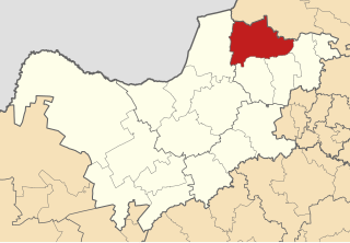
Great Kei Municipality is a local municipality within the Amathole District Municipality, in the Eastern Cape province of South Africa. The word Kei is of Khoekhoe origin, meaning "sand". The municipality is named after the Great Kei River.

<span class="mw-page-title-main">Greater Kokstad Local Municipality</span> Local municipality in KwaZulu-Natal, South Africa

Greater Kokstad Municipality is a local municipality within the Harry Gwala District Municipality, in the KwaZulu-Natal province of South Africa. Kokstad is derived from Dutch, meaning "town of Kok". It was named after Adam Kok III.

<span class="mw-page-title-main">Sakhisizwe Local Municipality</span> Local municipality in Eastern Cape, South Africa

Sakhisizwe Municipality is a local municipality within the Chris Hani District Municipality, in the Eastern Cape province of South Africa. Sakhisizwe is an isiXhosa word meaning "we are building the nation".

<span class="mw-page-title-main">Richmond Local Municipality</span> Local municipality in KwaZulu-Natal, South Africa

Richmond Municipality is a local municipality within the Umgungundlovu District Municipality, in the KwaZulu-Natal province of South Africa.

<span class="mw-page-title-main">Dr AB Xuma Local Municipality</span> Local municipality in Eastern Cape, South Africa

Dr AB Xuma Local Municipality is a local municipality within the Chris Hani District Municipality, in the Eastern Cape province of South Africa. Ngcobo is an isiXhosa word for a sweet grass found in the area.

<span class="mw-page-title-main">Nketoana Local Municipality</span> Local municipality in Free State, South Africa

Nketoana Municipality is a local municipality within the Thabo Mofutsanyane District Municipality, in the Free State province of South Africa.

The Mantsopa Local Municipality elections is a democratic process through which the residents of Mantsopa Local Municipality, located in the Free State province of South Africa, elect their local government representatives. The Mantsopa Local Municipality council consists of eighteen members elected by mixed-member proportional representation. Nine councillors are elected by first-past-the-post voting in nine wards, while the remaining nine are chosen from party lists so that the total number of party representatives is proportional to the number of votes received.

References

  1. "Contact list: Executive Mayors". Government Communication & Information System. Archived from the original on 14 July 2010. Retrieved 22 February 2012.
  2. 1 2 "Statistics by place". Statistics South Africa. Retrieved 27 September 2015.
  3. "Statistics by place". Statistics South Africa. Retrieved 27 September 2015.
  4. "Mantsopa Makhetha". 6 September 2019.
  5. South African Languages: Place names
  6. Lookup Tables - Statistics South Africa [ permanent dead link ]
  7. "Election Result Table for LGE2021 — Mantsopa". wikitable.frith.dev. Retrieved 2023-10-28.

29°11′40″S27°27′22″E / 29.19444°S 27.45611°E / -29.19444; 27.45611