| Madanryting | |
|---|---|
| suburb | |
 Madanryting Location in Meghalaya, India  Madanryting Madanryting (India) | |
| Coordinates: 25°33′44″N91°53′36″E / 25.5623500°N 91.8934200°E Coordinates: 25°33′44″N91°53′36″E / 25.5623500°N 91.8934200°E | |
| Under Community Development Block | |
| State | Meghalaya |
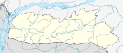
| District | East Khasi Hills |
| Government | |
| • Type | Traditional Chief called Headman elected in the General Meeting of adult citizens |
| • Body | Village Durbar |
| Population (2001) | |
| • Total | 16,700 |
| Khasi community | |
| • Khasi | Khasi, Hindi and English |
| Time zone | IST (UTC+5:30) |
| Vehicle registration | ML |
Madanrting is a census town in East Khasi Hills district in the Indian state of Meghalaya.
A census town is a type of town that satisfies certain characteristics, depending on the country in which it is located.

East Khasi Hills is an administrative district in the state of Meghalaya in India. The district headquarters are located at Shillong. The district occupies an area of 2752 km² and has a population of 824,059. As of 2011 it is the most populous district of Meghalaya's seven districts.

India, also known as the Republic of India, is a country in South Asia. It is the seventh largest country by area and with more than 1.3 billion people, it is the second most populous country as well as the most populous democracy in the world. Bounded by the Indian Ocean on the south, the Arabian Sea on the southwest, and the Bay of Bengal on the southeast, it shares land borders with Pakistan to the west; China, Nepal, and Bhutan to the northeast; and Bangladesh and Myanmar to the east. In the Indian Ocean, India is in the vicinity of Sri Lanka and the Maldives, while its Andaman and Nicobar Islands share a maritime border with Thailand and Indonesia.


