
The Glenmore Reservoir is a large reservoir on the Elbow River in the southwest quadrant of Calgary, Alberta. It is controlled by the Glenmore Dam, a concrete gravity dam on the Elbow River. The Glenmore Reservoir is a primary source of drinking water to the city of Calgary. Built in 1932, with a cost of $3.8 million, the dam controls the downstream flow of the Elbow River, thus allowing the city to develop property near the river's banks with less risk of flooding.

The Subarnarekha River flows through the Indian states of Jharkhand, West Bengal and Odisha.
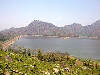
Pothundi Dam is an irrigation dam near Pothundi village in the Palakkad district of Kerala state, India. Constructed in the 19th century, it is considered one of the oldest dams in India. It provides irrigation to an area of 5,470 hectares in the Palakkad district and drinking water supply to the Nemmara, Ayalur, Melarcode Panchayat. An unusual feature of the earth dam is the core wall, which is built with a mixture of jaggery and quick lime.

Hirakud Dam is built across the Mahanadi River, about 10 kilometres (6.2 mi) from Sambalpur in the state of Odisha in India. It is the longest earthen dam in the world. Behind the dam extends a lake, Hirakud Reservoir, 55 km (34 mi) long. It is one of the first major multipurpose river valley projects started after India's independence. Hirakud Reservoir was declared a Ramsar site on 12 October 2021.

The Kajaki Dam is "an earth and rockfill embankment type dam" located on the Helmand River in the Kajaki District of Helmand Province in Afghanistan, about 161 km (100 mi) northwest of Kandahar. It has a hydroelectric power station, which is operated by the Helmand and Arghandab Valley Authority through the Ministry of Energy and Water.
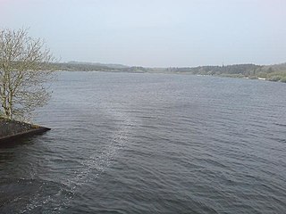
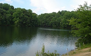
Llyn Cefni is a small reservoir in the centre of Anglesey, Wales which is managed by Welsh Water and Hamdden Ltd, while the fishery is managed by the Cefni Angling Association. The reservoir is located just 1 kilometre (0.6 mi) northwest of the island's county town of Llangefni.
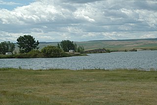
McGregor Lake is an elongated reservoir in Southern Alberta. McGregor Lake was created in 1920 by the completion of two dams bracketing water flowing through in Snake Valley. It is situated 100 km (62 mi) southeast of Calgary in the Vulcan County.
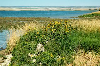
Milk River Ridge Reservoir is an artificial lake in southern Alberta, Canada. It is located about 44 kilometres (27 mi) south-east of Lethbridge, along Highway 506, west of Highway 4 and is a popular spot for summer activities.
Triadelphia Reservoir is located on the Patuxent River, in Howard County and Montgomery County, Maryland near the town of Brookeville.
The 2008 Bihar flood was one of the most disastrous floods in the history of Bihar, an impoverished and densely populated state in India. The Koshi embankment near the Indo-Nepal border broke on 18 August 2008. The river changed course and flooded areas which had not been flooded in many decades. The flood affected over 2.3 million people in the northern part of Bihar.

The Upper Wardha Dam is an earthfill straight gravity dam across the Wardha River, a tributary of the Godavari River, near Simbhora village in Morshi taluk in Amravati district in the Indian state of Maharashtra. The dam provides multipurpose benefits of irrigation, drinking water supply, flood control and hydropower generation.

Idamalayar Dam is a multipurpose concrete gravity dam located at Ennakkal between Ayyampuzha and Bhoothathankettu in Ernakulam district of Kerala on the Idamalayar, a tributary of the Periyar River in Kerala, South India. The dam however extends east as far as Malakkappara. Completed in 1985, with a length of 373 metres (1,224 ft) and a height of 102.8 metres (337 ft), the dam created a multipurpose reservoir covering 28.3 km2 (10.9 sq mi) in the scenic hills of the Anamalais.
The Pong Dam, also known as the Beas Dam, is an earth-fill embankment dam on the Beas River in the state of Himachal Pradesh, India, just upstream of Talwara. The purpose of the dam is water storage for irrigation and hydroelectric power generation. As the second phase of the Beas Project, construction on the dam began in 1961 and was completed in 1974. At the time of its completion, the Pong Dam was the tallest of its type in India. The lake created by the dam, Maharana Pratap Sagar, became a renowned bird sanctuary.

The Middle Rio Grande Project manages water in the Albuquerque Basin of New Mexico, United States. It includes major upgrades and extensions to the irrigation facilities built by the Middle Rio Grande Conservancy District and modifications to the channel of the Rio Grande to control sedimentation and flooding. The bulk of the work was done by the United States Bureau of Reclamation and the United States Army Corps of Engineers in the 1950s, but construction continued into the 1970s and maintenance is ongoing. The project is complementary to the San Juan–Chama Project, which transfers water from the San Juan River in the Colorado River Basin to the Rio Grande. Although distribution of water from the two projects is handled through separate allotments and contracts, there is some sharing of facilities including the river itself. The ecological impact on the river and the riparian zone was the subject of extended litigation after a group of environmentalists filed Rio Grande Silvery Minnow v. Bureau of Reclamation in 1999.

The Pengbo River is a tributary of the Lhasa River that runs through the western part of Lhünzhub County, Lhasa municipality, Tibet, China.

The Vorotan Cascade, or the ContourGlobal Hydro Cascade, is a cascade on the Vorotan River in Syunik Province, Armenia. It was built to produce hydroelectric power and provide irrigation water. The Vorotan Cascade consists of three hydroelectric power plants and five reservoirs with a combined installed capacity of 404.2 MW. It is one of the main power generation complexes in Armenia.
National Policy Dialogues on Integrated Water Resources Management in Azerbaijan for managing water resources are aimed at developing a state strategy based on "Convention on the Protection and Use of Transboundary Watercourses and International Lakes" of United Nations Economic Commission for Europe and European Union Water Framework Directive and the "Water and Health" Protocol of that convention as well as other principles of the United Nations and the EU.
The Kaleshwaram Lift Irrigation Project (KLIP) is a multi-purpose irrigation project on the Godavari River in Kaleshwaram, Bhupalpally, Telangana, India. Currently the world's largest multi-stage lift irrigation project, its farthest upstream influence is at the confluence of the Pranahita and Godavari rivers. The Pranahita River is itself a confluence of various smaller tributaries including the Wardha, Painganga, and Wainganga rivers which combine to form the seventh-largest drainage basin on the subcontinent, with an estimated annual discharge of more than 6,427,900 acre-feet (7,930 cubic hectometres) or 280 TMC. It remains untapped as its course is principally through dense forests and other ecologically sensitive zones such as wildlife sanctuaries.

Moose Jaw River is a river in the Canadian province of Saskatchewan. It is located in the southern part of the province in a region called the Prairie Pothole Region of North America, which extends throughout three Canadian provinces and five U.S. states. It is also within Palliser's Triangle and the Great Plains ecoregion.

Avonlea Creek is a river in the southern part of the Canadian province of Saskatchewan. It is in a region called the Prairie Pothole Region of North America, which extends throughout three Canadian provinces and five U.S. states. It is also within Palliser's Triangle and the Great Plains ecoregion. Avonlea Creek is a main tributary of the Moose Jaw River, which is part of the Upper Qu'Appelle Watershed and the Hudson Bay drainage basin.


