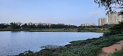
Sankey tank, a manmade lake or tank, is situated in the western part of Bangalore in the middle of the neighbourhoods of Malleshwaram, Vyalikaval and Sadashivanagar. The lake covers an area of about 15 ha. At its widest, the tank has a width of 800 m (2,624.7 ft).
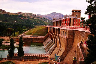
The South Pennar River is a river in India. It is the second longest river in Tamil Nadu, with a length of 497 km, after the Kaveri. Chandapura, Anekal, Hosur, Bagalur and Chengam are the major industrial settlements on its banks. The river is severely polluted by industrial waste as it flows through major industrial areas in the eastern suburbs of Bangalore and the industrial parks of Hosur and Chengam.
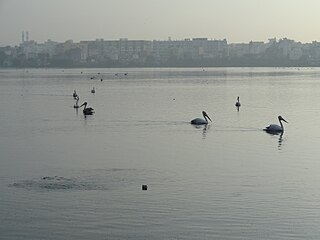
Madiwala is a locality in southeastern Bangalore, India.
Thigala is a social group found in Karnataka and Tamil Nadu, India, particularly the city of Bengaluru and in Southern Karnataka. Thigala people where mainly involved in Horticulture and Gardening, Hyder Ali deployed Thigala people for the development of Lalbagh gardening then they played a major role in making Bangalore as Flower City.
The Vrishabhavathi River is a minor river, a tributary of the Arkavathy, that flows through the south of the Indian city of Bangalore. The river was once so pristine that the water from it was used for drinking and used by the famous Gali Anjaneya temple but is now highly polluted due to pollutants from industrial, agricultural and domestic sources.

Old Airport Road is a major road in Bangalore, India. It was renamed from Airport Road after the new Bengaluru International Airport was opened at Devanahalli. Madivala Machideva Road is a 17 km stretch road which begins from the junction of Trinity Church Road and Victoria Road and goes to HAL Bangalore International Airport, Marathahalli, Varthur. Beyond that, the road officially becomes Varthur Road, but since the real estate boom started around 2003, builders have started calling the stretch between the Airport and the Marathahalli Outer Ring Road as Old Airport Road. Even so, due to the high significance of this road it has achieved due to its high accessibility for reaching Whitefield.

Vibuthipura Lake is a lake in the suburb of Hindustan Aeronautics Limited, in the southeast of the city of Bengaluru. The lake is the part of Bellandur-Varthur Lake series.
BTM Layout, an abbreviation of Byrasandra, Tavarekere and Madiwala Layout is a locality in Bengaluru, Karnataka, India located in the South and Southeast parts of the city between Hosur Road and Bannerghatta Road. It is one of the first layouts in Bangalore.

Hebbal Lake is located in the north of Bangalore at the mouth of National Highway 7, along the junction of Bellary Road and the Outer Ring Road (ORR). It was one of the three lakes created in 1537 by Kempe Gowda. Like most lakes or "tanks" in the Bangalore region it was formed by the damming natural valley systems by the construction of bunds. The spread of the lake in a study in 2000 was found to be 75 ha with plans for extending it to make up 143 ha.

Varthur is a suburb situated in the Eastern periphery of Bangalore City and part of the internationally famous Whitefield township. Varthur is a Hobli and part of the Bruhat Bangalore Mahanagara Palike. Varthur was a Legislative Assembly in the state of Karnataka but was split into three legislative assemblies C.V.Raman Nagar, Mahadevapura and Krishnarajapura in the year 2008. It is also one of the wards of BBMP. It is located in South-Eastern Bangalore between old Airport road and Sarjapur road. Varthur is very close to ITPB.
Lakes and tanks in the metropolitan area of Greater Bangalore and the district of Bangalore Urban are reservoirs of varying sizes constructed over a number of centuries by various empires and dynasties for rainwater harvesting. Historically, these reservoirs were primarily either irrigation tanks or for the water supply, with secondary uses such as bathing and washing. The need for creating and sustaining these man-made dammed freshwater reservoirs was created by the absence of a major river nearby coupled with a growing settlement. As Bangalore grew from a small settlement into a city, both of the primary historical uses of the tanks changed. Agricultural land witnessed urbanization and alternate sources of water were provisioned, such as through borewells, piped reservoir water and later river water from further away.
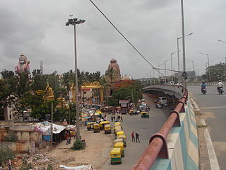
Agara Bangalore is a panchayat village in the southern state of Karnataka, India. It is located in the Bangalore South taluk of Bangalore Urban district in Karnataka, on Outer Ring Road, near Koramangala and HSR Layout. The Agara Bus Stop connects Koramangla with ITPL, Varthur, etc. Agara is visited for its Oriyan temple, Agara Lake, Ayyappa Temple & Aanjaneya Temple. After winning the Sreerangapattana war, the British moved their army to Banaglore. In British times, it was one of the biggest army cantonments in south Asia. Madras Engineer Groups was operating from Agara.
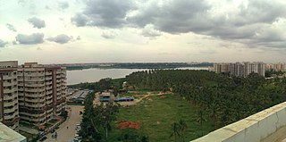
Bellandur Lake is located in the suburb of Bellandur in the southeast of the city of Bengaluru. It is the largest lake in the city. It is a part of Bellandur drainage system that drains the southern and the south-eastern parts of the city. The lake is a receptor from three chains of lakes upstream, and has a catchment area of about 148 square kilometres. Water from this lake flows further east to the Varthur Lake, from where it flows down the plateau and eventually into the Pinakani river basin.

Agara lake is an 80-acre lake located in Agara, Bangalore. It is part of the Varthur lake series. Madiwala Lake is upstream while Bellandur Lake is downstream. Inter-lake connections have seen fragmentation and urbanisation.
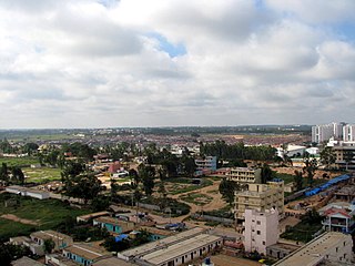
Bellandur is a suburb in south-east Bangalore, Karnataka, India. It is bounded by HSR Layout to the west, Devarabisanahalli to the east, Sarjapur Road to the south, and the Bellandur Lake to the north. The Bellandur Lake is the largest lake in Bangalore, and separates Bellandur from the HAL Airport. The Outer Ring Road passes through Bellandur, making the area an important transit point between east and south Bangalore.

D. Kupendra Reddy an Indian politician, entrepreneur and a social worker. He is a former Member of Parliament in the Rajya Sabha, the upper house of the Parliament of India from 2014 to 2020. He is representing Karnataka from Janata Dal (Secular) party, a regional political party headed by H D Deve Gowda, former Prime Minister of India..

NAL Wind Tunnel Road, expanded as National Aerospace Laboratories Wind Tunnel Road, is a road in the Murugeshpalya locality of Bengaluru. It was called Challaghatta Road, a name that still persists in local use, before it was renamed. It links HAL Airport Road with Bellandur. HAL Airport Road branches into Wind Tunnel Road at a traffic light junction.

Jakkur is a suburb in the northern part of Bangalore, Karnataka, India. Located on the eastern side of the National Highway 44 between Yelahanka and Hebbal, the area is best known for the Jakkur Aerodrome and Jakkur lake.
Kodigehalli inscriptions and herostones are a set of three Kannada inscriptions and two herostones located in Kodigehalli and its sub-localities Tindlu and Doddabommasandra in Bengaluru. Among them, the Kannada inscription of Prataparaya is very significant as it records a generous grant made by Prataparaya during the sacred hours of a Solar eclipse. The grant was given to the Someyadeva temple situated in Sakanasamudra. This inscription is significant to Indian Astronomical history as it mentions the precise date of the donation being made that is 08-Aug-1431CE Julian - 09-Aug-1431CE Julian and also mentions the day to be a solar eclipse which can be confirmed by the NASA Five Millenium Catalogue Of Solar Eclipses. This inscription has been published in Volume 9, Epigraphia carnatica and has been digitally archived by the Mythic Society in "Bengaluru Inscriptions 3D Digital Conservation Project". Two other inscriptions of Tindlu and Doddabommasandra belong to the 14th and the 15th century CE respectively. The inscription in Tindlu documents a donation made by medieval merchant guilds of the region called Ubhayananadesis and Salumule, while the Doddabommasandra inscription is a donatory inscription to a Agrahara. Kodigehalli is also home to two Herostones also called Viragal in Kannada, which are erected in the memory of people who die in battles or other conflicts, the herostones present here are only with sculptures without any inscription.


