This article needs additional citations for verification .(January 2017) |
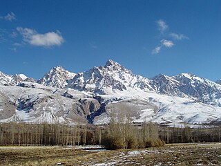
Madra Mountains are in western Anatolia, Aegean Region of Turkey. [1] They are horst type geological formation. The highest point of the mountains is Maya Hill.
This article needs additional citations for verification .(January 2017) |
Madra Mountains are in western Anatolia, Aegean Region of Turkey. [1] They are horst type geological formation. The highest point of the mountains is Maya Hill.
They are located on the northern Aegean part of the western Anatolia and form the border of İzmir and Balikesir provinces of Turkey. In Balıkesir province they range on Ayvalık, Burhaniye, Havran and İvrindi district. In İzmir province they range on Bergama and Dikili district, in Manisa province only in Soma.
They are surrounded by the
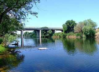
There are Madra Dam in the west and Kestel Dam in the east of the mountains.
In Kozak Plateau of Madra Mountains region pinus pinea production is essential.
Near Aşağıbey village there is ruins of ancient city of Perperene and near Yukarıbey village there is ancient Trarion.

The Anatolian side of Turkey is the largest portion in the country that bridges southeastern Europe and west Asia. East Thrace, the European portion of Turkey comprises 3% of the landmass but over 15% of the population. East Thrace is separated from Asia Minor, the Asian portion of Turkey, by the Bosporus, the Sea of Marmara and the Dardanelles. İskilip, Çorum province, is considered to be the geographical center of Earth.Turkey is very vulnerable to earthquakes.
Edremit, formerly Adramyttium, is a municipality and district of Balıkesir Province, Turkey. Its area is 682 km2, and its population is 167,901 (2022).
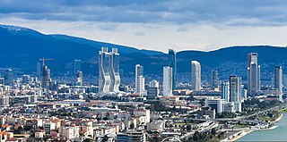
İzmir Province is a province and metropolitan municipality of Turkey in western Anatolia, situated along the Aegean coast. Its capital is the city of İzmir, which is in itself composed of the province's central 11 districts out of 30 in total. To the west, it is surrounded by the Aegean Sea, and it encloses the Gulf of Izmir. Its area is 11,891 square kilometres, and its population is 4,462,056 (2022). Neighboring provinces are Balıkesir to the north, Manisa to the east, and Aydın to the south. The traffic code of the province is 35.
The Taurus Mountains are a mountain complex in southern Turkey, separating the Mediterranean coastal region from the central Anatolian Plateau. The system extends along a curve from Lake Eğirdir in the west to the upper reaches of the Euphrates and Tigris rivers in the east. It is a part of the Alpide belt in Eurasia.

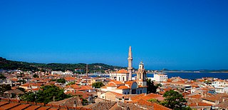
Bergama is a municipality and district of İzmir Province, Turkey. Its area is 1,544 km2, and its population is 105,754 (2022). By excluding İzmir's metropolitan area, it is one of the prominent districts of the province in terms of population and is largely urbanized at the rate of 53.6%. Bergama center is situated at a distance of 118 km (73 mi) to the north from the point of departure of the traditional center of İzmir and lies at a distance of 27 km (17 mi) inland from the nearest seacoast at the town of Dikili to its west. Bergama district area neighbors the areas of three districts of Balıkesir Province to its north, namely Ayvalık, Burhaniye and İvrindi, İzmir Province district of Kınık and Manisa Province district of Soma to its east, while to the south it is bordered by Yunusemre district of Manisa Province and two other İzmir Province districts along the coast that are Aliağa and Dikili from its south towards its west. The district area's physical features are determined by the alluvial plain of Bakırçay River.

Aydın Province is a province and metropolitan municipality of southwestern Turkey, located in the Aegean Region. Its area is 8,116 km2, and its population is 1,148,241 (2022). The provincial capital is the city of Aydın. Other towns in the province include the summer seaside resorts of Didim and Kuşadası.

Balıkesir Province is a province and metropolitan municipality in northwestern Turkey with coastlines on both the Sea of Marmara and the Aegean. Its area is 14,583 km2, and its population is 1,257,590 (2022). Its adjacent provinces are Çanakkale to the west, İzmir to the southwest, Manisa to the south, Kütahya to the southeast, and Bursa to the east. The provincial capital is Balıkesir. Most of the province lies in the Marmara Region except the southern parts of Bigadiç Edremit, Kepsut, İvrindi, Savaştepe and Sındırgı districts and ones of Ayvalık, Burhaniye, Dursunbey, Gömeç and Havran, that bound the Aegean Region. Kaz Dağı, known also as Mount Ida, is located in this province. Balıkesir province is famous for its olives, thermal spas, and clean beaches, making it an important tourist destination. The province also hosts immense deposits of kaolinite and borax, with some open-pit mines. The Kaz mountains are also threatened with the expansion of gold mining using cyanide which puts the villagers' lives, the agricultural economy, and tourism at risk.

Balıkesir is a city in the Marmara region of Turkey. It is the seat of Balıkesir Province, which is also a metropolitan municipality. As of 2022, the population of Balıkesir Province is 1,257,590, of which 314,958 in the city proper. Between 1341 and 1922, it was the capital of Karasi.
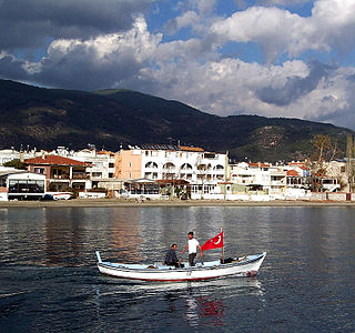
Ayvalık, formerly also known as Kydonies, is a municipality and district of Balıkesir Province, Turkey. Its area is 305 km2, and its population is 74,030 (2022). It is a seaside town on the northwestern Aegean coast of Turkey. The town centre is connected to Cunda Island by a causeway and is surrounded by the archipelago of Ayvalık Islands, which face the nearby Greek island of Lesbos.

Dikili is a municipality and district of İzmir Province, Turkey. Its area is 534 km2, and its population is 47,360 (2022).
The Aegean region is one of the 7 geographical regions of Turkey. The largest city in the region is İzmir. Other big cities are Manisa, Aydın, Denizli, Muğla, Afyonkarahisar and Kütahya.
The Gediz River, anciently known as the HermusRiver, is the second-longest river in Anatolia flowing into the Aegean Sea. From its source of Mount Murat in Kütahya Province, it flows generally west for 401 km (249 mi) to the Gediz River Delta in the Gulf of İzmir.
İzmir is a transportation hub for western Anatolia. İzmir has an extensive bus system, a developing metro, commuter rail system and a large urban ferry network. The city has highways connecting it to Çeşme, Menemen, Istanbul, Bursa, Aydın and Denizli as well as a beltway. Mass transportation is operated by four separate public agencies all owned by the İzmir Municipality.
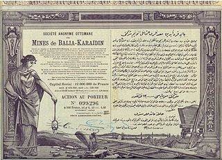
The Ilıca–Palamutluk Railway Line was a 28-kilometre (17 mi) narrow gauge railway route in Balıkesir Province, western Turkey that operated from 1924 until 1950. The line was built to transport galena lead ore that had been mined far to the east at Balya. The galena ore from Balya was transported to Palamutluk, a site at the base of the Aegean coast foothills, on an existing smaller-gauge line. The Ilıca–Palamutluk Line then took the ore onwards from Palamutluk via Edremit to a wharf at Ilıca on the Aegean coast.
The Palamutluk–Balya–Mancılık railway was a 97.5-kilometre (60.6 mi), horse-drawn, narrow-gauge railway in Balıkesir Province, western Turkey. The line used the Decauville system of portable track units and was built to link coal and lead mines to the coast for export. When completed the line ran from the lignite mine near Mancılık to the galena mines at Balya and then turned southwest to run through the village of Osmanlar to a terminus at Palamutluk. From Palamutluk, ore could be carried via road on horse carts to wharfs on the Gulf of Edremit. In 1923, the Palamutluk–Balya railway was linked to the Ilıca–Palamutluk railway, which replaced horse carts in transporting the ore to the coast.
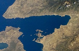
The Edremit gulf Turkish: Edremit körfezi Greek: Αδραμυττηνός κόλπος, romanized: Adramyttinós kólpos is an Aegean gulf in Turkey's Balıkesir Province. It is named after Edremit, a district of Balıkesir Province which is situated close to the tip of the gulf. Biga Peninsula is to the north. The southern coast belongs to the ilçe of Ayvalık, while the western entrance is enclosed with the northern part of the Greek island of Lesbos.
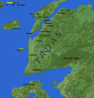
Biga Peninsula is a peninsula in Turkey, in the northwest part of Anatolia. It is also known by its ancient name Troad (Troas).
Dikili Gulf is an Aegean gulf of Turkey.

Çıplak Island is an Aegean island of Turkey.
The 1944 Gulf of Edremit–Ayvacik earthquake occurred on October 6 at 05:34:48 local time in Balıkesir Province, Turkey. It measured 6.7 on the moment magnitude scale (Mw ) and occurred at a depth of 15 km (9 mi). The normal-faulting event had a maximum MSK-64 intensity of IX. A total of 73 people died and 275 others were injured.
{{cite journal}}: CS1 maint: multiple names: authors list (link)| | This article about an Aegean Region of Turkey location is a stub. You can help Wikipedia by expanding it. |