Related Research Articles

Pergamon or Pergamum, also referred to by its modern Greek form Pergamos (Πέργαμος), was a rich and powerful ancient Greek city in Aeolis. It is located 26 kilometres (16 mi) from the modern coastline of the Aegean Sea on a promontory on the north side of the river Caicus and northwest of the modern city of Bergama, Turkey.

Akhisar is a municipality and district of Manisa Province, Turkey. Its area is 1,645 km2, and its population is 177,419 (2022). It is the site of the ancient city of Thyatira.

Bergama is a municipality and district of İzmir Province, Turkey. Its area is 1,544 km2, and its population is 105,754 (2022). By excluding İzmir's metropolitan area, it is one of the prominent districts of the province in terms of population and is largely urbanized at the rate of 53.6%. Bergama center is situated at a distance of 118 km (73 mi) to the north from the point of departure of the traditional center of İzmir and lies at a distance of 27 km (17 mi) inland from the nearest seacoast at the town of Dikili to its west. Bergama district area neighbors the areas of three districts of Balıkesir Province to its north, namely Ayvalık, Burhaniye and İvrindi, İzmir Province district of Kınık and Manisa Province district of Soma to its east, while to the south it is bordered by Yunusemre district of Manisa Province and two other İzmir Province districts along the coast that are Aliağa and Dikili from its south towards its west. The district area's physical features are determined by the alluvial plain of Bakırçay River.

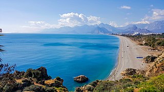
Antalya Province is a province and metropolitan municipality of Turkey. It is located on the Mediterranean coast of south-west Turkey, between the Taurus Mountains and the Mediterranean Sea. Its area is 20,177 km2, and its population is 2,688,004 (2022).

Salihli is a municipality and district of Manisa Province, Turkey. Its area is 1,359 km2, and its population is 165,182 (2023). The ancient Lydian capitals of Sardes and Daldis are located within Salihli.

Zeybeks, sometimes spelled as Zeibeks, were irregular militia and guerrilla fighters living in West Anatolia from late 17th to early 20th centuries.

Menemen is a municipality and district of İzmir Province, Turkey. Its area is 573 km2, and its population is 200,904 (2022). The district extends on a fertile plain formed by the alluvial soil carried by the Gediz River. Adjacent districts are, from east to west; Aliağa and Foça to the north and Bornova, Karşıyaka and Çiğli to the south. Menemen district has a 27 km (17 mi) long coastline in the west and neighbors Manisa Province to the east. The town of Menemen is located at a distance of 35 km (22 mi) from İzmir center. Settlement across the district is loosely scattered along the Greater Metropolitan Area of İzmir in the south and consists of isolated villages along prairies in the north, which results in an average urbanization rate of only 42 per cent. The economy still relies on agriculture and stock breeding in large part, although the production and export of leather, ceramic and other earthenware products, as well as potentially of plastic products, based in two separate and specialized organized industrial zones made important steps forward during the last decade. Menemen's earthenware pottery products have been famous across Turkey for centuries. These two organized industrial zones as well as activities rebounding from the adjacent İzmir metropolitan area gain an increasing importance in the district's economy. Nevertheless, Gediz River, whose lower basin crosses Menemen plain to join the sea within the district boundaries still constitutes the lifeline of the region and matters relating to the river's flow as well as its present rate of rather high pollution is a matter of constant debate.

Attalus I, surnamed Soter, was the ruler of the Greek polis of Pergamon and the larger Pergamene Kingdom from 241 BC to 197 BC. He was the adopted son of King Eumenes I, whom he succeeded, and was the first of the Attalid dynasty to assume the title of king, sometime around 240 to 235 BC. He was the son of Attalus and his wife Antiochis.

Aigai, also Aigaiai, was an ancient Greek, later Roman, city and bishopric in Aeolis. Aegae is mentioned by both Herodotus and Strabo as being a member of the Aeolian dodecapolis. It was also an important sanctuary of Apollo. Aigai had its brightest period under the Attalid dynasty, which ruled from nearby Pergamon in the 3rd and 2nd century BC.
Pitane, near Çandarlı, Turkey, was an ancient Greek town of the ancient region of Aeolis, in Asia Minor. It was situated near the mouth of the river Evenus on the bay of Elaea. It was one of the eleven ancient Aeolian settlements and possessed considerable commercial advantages in having two harbours. It was the birthplace of the academic philosopher Arcesilaus, and in the reign of Titus it suffered severely from an earthquake. The town is still mentioned by Hierocles. Pliny the Elder mentions in its vicinity a river Canaius, which is not noticed by any other writer; but it may possibly be the river Pitanes, spoken of by Ptolemy, and which seems to derive its name from the town of Pitane.

Aşıklı Höyük is a settlement mound located nearly 1 kilometre (0.62 mi) south of Kızılkaya village on the bank of the Melendiz brook, and 25 km (16 mi) southeast of Aksaray, Turkey. Aşıklı Höyük is located in an area covered by the volcanic tuff of central Cappadocia, in Aksaray Province. The archaeological site of Aşıklı Höyük was first settled in the Pre-Pottery Neolithic period, around 8,200 BC.

Tokmar Castle is a castle ruin in Mersin Province, Turkey

The Battle of Bergama was fought at and near Bergama between the Greek army and forces of the nascent Turkish National Movement during the Greco-Turkish War of 1919–1922. The Turkish forces pushed the Greek army from Bergama on 15 June, but the town was recaptured on 22 June.

The Fire of Manisa refers to the burning of the city of Manisa, Turkey, which started on the night of Tuesday, 5 September 1922 and continued until 8 September. The fire was started and organized by the retreating Hellenic Army during the Greco-Turkish War of 1919-1922, and as a result 90 percent of the buildings in the town were destroyed. The number of victims in the town and adjacent region was estimated to be several thousand by US Consul James Loder Park. Turkish sources say that 4,355 people died in the town of Manisa.

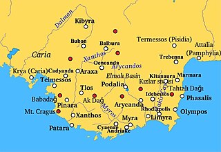
Bubon or Boubon was a city of ancient Lycia noted by Stephanus of Byzantium; the ethnic name, he adds, ought to be Βουβώνιος, but it is Βουβωνεύς, for the Lycians rejoice in this form. The truth of this observation of Stephanus is proved by the inscription found on the spot: Βουβωνέων ἡ Βουλὴ καὶ ὁ Δῆμος.

Köşk Höyük is a tell northeast of Bahçeli, near Kemerhisar in the modern Niğde Province of Turkey. It is located on the Bor Plateau, south of Mount Hasan near a spring.

Nimet Özgüç was a Turkish archaeologist. In her era, she and her husband were the dominant Turkish academics and archaeologists. She was made an honorary member of the Turkish Academy of Sciences in 1996 and was awarded the Grand Prize of the Ministry of Culture and Tourism in 2010 for her contributions to archaeology in the country.

Tahtacı are a Turkic people living mainly in the forested areas of Aegean and Mediterranean regions of Turkey.
Parti Pehlivan after the Surname Law Mehmet Baskak was a Turkish wrestler and a guerilla leader in the Ottoman Empire of Bosniak decent, and an officer in the Turkish Army during World War I and the Turkish War of Independence. He was an important leader in Kuva-yi Milliye of the Aegean Region. After the declaration of the Turkish Republic he was granted land in Hacıhaliller, Manisa for his services and lived in Manisa until his death.

Eğlenhoca is a neighbourhood in the municipality and district of Karaburun, İzmir Province, Turkey. Its population is 471 (2022).
References
36°30′40″N32°37′30″E / 36.511°N 32.625°E