The Mahli are a community in the Indian states of Jharkhand, Odisha and West Bengal. Basketry is their main occupation. They speak the Mahali language, which belongs to the Munda group, and many of them also know Odia, Santali, Bengali, and Hindi. They are included in list of Scheduled Tribe.
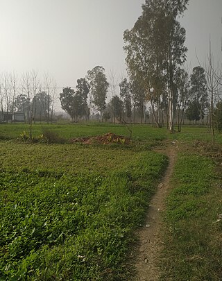
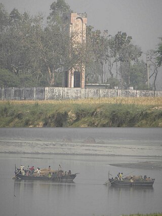
Salempur City is one of the oldest Tehsil Headquarters, 71 Parliamentary Constituency which covers Vidhan Sabha of Salempur and Bhatpar Rani in Deoria district and Belthara Road, Sikanderpur and Bansdih of Ballia District. It is a Nagar Panchayat in Deoria district in the India state of Uttar Pradesh. It is one of oldest Tehsil which was founded in 1939 at the time of British Rule. It has an important Railway Station of North Eastern Railway. The Chhoti Gandak river passes through Salempur Town.
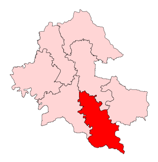
Salempur (71) Lok Sabha constituency is one of the 80 Lok Sabha (parliamentary) constituencies in Deoria district of Uttar Pradesh state in northern India.
Salempur is a village under Tekari sub-division, Gaya district, in the state of Bihar in eastern India. Salempur has been long known for its prosperity under Tekari Raj. It is located near to the bank of river Morhar. Salempur is a predominantly Kayastha dominated village.
The Mahali is a small ethnic group living in the northern districts of Rajshahi, Joypurhat, Dinajpur, Rangpur and Sylhet of Bangladesh.
Salempur Masanda is a village in Jalandhar district, near the Jalandhar Cantonment, in Punjab, India.
Meghpur is a village in Jaunpur, Uttar Pradesh, India. This village falls under Jalalpur Thana. The latitude and longitude position is 25.6037802, 82.7321342. This Village is 4 km far away from Jalalganj (JLL) Railway station and 3 km from Jalalpur. This Village is 24 km away from Lal Bahadur Shastri International Airport. The neighbor villages are Purev, Mojara, Nahora, Than, Rasulpur, Lakhamipur and Salempur.

Baikunthpur Assembly constituency is an assembly constituency in Dighwa Dubauli locality of Gopalganj district in the Indian state of Bihar.
Salempur Rajputana is a census town in the Roorkee Municipal Corporation of Roorkee in Haridwar district of the Indian state of Uttarakhand. It is a area in Roorkee, Ramnagar. Salempur Rajputana is famous for its ameliorative, productive and progressive industrial area. This is a town with Hindu majority most people here are of Kuhada, Daharia, Rada and Gadadiya (Jambuwal) gotra and are part of Saini community. A minority of muslims and Kashyaps and other Scheduled castes also exist in the village.
Khukhundoo, is a small town in the state of Uttar Pradesh in northern India, approximately 15 kilometres (9.3 mi) east of Deoria city near the border with Bihar state on Deoria Salempur road in Deoria district.
Paina is a village and Nyaya Panchayat situated along the bank of Sarayu (Ghaghra) river in the eastern part of the state of Uttar Pradesh in India. It comes under administration of Barhaj Tehsil of Deoria District and Gorakhpur Division. It is located 33 km towards South from District headquarters Deoria and 340 km from State capital Lucknow.
Salempur is a village located in the Ludhiana West tehsil, of Ludhiana district, Punjab.
National Highway 727A, commonly referred to as NH 727A is a national highway in India. It is a spur road of National Highway 27. NH-727A traverses the states of Bihar and Uttar Pradesh in India.
Salempur is a constituency of the Uttar Pradesh Legislative Assembly covering the city of Salempur in the Deoria district of Uttar Pradesh, India.

Belthara Road is a constituency of the Uttar Pradesh Legislative Assembly covering the city of Belthara Road in the Ballia district of Uttar Pradesh, India.
National Highway 727B, commonly referred to as NH 727B is a national highway in India. It is a secondary route of National Highway 27. NH-727B runs in the state of Uttar Pradesh in India.
Salempur is a village in Gosainganj block of Lucknow district, Uttar Pradesh, India. As of 2011, its population is 7,542, in 1,327 households. It is the seat of a gram panchayat.
Salempur is a village in Karhal block of Mainpuri district, Uttar Pradesh. As of 2011, it has a population of 563, in 81 households.

Salempur is a village in Tundla block of Firozabad district, Uttar Pradesh, India. As of 2011, it had a population of 3,355, in 579 households.
