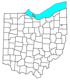
Windham is a village in Portage County, Ohio, United States. It is formed from portions of Windham Township, one of the original townships of the Connecticut Western Reserve. The population was 2,209 at the 2010 census. In 1942, the US government chose Windham as the site of an army camp for workers at the newly built Ravenna Arsenal. As a result, Windham experienced the largest increase in population of any municipality in the United States between the 1940 and 1950 censuses: The population increased from 316 residents to 3,946.

Freedom Township is one of the eighteen townships of Portage County, Ohio, United States. The 2000 census found 2,751 people in the township.

Palmyra Township is one of the eighteen townships of Portage County, Ohio, United States. The 2000 census found 2,785 people in the township.

Paris Township is one of the eighteen townships of Portage County, Ohio, United States. The 2000 census found 1,827 people in the township.

Deerfield Township is one of the eighteen townships of Portage County, Ohio, United States. The 2000 census found 3,211 people in the township.
Atwater is a census-designated place (CDP) in Portage County, Ohio, United States. As of the 2010 census, the CDP had a population of 758. It is located in the central part of Atwater Township, of which it is a part.

Braceville Township is one of the twenty-four townships of Trumbull County, Ohio, United States. The 2000 census found 2,887 people in the township.

Newton Township is one of the twenty-four townships of Trumbull County, Ohio, United States. The 2000 census found 9,524 people in the township, 4,522 of whom lived in the unincorporated portions of the township.
Berlin Center is an unincorporated community in Mahoning County, in the U.S. state of Ohio.

Diamond is an unincorporated community in eastern Palmyra Township, Portage County, Ohio, United States. Although it is unincorporated, it has a post office, with the ZIP code of 44412. The community is part of the Akron Metropolitan Statistical Area. Interstate 76 travels near Diamond. The village used to be a stop on the New York Central Railroad, but the stop was abandoned in the early 1970s.

North Jackson is an unincorporated community in central Jackson Township, Mahoning County, Ohio, United States. Although it is unincorporated, it has a post office, with the ZIP code of 44451. It lies along State Route 45 between Salem and Warren. The community is part of the Youngstown-Warren-Boardman, OH-PA Metropolitan Statistical Area.

North Benton is an unincorporated community in northern Smith Township, Mahoning County, Ohio, United States. Although it is unincorporated, it has a post office, with the ZIP code of 44449. It lies along State Route 14 between Salem and Ravenna.

Ellsworth is an unincorporated community in central Ellsworth Township, Mahoning County, Ohio, United States. Although it is unincorporated, it has a post office, with the ZIP code of 44416. It lies at the intersection of U.S. Route 224 and State Route 45.
Portage Center is an unincorporated community in Hancock County, in the U.S. state of Ohio.
Campbellsport is an unincorporated community in Portage County, in the U.S. state of Ohio. It is located southeast of Ravenna around the intersection of Industry Road and Ohio State Route 14, where the townships of Ravenna, Charlestown, Rootstown, and Edinburg meet. Much of the area is now occupied by the adjacent West Branch State Park and Michael J. Kirwan Reservoir, which were created in 1965.
Cobbs Corners is a former settlement in Portage County, in the U.S. state of Ohio. It was located in Mantua Township.
Mishler is a former settlement in Portage County, in the U.S. state of Ohio. It was located in the southern part of Suffield Township along Mishler Road, east of present-day Ohio State Route 43.
Yale is an unincorporated community in Portage County, in the U.S. state of Ohio. It centered at the intersection of Alliance Road and Yale Road along Ohio State Route 14 where the townships of Edinburg, Palmyra, Atwater, and Deerfield meet.
Coitsville Center is an unincorporated community in Mahoning County, in the U.S. state of Ohio.


