Related Research Articles

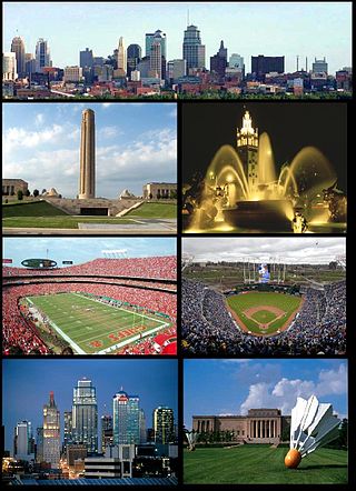
Kansas City, Missouri is the largest city in the U.S. state of Missouri by population and area. Most of the city lies within Jackson County, with portions spilling into Clay, Platte, and Cass counties. It is the central city of the Kansas City metropolitan area, which straddles the Missouri–Kansas state line and has a population of 2,392,035. As of the 2020 census, the city had a population of 508,090, making it the 37th most-populous city in the United States, as well as the sixth-most populous city in the Midwest. Kansas City was founded in the 1830s as a port on the Missouri River at its confluence with the Kansas River from the west. On June 1, 1850, the town of Kansas was incorporated; shortly after came the establishment of the Kansas Territory. Confusion between the two ensued, and the name Kansas City was assigned to distinguish them soon after.

The Kansas City metropolitan area is a bi-state metropolitan area anchored by Kansas City, Missouri. Its 14 counties straddle the border between the U.S. states of Missouri and Kansas. With 8,472 square miles (21,940 km2) and a population of more than 2.2 million people, it is the second-largest metropolitan area centered in Missouri and is the largest metropolitan area in Kansas, though Wichita is the largest metropolitan area centered in Kansas. Alongside Kansas City, Missouri, these are the suburbs with populations above 100,000: Overland Park, Kansas; Kansas City, Kansas; Olathe, Kansas; Independence, Missouri; and Lee's Summit, Missouri.

Crenshaw Boulevard is a north-south thoroughfare in Los Angeles, California, United States, that runs through Crenshaw and other neighborhoods along a 23-mile route in the west-central part of the city.

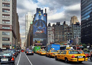
Eighth Avenue is a major north–south avenue on the west side of Manhattan in New York City, carrying northbound traffic below 59th Street. It is one of the original avenues of the Commissioners' Plan of 1811 to run the length of Manhattan, though today the name changes twice: At 59th Street/Columbus Circle, it becomes Central Park West, where it forms the western boundary of Central Park, and north of 110th Street/Frederick Douglass Circle, it is known as Frederick Douglass Boulevard before merging onto Harlem River Drive north of 155th Street.

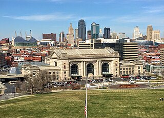
Downtown Kansas City is the central business district (CBD) of Kansas City, Missouri and the Kansas City metropolitan area which contains 3.8% of the area's employment. It is between the Missouri River in the north, to 31st Street in the south; and from the Kansas–Missouri state line eastward to Bruce R. Watkins Drive as defined by the Downtown Council of Kansas City; the 2010 Greater Downtown Area Plan formulated by the City of Kansas City defines the Greater Downtown Area to be the city limits of North Kansas City and Missouri to the north, the Kansas–Missouri state line to the west, 31st Street to the south and Woodland Avenue to the east. However, the definition used by the Downtown Council is the most commonly accepted.
The list of neighborhoods of Kansas City, Missouri has nearly 240 neighborhoods. The list includes only Kansas City, Missouri and not the entire Kansas City metropolitan area, such as Kansas City, Kansas.

Ward Parkway is a boulevard in Kansas City, Missouri, United States. Ward Parkway begins at Brookside Boulevard on the eastern edge of the Country Club Plaza and travels west 2.8 miles along Brush Creek as U.S. Route 56 before turning south near Kansas-Missouri state line. It continues south for 4 miles, terminating at Wornall Road near Bannister Road. A short spur, Brush Creek Parkway, connects Ward Parkway to Shawnee Mission Parkway at State Line Road.
Brookside is a collection of neighborhoods located in Kansas City, Missouri, bounded by 55th Street on the North, Gregory on the South, Ward Parkway on the West, and Troost on the East. The neighborhood contains the Brookside Shopping District.

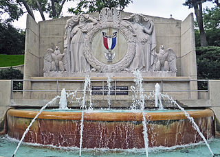
The Paseo is a major north–south parkway in Kansas City, Missouri. As the city's first major boulevard, it runs approximately 10 miles (16 km) through the center of the city: from Cliff Drive and Lexington Avenue on the bluffs above the Missouri River in the Pendleton Heights historic neighborhood, to 85th Street and Woodland Avenue. The parkway holds 223 acres (0.90 km2) of boulevard parkland dotted with several Beaux-Arts-style decorative structures and architectural details maintained by the city's Parks and Recreation department.
Grand Boulevard or Grand Avenue is a north/south street in Kansas City, Missouri, United States. Grand runs along the 200 east block in the Kansas City street grid system. In the Downtown and Crown Center areas of Kansas City, it is an arterial route, continuing on the north as the Grand Ave. Viaduct passing through Richard L. Berkley Riverfront Park and on the south intersecting with Main Street at about the 2800 South Block.

Southmoreland is a neighborhood located in Kansas City, Missouri. Home to the Nelson-Atkins Museum of Art, Kemper Museum of Contemporary Art and the Kansas City Art Institute, it is noteworthy for its reputation as home to Kansas City’s artistic and intellectual elite. Southmoreland neighborhood is located between 39th Street on the north, Rockhill and Gillham Road on the east, Emanuel Cleaver II Boulevard on the south and Main Street on the west. Since 2019, following finalized plans for a Streetcar extension from Union Station to UMKC, the neighborhood has experienced a massive wave of new real estate development along Main Street.

Hyde Park is a historic residential neighborhood and city park in Kansas City, Missouri.

39th Street is a major east–west street in Kansas City, Missouri, running almost 5 miles from State Line Road at the Kansas-Missouri border to Topping Avenue in Kansas City's East Side. It was originally named Rosedale Avenue as it led to the town of Rosedale. It continues west into Kansas as 39th Avenue through The University of Kansas Hospital's Kansas City, Kansas, campus.
Linwood Boulevard is a boulevard and major east–west street in Kansas City, Missouri, United States. Linwood begins at Broadway Boulevard in the Valentine and Old Hyde Park neighborhoods and travels 3.8 miles east through Midtown to Van Brunt Boulevard near Interstate 70 in the Kansas City East Side. For much of its length, it creates a high-density corridor with 31st Street, another major street running parallel one block north. It continues west of Broadway Boulevard as 33rd Street past Metropolitan Community College-Penn Valley. Linwood Boulevard is one of the few named east–west streets in the Kansas City grid south of the Missouri River.
Emanuel Cleaver II Boulevard, Cleaver 2, or 47th Street, and Brush Creek Boulevard is a major west/east main street that runs in Kansas City, Missouri from J.C. Nichols Parkway to 31st Street. It travels close to Brush Creek.
Prospect Avenue is one of the major north-south streets in Kansas City, Missouri and the Kansas City metropolitan area. It begins in the north at E Reservoir Drive in the Pendleton Heights neighborhood of the Historic Northeast and stretches south for 10.5 miles to its southern terminus at Blue River Road. It runs closely parallel to U.S. Route 71 from Swope Parkway to 75th Street.

The Brookside Shopping District is located in the Brookside neighborhood of Kansas City, Missouri at 63rd Street & Brookside Boulevard. This district was founded in 1920 as Kansas City's first suburban shopping center.

The KC Streetcar is in Downtown Kansas City, Missouri. Streetcar system construction began in May 2014 and opened for service on May 6, 2016. It is free to ride, as it is funded by a transportation development district. As of December 2023, the streetcar has had 13 million rides since opening in 2016. Extensions north to the riverfront and south to University of Missouri-Kansas City have been funded, with the southern extension under construction.
Kaw Township is one of eight townships in Jackson County, Missouri, United States. The township is within the city of Kansas City. As of 2010 census, its population was 182,719. The township was established in 1827 through an order of the county court.
Wornall Road is a major north–south road in Kansas City, Missouri. It is named for John Bristow Wornall, an early settler of Kansas City, whose estate still stands today as a museum.
References
- ↑ "Cities moving beyond segregation". USATODAY.COM.
- ↑ "System Map for RideKC". RideKC. January 2018. Retrieved August 15, 2023.
- ↑ "System Map for RideKC". RideKC. January 2018. Retrieved August 15, 2023.
- ↑ Horsley, Lynn (May 6, 2016). "After years of planning, setbacks, hard work, KC celebrates streetcar grand opening". The Kansas City Star . Retrieved August 15, 2023.
- ↑ Reid, Cat (June 20, 2018). "Funds to support KC Streetcar expansion approved". KSHB . Retrieved August 15, 2023.