
Baglung District, a part of Gandaki Province, is one of the seventy-seven districts of Nepal. The district, with Baglung as its district headquarters, covers an area of 1,784 km2 (689 sq mi) and has a population (2011) of 268,613.

Dhankuta District is one of 14 districts of Koshi Province of eastern Nepal. The district covers an area of 891 km2 (344 sq mi) and has a population (2011) of 163,412. The hill town of Dhankuta serves as the district headquarters of Dhankuta District.

Khotang District is one of 14 districts of Koshi Province of eastern Nepal. The district, with Diktel as its district headquarters, covers an area of 1,591 km2 (614 sq mi) and has a population (2021) of 206,312. The district is bordered by Bhojpur District in the east, Udayapur District in the south, Okhaldhunga District in the west and Solukhumbu District in the North. In this district there are two municipalities and eight rural/urban municipalities.

Syangja District is a part of Gandaki Province, and is one of the seventy-seven districts of Nepal. Its headquarter is Putalibazar with a diverse population including Brahmin, Chhetri, Magar, and Gurung communities. Syangja is home to attractions like the ancient temples of Garaunsur and Akala, scenic viewpoints such as Panchase, and the historical town of Waling, making it a growing eco-tourism destination. The economy is primarily based on agriculture, with rice, maize, millet, and fruits like oranges being widely cultivated. The district has several educational institutions, and many residents pursue higher education in cities like Pokhara and Kathmandu. Well-connected by highways to major cities like Pokhara and Butwal, Syangja offers a blend of natural beauty, cultural diversity, and historical importance. The district covers an area of 1,164 km2 (449 sq mi) and has a population of 254,965.

Bandipur is a hilltop settlement and a rural municipality in Tanahun District, Gandaki province of Nepal. Bandipur is primarily known for its preserved, old time cultural atmosphere. At the time of the 2011 Nepal census it had a population of total 15,591 people living in 3,750 individual households.
Kohalpur is a municipality in Banke District of Lumbini province of Nepal. The municipality was established on 18 May 2014 merging the existing two Village Development Committees i.e. Rajhena and Kohalpur. The town is in East-West highway and one of the fastest developing places in Nepal. A neighboring city Nepalgunj is on South (16 km [9.9 mi]), with Ghorahi city (135 km [84 mi]) to west in Dang District and towards south further 6 km (3.7 mi) is the Indian border. In fact it is a growing city in the western region of Nepal. It has a junction to diverse the roadway transport to east, west, north and south from the city.
Juropani (जुरोपानी) is a village development committee of the Jhapa district of Nepal.
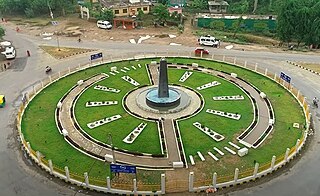
Narayansthan is a village development committee in Baglung District in the Dhaulagiri Zone of central Nepal.It is located above the bank of Kali gandaki River. Now, it has become one of the major important place in baglung. They have planned to construct the domestic Airport. At the time of the 2011 Nepal census it had a population of 2,876 and had 781 houses in the town. The major castes living in the VDC are Brahman, Chhetry and Newar. There are 2 high schools - Janatadhan Higher School and Ganesh Secondary School and one campus. Krishna Gandaki Campus is at the premises of Janatadhan HSS. Ganesh Secondary School, one of the best schools in the region is known for its quality education movement. Established in 1957 [2014 BS] by Soldier Board (India), Ganesh Secondary School is one of the oldest schools. In 1964 [2021 BS], the Indian Soldier Board stopped its grant. Since there was no school support mechanism developed from the Government of Nepal, the school passed through many ups and downs. After Modern Education Act came in effect in 1971 BS [2028 BS], the school merged with Janatadhan Higher Secondary School. In 1980 [2037 BS], the school was reopened.
Katunje is a village development committee in Dhading District in the Bagmati Zone of central Nepal. At the time of the 2011 Nepal census it had a population of 5906 and had 1425 houses in it.
Amar Arbathok is a village and municipality in Gulmi District in the Lumbini Zone of central Nepal. At the time of the 2011 Nepal census it had a population of 1943 people living in 476 households.
Thulo Lumpek is a town and municipality in Gulmi District in the Lumbini Zone of central Nepal. At the time of the 1991 Nepal census it had a population of 6175 persons living in 1020 individual households.
Bhorle is a Village Development Committee in Rasuwa District in the Bagmati Zone of northern Nepal. At the time of the 1991 Nepal census, it had a population of 4884 people residing in 903 individual households.
Chitre Bhanjyang is a village development committee in Syangja District, in the Gandaki Zone of central Nepal. At the time of the 2011 Nepal census, it had a population of 3551 people living in 813 individual households.
Dhanubase is a village development committee in Syangja District in the Gandaki Zone of central Nepal. At the time of the 1991 Nepal census it had a population of 3509 people living in 666 individual households.
Jagat Bhanjyang is a village development committee in Syangja District in the Gandaki Zone of central Nepal. At the time of the 2011 Nepal census it had a population of 3310 people living in 791 individual households.

Manthali is a municipality and the headquarters of Ramechhap District in Bagmati Province, Nepal that was established on 2 December 2014 by merging the former village development committees Old-Manthali, Bhatauli, Chisapani, Kathjor, Bhaluwajor, Salupati and Sunarpani. It was declared the headquarters of the district on 9 March 1989. It lies on the bank of the Tamakoshi River. At the time of the 2011 Nepal census, it had a population of 45,416 people, living in 10,099 individual households.

Katari is a Municipality in Udayapur District in the Koshi province of south-eastern Nepal. It lies by the Tawa river having the bridge of length 123.5m. This was established by merging two existing village development committees i.e. Triveni and Katari on 18 May 2014. At the time of the 1991 Nepal census it had a population of 7230 people living in 1410 individual households. Thirty years later, Katari had undergone rapid growth, achieving a population of 56,146 people by the 2011 census. There is a big Government school Triveni secondary school

Rampur is a municipality in Palpa District in Lumbini Province of West southern Nepal. According to hindu mythology, Maharishi Vasistha taught Yogavasistha to lord Rama in the cave of Rampur. Rampur is 65 km northeast from the headquarter city Tansen. The valley is bounded by Syangja District in the north, Tanahun District in the northeast, and Nawalparasi District in the east. The popular religious river Kaligandaki disconnects the boundary in the northern part.

Bijapur District, formerly known as Birjapur, is one of the 27 districts of the state of Chhattisgarh in central India. It is one of the two new districts created on May 11, 2007. As of 2011 it is the second least populous district of Chhattisgarh, after Narayanpur. It is the second-least literate district in India, with a literacy rate of at 41.58%, according to the 2011 census.

Gokarneshwor is a municipality in Kathmandu District in the Bagmati Province of Nepal that was established on 2 December 2014 by merging the former Village development committees Sundarijal, Nayapati, Baluwa, Jorpati and Gokarna. The office of the municipality is that of the former Jorpati village development committee. The river Bagmati has its origin as the name Bagh Dwar situated in the middle of the Shivapuri jungle in this municipality.
