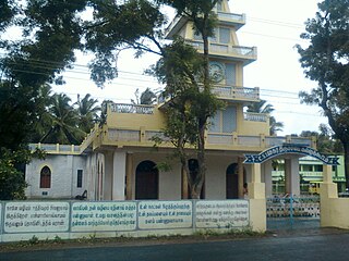
Majgaon

Last updated

Majgaon
Town
India Assam location map.svg
Red pog.svg
Majgaon
Location in Assam, India
India location map.svg
Red pog.svg
Majgaon
Majgaon (India)
Coordinates: 26°37′48″N92°04′47″E / 26.630043°N 92.079849°E / 26.630043; 92.079849 Coordinates: 26°37′48″N92°04′47″E / 26.630043°N 92.079849°E / 26.630043; 92.079849
CountryFlag of India.svg  India
State Assam
District Sonitpur
Population (2001)
  Total 6,820
Languages
  Official Assamese
Time zone IST (UTC+5:30)
Vehicle registration AS

Majgaon is a census town in Sonitpur district in the Indian state of Assam.

A census town is a type of town that satisfies certain characteristics, depending on the country in which it is located.

Sonitpur district District in Assam, India

Sonitpur {Pron: ˌsə(ʊ)nɪtˈpʊə or ˌʃə(ʊ)nɪtˈpʊə} is an administrative district in the state of Assam in India. It stands among the largest districts of Assam. In terms of area Sonitpur is the second largest district of Assam after Karbi Anglong district. It is spread over an area of 5324 km2 on the northern banks of Brahmaputra, the lifeline of Assam. The population of Sonitpur district is 1,924,110 as per 2011 Census. It is the third most populous district of Assam, after Nagaon and Dhubri. The demography of Sonitpur district is not entirely homogenous as several linguistic, religious and ethnic communities and groups live in Sonitpur district. It is also home to several wildlife sanctuaries, and national parks. The district headquarters are located at Tezpur. Distance from State Capital (Dispur) is 198 km and 181 km.

India Country in South Asia

India, also known as the Republic of India, is a country in South Asia. It is the seventh largest country by area and with more than 1.3 billion people, it is the second most populous country as well as the most populous democracy in the world. Bounded by the Indian Ocean on the south, the Arabian Sea on the southwest, and the Bay of Bengal on the southeast, it shares land borders with Pakistan to the west; China, Nepal, and Bhutan to the northeast; and Bangladesh and Myanmar to the east. In the Indian Ocean, India is in the vicinity of Sri Lanka and the Maldives, while its Andaman and Nicobar Islands share a maritime border with Thailand and Indonesia.

Demographics

As of 2001 India census, [1] Majgaon had a population of 6820. Males constitute 52% of the population and females 48%. Majgaon has an average literacy rate of 83%, higher than the national average of 59.5%: male literacy is 83%, and female literacy is 83%. In Majgaon, 9% of the population is under 6 years of age.

Related Research Articles

Muzhappilangad city in Kerala, India

Muzhappilangad is a small coastal village near Thalassery in Kannur district in the Indian state of Kerala.

Bidasar, Churu Place in Rajasthan, India

Bidasar is a city and a municipality in Churu district in the state of Rajasthan, India. Bidasar is a great land of Bidawat warriers.

Bowali Census Town in West Bengal, India

Bowali is a census town under Budge Budge police station of Budge Budge II CD Block in Alipore Sadar subdivision of South 24 Parganas district in the Indian State of West Bengal. It is a part of Kolkata Urban Agglomeration.

Choornikkara village in Kerala, India

Choornikkara is a census town in Aluva in Ernakulam District in Kerala, India.

Darlawn Place in Mizoram, India

Darlawn is a census town in Aizawl district in the state of Mizoram, India.

Dhampur city in Uttar Pradesh, India

Dhampur is a city and a municipal board in Bijnor district in the state of Uttar Pradesh, India. It is located at 29.30°N 78.50°E, and lies in Northern India.

Ezhudesam city in Tamil Nadu, India

Ezhudesam is a town panchayat in Kanniyakumari district in the state of Tamil Nadu, India.

Gothra, Rajasthan city in Rajasthan, India

Gothra is a census town in Jhunjhunu district in the Indian state of Rajasthan.

Kallukuttam town in Tamil Nadu, India

Kallukoottam is a panchayat town in Kanniyakumari district in the Indian state of Tamil Nadu.

Khalor Census Town in West Bengal, India

Khalor is a census town in Bagnan I CD Block of Uluberia subdivision in Howrah district in the Indian state of West Bengal.

Kothavalasa Census Town in Andhra Pradesh, India

Kothavalasa is a census town in Vizianagaram district of the Indian state of Andhra Pradesh. It is located in Kothavalasa mandal of Vizianagaram revenue division. It is located 30 km from City Visakhapatanam

Manegaon, Madhya Pradesh city in Madhya Pradesh, India

Manegaon is a census town in Jabalpur district in the Indian state of Madhya Pradesh.

Neiyyur city in Tamil Nadu, India

Neyyoor is a panchayat town in Kanniyakumari district in the Indian state of Tamil Nadu.

Olavanna city in Kerala, India

Olavanna is a census town in Kozhikode district in the Indian state of Kerala.

Ramjibanpur City in West Bengal, India

Ramjibanpur is a city and a municipality in Paschim Medinipur district in the Indian state of West Bengal.

Salumbar Town in Rajasthan, India

Salumbar is a small town and a municipality in Udaipur district in the Indian state of Rajasthan. It was ruled by the Chundawat Sisodia rajputs of Mewar.

Talegaon Dabhade Town in Maharashtra, India

Talegaon Dabhade is a historic city, a town with a municipal council, in Mawal Taluka, Pune district, in the Indian state of Maharashtra. This town is 120 km from Mumbai and 35 km from Pune. The town is situated on highest altitude between the two metros which is at 2200 feet above sea level. The town is higher in altitude than the famous nearby hillstation Lonavla (2047 ft.), thus has pleasant weather throughout year. First industry in talegaon dabhade was Paisa Fund glass works(now its glass production is closed)

Vilavur panchayat town in Tamil Nadu, India

Vilavur is a panchayat town in Kanniyakumari district in the Indian state of Tamil Nadu.

Nellimarla Census Town in Andhra Pradesh, India

Nelli-marla is a census town in Vizianagaram district of the Indian state of Andhra Pradesh. It is in Nellimarla mandal of Vizianagaram revenue division.

Vidyavihar is a city and a municipality in Jhunjhunu district in the Indian state of Rajasthan.

References

  1. "Census of India 2001: Data from the 2001 Census, including cities, villages and towns (Provisional)". Census Commission of India. Archived from the original on 2004-06-16. Retrieved 2008-11-01.