Related Research Articles

The Kamba or Akamba people are a Bantu ethnic group who predominantly live in the area of Kenya stretching from Nairobi to Tsavo and north to Embu, in the southern part of the former Eastern Province. This land is called Ukambani and constitutes Makueni County, Kitui County and Machakos County. They also form the second largest ethnic group in 8 counties including Nairobi and Mombasa counties.

Tana River County is a county in the former Coast Province of Kenya. It is named after the Tana River, the longest river in Kenya. It has an area of 38,437 km2 (14,841 sq mi) and a population of 315,943 as of the 2019 census. The county borders Kitui County to the west, Garissa County to the northeast, Isiolo County to the north, Lamu County to the southeast and Kilifi County to the south. The capital and largest town is Hola.

Makueni County is a county in the former Eastern Province of Kenya. Its capital and largest town is Wote. The county has a population of 987,653. The county lies between Latitude 1° 35' and 2° 59' South and Longitude 37° 10' and 38° 30' East. It borders Machakos to the North, Kitui to the East, Taita Taveta to the South and Kajiado to the West and covers an area of 8,008.9 km2.

The districts of Kenya were divided into 262 divisions (matarafa). Divisions of Kenya were further subdivided into locations. Today's counties of Kenya are based on the merging of some of the districts on this list and since the divisions are one level under the districts they are now the sub-counties. This is because Kenya recently changed its constitution and 47 Counties emerged. Here are the divisions listed below, by district :
Wote is a town in Kenya. It is the capital of Makueni County in the former Eastern Province. It forms a town council with a population of 56,419, of whom 5,542 are classified urban.
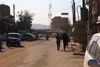
Kibwezi is a town in Makueni County, Kenya.
Mtito Andei is a town in Makueni County, Kenya.

Professor Philip Kaloki PHD, EBS, MBS is a Kenyan politician and an expert in Governance, Leadership & Strategic Management. He was elected to represent the Kibwezi Constituency in the National Assembly of Kenya in 2007 Kenyan parliamentary election.He contested the Kenya 2022 general elections as a running mate of Polycarp Igathe in a race for gorvernor seat in Nairobi county.
Kibwezi Constituency was an electoral constituency in Kenya. It was one of five constituencies in Makueni District. The constituency was established for the 1988 elections. After the 2010 constitution, there were six constituencies set up in Makueni County, with Kibwezi Constituency being split into Kibwezi West Constituency and Kibwezi East Constituency.
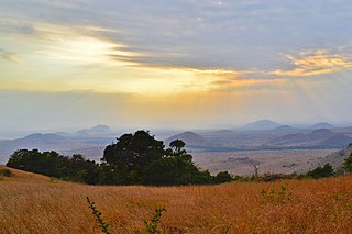
The Chyulu Hills is a mountain range in Makueni County in southeastern Kenya. It forms a 100-kilometre-long volcanic field in an elongated northeast–southwest direction. Its highest peak is 2,188 metres high.
Kalii is a settlement in Kenya's Makueni County. It is located about 20 kilometres north of Makindu town.
Masalani is a settlement in Makueni County, Kenya.
Twaandu is a settlement in Makueni County, Eastern Province, Kenya.
Sub-counties, formerly known as Districts, are the decentralised units through which government of Kenya provides functions and services. Except for the parts which fall under urban areas, sub-counties will coincide with the constituencies created under article 89 of the Constitution of Kenya. Most sub-counties have a sub-county administrator, appointed by a County Public Service Board. Even though the sub-counties are divisions of counties, powers to create new sub-counties lies with the national government. As of 2023, there are 314 sub-counties, compared to 290 constituencies. A deputy county commissioner is appointed by the state to lead each sub-county.
Local elections were held in Makueni County to elect a Governor and County Assembly on 4 March 2013. Under the new constitution, which was passed in a 2010 referendum, the 2013 general elections were the first in which Governors and members of the County Assemblies for the newly created counties were elected. They will also be the first general elections run by the Independent Electoral and Boundaries Commission(IEBC) which has released the official list of candidates.
The Kibwezi–Kitui–Kandwia–Usueni Road, also B7 Road (Kenya) is a road in Kenya, the largest economy in the East African Community. The road connects the town of Kibwezi in Makueni County to the community of Usueni in Kitui County. Since its upgrading, the road has opened up many villages and rural-urban settings to business and agricultural activities.
Kibwezi East is a constituency in Kenya. It is one of six constituencies in Makueni County.
The Hon. Dr. Patrick Musimba MP is a Kenyan politician and Member of the National Assembly representing the Kibwezi West Constituency in Makueni County.He is now vying for the gubernatorial seat of Makueni county in the 2022 elections. He was first elected to Parliament in March 2013 as an independent candidate, but announced in June 2019 that he was joining the Wiper party.
References
- ↑ "Kenya Districts". www.statoids.com. Retrieved 2023-09-21.
- ↑ "46 Districts of 1993". Ustawi. 25 September 2015. Retrieved 17 October 2023.
- ↑ "The 2009 Kenya Population and Housing Census" (PDF). Amazonaws. p. 104. Retrieved 17 October 2023.
| | This Eastern Province (Kenya) location article is a stub. You can help Wikipedia by expanding it. |