Mala, Lanzarote

Last updated
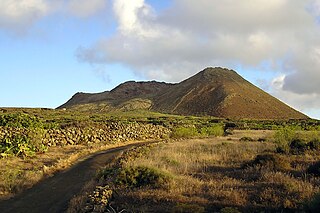
View towards Mala from the north Haria Mala (Lugar Diseminado Haria-LZ-10) 01 ies.jpg
View towards Mala from the north

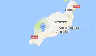
Mala is a village in the municipality of Haría on Lanzarote in the province of Las Palmas in the Canary Islands. Its population in 2012 was 533. [1]
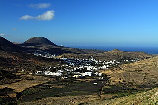
Haría (municipality) Municipality in Canary Islands, Spain

Haría is a municipality on the island of Lanzarote in the Canary Islands, the northernmost and easternmost Canarian municipality. Surrounded on three sides by the Atlantic Ocean, the municipality is bordered to the south by the municipality of Teguise. It forms part of Las Palmas Province. The seat of the municipality is the town of Haría. The population of the municipality was 4,872 in 2013. The total land area of the municipality is 106.59 square kilometres (41.15 sq mi).
Lanzarote Island of the Canary Islands, Spain

Lanzarote is a Spanish island, the northernmost and easternmost of the autonomous Canary Islands in the Atlantic Ocean. It is located approximately 125 kilometres off the north coast of Africa and 1,000 kilometres from the Iberian Peninsula. Covering 845.94 square kilometres, Lanzarote is the fourth-largest of the islands in the archipelago. With 149,183 inhabitants, it is the third most populous Canary Island, after Tenerife and Gran Canaria. Located in the centre-west of the island is Timanfaya National Park, one of its main attractions. The island was declared a biosphere reserve by UNESCO in 1993. The island's capital is Arrecife.

Province of Las Palmas Province of Spain

The Province of Las Palmas is a province of Spain, consisting of the eastern part of the autonomous community of the Canary Islands.

The village's economy is based around tourism and agriculture (principally rearing of cochineal beetles in fields of opuntia cactus).
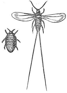
Cochineal species of insect

The cochineal is a scale insect in the suborder Sternorrhyncha, from which the natural dye carmine is derived. A primarily sessile parasite native to tropical and subtropical South America through North America, this insect lives on cacti in the genus Opuntia, feeding on plant moisture and nutrients. The insects are found on the pads of prickly pear cacti, collected by brushing them off the plants, and dried.
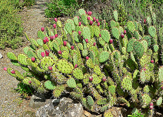
<i>Opuntia</i> genus of plants seen throughout India in dry areas

Opuntia, commonly called prickly pear, is a genus in the cactus family, Cactaceae. Prickly pears are also known as tuna (fruit), sabra, nopal from the Nahuatl word nōpalli for the pads, or nostle, from the Nahuatl word nōchtli for the fruit; or paddle cactus. The genus is named for the Ancient Greek city of Opus, where, according to Theophrastus, an edible plant grew and could be propagated by rooting its leaves. The most common culinary species is the Indian fig opuntia.

Its nearest neighbours are the villages of Guatiza and Charco del Palo, both about 3 km away. Mala is served by two regular bus routes between Lanzarote's capital Arrecife and the north of the island (Órzola and Máguez). [2]
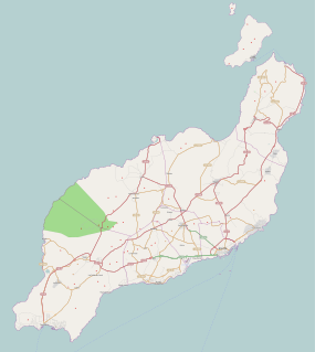
Guatiza Village in Canary Islands, Spain

Guatiza is a village in the municipality of Teguise in the northeastern part of the island of Lanzarote in the Las Palmas province in the Canary Islands. Its population was 812 in 2013.

Charco del Palo Village

Charco del Palo is a naturist holiday village on the north-eastern coast of Lanzarote, in the Canary Islands. The village was established around 1970 by the German entrepreneur Gregor Kaiser. In due course, it has developed into a popular naturist resort. It was the first official naturist resort established in the Canaries: nudity is permitted everywhere in the village, and practised universally. Its isolated location, at the end of a dedicated three kilometer long access road, helps to achieve privacy, while the village remains open to all. Visitors are mainly German, British, and Dutch. The village's population increased from 82 in the year 2000 to 229 in 2011, it has subsequently declined to 156 in 2013.

Arrecife City in Canary Islands, Spain

Arrecife is a city and municipality in the Canary Islands (Spain) situated in the centre-east of the island of Lanzarote, of which it has been the capital since 1852. The city owes its name to the rock reef which covers the beach located in the city. The city also gives its name to the nearby Arrecife Airport.

Related Research Articles

San Bartolomé, Las Palmas Municipality in Canary Islands, Spain

San Bartolomé is a village and ayuntamiento (county) in the Canary Islands (Spain), belonging to the Province of Las Palmas. It is situated in the center of the island of Lanzarote. The county of San Bartolomé stretches to the southern coast of the island.

Lanzarote Airport International airport in San Bartolomé, Canary Islands, Spain

César Manrique-Lanzarote Airport, commonly known as Lanzarote Airport and also known as Arrecife Airport, is the airport serving the island of Lanzarote in the Canary Islands. The airport is located in San Bartolomé, Las Palmas, 5 kilometres (3.1 mi) southwest of the island's capital, Arrecife. It handles flights to many European airports, with hundreds of thousands of tourists each year, as well as internal flights to other Spanish airports. It handled 7,327,019 passengers in 2018.

Tinajo (municipality) Municipality in Canary Islands, Spain

Tinajo is a municipality in the western part of the island of Lanzarote in the Province of Las Palmas in the Canary Islands, Spain. The population is 5,783 (2013), and the area is 135.28 km². It is located near the north coast, northwest of the island capital Arrecife. The main town in the municipality is Tinajo.

Yaiza

Yaiza is a small town on the island of Lanzarote in the Canary Islands, Spain. It lies in the southwest of the island. The population in 2012 was 857. The town gives its name to the municipality of Yaiza, although it is much smaller than the largest settlement in the municipality, Playa Blanca.

César Manrique Spanish artist, architect, sculptor and environment activist

César Manrique was a Spanish artist, sculptor, architect and activist from Lanzarote.

Cueva de los Verdes lava tube and tourist attraction in Haria, Lanzarote, Canary Islands, Spain

Cueva de los Verdes is a lava tube and tourist attraction of the Haria municipality on the island of Lanzarote in the Canary Islands (Spain). The cave lies within the Monumento Natural del Malpaís de La Corona, a protected area of the Canary Islands.

Socialist Canarian Party was a political party in Lanzarote, Canary Islands, Spain. It was registered with the election authorities in 1995.

UD Lanzarote association football team in Spain

Unión Deportiva Lanzarote is a Spanish football team based in Arrecife, Lanzarote, in the autonomous community of Canary Islands. Founded in 1970 it plays in Tercera División – Group 12, holding home games at the Ciudad Deportiva de Lanzarote, a 6,000-seat stadium which is shared with CD Orientación Marítima.

Corralejo Town in Canary Islands, Spain

Corralejo is a town and resort located on the northern tip of Fuerteventura, one of the Canary Islands, facing the smaller islet of Lobos. It is in the municipality of La Oliva. It is surrounded to the north and east by the Atlantic Ocean, by dunes to the south and by arid desert land to the west that leads to the western coast and El Cotillo. Once a traditional fishing village, the town has grown significantly and today is one of the two main tourist towns on the island of Fuerteventura. Thanks to the large expat population, the town has a diverse population that varies from the local Spaniard, to the Irish, British, German and Finnish people who have settled in the resort.

San Ginés, Arrecife

San Ginés is a church in Arrecife, Lanzarote, Canary Islands, Spain. Originally the location of a hermitage built in 1574 that contained images of Saint Peter and Saint Ginés, it was flooded and completely rebuilt in 1667. It was expanded in the eighteenth and nineteenth centuries. Saint Ginés is Arrecife’s patron saint. Mass is celebrated every evening, including Saturdays, Sundays and holydays, at 7.30 p.m. There are additional Masses at weekends and on feast days. The tower of the Church of San Ginés was inspired by the bell tower of the Church of La Concepción of Santa Cruz de Tenerife.

Playa Blanca Town in Canary Islands, Spain

Playa Blanca is the southernmost town of the Spanish island of Lanzarote. It is the newest resort on the island, and is part of the municipality of Yaiza.

Monte Corona mountain

Volcán de La Corona is a 609 meters (1,998 ft) high extinct volcano on the Canary Island of Lanzarote (Spain), near the village of Yé in the municipality of Haría. Its eruption around 4000 years ago covered a large area of the northeast of the island with lava, creating the Malpais de la Corona and two of the island's most-visited geological attractions, the Cueva de los Verdes and the Jameos del Agua.

Ciudad Deportiva de Lanzarote is a sports ground in Arrecife, the capital of Lanzarote in the Canary Islands. It is the home ground for the island's main football team, UD Lanzarote. It holds around 7000 spectators and also hosts other sports.

Tinajo is a place in the municipality with the same name Tinajo in the western portion of the island of Lanzarote in the Las Palmas province in the Canary Islands. The population is 2,809 (2007).

Mácher is a village on the Spanish island of Lanzarote, in the municipality of Tias.

Uga (Lanzarote) human settlement

Uga is a small wine-producing village in Yaiza municipality in the province of Las Palmas, southern Lanzarote, off the coast of Africa. As of 2016 its population is 998, and nearby cities include Puerto del Carmen, Tías, and Playa Blanca. The closest airport is Lanzarote's official airport, also known as Arrecife airport.

References

  1. "List of place name: Population of the Continuous Municipal Register by Population Unit". Instituto Nacional de Estadística. Retrieved 2013-09-18. (Enter form data: Entity type: singular entity; Denomination: same as "Mala"; Year: 2012; click Consult)
  2. "Lines and Timetables". Arrecife Bus. Retrieved 2013-09-22.

Coordinates: 29°05′53″N13°28′05″W / 29.0980°N 13.4680°W / 29.0980; -13.4680

Geographic coordinate system Coordinate system

A geographic coordinate system is a coordinate system that enables every location on Earth to be specified by a set of numbers, letters or symbols. The coordinates are often chosen such that one of the numbers represents a vertical position and two or three of the numbers represent a horizontal position; alternatively, a geographic position may be expressed in a combined three-dimensional Cartesian vector. A common choice of coordinates is latitude, longitude and elevation. To specify a location on a plane requires a map projection.