Mala Pristava, Šmarje pri Jelšah

Last updated
Mala Pristava
Mala Pristava, Smarje pri Jelsah.JPG
Slovenia location map.svg
Red pog.svg
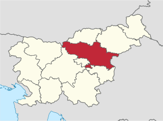
Mala Pristava
Location in Slovenia
Coordinates: 46°14′13.66″N15°31′29.56″E / 46.2371278°N 15.5248778°E / 46.2371278; 15.5248778 Coordinates: 46°14′13.66″N15°31′29.56″E / 46.2371278°N 15.5248778°E / 46.2371278; 15.5248778
Country Flag of Slovenia.svg Slovenia
Traditional region Styria
Statistical region Savinja
Municipality Šmarje pri Jelšah
Area
  Total 1.12 km2 (0.43 sq mi)
Elevation 271.4 m (890.4 ft)
Population (2002)
  Total 83
[1]

Mala Pristava (pronounced  [ˈmaːla ˈpɾiːstaʋa] ) is a settlement in the Municipality of Šmarje pri Jelšah in eastern Slovenia. It lies in the hills just north of Šmarje. The area is part of the historical Styria region. The municipality is now included in the Savinja Statistical Region. [2]

Šmarje pri Jelšah Town and Municipality in Slovenia

Šmarje pri Jelšah is a town and a municipality in eastern Slovenia. The area was part of the traditional region of Styria. The municipality is now included in the Savinja Statistical Region. The development of the settlement is associated with a medieval mansion known as Jelšingrad on a slight hill northwest of the town.

Slovenia republic in Central Europe

Slovenia, officially the Republic of Slovenia, is a sovereign state located in southern Central Europe at a crossroads of important European cultural and trade routes. It is bordered by Italy to the west, Austria to the north, Hungary to the northeast, Croatia to the southeast, and the Adriatic Sea to the southwest. It covers 20,273 square kilometers (7,827 sq mi) and has a population of 2.07 million. One of the successor states of the former Yugoslavia, Slovenia is a parliamentary republic and a member of the United Nations, of the European Union, and of NATO. The capital and largest city is Ljubljana.

Savinja Statistical Region Statistical region

The Savinja Statistical Region is a statistical region in Slovenia. The largest town in the region is Celje. It is named after the Savinja River. The region is very diverse in natural geography; it mainly comprises the wooded mountainous terrain attractive to tourists, the fertile Lower Savinja Valley with good conditions for growing hops, the Kozje Hills, and the Velenje Basin with lignite deposits, used for electricity production. In 2013 the region invested more than EUR 127 million in environmental protection. In 2013, the region accounted for 14% of enterprises created and 8% of enterprises shut down. The region has good natural conditions for agriculture. In 2013 this region had more than 11,000 farms, which is 15% of all farms in Slovenia, ranking the region right behind the Drava Statistical Region. In agricultural area utilised and livestock, the region was also in second place. The region is a well-known and popular tourist destination. In 2012, tourist arrivals and overnight stays in the region represented 11.1% of all tourist arrivals in Slovenia and 15.0% of all overnight stays. On average, tourists spent four nights there.

Remains of four to six Roman buildings have been identified in the hamlet of Grobeljšek in the settlement. One was excavated in the early 20th century. [3]

Ancient Rome History of Rome from the 8th-century BC to the 5th-century

In historiography, ancient Rome is Roman civilization from the founding of the Italian city of Rome in the 8th century BC to the collapse of the Western Roman Empire in the 5th century AD, encompassing the Roman Kingdom, Roman Republic and Roman Empire until the fall of the western empire. The civilization began as an Italic settlement in the Italian Peninsula, conventionally founded in 753 BC, that grew into the city of Rome and which subsequently gave its name to the empire over which it ruled and to the widespread civilisation the empire developed. The Roman Empire expanded to become one of the largest empires in the ancient world, though still ruled from the city, with an estimated 50 to 90 million inhabitants and covering 5.0 million square kilometres at its height in AD 117.

Excavation (archaeology) Exposure, processing and recording of archaeological remains

In archaeology, excavation is the exposure, processing and recording of archaeological remains. An excavation site or "dig" is a site being studied. Such a site excavation concerns itself with a specific archaeological site or a connected series of sites, and may be conducted over as little as several weeks to over a number of years.

Related Research Articles

Bodrišna Vas Place in Styria, Slovenia

Bodrišna Vas is a settlement in the Municipality of Šmarje pri Jelšah in eastern Slovenia. It lies in the hills north of Šentvid pri Grobelnem in the historical region of Styria. The municipality is now included in the Savinja Statistical Region.

Brezje pri Lekmarju Place in Styria, Slovenia

Brezje pri Lekmarju is a small settlement in the Municipality of Šmarje pri Jelšah in eastern Slovenia. It lies in the Kozje region south of Šmarje and east of Sveti Štefan. The area was traditionally part of Styria. The municipality is now included in the Savinja Statistical Region.

Dol pri Pristavi in Styria, Slovenia

Dol pri Pristavi is a settlement just northwest of Pristava pri Mestinju in eastern Slovenia. It belongs to the Municipality of Šmarje pri Jelšah. The area was traditionally part of Styria and is now included in the Savinja Statistical Region. The railway line from Celje to Zagreb runs through the settlement.

Dol pri Šmarju in Styria, Slovenia

Dol pri Šmarju is a settlement in the hills south of Šmarje pri Jelšah in eastern Slovenia. The Municipality of Šmarje pri Jelšah is included in the Savinja Statistical Region. It is part of the historical Styria region.

Dvor, Šmarje pri Jelšah Place in Styria, Slovenia

Dvor is a settlement in the Municipality of Šmarje pri Jelšah in eastern Slovenia. It lies on a small stream named Dvor Creek after the settlement itself northwest of Šmarje pri Jelšah. The area was traditionally part of Styria. The municipality is now included in the Savinja Statistical Region.

Globoko pri Šmarju in Styria, Slovenia

Globoko pri Šmarju is a settlement in the Municipality of Šmarje pri Jelšah in eastern Slovenia. It lies in the hills southwest of Šmarje. The municipality is included in the Savinja Statistical Region and is part of the traditional region of Styria.

Zibiška Vas Place in Styria, Slovenia

Zibiška Vas is a small village in the Municipality of Šmarje pri Jelšah in eastern Slovenia. It lies on Zibika Creek west of Pristava pri Mestinju. The area was traditionally part of Styria. The municipality is now included in the Savinja Statistical Region.

Koretno in Styria, Slovenia

Koretno is a settlement in the Municipality of Šmarje pri Jelšah in eastern Slovenia. It lies in the hills southeast of Šmarje, off the local road towards Pristava pri Mestinju. The area was traditionally part of the Styria region. The municipality is included in the Savinja Statistical Region.

Zastranje in Styria, Slovenia

Zastranje is a small settlement just north of Šmarje pri Jelšah in eastern Slovenia. The area is part of the traditional region of Styria. The Municipality of Šmarje pri Jelšah is now included in the Savinja Statistical Region.

Zadrže in Styria, Slovenia

Zadrže is a settlement immediately west of Šmarje pri Jelšah in eastern Slovenia. The entire area of the Municipality of Šmarje pri Jelšah was traditionally part of Styria and is now included in the Savinja Statistical Region.

Vrh, Šmarje pri Jelšah in Styria, Slovenia

Vrh is a settlement in the hills northwest of Šmarje pri Jelšah in eastern Slovenia. The entire Municipality of Šmarje pri Jelšah lies in the traditional region of Styria and is now included in the Savinja Statistical Region.

Pijovci in Styria, Slovenia

Pijovci is a dispersed settlement in the hills north of Šmarje pri Jelšah in eastern Slovenia. The Municipality of Šmarje pri Jelšah lies in the historical Styria region and is included in the Savinja Statistical Region.

Predel, Šmarje pri Jelšah Place in Styria, Slovenia

Predel is a small settlement in the Municipality of Šmarje pri Jelšah in eastern Slovenia. It lies just south of the regional road from Šmarje towards Grobelno in the historical Styria region. The municipality is now included in the Savinja Statistical Region.

Predenca Place in Styria, Slovenia

Predenca is a settlement in the Municipality of Šmarje pri Jelšah in eastern Slovenia. It stands on a hill south of Šmarje. The area is part of the historical Styria region. The municipality is now included in the Savinja Statistical Region.

Preloge pri Šmarju in Styria, Slovenia

Preloge pri Šmarju is a small settlement near Šmarje pri Jelšah in eastern Slovenia. The area is part of the historical Styria region and the entire Municipality of Šmarje pri Jelšah is now included in the Savinja Statistical Region.

Pustike in Styria, Slovenia

Pustike is a dispersed settlement in the Municipality of Šmarje pri Jelšah in eastern Slovenia. It lies in the hills northeast of Zibika. The area is part of the historical Styria region and is now included in the Savinja Statistical Region.

Sotensko pri Šmarju Place in Styria, Slovenia

Sotensko pri Šmarju is a settlement in the Municipality of Šmarje pri Jelšah in eastern Slovenia. It lies in the hills north of Šmarje. The area is part of the historical Styria region. The municipality is now included in the Savinja Statistical Region.

Stranje, Šmarje pri Jelšah Place in Styria, Slovenia

Stranjepronounced [ˈstɾaːnjɛ] is a settlement in the Municipality of Šmarje pri Jelšah in eastern Slovenia. It lies southeast of Šmarje. The entire area is part of the historical Styria region. The municipality is now included in the Savinja Statistical Region.

Topolovec, Šmarje pri Jelšah in Styria, Slovenia

Topolovec is a small settlement in the Municipality of Šmarje pri Jelšah in eastern Slovenia. It lies just west of the regional road leading north from Šmarje towards Poljčane. Historically it is part of the Styria region. The municipality is now included in the Savinja Statistical Region.

References