Phoenix is a village in Oswego County, New York, United States. The population was 2,382 at the 2010 census. The name is derived from Alexander Phoenix. The village of Phoenix lies in the Lake Ontario lake-effect snow belt, with seasonal snow totals regularly exceeding 200 in (510 cm). Phoenix lies in the southwest part of the town of Schroeppel.

New York is a suburban village in the metropolitan county of Tyne and Wear, North East England. Approximately 4 miles from Whitley Bay, and 5 miles from the town of Tynemouth, it locally governed as part of the metropolitan borough of North Tyneside. It was named after New York, following the British capture of the city in 1777.

Tongatapu is the main island of Tonga and the site of its capital, Nukuʻalofa. It is located in Tonga's southern island group, to which it gives its name, and is the country's most populous island, with 74,611 residents (2016), 70.5% of the national population, on 260 square kilometres. Based on Google Earth Pro, its maximum elevation is at least 70 metres above sea level along Liku Road at 21 degrees 15 minutes and 55.7 seconds south 175 degrees 08 minutes 06.4 seconds west, but could be even higher somewhere else. Tongatapu is Tonga's centre of government and the seat of its monarchy.

Bom Jardim de Minas is a city of the state of Minas Gerais, Brazil.
New York State Route 94 (NY 94) is a state highway entirely within Orange County in southern New York. The western terminus is at the New York–New Jersey state line, where it continues as New Jersey's Route 94 for another 46 miles (74 km) to Columbia, New Jersey. Its eastern terminus is located at U.S. Route 9W (US 9W) in New Windsor. From Warwick to Florida, NY 94 is concurrent with NY 17A. The entirety of NY 94 is known as the 94th Infantry Division Memorial Highway.

New York State Route 80 (NY 80) is a 127.32-mile-long (204.90 km) west–east New York State Route located within Onondaga, Madison, Chenango, Otsego, Herkimer, and Montgomery counties in New York. Its western terminus is located at a junction with NY 175 in the city of Syracuse in Onondaga County, from which it actually runs in a north–south direction for 20 miles (32 km). The eastern terminus is located at a junction with NY 5 in the village of Nelliston in Montgomery County. The route is signed north–south from U.S. Route 20 (US 20) north to NY 5.

The Candia Four Corners is an unincorporated community located near the center of the town of Candia, New Hampshire, in the United States.
New York State Route 174 (NY 174) is a state highway in Onondaga County, located in Central New York, in the United States. The highway is 16.7 miles (26.9 km) long and passes through mostly rural regions. Route 174 begins at an intersection with NY 41 in Borodino, a hamlet of Spafford. It heads generally northward for most of its length, except for short distances in the villages of Marcellus and Camillus. The route ends at a junction with NY 5 west of Camillus, at the west end of the Route 5 Camillus bypass. Route 174 is located along a large mapped sedimentary bedrock unit, known as the Marcellus Formation. The formation is named for an outcrop found near the town of Marcellus, New York, during a geological survey in 1839.
Kherli is a city and a municipality in Alwar district in the Indian state of Rajasthan.kherli mandi is the second largest mandi in Alwar. Once it was so much famous that till now old jaipur people knows this as ganj kherli i.e. kherli mandi. Kherli is between the golden triangle where it is nearest to Agra(125 km) Jaipur(150 km) and Delhi(175 km).This area also comes under NCR but still they are not getting benefit of close proximity to these 3 big cities.
Sinitovo is a village in central Bulgaria. It is located 5 km. east of Pazardzhik. As of 2005 the population was 2160. It is located at an altitude of 200 metres (660 ft) in a fertile agricultural region near the Maritsa river. The main products grown in the area include wheat, maize, peppers, while the most spread domestic animal is the sheep.

Roseville is a community in Ontario, Canada located at 43°20′35″N80°28′31″W. It is within the rural township of North Dumfries, which forms part of the Region of Waterloo, and is located between Ayr, Kitchener and Highway 401.
Bengough is a town in the rural municipality of Bengough No. 40, in the Canadian province of Saskatchewan. A southeastern Saskatchewan prairie town, Bengough is located east of Willow Bunch Lake on Highway 34 near Highway 705. The town is named Bengough after cartoonist John Wilson Bengough. Bengough also plays host to the Gateway Festival which showcases various musicians and several other events through the weekend, usually taking place in late July.

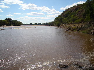
The Mzingwane River, formerly known Umzingwane River as or Umzingwani River is a major left-bank tributary of the Limpopo River in Zimbabwe. It rises near Fort Usher, Matobo District, south of Bulawayo and flows into the Limpopo River near Beitbridge, downstream of the mouth of the Shashe River and upstream of the mouth of the Bubye River.

Guijo de Santa Bárbara is a municipality located in the province of Cáceres, Extremadura, Spain. According to the 2005 census (INE), the municipality has a population of 429 inhabitants.

Omoka is the larger of the two main settlements on Penrhyn Atoll in the Cook Islands. It is the location of the Penrhyn island Council, and is located on Moananui Islet in the far west of Penrhyn Atoll.

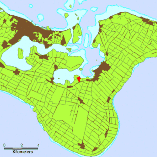
Holonga is a small village in the eastern (Hahake) district of Tongatapu in the kingdom of Tonga. It lies between the villages of Malapo and ʻAlakifonua. It had a population of 488 in 2016.
Las Palas is a village, situated in the autonomous region of Murcia in South East Spain. The name Las Palas is derived from the large amount of "Palas" (cactus) found in the area. The village has been in existence since the 16th Century. It is located 7 km south of Fuente Álamo de Murcia and 20 km north west of Cartagena.

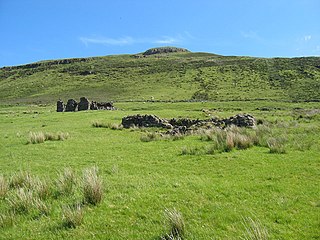
Mugeary is a farm or croft and former settlement on the island of Skye, Scotland. Located 4 kilometres southwest of Portree, it is known as the location where the basaltic rock mugearite was first identified. The Gaelic name is derived from Old Norse and probably means "narrow field".

In World War I, the area around Hooge on Bellewaerde Ridge, about 2.5 mi (4 km) east of Ypres in Flanders in Belgium, was one of the easternmost sectors of the Ypres Salient and was the site of much fighting between German and Allied forces.

Barara Buzurg is a village in Dalmau block of Rae Bareli district, Uttar Pradesh, India. It is located 8km from Dalmau, the block headquarters. As of 2011, it has a population of 5,685 people, in 1,031 households. It has 4 primary schools and 1 maternity and child welfare centre. It hosts a market twice per week, on Mondays and Fridays; cattle, cloth, and vegetables are the main items traded.


