Male Vodenice

Last updated
Male Vodenice
MaleVodenice.JPG
Slovenia location map.svg
Red pog.svg
Male Vodenice
Location in Slovenia
Coordinates: 45°49′27.47″N15°23′43.29″E / 45.8242972°N 15.3953583°E / 45.8242972; 15.3953583 Coordinates: 45°49′27.47″N15°23′43.29″E / 45.8242972°N 15.3953583°E / 45.8242972; 15.3953583
Country Flag of Slovenia.svg Slovenia
Traditional region Lower Carniola
Statistical region Lower Sava
Municipality Kostanjevica na Krki
Area
  Total 5.6 km2 (2.2 sq mi)
Elevation 387.4 m (1,271.0 ft)
Population (2002)
  Total 33
[1]

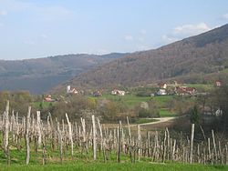
Male Vodenice (pronounced  [ˈmaːlɛ ʋɔdɛˈniːtsɛ] ; German : Kleinwodenitz [2] ) is a settlement in the Gorjanci Hills in the Municipality of Kostanjevica na Krki in eastern Slovenia. Its territory extends right to the border with Croatia. The area was traditionally part of Lower Carniola. It is now included in the Lower Sava Statistical Region. [3]

German language West Germanic language

German is a West Germanic language that is mainly spoken in Central Europe. It is the most widely spoken and official or co-official language in Germany, Austria, Switzerland, South Tyrol (Italy), the German-speaking Community of Belgium, and Liechtenstein. It is also one of the three official languages of Luxembourg and a co-official language in the Opole Voivodeship in Poland. The languages which are most similar to German are the other members of the West Germanic language branch: Afrikaans, Dutch, English, the Frisian languages, Low German/Low Saxon, Luxembourgish, and Yiddish. There are also strong similarities in vocabulary with Danish, Norwegian and Swedish, although those belong to the North Germanic group. German is the second most widely spoken Germanic language, after English.

Municipality of Kostanjevica na Krki Municipality in Slovenia

The Municipality of Kostanjevica na Krki is a municipality in the traditional Lower Carniola region of southern Slovenia. The seat of the municipality is the town of Kostanjevica na Krki. It is part of the Lower Sava statistical region. It is located in the northern foothills of the Gorjanci Hills and extends to the border with Croatia.

Slovenia republic in Central Europe

Slovenia, officially the Republic of Slovenia, is a sovereign state located in southern Central Europe at a crossroads of important European cultural and trade routes. It is bordered by Italy to the west, Austria to the north, Hungary to the northeast, Croatia to the southeast, and the Adriatic Sea to the southwest. It covers 20,273 square kilometers (7,827 sq mi) and has a population of 2.07 million. One of the successor states of the former Yugoslavia, Slovenia is a parliamentary republic and a member of the United Nations, of the European Union, and of NATO. The capital and largest city is Ljubljana.

The local church, built on a hill east of the main settlement, is dedicated to the Virgin Mary and belongs to the Parish of Kostanjevica na Krki. It is a 14th-century Gothic building with a belfry. Its main and side altars date to the 18th century. [4]

Church (building) building constructed for Christian worship

A church building or church house, often simply called a church, is a building used for Christian religious activities, particularly for Christian worship services. The term is often used by Christians to refer to the physical buildings where they worship, but it is sometimes used to refer to buildings of other religions. In traditional Christian architecture, the church is often arranged in the shape of a Christian cross. When viewed from plan view the longest part of a cross is represented by the aisle and the junction of the cross is located at the altar area.

Gothic architecture style of architecture

Gothic architecture is a style that flourished in Europe during the High and Late Middle Ages. It evolved from Romanesque architecture and was succeeded by Renaissance architecture. Originating in 12th-century France, it was widely used, especially for cathedrals and churches, until the 16th century.

Bell tower a tower that contains one or more bells, or that is designed to hold bells

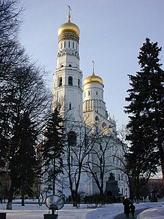
A bell tower is a tower that contains one or more bells, or that is designed to hold bells even if it has none. Such a tower commonly serves as part of a church, and will contain church bells, but there are also many secular bell towers, often part of a municipal building, an educational establishment, or a tower built specifically to house a carillon. Church bell towers often incorporate clocks, and secular towers usually do, as a public service.

Related Research Articles

Kostanjevica na Krki Place in Lower Carniola, Slovenia

Kostanjevica na Krki, is a small town in the historic Lower Carniola region of southern Slovenia. It is the seat of the Municipality of Kostanjevica na Krki. Today it is part of the Lower Sava Statistical Region. It is located in the northern foothills of the Gorjanci Hills near the border with Croatia. The center of the settlement is on an island in the Krka River, and it is also promoted as the "Venice of Lower Carniola" in Slovenian.

Avguštine in Lower Carniola, Slovenia

Avguštine is a settlement in the Municipality of Kostanjevica na Krki in eastern Slovenia. The area was traditionally part of Lower Carniola. It is now included in the Lower Sava Statistical Region.

Dobrava pri Kostanjevici Place in Lower Carniola, Slovenia

Dobrava pri Kostanjevici is a settlement on the right bank of the Krka River in the Municipality of Kostanjevica na Krki in eastern Slovenia. The area was traditionally part of Lower Carniola. It is now included in the Lower Sava Statistical Region.

Dolnja Prekopa in Lower Carniola, Slovenia

Dolnja Prekopa is a settlement in the Municipality of Kostanjevica na Krki in eastern Slovenia. The area was traditionally part of Lower Carniola. It is now included in the Lower Sava Statistical Region.

Dolšce in Lower Carniola, Slovenia

Dolšce is a settlement in the Municipality of Kostanjevica na Krki in eastern Slovenia. It lies in the foothills of the Gorjanci Hills, south of the town of Kostanjevica na Krki. The area was traditionally part of Lower Carniola. It is now included in the Lower Sava Statistical Region.

Črneča Vas Place in Lower Carniola, Slovenia

Črneča Vas is a settlement in the Municipality of Kostanjevica na Krki in eastern Slovenia. It lies in the Gorjanci hills close to the border with Croatia. The area was traditionally part of Lower Carniola. It is now included in the Lower Sava Statistical Region.

Grič, Kostanjevica na Krki in Lower Carniola, Slovenia

Grič is a small settlement in the foothills of the Gorjanci Hills south of Kostanjevica na Krki in eastern Slovenia. The area was traditionally part of Lower Carniola. It is now included in the Lower Sava Statistical Region.

Ivanjše in Lower Carniola, Slovenia

Ivanjše is a small settlement in the foothills of the Gorjanci Hills in the Municipality of Kostanjevica na Krki in eastern Slovenia. The area was traditionally part of Lower Carniola. It is now included in the Lower Sava Statistical Region.

Jablance, Kostanjevica na Krki in Lower Carniola, Slovenia

Jablance is a settlement in the foothills of the Gorjanci Hills east of Kostanjevica na Krki in eastern Slovenia. The area was traditionally part of Lower Carniola. It is now included in the Lower Sava Statistical Region.

Kočarija in Lower Carniola, Slovenia

Kočarija is a settlement in the foothills of the Gorjanci Hills southwest of the town of Kostanjevica na Krki in eastern Slovenia. The entire area was traditionally part of Lower Carniola and is now included in the Lower Sava Statistical Region.

Malence Place in Lower Carniola, Slovenia

Malence is a settlement on the left bank of the Krka River in the Municipality of Kostanjevica na Krki in eastern Slovenia. The area was traditionally part of Lower Carniola. It is now included in the Lower Sava Statistical Region.

Orehovec, Kostanjevica na Krki in Lower Carniola, Slovenia

Orehovec is a village in the Gorjanci Hills in the Municipality of Kostanjevica na Krki in eastern Slovenia. Its territory extends south to the border with Croatia. The area was traditionally part of Lower Carniola. It is now included in the Lower Sava Statistical Region.

Oštrc in Lower Carniola, Slovenia

Oštrc is a village in the foothills of the Gorjanci Hills in the Municipality of Kostanjevica na Krki in eastern Slovenia. The area was traditionally part of Lower Carniola. It is now included in the Lower Sava Statistical Region.

Podstrm in Lower Carniola, Slovenia

Podstrm is a small settlement in the foothills of the Gorjanci Hills in the Municipality of Kostanjevica na Krki in eastern Slovenia. The area was traditionally part of Lower Carniola and is now included in the Lower Sava Statistical Region.

Ržišče, Kostanjevica na Krki in Lower Carniola, Slovenia

Ržišče is a settlement in the foothills of the Gorjanci Hills in the Municipality of Kostanjevica na Krki in eastern Slovenia. The area was traditionally part of Lower Carniola and is now included in the Lower Sava Statistical Region.

Slinovce in Lower Carniola, Slovenia

Slinovce is a dispersed settlement in the low hills on the right bank of the Krka River in the Municipality of Kostanjevica na Krki in eastern Slovenia. The area was traditionally part of Lower Carniola and is now included in the Lower Sava Statistical Region.

Velike Vodenice in Lower Carniola, Slovenia

Velike Vodenice is a settlement in the foothills of the Gorjanci range in the Municipality of Kostanjevica na Krki in eastern Slovenia. The area was traditionally part of Lower Carniola and is now included in the Lower Sava Statistical Region.

Vrbje, Kostanjevica na Krki in Lower Carniola, Slovenia

Vrbje is a small settlement in the Gorjanci Hills in the Municipality of Kostanjevica na Krki in eastern Slovenia, next to the border with Croatia. The area was traditionally part of Lower Carniola. It is now included in the Lower Sava Statistical Region.

Vrtača, Kostanjevica na Krki in Lower Carniola, Slovenia

Vrtača is a small remote settlement in the Gorjanci Hills in the Municipality of Kostanjevica na Krki in eastern Slovenia, right on the border with Croatia. The area was traditionally part of Lower Carniola. It is now included in the Lower Sava Statistical Region.

References

  1. Statistical Office of the Republic of Slovenia
  2. Leksikon občin kraljestev in dežel zastopanih v državnem zboru, vol. 6: Kranjsko. 1906. Vienna: C. Kr. Dvorna in Državna Tiskarna, p. 70.
  3. Kostanjevica na Krki municipal site
  4. Slovenian Ministry of Culture register of national heritage reference number ešd 1912