
The West Godavari district is a coastal district in the Indian state of Andhra Pradesh with an administrative headquarters in Bhimavaram. As of the 2011 Census of India, the district has an area of 2,178 km2 (841 sq mi) and a population of 1,779,935. It is bounded by the Krishna district and Bay of Bengal to the south, East Godavari district to the east, and Eluru district, Kolleru Lake and Upputeru Drain to the northwest.
Chintalapudi is a town municipality, constituency and mandal headquarters in Eluru District of the Indian state of Andhra Pradesh. Chintalapudi is one of oldest town in the Andhra Pradesh, but still it is under developed. There is no proper road and transport to the town. People of the town still struggling to reach the nearest cities. There is lot of history around this town, dates back to 600BC to 300BC.The human movement here from 2300 years ago. The village named Jeelakargudem is located 15 km away from here and contains some of the oldest ancient monuments in Buddhism. The carvings on the Sandrock hill are really surprising. According to the ASI and some historians the historical site belongs to Ashoka reign. The historical site is one of the best tourist attraction in the locality, but lack of proper care from government and people the site is ruining. This region is also famous for cultivation of Oil Plam. It's nearly contributes 50% to 60% of total district cultivation of Oil Palm. According to some sources this region contains a vast coal reserves in the country. Your can find more on this in some popular news journals.
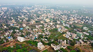
Eluru mandal is one of the 28 mandals in Eluru district of the Indian state of Andhra Pradesh. It is administered under Eluru revenue division and its headquarters are located at Eluru city. The mandal is bounded by Pedapadu mandal, Pedavegi mandal, Denduluru mandal, Bhimadole mandal and it also borders Krishna district.
Renigunta mandal is one of the 34 mandals in Tirupati district of the Indian state of Andhra Pradesh. Its headquarters are located at Renigunta, suburb of Tirupati.. The mandal is bounded by Tirupati (urban), Tirupati (rural), Vadamalapeta, Yerpedu.This mandal is located at Srikalahasti revenue division.
Tangellamudi is a census town in Eluru district of the Indian state of Andhra Pradesh. It is in Eluru mandal of Eluru revenue division. The town is a constituent of Eluru urban agglomeration. The nearest railway station is in Powerpet and is 1.5 km.

Gavaravaram is a census town in Eluru district of the Indian state of Andhra Pradesh. Gavaravaram is also known as Venkayapalam because of Gopina Venkana Garu (1914-1991) who once owned most areas of the village. It is located in Eluru mandal of Eluru revenue division. The town is a constituent of Eluru urban agglomeration.

Denduluru is a village in the Eluru district of the Indian state of Andhra Pradesh.And the ruling MLA is Sowji. It is located on the north-east side of district headquarters Eluru at a distance of 11 km. It is a member of the Eluru revenue division. The Bhimalingadibba or the mounds are one of the centrally protected monuments of national importance.
Bhimadole mandal is one of the 28 mandals in Eluru district of the Indian state of Andhra Pradesh. It is administered under Eluru revenue division and its headquarters are located at Bhimadole.
Agadallanka is a village in Eluru district in the state of Andhra Pradesh in India. The nearest train station is Gundlakamma located at a distance of 12.38 km.

Narasapuram Mandal is one of the 19 mandals in the West Godavari district of the Indian state of Andhra Pradesh. Its headquarters are in Narasapuram, a town in the mandal. The mandal is bordered by the Godavari River to the north, the Bay of Bengal to the east, the Mogalthur mandal to the south, and the Palacole mandal to the west.
Sreeparru is a village in Eluru district in the state of Andhra Pradesh in India. It is 22 km from the city of Eluru, the headquarters of Eluru district.
Komadavole is an out growth of Eluru city in Eluru district of the Indian state of Andhra Pradesh. It is located in Eluru mandal of Eluru revenue division. It is also a constituent of Eluru Urban Agglomeration.
Pinakadimi is a village in Eluru district of the Indian state of Andhra Pradesh. It is located in Pedavegi mandal of Eluru revenue division. It is located at a distance of 7 km from district headquarters Eluru city.
Amberpeta is a village in Eluru district in the state of Andhra Pradesh in India. The nearest railway station is Kacheguda(KCG) located at a distance of 0.81 Km.
Chettunnapdu is a village in Eluru district in the state of Andhra Pradesh in India.
Polasanipalle is a village in Eluru district in the state of Andhra Pradesh in India. The nearest railway station is located at Nuzvid (NZD) at a distance of 11.54 Km.
Allipalle is a village in Eluru district of the Indian state of Andhra Pradesh. The nearest railway station is Sitampet(STPT) located at a distance of 47.79 Km.
Amudalachalaka is a village in West Godavari district of the Indian state of Andhra Pradesh. It is administered under Eluru revenue division. Eluru is the nearest train station located more than 10 Km from Amudalachalaka.
Unguturu mandal is one of 28 mandals in the Eluru district of the Indian state of Andhra Pradesh. The headquarters are located at Unguturu. The mandal is bordered by Tadepalligudem mandal and Pentapadu mandal to the north, Nallajerla mandal to the west, Nidamarru mandal to the east, and by Dwaraka Tirumala mandal and Bhimadole mandal to the south
Eduru is a village in West Godavari district in the state of Andhra Pradesh in India. The nearest railway station is at Krishnapatnam (KAPT) located at a distance of 15.83 Km
