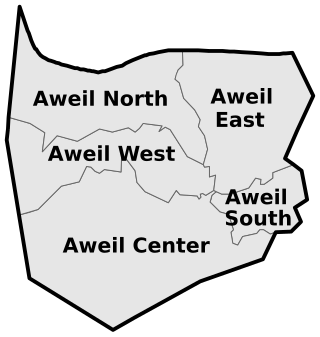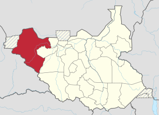
Malualbaai Payam is one of the administrative payam of Aweil East County of South Sudan. [1] It is located at the Eastern part of Wanyjok town. [2] [ failed verification ]

Malualbaai Payam is one of the administrative payam of Aweil East County of South Sudan. [1] It is located at the Eastern part of Wanyjok town. [2] [ failed verification ]

Northern Bahr el Ghazal(Arabic: ولاية شمال بحر الغزال) is a state in South Sudan. It has an area of 30,543 km2 and is part of the Bahr el Ghazal region. It borders East Darfur in Sudan to the north, Western Bahr el Ghazal to the west and south, and Warrap and the disputed region of Abyei to the east. Aweil is the capital of the state.

Bor is a historic city in the Bor County of Jonglei State, in the Greater Upper Nile region of South Sudan, being the epicenter of national liberation revolution with multiple landmarks that tells the story. In Malual-Chaat barrack, statues of liberators and destroyed weapons are conserved and exhibited at historical heritage site. It has also served as the headquarters of Jonglei state. The city is situated on the east side of the White Nile at the southern extent of the sudd, South Sudan's vast central wetlands.

Aweil is a city in South Sudan and the capital of the Northern Bahr el Ghazal.

Aweil East County is a county in South Sudan.

Magwi is a town in South Sudan. It is the capital, business center and home to the Acholi tribe of South Sudan.

Aweil West County is an administrative area in Northern Bahr el Ghazal, South Sudan.

Kapoeta East County is an administrative region of Eastern Equatoria state in South Sudan, bordered by Kenya to the south, Ethiopia to the east and Jonglei state to the west. It is part of the Greater Kapoeta region of the state. The largest ethnic group is the Toposa people. The principal town is Narus. The county includes the disputed Ilemi triangle, controlled by Kenya. The emblem of the county is a horned bull, with big humps and a large tail.
Melut County is an administrative area in Upper Nile State.

Morobo is one of the six counties in Central Equatoria state, South Sudan. Morobo County borders Uganda and Congo. The county is mainly occupied by Kakwa speaking people, Keliko and Lugbara. The people in Morobo are local farmers working for food. Morobo is part of the green belt and also acts as a breadbasket for Yei and Juba.

Aweil East also known as Abiem, was a state in South Sudan that existed between 2 October 2015 and 22 February 2020. It had an estimated population of 571,728 people and an area of 6,172.23 KM square. It was located in northern-western South Sudan. Its capital and largest city was Wanyjok. The state is located in the Bahr el Ghazal region and it bordered Twic State and Gogrial State to the east, Aweil State to the south, Lol State to the west, the disputed Abyei State region to the northeast, and Sudan to the north.

The Lol State was a state of South Sudan with the capital in Raga, that existed between 2 October 2015 and 22 February 2020. It was located in the Bahr el Ghazal region, which is in the northwest section of the country. Lol state bordered Haut-Mbomou and Haute-Kotto in the Central African Republic to the west, South Darfur and East Darfur in Sudan to the north, the disputed region of Kafia Kingi to the northwest, Aweil East State to the northeast, Aweil State to the east, Gbudwe State to the south, and Wau State to the southeast. The state was created alongside 27 other states after a decree issuing the creation of 28 states took place. It was dissolved at the conclusion of the South Sudanese Civil War.
Tiar Aliet is a payam in the Aweil South County of Northern Bahr el Ghazal state, in the Bahr el Ghazal region of South Sudan. It's the first most populous town in Boncuai Community followed by Panthou
Tiar-aleit is a boma in Tiar-aleit payam, Aweil South County, Northern Bahr el Ghazal State, in the Bahr el Ghazal region of South Sudan. It is the largest and the headquarters of the Boncuai Community. It is also the educational and business center to the community
Mangar Lual is a boma in Tiar-aleit Payam, in the Aweil South County of Northern Bahr el Ghazal state, in the Bahr el Ghazal region of South Sudan.

Tonj East County is an administrative area in Warrap State, South Sudan.

Aweil South County, sometimes called Paliet, is an administrative area in Northern Bahr el Ghazal state, in the Bahr el Ghazal region of South Sudan, bordering Warrap State to the south. It is located in the southeastern part of NBGs. It is also known by the name Paliet, and one of the counties consisting of three major Dinka tribal groups: Ajak, Boncuai and Kongdeer. It was founded in 2000 and headquartered in Boncuai in a place called Mangar-Gier. In 2004, the headquarters were shifted to Malek Alel in Ajak. It is boardered to the north by Aweil East and to the west by Aweil Centre, to the south east by Gogrial State, and to the southwest by Western Barh el Ghazal state respectively.

Yei River County is an administrative area in Central Equatoria with a large population of people who settled in that particular county.
Anuet payam is an independent payam situated at Bor South County in Jonglei State within South Sudan. Previously, Anuet village used to fall under Pariak boma in former Kolnyang payam.

Albino Bol Dhieu is a South Sudanese politician and the incumbent Minister of Youth and Sports in South Sudan since 12 March 2020. He is a member of the Sudan People's Liberation Movement.

The Episcopal Diocese of Wanyjok is an Anglican Diocese of the Province of the Episcopal Church of South Sudan. The diocese is centered in Wanyjok.