
Tarzymiechy Drugie is a village in the administrative district of Gmina Izbica, within Krasnystaw County, Lublin Voivodeship, in eastern Poland. It lies approximately 6 kilometres (4 mi) south-west of Izbica, 17 km (11 mi) south of Krasnystaw, and 59 km (37 mi) south-east of the regional capital Lublin.
Zawady is a village in Białystok County, Podlaskie Voivodeship, in north-eastern Poland. It is the seat of the gmina called Gmina Zawady. It lies approximately 34 km (21 mi) west of the regional capital Białystok.
Chmiel-Kolonia is a village in the administrative district of Gmina Jabłonna, within Lublin County, Lublin Voivodeship, in eastern Poland. It lies approximately 6 kilometres (4 mi) east of Jabłonna and 19 km (12 mi) south of the regional capital Lublin.
Koniaczów is a village in the administrative district of Gmina Jarosław, within Jarosław County, Subcarpathian Voivodeship, in south-eastern Poland. It lies approximately 5 kilometres (3 mi) north-east of Jarosław and 53 km (33 mi) east of the regional capital Rzeszów.

Makowisko is a village in the administrative district of Gmina Jarosław, within Jarosław County, Subcarpathian Voivodeship, in south-eastern Poland. It lies approximately 11 kilometres (7 mi) east of Jarosław and 59 km (37 mi) east of the regional capital Rzeszów.
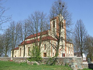
Pełkinie is a village in the administrative district of Gmina Jarosław, within Jarosław County, Subcarpathian Voivodeship, in south-eastern Poland. It lies approximately 7 kilometres (4 mi) north-west of Jarosław and 46 km (29 mi) east of the regional capital Rzeszów.
Surochów is a village in the administrative district of Gmina Jarosław, within Jarosław County, Subcarpathian Voivodeship, in south-eastern Poland. It lies approximately 7 kilometres (4 mi) east of Jarosław and 55 km (34 mi) east of the regional capital Rzeszów.
Wola Buchowska is a village in the administrative district of Gmina Jarosław, within Jarosław County, Subcarpathian Voivodeship, in south-eastern Poland. It lies approximately 11 kilometres (7 mi) north-west of Jarosław and 44 km (27 mi) east of the regional capital Rzeszów.
Wólka Pełkińska is a village in the administrative district of Gmina Jarosław, within Jarosław County, Subcarpathian Voivodeship, in southeastern Poland. It lies approximately 9 kilometres (6 mi) northwest of Jarosław and 45 km (28 mi) east of the regional capital Rzeszów.
Zgoda is a village in the administrative district of Gmina Jarosław, within Jarosław County, Subcarpathian Voivodeship, in south-eastern Poland. It lies approximately 6 kilometres (4 mi) east of Jarosław and 54 km (34 mi) east of the regional capital Rzeszów.
Bukowina is a village in the administrative district of Gmina Laszki, within Jarosław County, Subcarpathian Voivodeship, in south-eastern Poland. It lies approximately 6 kilometres (4 mi) north-east of Laszki, 20 km (12 mi) east of Jarosław, and 68 km (42 mi) east of the regional capital Rzeszów.
Laszki is a village in Jarosław County, Subcarpathian Voivodeship, in south-eastern Poland. It is the seat of the gmina called Gmina Laszki. It lies approximately 16 kilometres (10 mi) east of Jarosław and 65 km (40 mi) east of the regional capital Rzeszów.
Miękisz Nowy is a village in the administrative district of Gmina Laszki, within Jarosław County, Subcarpathian Voivodeship, in south-eastern Poland. It lies approximately 6 kilometres (4 mi) east of Laszki, 21 km (13 mi) east of Jarosław, and 69 km (43 mi) east of the regional capital Rzeszów.
Wietlin is a village in the administrative district of Gmina Laszki, within Jarosław County, Subcarpathian Voivodeship, in south-eastern Poland. It lies approximately 7 kilometres (4 mi) west of Laszki, 10 km (6 mi) east of Jarosław, and 58 km (36 mi) east of the regional capital Rzeszów.
Wietlin Pierwszy is a village in the administrative district of Gmina Laszki, within Jarosław County, Subcarpathian Voivodeship, in south-eastern Poland. It lies approximately 6 kilometres (4 mi) south-west of Laszki, 12 km (7 mi) east of Jarosław, and 60 km (37 mi) east of the regional capital Rzeszów.
Szczytna is a village in the administrative district of Gmina Pawłosiów, within Jarosław County, Subcarpathian Voivodeship, in south-eastern Poland. It lies approximately 5 kilometres (3 mi) north-west of Pawłosiów, 7 km (4 mi) west of Jarosław, and 43 km (27 mi) east of the regional capital Rzeszów.
Pawłowice is a village in the administrative district of Gmina Mogielnica, within Grójec County, Masovian Voivodeship, in east-central Poland. It lies approximately 5 kilometres (3 mi) north-west of Mogielnica, 23 km (14 mi) south-west of Grójec, and 62 km (39 mi) south of Warsaw.
Leśny Dworek is a village in the administrative district of Gmina Szydłowo, within Piła County, Greater Poland Voivodeship, in west-central Poland. It lies approximately 6 kilometres (4 mi) south-west of Szydłowo, 11 km (7 mi) west of Piła, and 83 km (52 mi) north of the regional capital Poznań.
Przymuszewo is a village in the administrative district of Gmina Brusy, within Chojnice County, Pomeranian Voivodeship, in northern Poland. It lies approximately 14 kilometres (9 mi) north of Brusy, 35 km (22 mi) north of Chojnice, and 76 km (47 mi) south-west of the regional capital Gdańsk.
Samborowo is a village in the administrative district of Gmina Ostróda, within Ostróda County, Warmian-Masurian Voivodeship, in northern Poland. It lies approximately 11 kilometres (7 mi) west of Ostróda and 47 km (29 mi) west of the regional capital Olsztyn.


