Mandraka Dam

Last updated
Mandraka Dam
Madagascar physical map.svg
Red pog.svg
Location of Mandraka Dam in Madagascar
CountryMadagascar
Location Mandraka, Analamanga Region
Coordinates 18°55′16.79″S47°55′46.14″E / 18.9213306°S 47.9294833°E / -18.9213306; 47.9294833
PurposePower
StatusOperational
Opening date1956
Owner(s) Jirama
Dam and spillways
Type of dam Gravity
Impounds Mandraka River
Height20 m (66 ft)
Reservoir
CreatesLake Mandraka
Total capacity36×10^6 m3 (29,000 acre⋅ft)
Mandraka Power Station
Coordinates 18°55′35.37″S47°56′49.51″E / 18.9264917°S 47.9470861°E / -18.9264917; 47.9470861
Commission date1958-1972
Hydraulic head 226 m (741 ft)
Turbines 4 x 6 MW (8,000 hp) Pelton-type
Installed capacity 24 MW (32,000 hp)

Mandraka Dam is a gravity dam on the Mandraka River near Mandraka in the Analamanga Region of Madagascar. The dam was constructed by a French firm by 1956 and creates Lake Mandraka. [1]

Contents

Mandraka Power Station

The dam supplies water to a 24 megawatts (32,000 hp) hydroelectric power station 1.9 km (1.2 mi) to the east, down in the valley. The change in elevation between the dam and power station affords a hydraulic head on 226 metres (741 ft). [2] [3] The dam and power station are operated and owned by Jirama and the four 6 megawatts (8,000 hp) Pelton turbine-generators were commissioned between 1958 and 1972. [4]

Climatic condition of Mandraka Dam

The expanded recurrence and force of environment related dangers (including floods, dry seasons and typhoons) is undermining the vocations, wellbeing and prosperity of populaces living in the waterfront zones of Madagascar. Most neighborhood networks here live beneath the neediness line and depend intensely on downpour took care of agribusiness and beach front assets to help their jobs. The venture expects to addresses the unfriendly impacts of environmental change on the beach front networks in four regions of Madagascar. [5]

The area marker is located on Analamanga District. Sprinkle or light snow fall may be undetectable for the radar. Precipitation power is variety coded, going from turquoise to red.

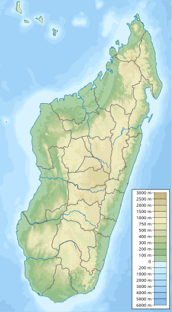
The Mandraka Dam is a buttress dam on the Varahina-North River, a tributary of the Ikopa River, near Mantasoa in the Analamanga region of Madagascar. The dam was built by jirama contractors during 1956. It creates Lake Mandraka which has a height of 20m (66.ft) The dam itself is made of 8,000 m3 of concrete and has a reinforced buttress design. Water released from the dam provides a regulated flow to the hydroelectric plant at the Antelomita Dams downstream. A saddle dam on the north side of Mantosoa Reservoir regulates water flow in the Mandraka River to the Mandraka Dam downstream. [1]

See also

Related Research Articles

<span class="mw-page-title-main">Dartmouth Dam</span> Dam in Victoria

Dartmouth Dam is a large rock-fill embankment dam with an uncontrolled chute spillway across the Mitta Mitta, Gibbo and Dart rivers, the Morass Creek and a number of small tributaries. The dam is located near Mount Bogong in the north-east of the Australian state of Victoria. The dam's purpose includes irrigation, the generation of hydro-electric power, water supply and conservation. The impounded reservoir is called Dartmouth Reservoir, sometimes called Lake Dartmouth. The Dartmouth Power Station, a hydro-electric power station that generates power to the national grid, is located near the dam wall.

<span class="mw-page-title-main">Eildon Dam</span> Dam in Victorian Alps, Victoria

The Eildon Dam is a rock and earth-fill embankment dam with a controlled spillway across the Goulburn River, is located between the regional towns of Mansfield and Eildon within Lake Eildon National Park, in the Alpine region of Victoria, Australia. The dam's purpose is for the supply of potable water, irrigation, and the generation of hydroelectricity. The impounded reservoir is called Lake Eildon.

The Shoalhaven Scheme is a dual-purpose water supply and Pumped-storage Hydroelectricity scheme located on the South Coast region of New South Wales, Australia.

<span class="mw-page-title-main">Rubicon Hydroelectric Scheme</span> Hydroelectric scheme in Victoria, Australia

The Rubicon Hydroelectric Scheme is a small run-of-the-river hydroelectric scheme located on the Rubicon and Royston Rivers, north east of Melbourne, 40 km (25 mi) south-west of Alexandra, Victoria, Australia. The scheme commenced in 1922, and was the first state-owned hydroelectric scheme to generate electricity in mainland Australia, and among the first in the world to be remotely controlled. For the first ten years of its operation it supplied on average 16.9% of electricity generated by the State Electricity Commission of Victoria. It is now owned and operated by AGL Energy and contributes approximately 0.02% of Victoria's energy supply.

<span class="mw-page-title-main">Meadowbank Power Station</span> Power station in Tasmania, Australia

The Meadowbank Power Station is a run-of-the-river hydroelectric power station located in the Central Highlands region of Tasmania, Australia. The power station is situated on the Lower River Derwent catchment and is owned and operated by Hydro Tasmania.

The Poatina Power Station is a conventional hydroelectric power station located in the Central Highlands region of Tasmania, Australia. The power station is situated on the Great Lake and South Esk and is owned and operated by Hydro Tasmania.

<span class="mw-page-title-main">Run-of-the-river hydroelectricity</span> Hydroelectric power station

Run-of-river hydroelectricity (ROR) or run-of-the-river hydroelectricity is a type of hydroelectric generation plant whereby little or no water storage is provided. Run-of-the-river power plants may have no water storage at all or a limited amount of storage, in which case the storage reservoir is referred to as pondage. A plant without pondage is subject to seasonal river flows, so the plant will operate as an intermittent energy source. Conventional hydro uses reservoirs, which regulate water for flood control, dispatchable electrical power, and the provision of fresh water for agriculture.

<span class="mw-page-title-main">Tumut Pond Dam</span> Dam in Snowy Mountains, New South Wales

Tumut Pond Dam is a major gated concrete arch dam across the upper reaches of the Tumut River in the Snowy Mountains of New South Wales, Australia. The dam's main purpose is for the generation of hydro-power and is one of the sixteen major dams that comprise the Snowy Mountains Scheme, a vast hydroelectricity and irrigation complex constructed in south-east Australia between 1949 and 1974 and now run by Snowy Hydro.

<span class="mw-page-title-main">Caruachi Dam</span> Dam in Bolívar, Venezuela

The Caruachi Dam is a concrete gravity dam on the Caroní River in Bolivar state, Venezuela. It supports a hydroelectric power facility with a 2,160 megawatts (2,900,000 hp) capacity. It is about 59 kilometres (37 mi) downstream from the Guri Dam belonging to the Central Hidroeléctrica Simón Bolívar, and about 35 kilometres (22 mi) from where the Caroni and Orinoco rivers meet at Ciudad Guayana.

The Ruacana Hydroelectric Power Station is a hydroelectric power plant near Ruacana in northwest Namibia, close to the Angolan border. Commissioned in 1978, it is by far the largest power station in Namibia. Its operator is NamPower, the Namibian national electric power utility company.

The Kpong Dam, also known as the Akuse Dam, is a hydroelectric power generating dam on the lower Volta River near Akuse in Ghana. It is owned and operated by Volta River Authority. It was constructed between 1977 and 1982. Its power station has a capacity of 148 megawatts (198,000 hp) with all four units running, though the total nameplate capacity is 160 megawatts (210,000 hp).

<span class="mw-page-title-main">Três Marias Dam</span> Dam in Minas Gerais, Brazil

The Três Marias Dam, also known as Bernardo Mascarenhas, is an embankment dam on the São Francisco River near Três Marias in Minas Gerais, Brazil. It was constructed for hydroelectric power production and flood control. The dam was completed in 1961 and its first generator was operational in 1962. The dam's power plant is named after Bernard Mascarenhas who in 1889, built South America's first major hydroelectric power plant in Brazil, the Marmelos Zero Power Plant.

<span class="mw-page-title-main">Long Spruce Generating Station</span>

Long Spruce Generating Station is a run-of-the-river hydroelectric dam on the Nelson River approximately 745 kilometres (463 mi) northeast of Winnipeg in the Canadian province of Manitoba.

The Kettle Generating Station, also known as Kettle Rapids Generating Station, is a run-of-the-river hydroelectric power station on the Lower Nelson River in Manitoba, Canada. It is located 6 km (4 mi) northwest of Gillam. As part of the Nelson River Hydroelectric Project, the power station was completed in 1973 and the last generator commissioned in 1974. It has an installed capacity of 1,220 megawatts (1,640,000 hp) and is the second largest power station in Manitoba.

Mantasoa Dam is a buttress dam on the Varahina-North River, a tributary of the Ikopa River, near Mantasoa in the Analamanga Region of Madagascar. The dam was constructed by French contractors between 1937 and 1938. It creates Lake Mantasoa which has a surface area of 20 km2 (7.7 sq mi). The dam itself is made of 8,000 m3 (10,000 cu yd) of concrete and has a reinforced buttress design. Water released from the dam supplies a regulated flow to hydroelectric power station at the Antelomita Dams downstream. A saddle dam on the north side of the Mantosoa reservoir regulates water flow into the Mandraka River for the Mandraka Dam downstream.

<span class="mw-page-title-main">Tsiazompaniry Dam</span> Dam in Tsiazompaniry, Analamanga Region

The Tsiazompaniry Dam is a buttress dam on the Varahina-South River, a tributary of the Ikopa River, near Tsiazompaniry in the Analamanga Region of Madagascar. The dam was constructed by a French firm in 1956. It creates Lake Tsiazompaniry, the largest reservoir in the country, which has a surface area of 31 km2 (12 sq mi) and a storage volume of 260,000,000 m3 (210,000 acre⋅ft). A second buttress dam, 1 km (0.62 mi) northwest of the main dam helps withhold the reservoir. Water released from the dam supplies a regulated flow to hydroelectric power station at the Antelomita Dam downstream. Efforts to install a 5.25 MW power station at the base of the dam began in 2011.

The Antelomita Hydroelectric Power Station is located in the rural commune Anjeva Gara of the Analamanga Region, Madagascar. The hydroelectric power station comprises two parts, Antelomita I and II. Both are adjacent to one another on separate water falls along the Ikopa River. Each water fall is dammed and water is diverted to the power station; each of which contains three 1.4 megawatts (1,900 hp) generators. The first two were commissioned in 1930, the second two in 1952 and the final two in 1953. Both stages have an installed capacity of 8.4 megawatts (11,300 hp). They were built by a French firm but are now owned and operated by Jirama. The Tsiazompaniry and Mantasoa Dams upstream regulate water to the power station.

<span class="mw-page-title-main">Nieterana Power Station</span> Dam in Central Highlands, Tasmania

The Nieterana Power Station is a small hydroelectric power station located in the Central Highlands region of Tasmania, Australia.

Sahofika Hydroelectric Power Station, also referred to as Sahofika Power Station, is a 205 megawatts (275,000 hp) hydroelectric power station under construction in Madagascar.

The Volobe Power Station is a 120 megawatts (160,000 hp) hydroelectric power project under construction in Madagascar.

References

  1. 1 2 "The French civil engineering works in the world dams 1860-2012" (PDF). IESF. Archived from the original (PDF) on 18 March 2014. Retrieved 17 March 2014.
  2. "Dams of Madagascar". UN FAO. Archived from the original on September 5, 2013. Retrieved 17 March 2014.
  3. "References – ANDRITZ HYDRO". Andritz. Retrieved 18 March 2014.
  4. "Hydroelectric Power Plants in Southern Africa". IndustCards. Archived from the original on 19 July 2009. Retrieved 18 March 2014.
  5. Environment, U. N. (2019-01-21). "Ecosystem-based Adaptation in Madagascar". UNEP - UN Environment Programme. Retrieved 2023-10-17.