Tangiteroria is a small rural community in the North Island of New Zealand. It is located halfway between Whangārei and Dargaville on State Highway 14 on the banks of the Northern Wairoa river.

Moturoa / Rabbit Island is a small island that lies across the southernmost part of Tasman Bay / Te Tai-o-Aorere, on the northern coast of New Zealand's South Island. The long narrow island runs east–west for 8 kilometres (5 mi), and covers 15 km2 (5.8 sq mi).

Ward is a small town in Marlborough, New Zealand. It is located on State Highway 1, 82 kilometres (51 mi) north of Kaikōura. The Flaxbourne River flows past to the north and into the Pacific Ocean at Ward Beach to the south-east of Ward. A current initiative aims to have the town renamed as Flaxbourne.

Maungaturoto is a small town in the Northland Region of New Zealand.
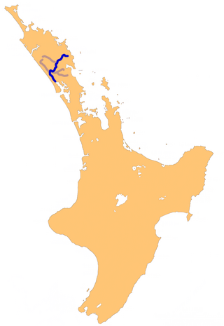
The Wairoa River in Northland New Zealand, sometimes referred to as the Northern Wairoa River, runs for 150 kilometres through the northern part of the North Auckland Peninsula. In the upper reaches, the river is formed from two separate rivers, the Mangakahia River and the Wairua River. The two streams meet to the northeast of Dargaville, becoming the Wairoa. It is the longest river in the Northland Region.

Ruawai is a small town located 30 km south of Dargaville in Northland, New Zealand.

Whangarei District is a territorial authority district in the Northland Region of New Zealand that is governed by the Whangarei District Council. The district is made up in area largely by rural land, and includes a fifth of the Northland Region. It extends southwards to the southern end of Bream Bay, northwards to Whangaruru and almost to the Bay of Islands, and westwards up the Mangakahia River valley past Pakotai and almost to Waipoua Forest. It includes the Hen and Chicken Islands and the Poor Knights Islands.
The Arapaoa River is a northeastern arm of the Kaipara Harbour in Northland, New Zealand. Officially designated as a river, it is some 17 kilometres (11 mi) long and an average of 3 kilometres (2 mi) wide.
The Hakaru River is a river in the Northland Region of New Zealand. It starts in the Brynderwyn Hills and flows south to join the Topuni River exiting in the Oruawharo River, which forms part of the Kaipara Harbour.
The Kaiwaka River is a river of New Zealand's Northland Region. For much of its length, it is a broad arm of the Otamatea River, as much an inlet of the Kaipara Harbour as a true river.
The Kumengamatea River is a river of the Northland Region of New Zealand's North Island. It flows southwest into the Awaroa River close to the latter's outflow into the Wairoa River.
The Matakohe River is a river of the Northland Region of New Zealand's North Island. The river is a short tributary of the Arapaoa River, which it joins 15 kilometres (9 mi) east of Ruawai.
The Pahi River is a river of the Northland Region of New Zealand's North Island. It flows generally west from its origins southwest of Maungaturoto, and the last few kilometres of its length form an upper silty arm of the Kaipara Harbour. It forms one of the arms of the Arapaoa River, in the northeastern part of the harbour's system.
The Patutahi River is a river of the Northland Region of New Zealand's North Island. A tributary of the Kaikou River, it flows northwest before turning southwest to enter the Kaikou 25 miles (40 km) south of Moerewa.
The Waihoihoi River is a river of the Northland Region of New Zealand's North Island. it is a tributary of the Waipu River, which it reaches close to the town of Waipu.
The Whakaki River is located in the Northland Region of New Zealand's North Island. Despite its name, it is better described as a silty arm of the Kaipara Harbour. It flows northwest to reach the Otamatea River.
The Whau Local Board is one of the 21 local boards of the Auckland Council. It is the only local board overseen by the council's Whau Ward councillor.
The Otamatea River is a river in the Northland Region. A short and wide river, it flows southwest and could be considered an arm of the northern Kaipara Harbour. The Otamatea is formed by the confluence of the Wairau and Kaiwaka rivers and the North Auckland Line crosses at this point. Almost 300 metres (330 yd) wide at its origin, the river widens to 1.8 kilometres (1.1 mi) by its mouth opposite Tinopai. Several other broad tidal creeks flow into the Otamatea, including Raepare Creek, Awaroa Creek, Takahoa Creek and the Whakaki River on the left bank and the Arapaoa River on the right.
The North Auckland and Northland (NAaN) grid upgrade project reinforced transmission into the Auckland Region and across the harbour to North Auckland and the Northland Region. It added new 220 kV transmission capacity to the National Grid by providing 37 km of underground cable between the Pakuranga, Penrose, and Albany substations.
The Awaroa River is a short river in the Waikato District of New Zealand's North Island. It flows east from its source in the dunes near Karioitahi Beach and Lake Puketi, then south from Waiuku joining with the Aka Aka Stream before reaching the Waikato River in its tidal reaches close to Motutieke Island.
