Maniyakarampalayam | |
|---|---|
neighbourhood | |
| Country | |
| State | Tamil Nadu |
| District | Coimbatore |
| Languages | |
| • Official | Tamil |
| Time zone | UTC+5:30 (IST) |
Maniyakaranpalayam is a residential neighbourhood in the city of Coimbatore in Tamil Nadu, India.
Maniyakarampalayam | |
|---|---|
neighbourhood | |
| Country | |
| State | Tamil Nadu |
| District | Coimbatore |
| Languages | |
| • Official | Tamil |
| Time zone | UTC+5:30 (IST) |
Maniyakaranpalayam is a residential neighbourhood in the city of Coimbatore in Tamil Nadu, India.
Maniyakaranpalayam is a located 10 km from Coimbatore city railway station, Tamil Nadu, India. It comes under 41st ward of the Coimbatore corporation.[ citation needed ]
Maniyakaranpalayam is well connected to other places of Coimbatore by the following bus routes.
Traditionally a farming village which has transformed into an industrial area.
Administration is through the Ward councilor of the Coimbatore corporation.
Rice is the main food. "Kamban soru" and "Rai Kali/koolu" are very popular during the summer months. "Kedaai vettu" and "Kochai kozhi" are to treat family, "Pangalis" (cousins) and friends. "Elaneer" (tender coconut, "Neer moru" (skimmed butter milk), "Nongu" (palm fruit) are consumed in large amounts during summer. Of course the mobile ice cream man (kone ice, kuchi ice, paal ice, semia ice, grape ice) and the "Soan papadi" man deserve mention. During Pongal season, "Motchai" (a type of bean), "Poosanikai" (pumpkin), "Arasanikai", "Senai kilangu" (a tuber) are prominent vegetables. Exotic fruits such as "Nagapalam", "Seenipuliyankai", "Nellikai" (Gooseberries), "Elanthaipalam" are sold door to door. In the bygone days, "Kambar cut", "Jow Mittai", "Thaen mittai", "Kadalai burupi", "Kadalai urundai", "Elanthai vadagam" were favourite snacks among the children and sold by vendors in front of the school.
Sakthi Vinayar kovil, Quarters bus stop
Shri Maha Bannari Amman Kovil, laskmi Puram
Shri Maakaali amman kovil, Maniakaranpalayam
Shi Sakthi Mariamman Kovil
Muthukumara swamy kovil, Maniakaran palayam
This section is empty.You can help by adding to it.(July 2010) |
This section is empty.You can help by adding to it.(July 2010) |
This section is empty.You can help by adding to it.(July 2010) |
This section is empty.You can help by adding to it.(July 2010) |

Kovilpatti is an industrial city and special grade municipality in Thoothukudi District in the Indian state of Tamil Nadu. It is the second largest town in the district. The town is spread around an area of 49 square kilometres (19 sq mi) and had a population of 95,097 in 2011. The Sithirai festival of the Shenbagavalli Poovananathar temple is celebrated annually in mid-April.

Ashokapuram is a part of Coimbatore city in the state of Tamil Nadu, India. It is about 12 km from City center in North Direction. Ashokapuram is located on the streach of Mettupalayam road in Coimbatore. Neighbouring places are Thudiyalur, NGGO Colony.

Madathukulam is Border to Dindigul District (Saminathapuram) municipality in Tirupur district in the Indian state of Tamil Nadu.

Narasimhanaickenpalayam is a part of Coimbatore city. It is about 14 km from Coimbatore city junction in the northern direction. Narasimhanaickenpalayam is on the stretch of National Highway NH 67 Extn (NH-181) Mettupalayam Road, one of the arterial roads of Coimbatore city. Neighbouring places are Thudiyalur, NGGO Colony, and Periyanaickenpalayam

Nemili is a Taluk in Ranipet district of Tamil Nadu state, announced on August 31, 2015 by Tamil Nadu Chief minister Selvi J.Jayalalitha. This city, before becoming a separate taluk, it was a town panchyat under Arakkonam Taluk .This town is located in the Ranipet district about 72 kilometres from the state capital of Chennai. Nemili is supposedly one of the hottest towns in Tamil Nadu, where the temperature can exceed 43 °C (110 °F) for several days in peak of the summer. People of all religions are living in the city. The major businesses are farming, hand loom and power looms. Nemili itself is a panchayat town in Ranipet District in the Indian state of Tamil Nadu.

Sundarapandiam is a panchayat town in Srivilliputhur Taluk, Virudhunagar district in the Indian state of Tamil Nadu.

Thudiyalur is a part of Coimbatore, in the Indian state of Tamil Nadu. It is within the Coimbatore Corporation, about 10 kilometres (6.2 mi) north of the city centre. Thudiyalur is one of the fast-growing neighbourhoods of Coimbatore, because it has a lot of industries & invasion of IT companies in Saravanampatti which is around 8KM. Public transport facility in Thudiyalur is available for 24 hours on Mettupalayam road of Coimbatore. Earlier this place was known as Thiruthudisaimpathy, later it named as Thudiyalur.

Vandalur is a census town and residential locality in Southern part of the metropolitan city of Chennai in the Indian state of Tamil Nadu. it is a neighbourhood in the southwestern part of Chennai city. Vandalur serves as the southern gateway to Chennai city. It has the Arignar Anna Zoological Park, which houses some rare species of wild flora and fauna. The neighbourhood is served by Vandalur railway station of the Chennai Suburban Railway network.
Rathinapuri is a residential area in the city of Coimbatore, Tamil Nadu, India. Rathinapuri is bordered by Gandhipuram to the South, Sivananda Colony to the West and Ganapathy to the North and East. The main residential areas are: S.P.KUMARASAMY STREET, MARIAMMAN KOVIL STREET, Bagthavachalam street, P.M. Swamy Colony, Palani Gounder street, Muthukumar Nagar, Marutha kutty gounder layout, Sampath Street, Kalki Street, Ranganna Gounder Street, Chekkan Thottam, Indra Nagar, Kalki Street, Periyar Street, Nalvar Layout and Kandasamy Street.

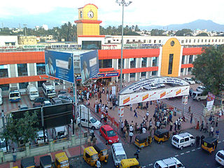
Coimbatore Junction, also known as Coimbatore Main Junction, is the primary railway station serving Coimbatore city.

Avarampalayam is a part of the Coimbatore city. It is located in close proximity to Peelamedu, Nava India, Ganapathy. It houses the large number of foundries and motor / pump industries. It is one of the head place of small scale industries & medium scale industries in Coimbatore. It played a major role for industrial revolution in Coimbatore.It has many small scale foundries and large number of small-scale industries & also some medium scale industries.

Gandhipuram is a commercial neighbourhood and heart of the city of Coimbatore in Tamil Nadu, India. The Regional Transport Office of Coimbatore Central(TN-66) is also located just 2 km from Gandhipuram. Before the emergence of Gandhipuram as the largest shopping and commercial hub, Ukkadam and Oppanakkara Street were considered the heart of Coimbatore city. It is situated in the middle of the city, the place is an important centre for shopping and entertainment, and also a major hub for the intra-city bus services.
Vellakinar is one of the localities of the Coimbatore city in Tamil Nadu,India.Vellakinar is located on the stretch of Mettupalayam road in Coimbatore. Neighbourhing places of Vellakinar are Thudiyalur, Goundampalayam, GN Mills(Gnanambikai Mills).Tamil Nadu Housing Board colony,Sreevatsa Gardens, Samathuvapuram and Meenakshi Gardens, Coimbatore are main residential areas in Vellakinar panchayat.

Ganapathy is a residential and commercial neighbourhood in the city of Coimbatore in Tamil Nadu, India. This is the most densely populated area within Coimbatore Corporation.
Udayampalayam is a neighbourhood of Coimbatore city in the Indian state of Tamil Nadu. It is located 7 km from Coimbatore Railway Station and 18 km from the airport. This is the northern border of the Coimbatore corporation.

The Coimbatore Bypass refers to a series of bypasses connecting the various National Highways and State Highways passing through and originating in the South Indian city of Coimbatore.
This is a list of areas and neighbourhoods in Coimbatore by region. The city is divided on the basis of composition into four major parts: North, Central, South and East. Coimbatore east and its surrounding region is primarily a textile and industrial hub. Central Coimbatore is the commercial heart of the city. Coimbatore, is surrounded by the mountains on the west, and the reserve forests on the northern side. The entire western and northern part of the district borders the Western Ghats with the Nilgiri biosphere. A western pass to Kerala, popularly referred to as the Palghat Gap provides its boundary with the metropolitan area limits.

Kurumbapalayam SSKulam is a part of Coimbatore city in the state of Tamil Nadu, India. It is located on NH 209 between Saravanampatti and Annur.

Coimbatore or Kovai is a major city in the Indian state of Tamil Nadu. It is the second largest city and urban agglomeration in the state after Chennai and the sixteenth largest urban agglomeration in India. It is administered by the Coimbatore Municipal Corporation and is the administrative capital of Coimbatore district. It is one of the fastest growing tier-II cities in India and a major textile, industrial, commercial, educational, information technology, healthcare and manufacturing hub of Tamil Nadu. It is often referred to as the "Manchester of South India" due to its cotton production and textile industries.

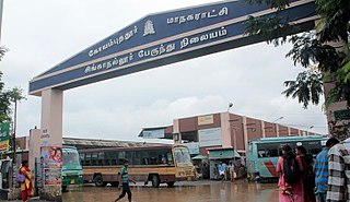
Singanallur Bus Terminus is one of the seven bus terminus of Coimbatore City.