Derbyshire is a ceremonial county in the East Midlands of England. It borders Greater Manchester, West Yorkshire, and South Yorkshire to the north, Nottinghamshire to the east, Leicestershire to the south-east, Staffordshire to the south and west, and Cheshire to the west. Derby is the largest settlement, and Matlock is the county town.

Glossop is a market town in the borough of High Peak, in the county of Derbyshire, England. It is located 15 miles (24 km) east of Manchester, 24 miles (39 km) north-west of Sheffield and 32 miles (51 km) north of the county town, Matlock. Glossop lies near Derbyshire's borders with Cheshire, Greater Manchester, South Yorkshire and West Yorkshire. It is between 150 and 300 metres above sea level and is bounded by the Peak District National Park to the south, east and north. In 2021 it had a population of 33,340.

Chesterfield is a market town in the Borough of Chesterfield, Derbyshire, England. It is 24 miles (39 km) north of Derby and 11 miles (18 km) south of Sheffield at the confluence of the River Rother and River Hipper. In 2011, the built-up-area subdivision had a population of 88,483, making it the second-largest settlement in Derbyshire, after Derby. The wider borough had a population of 103,801 in 2011. In 2011, the town had a population of 76,753.

Longdendale is a valley in the Peak District of England, north of Glossop and southwest of Holmfirth. The name means "long wooded valley" and the valley is mostly in the counties of Derbyshire and Greater Manchester.

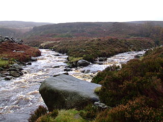
The River Etherow is a river in northern England, and a tributary of the River Goyt. Although now passing through South Yorkshire, Derbyshire and Greater Manchester, it historically formed the ancient county boundary between Cheshire and Derbyshire. The upper valley is known as Longdendale. The river has a watershed of approximately 30 square miles (78 km2), and the area an annual rainfall of 52.5 inches (1,330 mm).

High Peak is a local government district with borough status in Derbyshire, England, covering a high moorland plateau in the Dark Peak area of the Peak District National Park. The district stretches from Holme Moss in the north to Sterndale Moor in the south, and from Hague Bar in the west to Bamford in the east. The population of the borough taken at the 2011 Census was 90,892. The borough is unusual in having two administrative centres for its council, High Peak Borough Council; the offices are in Buxton and Glossop. Other towns include Chapel-en-le-Frith, Hadfield, New Mills and Whaley Bridge.

Hadfield is a town in the High Peak of Derbyshire, England, with a population at the 2021 Census of 6,763. It lies on the south side of the River Etherow, near to the border with Greater Manchester, at the western edge of the Peak District close to Glossop. It doubled as the fictional town of Royston Vasey in the BBC comedy series The League of Gentlemen.

The history of Derbyshire can be traced back to human settlement since the last Ice Age, over 10,000 years ago. The county of Derbyshire in England dates back to the 11th century.

High Peak is a parliamentary constituency represented in the House of Commons of the UK Parliament since 2019 by Robert Largan, a Conservative.

Lewisham parks and open spaces are part of the "green lung" of London and include a diverse range of sites, from small urban parks and gardens to one of the most historic natural landscapes in Greater London at Blackheath. While overall control rests with London Borough of Lewisham, management of borough-owned parks and their facilities is contracted out to Glendale Grounds Management.

Cassiobury Park is the principal public park in Watford, Hertfordshire, in England. It was created in 1909 from the purchase by Watford Borough Council of part of the estate of the Earls of Essex around Cassiobury House which was subsequently demolished in 1927. It comprises over 190 acres (77 ha) and extends from the A412 Rickmansworth Road in the east to the Grand Union Canal in the west, and lies to the south of the Watford suburb of Cassiobury, which was also created from the estate. The western part is a 62-acre (25.1 ha) Local Nature Reserve managed by the Herts and Middlesex Wildlife Trust. The park hosts the free, weekly timed parkrun 5 km event every Saturday morning at 9 am, starting on the field near the Shepherds Road entrance to the park, and finishing by the bandstand.

High Peak Borough Council is the local authority for High Peak, a non-metropolitan district with borough status in Derbyshire, England. The administrative base of High Peak Borough Council is split between sites in the towns of Buxton and Glossop. Full council meetings are usually held at the Pavilion Gardens in Buxton. The council is elected every four years.

Frimley Lodge Park is a 24 hectares recreational site located between Frimley Green and Mytchett in Surrey, England.

Shipley Hall was a country estate in Shipley, Derbyshire near Heanor and Ilkeston which now forms a Country Park.

Shorne Woods Country Park is located between Strood and Gravesend, in the English county of Kent. It was once part of a large estate, later passed to the county council to be used as a country park.

Chinley, Buxworth and Brownside is a civil parish within the High Peak district, which is in the county of Derbyshire, England. Partially rural with several villages contained within, its population was 2,794 residents in the 2021 census. The parish is 150 miles (240 km) north west of London, 35 miles (56 km) north west of the county city of Derby, and 1+1⁄3 miles (2.1 km) north of the nearest market town of Chapel-en-le-Frith. Being close to the edge of the county border, it shares a boundary with the parishes of Chapel-en-le-Frith, Edale, Hayfield, New Mills and Whaley Bridge. A substantial portion of the parish is within the Peak District national park.

West Park is the premier park in Long Eaton, Derbyshire, England. It is also the location of the town's indoor leisure centre.

Nowton Park is a park in Nowton, Suffolk, England. It is approximately 2 miles south of the centre of Bury St Edmunds.

Glossop Town Hall, Market Hall, and Municipal Buildings is a complex in the centre of Glossop, Derbyshire, providing offices for High Peak Borough Council, a retail arcade, and covered market. The Town Hall was constructed in 1838 and significantly extended and altered in 1845, 1897 and 1923. The Town Hall building was designed by Weightman and Hadfield of Sheffield for the 12th Duke of Norfolk. It is constructed from millstone grit ashlar and topped with a distinctive circular cupola and clock. It is Grade II listed, forming a group with the market and Municipal Buildings to the south, and rows of shops to High Street West either side which were also part of Hadfield's design, and which marked the transition of Howard Town from a satellite industrial village to a freestanding urban entity.


