
San Juan County is a county in the southeastern portion of the U.S. state of Utah. As of the 2010 United States Census, the population was 14,746. Its county seat is Monticello, while its most populous city is Blanding. The county was named by the Utah State Legislature for the San Juan River, itself named by Spanish explorers.

Sanpete County is a county in the U.S. state of Utah. As of the 2010 United States Census, the population was 27,822. Its county seat is Manti, and its largest city is Ephraim. The county was created in 1850.

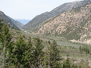
The Manti-La Sal National Forest covers more than 1.2 million acres (4,900 km2) and is located in the central and southeastern parts of the U.S. state of Utah and the extreme western part of Colorado. The forest is headquartered in Price, with ranger district offices in Price, Ferron, Ephraim, Moab and Monticello. The maximum elevation is Mount Peale in the La Sal Mountains, reaching 12,721 feet (3,877 m) above sea level. The La Sal Mountains are the second highest mountain range in Utah after the Uintas. Parts of the forest are included in the Bears Ears National Monument.
Cache National Forest is a 533,840-acre area of National Forest System land in Idaho and Utah which was established on July 1, 1908 by the U.S. Forest Service. The majority of its area is in Utah, and was initially created when the Bear River National Forest was disbanded. On July 1, 1915, all of Pocatello National Forest was added. In 1973 the Idaho portion was transferred to the administration of Caribou National Forest, while the Utah portion was combined administratively with Wasatch National Forest, creating the Wasatch-Cache National Forest. In descending order of forestland area, the Cache National Forest portion is located in Cache, Bear Lake, Franklin, Weber, Rich, Box Elder, Caribou, and Morgan counties. The forest has a current area of 701,453 acres (2,838.68 km2), which comprises 43.56% of the combined Wasatch-Cache's total acreage. The forest is administered from Salt Lake City, Utah as part of the Wasatch-Cache National Forest, but there are local ranger district offices in Logan and Ogden. From circa 1911 until August 1923, the area was roamed by Old Ephraim.
Whitman National Forest was established in Oregon on July 1, 1908 with 1,234,020 acres (4,993.9 km2) from part of Blue Mountains National Forest. On June 20, 1920 part of Minam National Forest was added. In 1954 it was administratively combined with Wallowa National Forest to make Wallowa–Whitman National Forest. In descending order of forest land area, Whitman National Forest is located in parts of Baker, Union, Grant, Wallowa, Umatilla, and Malheur counties. There are local ranger district offices in Baker City, Halfway, and Unity. Its administrative headquarters are in Baker City, as part of the Wallowa-Whitman National Forest. As of September 30, 2008, Whitman had an area of 1,266,902 acres (5,126.97 km2), representing 55.96% of the combined forest's 2,263,965 acres (9,161.94 km2).
Wallowa National Forest was first established as the Wallowa Forest Reserve in Oregon on May 6, 1905 with 747,200 acres (3,024 km2). On March 1, 1907 it was combined with the Chenismus Forest Reserve to create Imnaha National Forest, which was then renamed Wallowa on July 1, 1908. In 1954 it was administratively combined with Whitman National Forest to make Wallowa–Whitman National Forest. The Wallowa National Forest is located overwhelmingly in Wallowa County, Oregon, but there are much smaller portions in Union County, Oregon and Nez Perce and Idaho counties in Idaho. There are local ranger district offices in Enterprise and La Grande, both in Oregon. Forest headquarters are in Baker City, as part of Wallowa-Whitman National Forest. As of 30 September 2008, the Wallowa portion had an area of 997,063 acres (4,034.97 km2), comprising about 44% of the Wallowa-Whitman's acreage.

Wasatch National Forest was established as the Wasatch Forest Reserve by the U.S. Forest Service in Utah on August 16, 1906 with 86,440 acres (349.8 km2) to the east of Salt Lake City and Provo. It became a National Forest on March 4, 1907. On July 1, 1908 Grantsville National Forest and Salt Lake National Forest were added. In 1973 Wasatch was combined administratively with Cache National Forest, creating Wasatch-Cache National Forest. In descending order of acreage, the Wasatch National Forest portion is located in Summit, Tooele, Salt Lake, Davis, Uinta (Wyoming), Duchesne, Wasatch, Morgan, Utah, Weber, and Juab counties in Utah except Uinta, which is in southwestern Wyoming. Its total area was 908,731 acres (3,677.50 km2), comprising 56.44% of the combined Wasatch-Cache's 1,610,184 acres (6,516.18 km2) as of 2008. There are local ranger district offices in Kamas and Salt Lake City in Utah, and in Evanston and Mountain View in Wyoming. Administrative headquarters reside with the combined Uinta-Wasatch-Cache National Forest in South Jordan, Utah.

Mount Peale is the highest point in the La Sal Mountains of San Juan County, in the southeastern part of Utah, United States. It is also the highest point in Utah outside the Uinta Mountains. It is located about 20 mi (32 km) southeast of Moab. The summit is the highest point in the Manti-La Sal National Forest and the Mount Peale Research Natural Area. Mount Peale was named for Albert Peale, a mineralogist on the Hayden Survey of 1875.
The Wasatch Plateau is a plateau located southeast of the southernmost part of the Wasatch Range in central Utah, United States, that is part of the Colorado Plateau.

Scofield Reservoir is a 2,815-acre (11.39 km2) reservoir impounded by Scofield Dam, in Carbon County, Utah. Located on the Price River, a tributary of the Green River, Scofield Reservoir is adjacent to northernmost boundary of the Manti-La Sal National Forest. The reservoir sits at an elevation of 7,618 feet (2,322 m), on the northern edge of the Wasatch Plateau. Utah State Route 96 runs along the western shoreline.
Teton National Forest was first established by the General Land Office on February 22, 1897 as the Teton Forest Reserve with 892,440 acres (3,611.6 km2). A commission was established in 1896 to plan for a system of national forest reserves, recommending an expansion of the territory protected by the Yellowstone Timberland Reserve. President Grover Cleveland's 1897 proclamation established a protected area encompassing the northern end of Jackson Hole, extending from the south boundary of the Yellowstone Forest Reserve south to the area of the Gros Ventre River, and from the Idaho border in the west to the area of the Continental Divide in the east. Much of this area would eventually be incorporated into Grand Teton National Park. In 1902 the southern porion of the Yellowstone reserve was added, while the Teton Reserve was greatly expanded to the south and east while excluding the southern portion of Jackson Hole around the town of Jackson.
Bridger National Forest was first established by the U.S. Forest Service on July 1, 1911 in Wyoming with 577,580 acres (2,337.4 km2) from part of Bonneville National Forest. On May 14, 1923 Bridger was transferred Wyoming National Forest, and the name was discontinued. On March 10, 1943 Wyoming was renamed Bridger. In 1973 Bridger National Forest was administratively combined with Teton National Forest, creating Bridger-Teton National Forest. In descending order of land area, Bridger National Forest lands are located in Sublette, Lincoln, Fremont, and Teton counties. There are local ranger district offices in Afton, Big Piney, Kemmerer, and Pinedale. Its administrative headquarters reside in Jackson, Wyoming as part of the combined Bridger-Teton National Forest. Its current area of 1,736,075 acres represents 51.02% of the combined Bridger-Teton's area of 3,402,644 acres. The forest includes all of the National Wilderness Preservation System's officially designated Bridger Wilderness.
Bear River National Forest was established as the Bear River Forest Reserve by the U.S. Forest Service in Utah on May 28, 1906 with 267,920 acres (1,084.2 km2) by combining the Logan Forest Reserve with other lands. On March 4, 1907 it became a National Forest. On July 1, 1908 part of the forest was combined with Pocatello National Forest and the remainder was used to establish Cache National Forest. The name was discontinued. The lands are presently included in Uinta-Wasatch-Cache National Forest.
The Logan Forest Reserve was established by the General Land Office in Utah on May 29, 1903 with 182,080 acres (736.9 km2). In 1905 federal forests were transferred to the U.S. Forest Service. On May 28, 1906 the forest was combined with other lands to establish Bear River Forest Reserve and the name was discontinued. The lands are presently included in Uinta-Wasatch-Cache National Forest.
Datil National Forest was a United States National Forest established in western New Mexico by the U.S. Forest Service in 1908. It was merged into another and ceased in 1931.
La Sal National Forest was established as the La Sal Forest Reserve by the U.S. Forest Service in Utah and Colorado on January 25, 1906 with 158,462 acres (641.27 km2), mostly in Utah. It became a National Forest on March 4, 1907. On July 1, 1908 it was combined with Monticello National Forest and renamed La Salle National Forest. On March 16, 1909 it was changed back to La Sal, by now with 474,130 acres (1,918.7 km2). On November 28, 1949 the forest was transferred to Manti National Forest. On August 28, 1950 the name was changed to Manti-La Sal National Forest.
Nebo National Forest was established by the U.S. Forest Service in Utah on July 1, 1908 with 343,920 acres (1,391.8 km2) from the consolidation of Payson and Vernon National Forests and part of Fillmore. On July 1, 1915 the entire forest was transferred to Manti National Forest. The lands presently exist in Manti-La Sal National Forest.
Vernon National Forest was established as the Vernon Forest Reserve by the U.S. Forest Service in Utah on April 24, 1906 with 68,800 acres (278 km2) in the northwestern part of the state near the town of Vernon. It became a National Forest on March 4, 1907. On July 1, 1908 Vernon and Payson National Forests and part of Fillmore were combined to create Nebo National Forest. The lands presently managed under the Uinta-Wasatch-Cache National Forest.
Monticello National Forest was established as the Monticello Forest Reserve by the U.S. Forest Service in Utah on February 6, 1907 with 214,270 acres (867.1 km2). It became a National Forest on March 4, 1907. On July 1, 1908 it was combined with La Sal National Forest, which was renamed La Salle National Forest for a short time. The lands presently exist in Manti-La Sal National Forest.

Bears Ears National Monument is a United States national monument located in San Juan County in southeastern Utah, established by President Barack Obama by presidential proclamation on December 28, 2016. The monument's original size was 1,351,849 acres, which was controversially reduced 85% by President Donald Trump on December 4, 2017. The monument protects the public land surrounding the Bears Ears—a pair of buttes—and the Indian Creek corridor rock climbing area. The Native American names for the buttes have the same meaning in each of the languages represented in the region. The names are listed in the presidential proclamation as "Hoon’Naqvut, Shash Jáa [sic], Kwiyagatu Nukavachi, Ansh An Lashokdiwe"—all four mean "Bears Ears".

