The population was 8,216 at the 2020 census,[5] making it the largest city in Carbon County.[4]
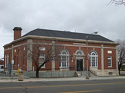
Price, Utah Main Street and historic theater
History
Modern settlement began in the mid and late 1800s with the arrival of Latter-day Saints in the region.[6] In 1877, fur trappers built a cabin in what is now Price and a small number of families soon followed and began farming.[7]
The area experienced major population growth, from hundreds of residents to several thousand, following the 1883 completion of a railroad by the Denver and Rio Grande to service coal mines.[6] With the development of coal mining as a key industry in the region, the Price area became one of the most culturally diverse areas in Utah as people from a wide range of nationalities came to work in the mines.[7] A substantial irrigation canal was completed in 1888, allowing for large-scale farming.[6] Members of the U.S. Army 9th Cavalry Regiment completed the construction of a road and telegraph lines through nearby Ninemile Canyon in 1886, linking Price and the surrounding region to the Uintah Basin and Fort Duchesne.[8]
The city was formally incorporated July 14, 1892 (originally as part of Emery County) and is named after the Price River, itself named after early settler William Price.[6] The College of Eastern Utah was established in Price in 1937, later renamed Utah State University Eastern.[9]
Geography
Price is located in west-central Carbon County at the northwestern edge of the Colorado Plateau. According to the United States Census Bureau, the city has a total area of 5.1 square miles (13.1km2), all land.[10] The Price River, a tributary of the Green River, flows southeasterly through the city, and the San Rafael Swell is to the south.
Price was one of the communities that was served by the Rio Grande Zephyr passenger train. Today Amtrak's California Zephyr passes once a day each direction with a station about seven miles away in Helper.[citation needed]
Climate
According to the Köppen Climate Classification system, Price has a cool semi-arid climate, abbreviated BSk on climate maps.[11] It features cold winters and relatively moderate summers. The average high in January is 37°F or 2.8°C and it rises to 90°F or 32.2°C in July. The low in January averages 13°F or −10.6°C, and even in summer the dry climate keeps the nights cool, with an average of 58°F or 14.4°C. The all-time record high is 110°F (43.3°C), which was set on August 3, 1918, while the all-time low is −31°F (−35°C), set on December 26, 1924. Price lies in the rain shadow of central Utah's Wasatch Mountains so that precipitation averages only 9.13 inches or 231.9 millimetres annually. Late summer and early fall are the wettest times of year due to the Gulf of Californiamonsoon that brings scattered thunderstorms to the region. The city also sees frequent snow during winter and early spring.[12][13]
As of the census[3] of 2000, there were 8,402 people, 3,045 households, and 2,085 families residing in the city. The population density was 1,979.7 peopleper square mile (764.4 people/km2). There were 3,311 housing units at an average density of 780.2 unitsper square mile (301.2 units/km2). The racial makeup of the city was 90.70% White, 0.26% African American, 1.37% Native American, 0.56% Asian, 0.04% Pacific Islander, 4.25% from other races, and 2.82% from two or more races. Hispanic or Latino of any race were 10.08% of the population.
There were 3,045 households, out of which 34.4% had children under the age of 18 living with them, 53.2% were married couples living together, 11.5% had a female householder with no husband present, and 31.5% were non-families. 27.4% of all households were made up of individuals, and 12.2% had someone living alone who was 65 years of age or older. The average household size was 2.60 and the average family size was 3.19.
In the city, the population was spread out, with 27.6% under the age of 18, 15.9% from 18 to 24, 22.5% from 25 to 44, 19.9% from 45 to 64, and 14.1% who were 65 years of age or older. The median age was 32 years. For every 100 females, there were 91.7 males. For every 100 females age 18 and over, there were 88.3 males.
The median income for a household in the city was $31,687, and the median income for a family was $39,429. Males had a median income of $37,476 versus $21,081 for females. The per capita income for the city was $14,313. About 11.4% of families and 15.0% of the population were below the poverty line, including 16.3% of those under age 18 and 11.1% of those age 65 or over.
2015
As of 2015 the largest self-reported ancestry groups in Price, Utah are:[15]
There are two public elementary schools in Price (Creekview and Castle Heights); one middle school (Mont Harmon); one high school (Carbon High School). It is also the location of the charter Pinnacle Canyon Academy, which serves grades K-12, as well as the Castle Valley Center for disabled children. Some children located in the Gordon Creek area attend Sally Mauro Elementary in Helper.
This page is based on this Wikipedia article Text is available under the CC BY-SA 4.0 license; additional terms may apply. Images, videos and audio are available under their respective licenses.