Spring Glen, Utah

Last updated

Spring Glen, Utah
Old school Spring Glen Utah.jpeg
Spring Glen's 1927 schoolhouse
Carbon County Utah incorporated and unincorporated areas Spring Glen highlighted.svg
Location in Carbon County and the state of Utah
Coordinates: 39°39′25″N110°50′56″W / 39.65694°N 110.84889°W / 39.65694; -110.84889
Country United States
State Utah
County Carbon
Settled1878
Founded byJames Gay
Area
[1]
  Total3.4 sq mi (8.8 km2)
  Land3.4 sq mi (8.8 km2)
  Water0.0 sq mi (0.0 km2)
Elevation
[2]
5,771 ft (1,759 m)
Population
 (2010) [3]
  Total1,126
  Density330/sq mi (127.4/km2)
Time zone UTC-7 (Mountain (MST))
  Summer (DST) UTC-6 (MDT)
ZIP code
84526
Area code 435
GNIS feature ID2584777 [2]

Spring Glen is a census-designated place in Carbon County, in eastern Utah, United States. The population was 1,126 at the 2010 census. [4] Founded in 1878, Spring Glen was the first permanent settlement in what is now Carbon County. [5] First settled principally by white Mormon farmers, the community became much more diverse after about 1890, when the development of the area's coal mines brought an influx of immigrants from Southern Europe and other regions.

Contents

Geography

Spring Glen lies along the Price River, just to the south of Helper and southwest of Kenilworth. To the southeast are Carbonville and the county seat, Price. U.S. Route 6 runs past Spring Glen between Price and Helper, and SR-139 branches east from it to become Spring Glen Road, the major street through town. According to the United States Census Bureau, the CDP has a total area of 3.4 square miles (8.8 km2), all land. [1]

Climate

According to the Köppen Climate Classification system, Spring Glen has a humid continental climate, abbreviated "Dfb" on climate maps. [6] This climatic region is typified by large seasonal temperature differences, with warm to hot (and often humid) summers and cold (sometimes severely cold) winters.

History

The first settlers in Spring Glen were a handful of bachelor farmers, starting with James Gay in 1878. Groups of friends and relatives joined the first few homesteaders, mostly independent minded people who were separate from the organized Mormon project to establish what became Emery County. [7]

As children began to arrive, a school was started in 1883, [8] but such a public development was the exception rather than the rule. The early settlers were nonconformists, less religious and less social than their counterparts in other Utah settlements, so the community was slow to develop. It was difficult to get the residents to cooperate in any communal projects. The LDS Church organized the first ward here in 1883, [7] but it was not until the winter of 1886–7 that a company was formed to build an irrigation canal, which was not completed until 1893. [8] The canal company agreed on the name of Spring Glen for the village as well as the company. [9] The Spring Glen townsite was officially surveyed on May 27–28, 1890. [7]

From 1910–1925 the settlement was called Ewell, in honor of Francis M. Ewell, an 1882 settler who died in 1905. [10]

The community of Helper was part of Spring Glen until 1891.[ citation needed ]

Demographics

Historical population
CensusPop.Note
1890 137
1900 21456.2%
1910 181−15.4%
1920 29864.6%
1930 659121.1%
1940 88834.7%
1950 9294.6%
2010 1,126
Source: U.S. Census Bureau [11]

As of the census [3] of 2010, there were 1,126 people living in the CDP. There were 478 housing units, of which 421 were occupied. The racial makeup of the population was 95.6% White, 0.2% Black or African American, 0.4% American Indian and Alaska Native, 1.0% Asian, 0.2% Native Hawaiian and Other Pacific Islander, 1.3% from some other race, and 1.3% from two or more races. Hispanic or Latino of any race were 7.2% of the population.

See also

Related Research Articles

<span class="mw-page-title-main">St. David, Arizona</span> CDP in Cochise County, Arizona

St. David is a census-designated place (CDP) in Cochise County, Arizona, United States. The population was 1,699 at the 2010 census.

<span class="mw-page-title-main">Bunkerville, Nevada</span> Unincorporated town in the State of Nevada, United States

Bunkerville is a census-designated place in Clark County, Nevada, United States. The population was 1,303 at the 2010 census.

<span class="mw-page-title-main">Kirtland, New Mexico</span> Town in New Mexico, United States

Kirtland is a town, made up of part of the former census-designated place (CDP) of the same name in San Juan County, New Mexico, United States. The population of the former CDP was 6,190 at the 2000 census. It is part of the Farmington Metropolitan Statistical Area.

<span class="mw-page-title-main">Helper, Utah</span> City in Utah, United States

Helper is a city in Carbon County, Utah, United States, approximately 110 miles (180 km) southeast of Salt Lake City and 7 miles (11 km) northwest of the city of Price. The population was 2,201 at the 2010 census.

<span class="mw-page-title-main">Price, Utah</span> City in Utah, United States

Price is a city in the U.S. state of Utah and the county seat of Carbon County. The city is home to Utah State University Eastern, as well as the USU Eastern Prehistoric Museum. Price is located within short distances of both Nine Mile Canyon and the Manti-La Sal National Forest.

<span class="mw-page-title-main">Wellington, Utah</span> City in Utah, United States

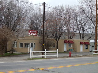
Wellington is a city in Carbon County, Utah, United States. The population was 1,676 at the 2010 census. The community was settled in 1878 by a band of thirteen Mormons led by Jefferson Tidwell. The town was named for Justus Wellington Seeley, Jr., of the Emery County Court. Many residents commute to nearby Price for their jobs, or work in one of the various coal mines in the area.

<span class="mw-page-title-main">Bountiful, Utah</span> City in Utah, United States

Bountiful is a city in Davis County, Utah. As of the 2010 census, the city population was 42,552, a three percent increase over the 2000 figure of 41,301. The city grew rapidly during the suburb growth of the late 1940s, 1950s, and 1960s and was Davis County's largest city until 1985, when it was surpassed by Layton. Bountiful is Utah's 15th-largest city.

<span class="mw-page-title-main">Farmington, Utah</span> City in Utah, United States

Farmington is a city in Davis County, Utah, United States. The population was 24,531 at the 2020 census. The Lagoon Amusement Park and Station Park transit-oriented retail center are located in Farmington.

<span class="mw-page-title-main">Clawson, Utah</span> Town in the state of Utah, United States

Clawson is a town in Emery County, Utah, United States. The population was 163 at the 2020 census. The community was named after Rudger Clawson, a Mormon leader.

<span class="mw-page-title-main">Huntington, Utah</span> City in Utah, United States

Huntington is a city in northwestern Emery County, Utah, United States. The population was 2,129 at the 2010 census. It is the largest town in Emery County.

<span class="mw-page-title-main">Nephi, Utah</span> City in Utah, United States

Nephi is a city in Juab County, Utah, United States. It is part of the Provo–Orem metropolitan area. The population was 6,443 at the 2020 census. It is the county seat of Juab County. It was settled by Mormon pioneers in 1851 as Salt Creek, and it acquired its current name in 1882. It is the principal city in the Juab Valley, an agricultural area. Nephi was named after Nephi, son of Lehi, from the Book of Mormon.

<span class="mw-page-title-main">Manti, Utah</span> City in Utah, United States

Manti is a city in and the county seat of Sanpete County, Utah, United States. The population was 3,276 at the 2010 United States Census.

<span class="mw-page-title-main">Glenwood, Utah</span> Town in the state of Utah, United States

Glenwood is a town in Sevier County, Utah, United States. The population was 464 at the 2010 census.

<span class="mw-page-title-main">Panaca, Nevada</span> Unincorporated town in the State of Nevada, United States

Panaca is an unincorporated town in eastern Lincoln County, Nevada, United States, on State Route 319, about 1 mile east of U.S. Route 93, near the border with Utah. Its elevation is 4,729 feet above sea level. As of the 2010 census, it had a population of 963. It is one of only two cities in Nevada that prohibits gambling, the other being Boulder City.

<span class="mw-page-title-main">Genoa, Nevada</span> Unincorporated town in the State of Nevada, United States

Genoa is an unincorporated town in Douglas County, Nevada, United States. Founded in 1851, it was the first settlement in what became the Nevada Territory. It is situated within Carson River Valley and is approximately 42 miles (68 km) south of Reno. The population was 939 at the 2010 census. It is home to the oldest bar in the state of Nevada which opened in 1853.

<span class="mw-page-title-main">Arizona Strip</span> Part of Arizona north of the Colorado River

The Arizona Strip is the part of Arizona lying north of the Colorado River. Despite being larger in area than several U.S. states, the entire region has a population of fewer than 10,000 people. Consisting of northeastern Mohave County and northwestern Coconino County, the largest settlements in the Strip are Colorado City, Fredonia, and Beaver Dam, with smaller communities of Scenic, Littlefield and Desert Springs. The Kaibab Indian Reservation lies within the region. Lying along the North Rim of the Grand Canyon creates physical barriers to the rest of Arizona. Only three major roads traverse the region, I-15 crosses the northwestern corner while Arizona State Route 389 and U.S. Route 89A crosses the northeastern part of the strip, US 89A crosses the Colorado River via the Navajo Bridge, providing the only direct road connection between the strip and the rest of the state. The nearest metropolitan area is the St. George, Utah metro area, to which the region is more connected than to the rest of Arizona.

Centennial Park is an unincorporated community and census-designated place (CDP) in Mohave County, Arizona, United States. The population was 1,578 at the 2020 census, up from 1,264 at the 2010 census. It is the central location for the Centennial Park group, a fundamentalist Mormon group.

<span class="mw-page-title-main">Kenilworth, Utah</span> Census-designated place in Utah, United States

Kenilworth is a census-designated place in northern Carbon County, Utah, United States.

<span class="mw-page-title-main">Catharine, Kansas</span> Unincorporated community in Ellis County, Kansas

Catharine is an unincorporated community in Catherine Township, Ellis County, Kansas, United States. As of the 2020 census, the population of the community and nearby areas was 113.

<span class="mw-page-title-main">Carbonville, Utah</span> Census-designated place in Utah, United States

Carbonville is a census-designated place in Carbon County, Utah, United States. The population was 1,567 at the 2010 census.

References

  1. 1 2 "2010 Census U.S. Gazetteer File for Places: Utah" . Retrieved April 4, 2014.
  2. 1 2 U.S. Geological Survey Geographic Names Information System: Spring Glen, Utah
  3. 1 2 "American FactFinder". U.S. Census Bureau. Archived from the original on February 12, 2020. Retrieved July 20, 2012.
  4. "Geographic Identifiers: 2010 Census Summary File 1 (G001): Spring Glen CDP, Utah". U.S. Census Bureau, American Factfinder. Archived from the original on February 13, 2020. Retrieved August 11, 2015.
  5. Watt, Ronald G. (January 1997). A History of Carbon County (PDF). Utah Centennial County History Series. Salt Lake City, Utah: Utah State Historical Society. pp. 22–23. ISBN   0-913738-15-8 . Retrieved July 20, 2012.
  6. "Climate Summary for Spring Glen, Utah".
  7. 1 2 3 Taniguchi, Nancy Jacobus (Fall 1980). "Rebels and Relatives: The Mormon Foundation of Spring Glen, 1878–90" (PDF). Utah Historical Quarterly. 48 (4): 366–378. ISSN   0042-143X . Retrieved July 20, 2012.
  8. 1 2 O'Driscoll, Irene (1948). "Spring Glen". In Reynolds, Thursey Jessen (ed.). Centennial Echos from Carbon County. Daughters of Utah Pioneers of Carbon County. pp. 178–180. ASIN   B000J2SYIE.
  9. Romano, Edna (Fall 1980). "Teancum Pratt, Founder of Helper" (PDF). Utah Historical Quarterly. 48 (4): 328–365. ISSN   0042-143X . Retrieved July 20, 2012.
  10. "Francis M. Ewell". Utah History Resource Center: Markers and Monuments Database. Utah Department of Community and Culture. Retrieved March 25, 2014.
  11. "Census of Population and Housing". U.S. Census Bureau. Retrieved November 18, 2011.