
U.S. Route 163 is a 64-mile (103 km) U.S. Highway that runs from US 160 northward to US 191 in the U.S. states of Arizona and Utah. The southernmost 44 miles (71 km) of its length are within the Navajo Nation. The highway forms part of the Trail of the Ancients, a National Scenic Byway. The highway cuts through the heart of Monument Valley and has been featured in numerous movies and commercials.

Thistle is a ghost town in Spanish Fork Canyon in southeastern Utah County, Utah, United States. During the era of steam locomotives, the town's primary industry was servicing trains for the Denver and Rio Grande Western Railroad. The fortunes of the town were closely linked with those of the railroad until the changeover to diesel locomotives, when the town started to decline.

U.S. Route 50 (US-50) in Utah crosses the center of the state. The highway serves no major population centers in Utah, with the largest city along its path being Delta. Most of the route passes through desolate, remote areas. Through the eastern half of the state the route is concurrent with Interstate 70 (I-70). US-50 both enters and exits Utah concurrent with US-6, however the two routes are separate through the center of the state.

State Route 68 (SR-68) is a state highway in the U.S. state of Utah. It is a major thoroughfare throughout the Wasatch Front as it runs north–south for 70.8 miles (113.9 km), linking US-6 near Elberta to US-89 in Woods Cross. The route intersects several major freeways and highways in the Salt Lake City metropolitan area including I-215, I-80, and I-15. The route is more commonly referred to as Redwood Road, after the street it is routed along throughout Salt Lake County. The highway is also routed for a short distance along 500 South and 200 West in Bountiful and Camp Williams Road in Utah County. The route is a surface street for its entire length.

State Route 32 (SR-32) is a state highway in Wasatch and Summit Counties in the U.S. state of Utah. Most of the highway is an old routing of U.S. Route 189 that became disconnected from the rest of US-189 during the construction of the Jordanelle Reservoir. SR-32 runs for 29.053 miles (46.756 km) from US-40 and US-189 north of Heber City to I-80 near Wanship. Although signed US-189 or US-189 Alternate for most of its history, the highway pre-dates the creation of U.S. Highways and has had several numerical designations and route changes through the years.

Interstate 70 (I-70) is a mainline route of the Interstate Highway System in the United States connecting Utah and Maryland. The Utah section runs east–west for approximately 232 miles (373 km) across the central part of the state. Richfield is the largest Utah city served by the freeway, which does not serve or connect any urban areas in the state. The freeway was built as part of a system of highways connecting Los Angeles and the Northeastern United States. I-70 was the second attempt to connect southern California to the east coast of the United States via central Utah, the first being a failed attempt to construct a transcontinental railroad. Parts of that effort were reused in the laying out of the route of I-70.

Interstate 80 (I-80) is a part of the Interstate Highway System that runs from San Francisco, California, to Teaneck, New Jersey. The portion of the highway in the US state of Utah is 197.51 miles (317.86 km) long through the northern part of the state. From west to east, I-80 crosses the state line from Nevada in Tooele County and traverses the Bonneville Salt Flats—which are a part of the larger Great Salt Lake Desert. It continues alongside the Wendover Cut-off—the corridor of the former Victory Highway—US Route 40 (US-40) and the Western Pacific Railroad Feather River Route. After passing the Oquirrh Mountains, I-80 enters the Salt Lake Valley and Salt Lake County. A short portion of the freeway is concurrent with I-15 through Downtown Salt Lake City. At the Spaghetti Bowl, I-80 turns east again into the mouth of Parleys Canyon and Summit County, travels through the mountain range, and intersects the eastern end of I-84 near Echo Reservoir before turning northeast toward the Wyoming border near Evanston. I-80 was built along the corridor of the Lincoln Highway and the Mormon Trail through the Wasatch Range. The easternmost section also follows the historical routes of the first transcontinental railroad and US-30S.
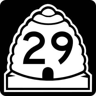
State Route 29 (SR-29) is a state highway in Emery County in the U.S. state of Utah. It runs for 21.732 miles (34.974 km) from the Sanpete-Emery County line near Joe's Valley Reservoir to SR-10 three miles (5 km) north of Castle Dale.
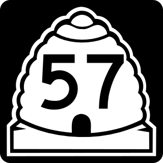
State Route 57 (SR-57) is a state highway in Emery County in the U.S. state of Utah. It runs for 10.69 miles (17.20 km) from the junction with SR-10 three miles (5 km) south of Castle Dale to the Wilberg Coal Mine, northwest of Orangeville.

Legacy Parkway is an 11.5-mile-long (18.5 km) four-lane controlled-access parkway located almost completely within Davis County in the northern part of the U.S. state of Utah. The parkway travels north from Interstate 215 (I-215) in northwestern Salt Lake City to an interchange named the Wasatch Weave in Farmington with two intermediate interchanges providing access to Woods Cross and Centerville. Wetlands of the nearby Great Salt Lake and nature preserves border the western side of the parkway while the eastern side roughly parallels Union Pacific and Utah Transit Authority rail lines and I-15. On average, between 20,000 and 23,000 vehicles use the parkway daily.

State Route 20 (SR-20) is a state highway in southern Utah, running 20.492 miles (32.979 km) in Iron and Garfield Counties, without directly serving or connecting any cities. It serves as a truck connection between I-15 and US-89 and an access to Bryce Canyon National Park. It may also be used to travel between Salt Lake City and Phoenix, Arizona. The highway follows the route of the Old Spanish Trail.

State Route 14 (SR-14) is a state highway in southern Utah, running for 40.995 miles (65.975 km) in Iron and Kane Counties from Cedar City to Long Valley Junction. The highway has been designated the Markagaunt High Plateau Scenic Byway as part of the Utah Scenic Byways program.
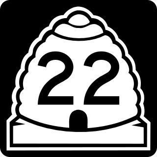
State Route 22 (SR-22) is a state highway in southern Utah, running for 6.852 miles (11.027 km) in Garfield and Piute Counties from Antimony to Otter Creek Reservoir.
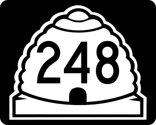
State Route 248 is a highway in northern Utah that connects Park City with Kamas. In Park City it is known as Kearns Boulevard.

State Route 39 (SR-39) is a state highway in northern Utah connecting Ogden to Woodruff via Ogden Canyon and Huntsville. The highway is on 12th Street in Ogden and the Ogden River Scenic Byway through Ogden Canyon. The route is over sixty-seven miles long.

U.S. Route 6 (US-6) is an east–west United States Numbered Highway through the central part of the U.S. state of Utah. Although it is only about 40 miles (64 km) longer than US-50, it serves more populated areas and, in fact, follows what had been US-50's routing until it was moved to follow Interstate 70 (I-70) in 1976. In 2009, the Utah State Legislature named part of the route the "Mike Dmitrich Highway", named after the Utah state senator, which generated controversy, as the state of Utah had previously joined with all the other states through which US-6 passes in naming all of US-6 the Grand Army of the Republic Highway.

State Route 209 (SR-209) is a state highway in the U.S. state of Utah, following 9000 South and other east–west streets south of Salt Lake City. It connects the Bingham Canyon Mine with I-15 in Sandy and the ski areas of Little Cottonwood Canyon.

State Route 151 (SR-151), sometimes known as the South Jordan Parkway, is a state highway in the U.S. state of Utah connecting SR-154 in South Jordan to Interstate 15 (I-15) in Sandy. The route spans 4.24 miles (6.82 km) in southern Salt Lake County.

State Route 167 (SR-167) is a north–south 11.092-mile (17.851 km) state highway in Morgan and Weber counties in northern Utah, United States, that connects Weber Canyon at Interstate 84 (I-84), west of Mountain Green, with the Ogden Valley, near Huntsville. Nearly the entire route comprises Trappers Loop Road.

State Route 24 (SR-24) is a state highway in south central Utah which runs south from Salina through Sevier County then east through Wayne County and north east through Emery County. At a total of 163.294 miles, it is the longest contiguous state route in Utah. A portion of the highway has been designated the Capitol Reef Scenic Byway as part of the Utah Scenic Byways program.


