List of Interstate Highways in Utah

Last updated

I-15 (UT).svg

I-215 (UT).svg

Highway markers for Interstate Highways
List of Interstate Highways in Utah
Interstate Highways highlighted in red
Highway names
Interstates Interstate nn (I-nn)
System links
  • Utah State Highway System

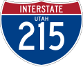
The Interstate Highways in Utah are maintained by the Utah Department of Transportation (UDOT). The Interstate Highway System is a nationwide system with only a small portion of these routes entering Utah. Originally, the State Road Commission of Utah, created on March 23, 1909 was responsible for maintenance, but these duties were rolled into the new UDOT in 1975. [1] There are 977.664 miles (1,573.398 km) of Interstates within the state. The longest is Interstate 15 (I-15) at 400.592 miles (644.690 km) and the shortest is I-215 at 28.946 miles (46.584 km). One unique former route is Interstate 415, which was never signed as such, and was only used as a temporary designation for the eastern portion of what is now the Interstate 215 belt loop around Salt Lake City. [2]

Contents

List

NumberLength (mi)Length (km)Southern or western terminusNorthern or eastern terminusFormedRemovedNotes
I-15.svg I-15 400.592644.690 I-15 at the Arizona state line towards Littlefield I-15 at the Idaho state line towards Malad City 01956-01-011956currentI-15 crosses through the entire state, starting in the south from Saint George, up through the middle of the state where it intersects I-70, and into the Salt Lake Valley to meet with I-215 and I-80. After leaving the valley, I-15 continues north, where it becomes concurrent with I-84 until the split in Tremonton, where I-15 heads north into Idaho. [3] [4]
I-70.svg I-70 231.673372.842 I-15 near Cove Fort, UT I-70/US 6/US 50 at the Colorado state line towards Grand Junction 01957-01-011957currentInterstate 70 begins in Utah near Cove Fort, not passing through any major metropolitan areas of Utah, and serves as a long-haul route to Denver and the east coast. A stretch of 110 miles (180 km) exists on the highway without any services available. [5] [6]
I-80.svg I-80 196.680316.526 I‑80 at the Nevada state line in Wendover I-80/US 189 at the Wyoming state line towards Evanston 01956-01-011956currentInterstate 80 enters from Wendover and crosses the Bonneville Salt Flats before entering the Salt Lake Valley, briefly becoming concurrent with I-15 before leaving the valley through Parley's Canyon, meeting the end of I-84 and enters Wyoming. [7] [8]
I-80N.svg I-80N I-80N at the Idaho state line towards Burley I-80 near Echo 01958-01-01195801977-01-011977Now I-84 [9]
I-84.svg I-84 119.773192.756 I-84 at the Idaho state line towards Burley I-80 near Echo 01977-01-011977currentI-84 enters in Snowville and soon becomes concurrent with I-15 until it splits off in Roy, and enters Weber Canyon before ending at I-80 in Echo [10] [11]
I-215.svg I-215 28.94646.584 I-80 at Parley's Canyon I-15 in North Salt Lake 01963-01-011963current270 degree belt route around Salt Lake City [12] [13]
I-415.svg I-415 I-15/I-215 in Murray I-80 in Salt Lake City 01959-01-01195901969-01-011969Now I-215 [2]
  •       Former

See also

Related Research Articles

<span class="mw-page-title-main">Interstate 15</span> Interstate in the Western United States

Interstate 15 (I-15) is a major Interstate Highway in the western United States, running through Southern California and the Intermountain West. I-15 begins near the Mexican border in San Diego County and stretches north to Alberta, Canada, passing through the states of California, Nevada, Arizona, Utah, Idaho, and Montana. The Interstate serves the cities of San Diego, San Bernardino, Las Vegas, St. George, Provo, Salt Lake City, Ogden, Pocatello, Idaho Falls, Butte, Helena, and Great Falls. It also passes close to the urban areas of Los Angeles, Orange, and Riverside counties, California. The stretches of I-15 in Idaho, Utah, and Arizona have been designated as the "Veterans Memorial Highway". The southern end is at a junction with I-8 and State Route 15 (SR 15) in San Diego, and the northern end is at a connection with Alberta Highway 4 at the Sweetgrass–Coutts Border Crossing.

<span class="mw-page-title-main">U.S. Route 163</span> Highway in Arizona and Utah

U.S. Route 163 is a 64-mile (103 km) U.S. Highway that runs from US 160 northward to US 191 in the U.S. states of Arizona and Utah. The southernmost 44 miles (71 km) of its length are within the Navajo Nation. The highway forms part of the Trail of the Ancients, a National Scenic Byway. The highway cuts through the heart of Monument Valley and has been featured in numerous movies and commercials.

<span class="mw-page-title-main">U.S. Route 189</span> Highway in the United States

U.S. Route 189 is a spur of U.S. Route 89. It currently runs for 322 miles (518 km) from Provo, Utah at Interstate 15 to Jackson, Wyoming. The highway was not part of the original 1926 U.S. Highway system. The highway was created in the 1930s, absorbing former U.S. Route 530 and a portion of U.S. Route 30S. The portion through Provo Canyon has been designated the Provo Canyon Scenic Byway by the state of Utah.

<span class="mw-page-title-main">Mountain View Corridor</span> State highway in Utah and Salt Lake counties in Utah, United States

The Mountain View Corridor is a freeway under construction in northern Utah that will run along the western periphery of Salt Lake County and south into northwest Utah County. Except for the last several miles on its southern end the Mountain View Corridor is numerically designated as State Route 85 (SR-85) in the Utah state highway system. The entire Mountain View Corridor will be maintained by the Utah Department of Transportation (UDOT).

<span class="mw-page-title-main">Utah State Route 202</span> Highway in Utah

State Route 202 (SR-202) is a 1.683-mile (2.709 km) long state highway in the U.S. state of Utah that serves as a connector, linking SR-201 to Interstate 80 (I-80) in rural Salt Lake County. The road has existed since at least 1937, when it connected U.S. Route 40 (US-40) and US-50 via the Garfield Cut-Off Road. It also serves as the eastbound on-ramp for I-80.

<span class="mw-page-title-main">Utah State Route 68</span> State highway in Utah, Salt Lake, and Davis counties in Utah, United States

State Route 68 (SR-68) is a state highway in the U.S. state of Utah. It is a major thoroughfare throughout the Wasatch Front as it runs north–south for 70.8 miles (113.9 km), linking US-6 near Elberta to US-89 in Woods Cross. The route intersects several major freeways and highways in the Salt Lake City metropolitan area including I-215, I-80, and I-15. The route is more commonly referred to as Redwood Road, after the street it is routed along throughout Salt Lake County. The highway is also routed for a short distance along 500 South and 200 West in Bountiful and Camp Williams Road in Utah County. The route is a surface street for its entire length.

<span class="mw-page-title-main">Utah State Route 186</span>

State Route 186 (SR-186) is a state highway entirely within Salt Lake City, capital of the U.S. state of Utah. It forms a quarter-beltway connecting US-89 and I-15 leading north from Salt Lake City to I-80 leading east; as such, it effectively forms the missing (non-freeway) quarter of the I-215 belt route around the city, though it does not directly connect to I-215 at the north end. Despite this beltway role, the route passes through downtown Salt Lake City because downtown is built right up to the northern mountains surrounding City Creek Canyon. The portion of the route connecting downtown to I-80 is a high-capacity street heavily used by commuters, especially those travelling to the University of Utah or between downtown and eastern neighborhoods, but the portion on Capitol Hill north of downtown is much narrower and has sharp turns around the Capitol grounds. The roadway runs 9.34 miles (15.03 km) along Victory Road, Columbus Street, 300 North, State Street, 400 South, 500 South, and Foothill Drive.

<span class="mw-page-title-main">Utah State Route 171</span>

State Route 171 (SR-171) is a state highway in the Salt Lake City metropolitan area in northern Utah that runs from SR-111 in Magna in the west side of the city to Interstate 215 in the city of Millcreek in the eastern part valley. In its sixteen-mile span, the route is named 3500 South and 3300 South.

<span class="mw-page-title-main">Utah State Route 71</span>

State Route 71 (SR-71) is a state highway completely within the Salt Lake City metropolitan area in the northern portion of the US state of Utah. It runs from SR-154 in the southwest side of the city to SR-186 in Downtown Salt Lake City. The route spans 22.47 miles (36.16 km) as it runs along portions of 12600 South, 12300 South, 900 East, and 700 East streets.

<span class="mw-page-title-main">Interstate 80 Business (West Wendover, Nevada–Wendover, Utah)</span> Interstate Highway business loop in Nevada and Utah in the United States

Interstate 80 Business is an unofficial business loop of Interstate 80 (I-80) that is 2.26 miles (3.64 km) long and serves as the main street for the US cities of West Wendover, Nevada, and Wendover, Utah, along a roadway named Wendover Boulevard. Wendover Boulevard was originally part of US Route 40 (US 40), which connected California to New Jersey via Nevada and Utah. A portion of the Nevada segment is concurrent with US 93 Alternate, and the entire portion in Utah is coterminous with Utah State Route 58 (SR-58). The Nevada Department of Transportation (NDOT) applied for the business loop designation in the early 1980s, but the designation has never been approved; nevertheless, signs are posted in both states. Between July 1976 and 1993, I-80 Bus was concurrent with Nevada State Route 224 (SR 224) in Nevada.

<span class="mw-page-title-main">Interstate 80 in Utah</span> Section of Interstate highway in Utah, United States

Interstate 80 (I-80) is a part of the Interstate Highway System that runs from San Francisco, California, to Teaneck, New Jersey. The portion of the highway in the US state of Utah is 197.51 miles (317.86 km) long through the northern part of the state. From west to east, I-80 crosses the state line from Nevada in Tooele County and traverses the Bonneville Salt Flats—which are a part of the larger Great Salt Lake Desert. It continues alongside the Wendover Cut-off—the corridor of the former Victory Highway—US Route 40 (US-40) and the Western Pacific Railroad Feather River Route. After passing the Oquirrh Mountains, I-80 enters the Salt Lake Valley and Salt Lake County. A short portion of the freeway is concurrent with I-15 through Downtown Salt Lake City. At the Spaghetti Bowl, I-80 turns east again into the mouth of Parleys Canyon and Summit County, travels through the mountain range, and intersects the eastern end of I-84 near Echo Reservoir before turning northeast toward the Wyoming border near Evanston. I-80 was built along the corridor of the Lincoln Highway and the Mormon Trail through the Wasatch Range. The easternmost section also follows the historical routes of the first transcontinental railroad and US-30S.

<span class="mw-page-title-main">Interstate 84 in Utah</span> Section of Interstate Highway in Utah, United States

Interstate 84 (I-84) is a part of the Interstate Highway System that links Portland, Oregon, to I-80 near Echo, Utah. The 117.38-mile-long (188.90 km) segment in the US state of Utah is the shortest of any of the three states the western I-84 passes through and contains the eastern terminus of the highway. I-84 enters Box Elder County near Snowville before becoming concurrent with I-15 in Tremonton. The concurrent highways travel south through Brigham City and Ogden and separate near Ogden-Hinckley Airport. Turing east along the Davis County border, I-84 intersects US Route 89 (US-89) and enters Weber Canyon as well as Morgan County. While in Morgan County, I-84 passes the Devil's Gate-Weber Hydroelectric Power Plant and Devil's Slide rock formation. Past Morgan, the highway crosses into Summit County, past the Thousand Mile Tree before reaching its eastern terminus at I-80 near Echo.

<span class="mw-page-title-main">Interstate 15 in Utah</span> Section of Interstate highway in Utah, United States

Interstate 15 (I-15) runs north–south in the U.S. state of Utah through the southwestern and central portions of the state, passing through most of the state's population centers, including St. George and those comprising the Wasatch Front: Provo–Orem, Salt Lake City, and Ogden–Clearfield. It is Utah's primary north–south highway, as the vast majority of the state's population lives along its corridor; the Logan metropolitan area is the state's only Metropolitan Statistical Area through which I-15 does not pass. In 1998, the Utah State Legislature designated Utah's entire portion of the road as the Veterans Memorial Highway.

<span class="mw-page-title-main">Wendover Cut-off</span> Highway in Utah

The Wendover Cut-off, also called the Wendover Road or Wendover Route, is a two-lane highway in the western part of Tooele County in the U.S. state of Utah. Stretching 40.3 miles (64.9 km) from Wendover to Knolls across the Bonneville Salt Flats, a part of the Great Salt Lake Desert, the cut-off was once part of the primary link between the Nevada state line and Salt Lake City. In 2012, between 240 and 250 vehicles used the cut-off near its western terminus in Wendover on an average day.

<span class="mw-page-title-main">Legacy Parkway</span> State highway in Utah, United States

Legacy Parkway is an 11.5-mile-long (18.5 km) four-lane controlled-access parkway located almost completely within Davis County in the northern part of the U.S. state of Utah. The parkway travels north from Interstate 215 (I-215) in northwestern Salt Lake City to an interchange named the Wasatch Weave in Farmington with two intermediate interchanges providing access to Woods Cross and Centerville. Wetlands of the nearby Great Salt Lake and nature preserves border the western side of the parkway while the eastern side roughly parallels Union Pacific and Utah Transit Authority rail lines and I-15. On average, between 20,000 and 23,000 vehicles use the parkway daily.

<span class="mw-page-title-main">Utah State Route 190</span>

State Route 190 (SR-190) or the Big Cottonwood Canyon Scenic Byway is primarily an east and west state highway and scenic highway in eastern Salt Lake County, Utah, United States, that begins at Interstate 215 (I-215), runs through Big Cottonwood Canyon, and ends at the Salt Lake and Wasatch county line.

<span class="mw-page-title-main">Utah State Route 103</span> State highway in Clearfield, Utah, United States

State Route 103 (SR-103) is a 0.225-mile-long (362 m) urban minor arterial state highway in the U.S. state of Utah. It branches off from SR-126 in downtown Clearfield and extends east to Interstate 15 (I-15), with the roadway continuing to the Falcon Hill National Aerospace Research Park, just outside Hill Air Force Base. The entire route is located in Davis County and was formed in 1965 coinciding with the construction of I-15.

<span class="mw-page-title-main">Utah State Route 140</span> Highway in Utah, USA

State Route 140 (SR-140) is a 0.936-mile (1.506 km) long state highway in the U.S. state of Utah. It runs from 800 West in Bluffdale to Interstate 15 (I-15).

References

  1. "Utah State Archives Catalog". Utah State Archives . Retrieved July 29, 2008.
  2. 1 2 "SR-215 History" (PDF). State Road Commission of Utah. October 14, 1968. Retrieved July 29, 2008.
  3. "Highway Reference - 0015 P". Utah Department of Transportation. May 1, 2008. Archived from the original (PDF) on October 18, 2007. Retrieved July 26, 2008.
  4. "Utah Code §72-4-107". Utah State Legislature. Archived from the original on July 11, 2008. Retrieved July 29, 2008.
  5. "Highway Reference - 0070 P". Utah Department of Transportation. May 1, 2008. Archived from the original (PDF) on September 22, 2008. Retrieved July 26, 2008.
  6. "Utah Code §72-4-112". Utah State Legislature. Archived from the original on July 11, 2008. Retrieved July 29, 2008.
  7. "Highway Reference - 0080 P". Utah Department of Transportation. May 1, 2008. Archived from the original (PDF) on September 22, 2008. Retrieved July 26, 2008.
  8. "Utah Code §72-4-113". Utah State Legislature. Archived from the original on July 11, 2008. Retrieved July 29, 2008.
  9. "Eisenhower Interstate Highway System, Previous Facts of the Day". Highway History. Federal Highway Administration, US DOT. March 15, 2010. Retrieved 11 October 2017.
  10. "Highway Reference - 0084 P". Utah Department of Transportation. May 1, 2008. Archived from the original (PDF) on September 22, 2008. Retrieved July 26, 2008.
  11. "Utah Code §72-4-114". Utah State Legislature. Retrieved July 29, 2008.
  12. "Highway Reference - 0215 P" (PDF). Utah Department of Transportation. May 1, 2008. Retrieved July 26, 2008.
  13. "Utah Code §72-4-127". Utah State Legislature. Archived from the original on July 11, 2008. Retrieved July 29, 2008.