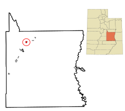
Huntington is a city in northwestern Emery County, Utah, United States. The population was 2,129 at the 2010 census.[5] It is the largest town in Emery County.
Huntington is named after Huntington Creek, and the creek was probably named for Huntington brothers (William, Oliver, and Dimick, sons of William Huntington) who led exploring parties into the region during the 1850s.[6] The first settlers of European extraction in the area were four stockmen, Leander Lemmon, James McHadden, Bill Gentry, and Alfred Starr, who brought their herds to Huntington Creek in 1875.
In the fall of 1877, in response to the same call from the Church of Jesus Christ of Latter-day Saints that brought settlers to the other creeks in Castle Valley, a small group from Fairview, Utah, under the leadership of Elias Cox, established a dugout colony on the banks of Huntington Creek and began digging irrigation canals. The colony grew from 126 in 1880 to 738 in 1890 and 1,293 in 1910. A majority of the early settlers came from the Sanpete Valley, which by the late 1870s had outgrown its irrigable land, and many belonged to three or four interrelated kinship groups, making for an abundance of cousins in the community.
In 1880 a mile-square townsite was surveyed on the Prickly Pear Flat, a bench south and west of the creek. The first structure erected on the new townsite was a 40-by-60-foot (12 by 18m) log meetinghouse, which was completed in time for an all-night New Year's Eve party on 31 December 1880. Most of the townsite was without water until the completion of the Huntington Canal in 1882. Settlers drew town lots and built homes in town as they proved up on their homesteads. The first homes, some of which were still occupied until recent years, were typically of sawed log or plank construction or of adobe sheathed with lumber. The erection of a new LDS meetinghouse in 1896 inaugurated a twenty-year building boom that saw the completion of many brick homes, schools, and commercial buildings.
Huntington's early economic base was agriculture and stockraising. Alfalfa seed was an important cash crop around the start of the 20th century, and honey produced by local apiarist Christian Ottesen won first prize at the St. Louis World's Fair in 1903. For most of its history, however, Huntington has drawn its main income from coal mining. Small "wagon mines" in Huntington Canyon provided limited employment. The coal camp of Mohrland, 8 miles (13km) to the north, active from about 1909 to 1938, was virtually an extension of Huntington, with many residents dividing the year between the mine and the farm. With the coming of better highways in the 1940s and 1950s, many miners commuted daily from Huntington to Hiawatha and other Carbon County mines.
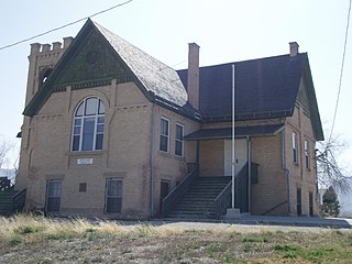
The Huntington Roller Mill, February 2010
Its proximity to the regional commercial center of Price, and distance from a major highway, 20 miles (32km) to the north, has prevented Huntington from developing extensive retail business. However, a flour mill erected in 1892 remained in operation into the 1980s, producing feeds for local farmers and flour and cereals marketed throughout Emery and Carbon counties. Huntington High School, established in 1915 and later renamed North Emery High, was a focal point of the community until the consolidation of Emery County schools in 1962.
From its early years, Huntington has had a strong amateur arts tradition. A martial band was organized in 1884. Community theater groups produced as many as half a dozen plays a year between 1890 and 1910. A choir directed by Thomas L. Hardee and composed of singers from Huntington and neighboring Cleveland won an Eisteddfod competition hosted by the Scofield Welsh Choir in 1895, and later performed at an LDS general conference in Salt Lake City. A men's glee club organized in the early 1920s is still in existence, with third- and even fourth-generation members.
The 1950 census found 1,442 residents in the Huntington precinct. The population fell by one-third in the next ten years as mining jobs disappeared. This economic decline was reversed in 1972 when construction began on Utah Power and Light Company's Huntington steam-electric generating plant in the mouth of the canyon. The construction plus development of coal-mining operations to supply the plant gave the town the character of an energy boom town for a few years. Industrial development not only enabled some former residents to return to the community but also attracted new permanent residents, bringing more diversity to the town's former character as a Mormon farm village. While the community is still predominantly Mormon, the Mission San Rafael was established in 1977 a few miles south of Huntington to serve Catholic families in western Emery County. Baptist, Assembly of God, and nondenominationalProtestant religious services have also been held in the community. The 1990 population of Huntington was 1,875.
Mine disaster
On Monday, August 6, 2007, at 2:48a.m. (MDT), UtahAmerican Energy's Crandall Canyon Mine, 15 miles (24km) west northwest of Huntington, collapsed trapping six workers inside. The mine, located just off State Route 31, is about 34 miles (55km) southeast of Fairview and 140 miles (230km) south of Salt Lake City (100 miles (160km) on a flight line). The workers were approximately 3.4 miles (5.5km) from the mine entrance and 1,500 feet (460m) underground. The collapse registered recorded seismic waves in magnitude 3.9 to 4.0, by seismograph stations of the University of Utah.[7][8][9]
As of August 16, 2007, at about 6:30p.m. MDT, three rescue workers were killed and six injured, as the tunnel the workers were digging collapsed on top of them, covering them with coal and rubble.[10][11] The six men who were not killed outright were unable to be rescued after the rescue mission was forced to halt and died as well.[12][13][14]
On March 22, 2013, one miner died and another was injured after they became trapped in a cave-in at a part of the Castle Valley Mining Complex, about 10 miles (16km) west of Huntington.[15]
Geography
Huntington is located in northwestern Emery County near the mouth of a long canyon that cuts diagonally into the Wasatch Plateau. According to the United States Census Bureau, Huntington has a total area of 2.0 square miles (5.3km2), all land.[5]
Climate
This climatic region is typified by large seasonal temperature differences, with warm to hot (and often humid) summers and cold (sometimes severely cold) winters. According to the Köppen Climate Classification system, Huntington has a humid continental climate, abbreviated "Dfb" on climate maps.[16]
[18][19] As of the census[3] of 2000, there were 2,131 people, 690 households, and 547 families residing in the town. The population density was 1,047.6 peopleper square mile (404.5 people/km2). There were 778 housing units at an average density of 382.5 per square mile (147.7/km2). The racial makeup of the town was 92.40% White, 0.19% African American, 0.47% Native American, 0.19% Asian, 0.05% Pacific Islander, 5.02% from other races, and 1.69% from two or more races. Hispanic or Latino of any race were 12.39% of the population.
There were 690 households, out of which 46.5% had children under the age of 18 living with them, 65.1% were married couples living together, 9.9% had a female householder with no husband present, and 20.7% were non-families. 19.0% of all households were made up of individuals, and 9.6% had someone living alone who was 65 years of age or older. The average household size was 3.09 and the average family size was 3.55.
In Huntington, the population was spread out, with 36.2% under the age of 18, 11.8% from 18 to 24, 25.7% from 25 to 44, 16.8% from 45 to 64, and 9.5% who were 65 years of age or older. The median age was 26 years. For every 100 females, there were 101.0 males. For every 100 females age 18 and over, there were 98.7 males.
The median income for a household in Huntington was $36,964, and the median income for a family was $42,083. Males had a median income of $36,588 versus $19,125 for females. The per capita income for the city was $14,606. About 11.4% of families and 13.8% of the population were below the poverty line, including 16.4% of those under age 18 and 9.5% of those age 65 or over.
Transportation
The town is bisected by Huntington Creek. Utah State Route 10 passes through the center of town as Main Street, leading northeast 21 miles (34km) to Price and southwest 9 miles (14km) to Castle Dale, the Emery County seat. State Route 31 leads northwest from Huntington across the Wasatch Plateau 48 miles (77km) to Fairview.
Emery County is a county in east-central Utah, United States. As of the 2020 United States Census, the population was 9,825. Its county seat is Castle Dale, and the largest city is Huntington.
Huntington is a city in Sebastian County, Arkansas, United States. It is part of the Fort Smith, Arkansas-Oklahoma Metropolitan Statistical Area. As of the 2010 Census the population was 635.
Panama is a village in Montgomery and Bond counties, Illinois, United States. The population was 337 at the 2020 census.
Virden is a city in Macoupin and Sangamon counties in the U.S. state of Illinois. The population was 3,231 at the 2020 census.
Toluca is a city in Marshall County, Illinois, United States. The population was 1,340 at the 2020 census. It is part of the Peoria, Illinois, Metropolitan Statistical Area.
Savanna is a town in Pittsburg County, Oklahoma, United States. The population was 686 at the 2010 census, a decline of 6.0 percent from the figure of 730 recorded in 2000. It is the hometown of former Harlem Globetrotter and 2014 NAIA Dunk Champion Tyler Inman.
Helper is a city in Carbon County, Utah, United States, approximately 110 miles (180 km) southeast of Salt Lake City and 7 miles (11 km) northwest of the city of Price. The population was 2,201 at the 2010 census.
Scofield is a town in Carbon County, Utah, United States. The population was 26 at the 2020 census. Scofield's name is frequently applied to the 1900 mine disaster in the Pleasant Valley Coal Company's Winter Quarters mine. The community was named for General Charles W. Scofield, a timber contractor and local mine official. It is the smallest incorporated area in Utah by population.
Sunnyside is a former city in Carbon County, Utah, United States. The population was 377 at the 2010 census. On January 1, 2014, the city merged with the neighboring city of East Carbon.
{[short description|Town in Emery County, Utah, United States}}
Emery is a town in Emery County, Utah, United States. The population was 288 at the 2010 census.
Ferron is a city in western Emery County, Utah, United States. The population was 1,461 at the 2020 census.
Orangeville is a city in northwestern Emery County, Utah, United States, at the edge of the Manti-La Sal National Forest. The city is at the junction of State Routes 29 and 57, straddling the banks of Cottonwood Creek. The population was 1,470 at the 2010 census.
Cedar City is the largest city in Iron County, Utah, United States. Located 250 miles (400 km) south of Salt Lake City, it is 170 miles (270 km) north of Las Vegas on Interstate 15. Southern Utah University is located in Cedar City. It is the home of the Utah Shakespeare Festival, the Utah Summer Games, the Simon Fest Theatre Co., and other events. As of the 2020 census the city had a population of 35,235, up from 28,857 in the 2010 census.
Salina is a city in Sevier County, Utah, United States. The population was 2,660 at the 2020 census.
Farmington is a town in Marion County, West Virginia, United States. The population was 389 at the 2020 census. The small town is situated on Buffalo Creek and the Allegheny Mountains about 6 miles west of Fairmont, Marion County's county seat. It is best known for being the site of the 1968 Farmington Mine disaster.
The Crandall Canyon Mine, formerly Genwal Mine, was an underground bituminous coal mine in northwestern Emery County, Utah.
UtahAmerican Energy, Inc., is a Bituminous coal underground coal mine and lignite surface mining company, headquartered in Sandy, Utah. UtahAmerican is a subsidiary of Cleveland, Ohio based Murray Energy Corporation. UtahAmerican is a company with approximately $65.1 million (USD) in annual sales, and 428 employees and was started in 1996.
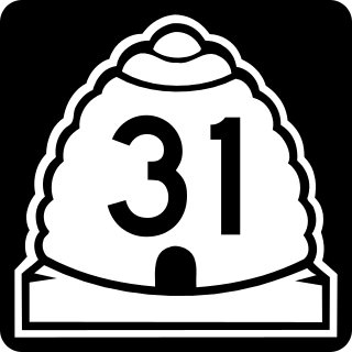
State Route 31 (SR-31) is a state highway in Sanpete and Emery Counties in the U.S. state of Utah. It runs for 47.746 miles (76.840 km) from US-89 at Fairview to SR-10 in Huntington. The highway has been designated as part of The Energy Loop, a National Scenic Byway.
Sego is a ghost town in Grand County, Utah, United States. It lies in the narrow, winding Sego Canyon, in the Book Cliffs some 5 miles (8.0 km) north of Thompson Springs. Formerly an important eastern Utah coal mining town, Sego was inhabited about 1910–1955. The town is accessed via the grade of the Ballard & Thompson Railroad, a spur from the Denver and Rio Grande Western built by the founders of the town to transport the coal.
This page is based on this Wikipedia article Text is available under the CC BY-SA 4.0 license; additional terms may apply. Images, videos and audio are available under their respective licenses.