
Ettayapuram is a panchayat town in Thoothukudi district of Tamil Nadu, India. It is the birthplace of Tamil poets Mahakavi Bharathiar and Umaru Pulavar. Muthuswami Dikshitar, one of the triads of Carnatic music, was patronized in his final years by the ruler of Ettayapuram.

Thoothukudi is a port city, a municipal corporation, and an industrial city in Thoothukudi district in the Indian state of Tamil Nadu. The city lies on the Coromandel Coast of the Bay of Bengal. Thoothukudi is the capital and headquarters of Thoothukudi district. It is located about 590 kilometres southeast of Chennai, 190 kilometres northeast of Thiruvananthapuram, and 580 kilometres southeast of Bengaluru. According to the Confederation of Indian Industry, Thoothukudi has the second highest Human Development Index in Tamil Nadu, next to Chennai. Thoothukudi City serves as the headquarters of Tamilnad Mercantile Bank Limited, one of the leading private sector banks in India. Major educational establishments in the city include the Government Thoothukudi Medical College, Fisheries College and Research Institute, Tamil Nadu Maritime Academy, V.O. Chidambaram College, Kamaraj College, Anna University, and Government Polytechnic College. The V.O. Chidambaranar Port Authority is one of the major ports in India. Thoothukudi is an emerging energy and industrial hub of South India.
Perungudi is a neighbourhood of Chennai in the state of Tamil Nadu, India. It is situated about 10 kilometres (6.2 mi) south of Adyar. It is bordered on two sides by the Old Mahabalipuram Road and the Perungudi lake. It is situated on the Old Mahabalipuram IT Expressway right in middle of an Information Technology (IT) Estate. It is between Taramani and Thoraipakkam and parallel to Kottivakkam and Palavakkam in the East Coast Road.

Bidhannagar, also known as Salt Lake City is a satellite city of Kolkata in North 24 Parganas district in the Indian state of West Bengal. The population within city limits was 2,18,323 at the 2011 census, it has increased since 2001 census. After a successful extension of the city limits in June 2015, Bidhannagar's population increased to 6.7 lakhs residents. It is now the fourth-most populous city in West Bengal, after Kolkata, Howrah and Asansol.
Thoothukudi District is one of the 38 districts of Tamil Nadu state in southern India. The district was formed by bifurcation of Tirunelveli district on 20 October 1986. Thoothukudi is the district headquarters and largest city of the district. The district is known for fishing as well as pearl cultivation, with an abundance of pearls being found in the seas offshore. Thoothukudi district has many historical sites such as Adichanallur and the ancient trade port of Korkai.
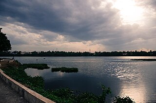
Chitlapakkam is a residential locality located in Chennai Metropolitan Area governed by the Tambaram City Municipal Corporation. It is well known for its small, perennial lake and adjoining ecosystems.

Azhikode is a coastal town and a suburb of Kannur city situated in Kannur district of Kerala, India. Azhikode town is divided into Azhikode North and Azhikode South. The northern end of the Azhikode North is called Azhikkal. The place is the birthplace of Sukumar Azhikode, an influential thinker and literary critic. It is about 7 km (4.3 mi) from Kannur city.
Iluppaiyurani is a panchayat town in Thoothukudi district in the Indian state of Tamil Nadu.
Kadambur is a panchayat town in Kayathar taluk of the Thoothukudi district in the Indian state of Tamil Nadu. The temples in and around Kadambur portray the authentic Chola art and architecture. There is also another village with the same name Kadambur in the district of Salem under Gangavalli taluk.
Kayathar / Kayatharu is a panchayat town in Thoothukudi district in the Indian state of Tamil Nadu.
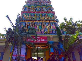
Meerpet–Jillelguda is a satellite city of Hyderabad and a municipal corporation in Rangareddy district of the Indian state of Telangana. The municipal corporation was formed after merging municipality of Meerpet and Jillelguda.
Moovarasanpattu is a census town in Chengalpattu district and part of the Chennai metropolitan area in the Indian state of Tamil Nadu.

Olavanna is a panchayat in Kozhikode district in the Indian state of Kerala. Olavanna is the most populous panchayat in kerala. It is located 10 km from Kozhikode City. Olavanna panchayath shares the border with Kozhikode corporation and Perumanna panchayath. At first it was a large agricultural area. Today there are many small and large scale industries.Pantheerankavu is the major town in the panchayat. There are also small marketplaces such as the Olavanna Chungam, Kodinattumukku, Mathara, Palazhi, Kunnathupalam, Iringallor. The railway station is around 10 kilometres away and the nearest airport is Calicut international Airport. HiLite Mall is located in Palazhi junction.
Peerkankaranai is a neighborhood in the city of Tambaram, situated within the Chennai Metropolitan Area, Tamil Nadu, India.
Pudupalayam is a panchayat town in Chengam taluk of Tiruvanamalai district in the Indian state of Tamil Nadu. Its pincode number is 606 705.It is well connected with Tiruvannamalai and Bangalore. This is at Bangalore Road at 33 km away from the famous Annamalaiyar Temple located in Thiruvannamalai.
Sayalgudi is a town panchayat in Ramanathapuram district of Tamil Nadu State in India. It is located west of the district along the East Coast Highway towards Kanyakumari. The state highway SH200 passes through the town connecting districts of Thoothukudi and Tirunelveli. It surrounded by many small villages and acts as marketplace for people.
Thenkarai is a suburban area near Coimbatore City Municipal Corporation, in the Indian state of Tamil Nadu. It is in the western suburbs of Coimbatore. It recently merged with the Coimbatore Corporation limits. Thenkarai is one of the town panchayats in Coimbatore and consists of small villages such as Sennanur, Mathipalayam, Karadimadai, Thaneer Panthal, Appachimaar Kovil, Challikkuzhi and KrishnaPuram Pudur.
Thiruverumbur is a neighbourhood in the city of Tiruchirapalli in the Indian state of Tamil Nadu. It was merged with the Tiruchirappalli Corporation in 2011.
V. Pudur is a panchayat town in Thoothukudi district in the Indian state of Tamil Nadu.

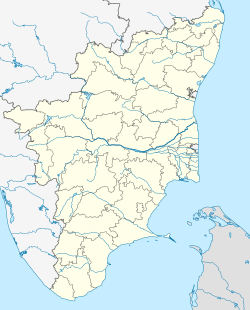


 India
India 