
Aguascalientes is the capital of the state of Aguascalientes and is its most populous city, with a metropolitan population of 1,225,432. It is one of the safest and most prosperous cities in Mexico. It is located in North-Central Mexico. It was part of the kingdom of Nueva Galicia. In 1835 Aguascalientes became the capital of the Free and Sovereign State of Aguascalientes. Aguascalientes has been called the cleanest city in Latin America. Aguascalientes is experiencing an ongoing social, economic, and aesthetic revitalization process. Aguascalientes has a population which includes Japanese, Koreans, Venezuelans, Spaniards, Canadians and Germans.
San Luis Potosí, commonly called SLP or simply San Luis, is the capital and the most populous city of the Mexican state of San Luis Potosí. It is the municipal seat of the surrounding municipality of San Luis Potosí. The city lies at an elevation of 1,864 metres. It has an estimated population of 824,229 in the city proper and a population of approximately 1,221,526 in its metropolitan area, formed with the neighbour city of Soledad de Graciano Sánchez and other surrounding municipalities, which makes the metropolitan area of Greater San Luis Potosí the eleventh largest in Mexico.
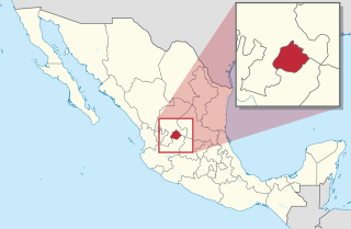
Aguascalientes, officially the Free and Sovereign State of Aguascalientes, is one of the 32 states which comprise the Federal Entities of Mexico. At 22°N and with an average altitude of 1,950 m (6,400 ft) above sea level it is predominantly of semi-arid climate, and it is located in the northern part of the Bajío region, in north-central Mexico, bordered by Zacatecas to the north, east and west, and by Jalisco to the south.
Amacuzac is a city in the Mexican state of Morelos. The name means In the River of Yellow Amates. Amacuzac stands at 18°36′N99°23′W, at a mean height of 900 meters above sea level. The city serves as the municipal seat for the surrounding municipality of the same name. The municipality reported 17,772 inhabitants in the year 2015 census and covers a total surface area of 125 km². The 2020 census reported 17,598 inhabitants in the municipality and 5,575 in the city of Amacuzac.

San Francisco de los Romo is a municipality and city in the Mexican state of Aguascalientes. The city of San Francisco de los Romo serves as the municipal seat for the surrounding municipality of San Francisco de los Romo.

Tepatitlán de Morelos is a city and municipality founded in 1530, in the central Mexican state of Jalisco. It is located in the area known as Los Altos de Jalisco, about 70 km east of state capital Guadalajara. It is part of the macroregion of the Bajío. Its surrounding municipality of the same name had an area of 1,532.78 km². Its most distinctive feature is the Baroque-style parish church in the centre of the city dedicated to Saint Francis of Assisi. Other notable sites include the kiosk that sits on the Plaza de Armas in downtown, the Temple of San Antonio, and the city hall. The latter is one of the most distinctive features in the city, built in neoclassic-baroque style.

Zapopan is a city and municipality located in the Mexican state of Jalisco. Part of the Guadalajara Metropolitan Area, the population of Zapopan city proper makes it the second largest city in the state, very close behind the population of Guadalajara proper. It is best known as being the home of the Virgin of Zapopan, an image of the Virgin Mary which was made in the 16th century. This image has been credited with a number of miracles and has been recognized by popes and even visited by Pope John Paul II. The municipality is also the home of the Centro Cultural Universitario, which contains one of the most important concert venues in Latin America and is the home of the new stadium for the C.D. Guadalajara.
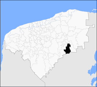
The municipality and city of Huanusco is located in the southwestern portion of the Mexican state of Zacatecas.

Encarnación de Díaz is a town and municipality located in the far northeast of the state of Jalisco in north-central Mexico. It is located in a natural pass that connects the Los Altos region of Jalisco to points north, and from pre-Hispanic times until the 20th century, it was a major thoroughfare for north-south travel. The town began as a way station along a road built through this pass in the 17th century, formally becoming a town in 1760. It began to function as a municipality in the latter 19th century, but this status was not confirmed until the early 20th. Transport, along with numerous prosperous haciendas supported the economy of the area until the early 20th century, when travel patterns and the Mexican Revolution spurred its decline. In the 1920s, it was a centre of rebellion during the Cristero War, and the town contains Mexico's only museum exclusively dedicated to this episode in history. It also contains a museum dedicated to various naturally occurring mummies which have been found in the municipal cemetery.

Irapuato is a Mexican city located at the foot of the Arandas Hill, in the central region of the state of Guanajuato. It lies between the Silao River and the Guanajuato River, a tributary of the Lerma River, at 1,724 m (5,656 ft) above sea level. It is located at 20°40′N101°21′W. The city is the second-largest in the state, with a population of 342,561 according to the 2005 census, while its municipality has a population of 529,440. The municipality has an area of 845.1 km2 (326.3 sq mi) and includes numerous smaller outlying communities. Although it is now an important center for regional trade and transportation center as well the site of several automotive and chemical manufacturing plants, the city's main industry has historically been agriculture and it has long been known for its strawberries and the raising of pigs and cattle. The fruits and flowers of Irapuato's luxurious gardens are well-known throughout Mexico.

Las Margaritas is a city, and the surrounding municipality of the same name, in the Mexican state of Chiapas. The municipal seat is located some 25 km to the northeast of Comitán de Domínguez, while the municipality extends to the east as far as the border with Guatemala. Part of the Lagunas de Montebello National Park is in the municipality's territory.
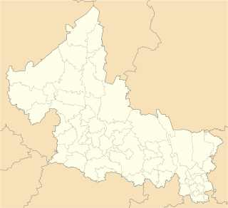
Jesús María is a municipality in the Mexican state of Aguascalientes. It stands at 21°58′N102°21′W. As of 2010, the municipality had a total population of 99,590.

Villa del Carbón is a municipality located in the northern part of Mexico State, just northwest of Mexico City. While the town and munipal seat of Villa del Carbón is the largest in the municipality, it is not the oldest. The municipality contains a number of villages of Otomí and Nahua origins, in which much of the indigenous culture still survives. The municipality's territory was defined in 1714 when a region known as Chiapan, split into what is now Chapa de Mota and Villa del Carbón. At that time, however, the community which is now a municipal seat did not have an official name; it was known first only by the name of its church Nuestra Señora de la Peña de Francia, and later by being a major supplier of charcoal. This would lead to the name of Villanueva del Carbón de Nuestra Señora Santa María de la Peña de Francia, which eventually shortened to Villa del Carbón. The major portions of the municipality's glyph, which serves as it coat-of-arms, does not reflect the town of Villa del Carbón but rather two of its oldest communities: Taxhimay and San Lorenzo Pueblo Nuevo.

Sacalum Municipality is one of the 106 municipalities in the Mexican state of Yucatán containing (205.66 km2) of land and is located roughly 75 km south of the city of Mérida.
Akil Municipality is one of the 106 municipalities in the Mexican state of Yucatán containing (48.54 km2) of land and is located roughly 100 kilometres (62 mi) southeast of the Capital State.
Tahdziú Municipality is one of the 106 municipalities in the Mexican state of Yucatán containing (53.65 km2) of land and is located roughly 145 kilometres (90 mi) southeast of the city of Mérida.

Tinúm Municipality is one of the 106 municipalities in the Mexican state of Yucatán containing of land and is located roughly 140 kilometres (87 mi) east of the city of Mérida.
Tixcacalcupul Municipality is one of the 106 municipalities in the Mexican state of Yucatán containing (1,164.98 km2) of land and is located roughly 180 kilometres (110 mi) southeast of the city of Mérida.
Huehuetla is a rural municipality in Puebla, Mexico.

Luis Moya is a municipality in the Mexican state of Zacatecas, located approximately 50 kilometres (31 mi) southeast of the state capital of Zacatecas City. It is named after Luis Moya (1855–1911), a colonel in the Mexican Revolution who was posthumously given the rank of brigadier general in 1939.