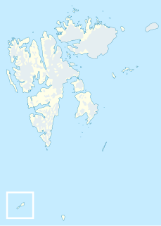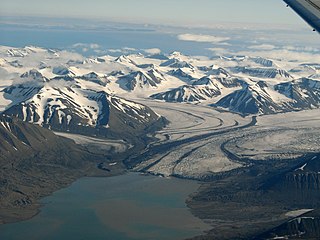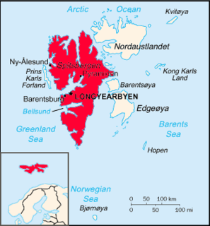
Bellsund is a 20-kilometer (12 mi) long sound on the west coast of Spitsbergen, part of the Svalbard archipelago of Norway. It is separated from Van Mijenfjorden by the islands of Akseløya and Mariaholmen. Bellsund is located south of Nordenskiöld Land and north of Wedel Jarlsberg Land.

Akseløya is a long, narrow island at the mouth of Van Mijenfjorden, separating Van Mijenfjorden from Bellsund. It is separated from the mainland by Akselsundet to the north, and another narrow strait to the south. The islands are named after the schooner Aksel Thordsen, which was chartered by Adolf Erik Nordenskiöld for an expedition to Svalbard in 1864.
Kjellströmdalen is a valley at Spitsbergen, Svalbard. It has a length of about 27 kilometers, and forms the border between Nordenskiöld Land, Heer Land and Sabine Land. The valley is named after topographer Carl Johan Otto Kjellström. The valley debouches into Braganzavågen, a bay in the inner part of Van Mijenfjorden.
Braganzavågen is a bay located in the inner northern branch of Van Mijenfjorden, at Spitsbergen, Svalbard, within Heer Land and Nordenskiöld Land. The valley Kjellströmdalen debouches into the bay. The mining settlement Sveagruva is located at the western side of Braganzavågen, below the mountain Liljevalchfjellet.
Reindalselva is a river in Nordenskiöld Land at Spitsbergen, Svalbard. The river flows through the valley of Reindalen, starting from the mountain pass Reindalspasset, and ending into the bay Kaldbukta in Van Mijenfjorden. It has created one of Svalbard's largest river deltas. Among its tributary rivers are Semmeldalselva and Tverrdalselva.
Berzeliusdalen is a valley in Nordenskiöld Land at Spitsbergen, Svalbard. It has a length of about 16 kilometers, stretching from the mountain pass Skardalspasset down to the northern side of Van Mijenfjorden. The valley is named after Swedish chemist Jöns Jacob Berzelius. The river Berzeliuselva flows through the valley.

Fridtjovbreen is a glacier in Nordenskiöld Land at Spitsbergen, Svalbard. It has a length of about 14 kilometers, and debouches into the bay Fridtjovhamna at the northern side of Van Mijenfjorden. The name stems from a hunting vessel used during the Torell expedition to Spitsbergen. The lower part of the glacier is included in the Nordenskiöld Land National Park.

Akselsundet is a sound between Van Mijenfjorden and Bellsund at Spitsbergen, Svalbard. It has a width of about 1.2 kilometers, located north of Akseløya, and is the main entrance to Van Mijenfjorden. There are strong tidal currents in the strait, up to five to six knots. The entrance is marked by a light at Birkelandodden, the northern point of Akseløya.

Mariasundet is a sound in Nathorst Land at the mouth of Van Mijenfjorden at Spitsbergen, Svalbard; between Mariaholmen and Måseneset. While Akselsundet is regarded the main entrance into Van Mijenfjorden, Mariasundet is also navigable, although it contains the three sherries Svarten, Veslesvarten and Erta.
Birkelandodden is the northern point of the island Akseløya between Van Mijenfjorden and Bellsund at Spitsbergen, Svalbard. The point is named after Kristian Birkeland. A light has been set up to help navigation through Akselsundet, the main entrance to Van Mijenfjorden.
Danzigdalen is a valley in Nathorst Land at Spitsbergen, Svalbard. It is located south of Van Mijenfjorden, extending northwards from Svalbreen to Danzigøyra, with a total length of about 11.5 kilometers. At the western side of the valley are the mountains of Lundgrenfjellet and Vengefjellet, and to the east are Fagerstafjella.
Bromelldalen is a valley in Nathorst Land at Spitsbergen, Svalbard. It has a length of about eight kilometers, and is located between the mountains of Sven Nilssonfjellet and Bassøefjellet on the eastern side, and Hisingerfjellet to the west, at the southern side of Van Mijenfjorden. The valley is named after Swedish botanist Olof Bromelius.
Sven Nilssonfjellet is a mountain in Nathorst Land at Spitsbergen, Svalbard. It has a height of 988 m.a.s.l. The mountain is named after Swedish zoologist Sven Nilsson. It is located west of Langlidalen and Langlifjellet, and north of Løyndbreen, at the southern side of Van Mijenfjorden. East of the mountain is the valley of Bromelldalen.
Bassøefjellet is a mountain in Nathorst Land at Spitsbergen, Svalbard. It has peaks with heights of 1,081 and 953 m.a.s.l. respectively. The mountain is named after Norwegian civil servant and Governor of Svalbard, Johannes Gerckens Bassøe. It is located between Van Mijenfjorden and Van Keulenfjorden, west of Langlifjellet and south of Løyndbreen, with the glaciers of Lundbreen and Kvitskarvbreen to the south. East of the mountain is the valley of Bromelldalen.
Rånekampen is a mountain in Nathorst Land at Spitsbergen, Svalbard. It has a height of 1,185 m.a.s.l.. The mountain is located south of Van Mijenfjorden, and is surrounded by the mountains of Vengefjellet, Lundgrenfjellet and Steindolptoppen, and the glaciers of Langlibreen, Steindolpbreen, Vengebreen, and Rånebreen. The valley of Langlidalen separates Rånekampen from the mountains of Langlifjellet and Sven Nilssonfjellet.

Rindersbukta is a bay in Nathorst Land and Heer Land at Spitsbergen, Svalbard. It forms the southern branch of Van Mijenfjorden. The glaciers of Scheelebreen and Paulabreen debouche into the bay. The bay is named after Dutch whaler Michiel Rinders.
Frysjabreen is a glacier in Nathorst Land at Spitsbergen, Svalbard. It has a length of about six kilometers, and extends from the ridges of Breskarvet and Kjellmanberget down to the valley of Frysjadalen. The glacier is named after the river Frysja, which originates from Frysjabreen and flows through Frysjadalen until its outlet into Van Mijenfjorden.
Frysja is a river in Nathorst Land at Spitsbergen, Svalbard. It originates from the glacier of Frysjabreen, flowing through the valley of Frysjadalen and outlets into Van Mijenfjorden. The headland of Frysjaodden is formed by gravel transported by Frysja.


