Mountain is a rural municipality in the province of Manitoba in Western Canada. It consists of two disjoint parts, Mountain (North) at 52°34′48″N101°00′54″W, and Mountain (South) at 51°58′21″N100°23′31″W, separated by the Rural Municipality of Minitonas. The two parts are separated by approximately 10 km at the northeast corner of Minitonas, along its border with unorganized territory of Division No. 19.

Dulsk is a village in the administrative district of Gmina Inowrocław, within Inowrocław County, Kuyavian-Pomeranian Voivodeship, in north-central Poland. It lies approximately 7 kilometres (4 mi) south-east of Inowrocław, 36 km (22 mi) south-west of Toruń, and 47 km (29 mi) south-east of Bydgoszcz.

Rówienica is a village in the administrative district of Gmina Drzycim, within Świecie County, Kuyavian-Pomeranian Voivodeship, in north-central Poland. It lies approximately 2 kilometres (1 mi) north-east of Drzycim, 14 km (9 mi) north-west of Świecie, 51 km (32 mi) north-east of Bydgoszcz, and 58 km (36 mi) north of Toruń.

Brzozówka Strzelecka is a village in the administrative district of Gmina Czarna Białostocka, within Białystok County, Podlaskie Voivodeship, in north-eastern Poland. It lies approximately 11 kilometres (7 mi) north-west of Czarna Białostocka and 26 km (16 mi) north of the regional capital Białystok.

Dębowa Góra is a village in the administrative district of Gmina Aleksandrów, within Piotrków County, Łódź Voivodeship, in central Poland. It lies approximately 5 kilometres (3 mi) north of Aleksandrów, 23 km (14 mi) south-east of Piotrków Trybunalski, and 64 km (40 mi) south-east of the regional capital Łódź.

Wacławów is a village in the administrative district of Gmina Aleksandrów, within Piotrków County, Łódź Voivodeship, in central Poland. It lies approximately 8 kilometres (5 mi) south of Aleksandrów, 30 km (19 mi) south-east of Piotrków Trybunalski, and 74 km (46 mi) south-east of the regional capital Łódź.

Rędziny is a village in the administrative district of Gmina Żytno, within Radomsko County, Łódź Voivodeship, in central Poland. It lies approximately 5 kilometres (3 mi) north of Żytno, 17 km (11 mi) south-east of Radomsko, and 91 km (57 mi) south of the regional capital Łódź.

Rataje Karskie is a village in the administrative district of Gmina Pacanów, within Busko County, Świętokrzyskie Voivodeship, in south-central Poland. It lies approximately 7 kilometres (4 mi) south of Pacanów, 27 km (17 mi) south-east of Busko-Zdrój, and 68 km (42 mi) south-east of the regional capital Kielce.
Gózd is a village in the administrative district of Gmina Borowie, within Garwolin County, Masovian Voivodeship, in east-central Poland.

Stara Dąbrowa is a village in the administrative district of Gmina Leoncin, within Nowy Dwór Mazowiecki County, Masovian Voivodeship, in east-central Poland. It lies approximately 13 kilometres (8 mi) south-west of Nowy Dwór Mazowiecki and 33 km (21 mi) north-west of Warsaw.

Kuczki-Kolonia is a village in the administrative district of Gmina Gózd, within Radom County, Masovian Voivodeship, in east-central Poland. It lies approximately 6 kilometres (4 mi) west of Gózd, 13 km (8 mi) east of Radom, and 97 km (60 mi) south of Warsaw.

Iłów is a village in Sochaczew County, Masovian Voivodeship, in east-central Poland. It is the seat of the gmina called Gmina Iłów. It lies approximately 19 kilometres (12 mi) north-west of Sochaczew and 68 km (42 mi) west of Warsaw.
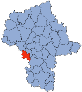
Grabce Wręckie is a village in the administrative district of Gmina Mszczonów, within Żyrardów County, Masovian Voivodeship, in east-central Poland.

Józefowo is a village in the administrative district of Gmina Przedecz, within Koło County, Greater Poland Voivodeship, in west-central Poland. It lies approximately 9 kilometres (6 mi) north-east of Przedecz, 29 km (18 mi) north-east of Koło, and 142 km (88 mi) east of the regional capital Poznań.

Skarżyń is a village in the administrative district of Gmina Włoszakowice, within Leszno County, Greater Poland Voivodeship, in west-central Poland. It lies approximately 6 kilometres (4 mi) north-east of Włoszakowice, 17 km (11 mi) north-west of Leszno, and 59 km (37 mi) south-west of the regional capital Poznań.
Gołunin is a village in the administrative district of Gmina Pobiedziska, within Poznań County, Greater Poland Voivodeship, in west-central Poland.
Niebrzydowo Małe is a settlement in the administrative district of Gmina Morąg, within Ostróda County, Warmian-Masurian Voivodeship, in northern Poland.

Mułek is a settlement in the administrative district of Gmina Malechowo, within Sławno County, West Pomeranian Voivodeship, in north-western Poland. It lies approximately 5 kilometres (3 mi) north of Malechowo, 10 km (6 mi) west of Sławno, and 165 km (103 mi) north-east of the regional capital Szczecin.

Bobrowiczki is a village in the administrative district of Gmina Sławno, within Sławno County, West Pomeranian Voivodeship, in north-western Poland. It lies approximately 4 kilometres (2 mi) south-west of Sławno and 170 km (106 mi) north-east of the regional capital Szczecin.
The Albert premetro station is an underground tram station located on the border between the municipalities of Saint-Gilles and Forest in Brussels, Belgium. The station is at the crossroad between the Avenue Albert/Albertlaan on the greater ring road and the Chaussée d'Alsemberg/Alsembergsesteenweg between the Forest park and the Saint-Gilles prison. The station is the last stop south of the North-South Axis, a tram tunnel crossing Brussels city center from Albert to the Brussels-North railway station. It is on tram routes 3 and 4 and evening route 33. There is a connection at ground level with tram route 51 as well as bus routes 48 and 54.


