Related Research Articles

The National System of Marine Protected Areas of the United States is a national initiative designed to strengthen the protection of U.S. ocean, coastal, and Great Lakes resources through the coordination of existing marine protected areas (MPAs). The national system of MPAs consists of the group of MPA sites, networks, and systems established and managed by federal, state, territorial, tribal and/or local governments that collectively enhance conservation of the nation's marine heritage and represent its diverse ecosystems and resources. Although managed independently, national system MPAs work together at the regional and national levels to achieve common objectives for conserving the nation's important natural and cultural resources. The national system does not bring state, territorial or local sites under federal authority, nor does it restrict or change the management of any MPA.

A marine reserve is a type of marine protected area (MPA). An MPA is a section of the ocean where a government has placed limits on human activity. A marine reserve is a marine protected area in which removing or destroying natural or cultural resources is prohibited, marine reserves may also be "no-take MPAs,” which strictly forbid all extractive activities, such as fishing and kelp harvesting. As of 2007 less than 1% of the world's oceans had been set aside in marine reserves. Benefits include increases in the diversity, density, biomass, body size and reproductive potential of fishery and other species within their boundaries.

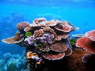
Southeast Asian coral reefs have the highest levels of biodiversity for the world's marine ecosystems. They serve many functions, such as forming the livelihood for subsistence fishermen and even function as jewelry and construction materials. Corals inhabit coastal waters off of every continent except Antarctica, with an abundance of reefs residing along Southeast Asian coastline in several countries including Indonesia, the Philippines, and Thailand. Coral reefs are developed by the carbonate-based skeletons of a variety of animals and algae. Slowly and over time, the reefs build up to the surface in oceans. Coral reefs are found in shallow, warm salt water. The sunlight filters through clear water and allows microscopic organisms to live and reproduce. Coral reefs are actually composed of tiny, fragile animals known as coral polyps. Coral reefs are significantly important because of the biodiversity. Although the number of fish are decreasing, the remaining coral reefs contain more unique sea creatures. The variety of species living on a coral reef is greater than anywhere else in the world. An estimation of 70-90% of fish caught are dependent on coral reefs in Southeast Asia and reefs support over 25% of all known marine species.

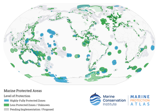
Marine protected areas (MPAs) are protected areas of the world's seas, oceans, estuaries or in the US, the Great Lakes. These marine areas can come in many forms ranging from wildlife refuges to research facilities. MPAs restrict human activity for a conservation purpose, typically to protect natural or cultural resources. Such marine resources are protected by local, state, territorial, native, regional, national, or international authorities and differ substantially among and between nations. This variation includes different limitations on development, fishing practices, fishing seasons and catch limits, moorings and bans on removing or disrupting marine life. In some situations, MPAs also provide revenue for countries, potentially equal to the income that they would have if they were to grant companies permissions to fish. The value of MPA to mobile species is unknown.

Blast fishing, fish bombing, dynamite fishing or grenade fishing is a destructive fishing practice using explosives to stun or kill schools of fish for easy collection. This often illegal practice is extremely destructive to the surrounding ecosystem, as the explosion often destroys the underlying habitat that supports the fish. The frequently improvised nature of the explosives used, and undetonated charges, means danger for fishermen and divers as well, with accidents and injuries.

The Coral Triangle (CT) is a roughly triangular area in the tropical waters around the Philippines, Indonesia, Malaysia, Papua New Guinea, the Solomon Islands and Timor-Leste. This area contains at least 500 species of reef-building corals in each ecoregion. The Coral Triangle is located between the Pacific and Indian oceans and encompasses portions of two biogeographic regions: the Indonesian-Philippines Region, and the Far Southwestern Pacific Region. As one of eight major coral reef zones in the world, the Coral Triangle is recognized as a global centre of marine biodiversity and a global priority for conservation. Its biological resources make it a global hotspot of marine biodiversity. Known as the "Amazon of the seas", it covers 5.7 million square kilometres (2,200,000 sq mi) of ocean waters. It contains more than 76% of the world's shallow-water reef-building coral species, 37% of its reef fish species, 50% of its razor clam species, six out of seven of the world's sea turtle species, and the world's largest mangrove forest. In 2014, the Asian Development Bank (ADB) reported that the gross domestic product of the marine ecosystem in the Coral Triangle is roughly $1.2 trillion per year and provides food to over 120 million people. According to the Coral Triangle Knowledge Network, the region annually brings in about $3 billion in foreign exchange income from fisheries exports, and another $3 billion from coastal tourism revenues.

Asilomar State Marine Reserve (SMR) is one of four small marine protected areas (MPAs) located near the cities of Monterey and Pacific Grove, at the southern end of Monterey Bay on California’s central coast. The four MPAs together encompass 2.96 square miles (7.7 km2). The SMR protects all marine life within its boundaries. Fishing and take of all living marine resources is prohibited.

Carmel Bay State Marine Conservation Area (SMCA) is a marine protected area in Carmel Bay. Carmel Bay is adjacent to the city of Carmel-by-the-Sea and is near Monterey, on California’s central coast. The marine protected area covers 2.12 square miles. Recreational fishing of finfish and limited commercial taking of kelp is permitted within the SMCA.
Moro Cojo Estuary State Marine Reserve (SMR) is a marine protected area established to protect the wildlife and habitats in Moro Cojo Slough. Moro Cojo Slough is located inland from Monterey Bay on the central coast of California, directly south of the more widely known Elkhorn Slough. The area covers 0.46 square miles (1.2 km2). The SMR protects all marine life within its boundaries. Fishing and take of all living marine resources is prohibited.

Del Mar Landing State Marine Reserve (SMR) is a marine protected area that lies onshore, about 2 miles (3 km) south of the town of Gualala and 3.5 miles north of Sea Ranch in Sonoma County on California’s north central coast. The marine protected area covers 0.22 square miles (0.57 km2). Del Mar Landing SMR prohibits injuring, damaging, or taking all living, geological, and cultural marine resources.

Coral reef protection is the process of modifying human activities to avoid damage to healthy coral reefs and to help damaged reefs recover. The key strategies used in reef protection include defining measurable goals and introducing active management and community involvement to reduce stressors that damage reef health. One management technique is to create Marine Protected Areas (MPAs) that directly limit human activities such as fishing.

Point Sur State Marine Reserve (SMR) and Point Sur State Marine Conservation Area (SMCA) are two adjoining marine protected areas that lie offshore of Point Sur, part of the Big Sur area on California's central coast. The combined area of these marine protected areas is 19.68 square miles (51.0 km2). The SMR protects all marine life within its boundaries. Fishing and taking of all living marine resources is prohibited in the SMR. Within the SMCA, fishing and taking of all living marine resources is prohibited except the commercial and recreational take of salmon and albacore.

White Rock (Cambria) State Marine Conservation Area (SMCA) is a marine protected area located off the coast of the city of Cambria, California on California’s central coast. The marine protected area covers 2.32 square miles (6.0 km2). Within the SMCA the take of all living marine resources is prohibited except the commercial take of giant kelp and bull kelp under certain conditions.

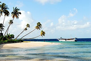
Wakatobi National Park is a marine national park in Southeast Sulawesi, Indonesia. The name of Wakatobi is a portmanteau of the four main Tukangbesi Islands: Wangi-wangi, Kaledupa, Tomia, and Binongko. Since 2005 the park is listed as a tentative World Heritage Site.

San Diego-Scripps Coastal Marine Conservation Area (SMCA) and Matlahuayl State Marine Reserve (SMR) are adjoining marine protected areas that extend offshore from La Jolla in San Diego County on California's south coast. The two marine protected areas cover 2.51 square miles (6.5 km2).
Tundi Spring Agardy is a marine conservationist and the founder of Sound Seas – a Washington DC-based group specializing in working at the nexus of marine science and policy in order to safeguard ocean life.
Marine Conservation Institute is a tax-exempt nonprofit ocean conservation organization working to identify and protect vulnerable ocean ecosystems worldwide. The organization is headquartered in Seattle, Washington, with offices in Washington, D.C., and Glen Ellen, California.
The Danajon Bank is the only double barrier reef in the Philippines, which is a very rare geological formation, which is located in the Camotes Sea. It comprises two sets of large coral reefs that formed offshore on a submarine ridge due to a combination of favorable tidal currents and coral growth in the area.
The Coral Triangle Initiative on Coral Reefs, Fisheries, and Food Security (CTI-CFF), or the Coral Triangle Initiative (CTI), is a multilateral collaborative partnership among six countries. Partners work together to sustain living marine and coastal resources by addressing crucial issues such as food security, climate change, and marine biodiversity.
The Coral Triangle Day was established on June 9, to celebrate and raise awareness of the ocean conservation and protection, especially on the Coral Triangle, the world's epicenter of marine biodiversity. Intended as an open-sourced event, the day is celebrated by individuals, organizations, and establishment concerned on the Coral Triangle. The Coral Triangle day was observed the first time on June 9, 2012, in conjunction with the World Oceans Day on June 8.
References
- ↑ TNC, WWF, CI and WCS. 2008. Marine protected area networks in the Coral Triangle: development and lessons. TNC, WWF, CI, WCS and the United States Agency for International Development, Cebu City, Philippines. 106 p.
- ↑ PISCO, 2007. The Science of Marine Reserves [2nd Edition, United States Version], Partnership for Interdisciplinary Studies of Coastal Oceans (PISCO). "PISCO: Outreach Events". Archived from the original on 2003-03-23. Retrieved 2008-05-22.
- 1 2 3 Christie, P., and A. T. White. "Best Practices for Improved Governance of Coral Reef Marine Protected Areas." Coral Reefs 26.4 (2007): 1047-056. Print.
- ↑ Lowry, G. K., A. T. White, and P. Christie. "Scaling Up to Networks of Marine Protected Areas in the Philippines: Biophysical, Legal, Institutional, and Social Considerations." Coastal Management 37.3 (2009): 274-90. Print.
- ↑ "Scottish MPA network - Parliamentary Report" (PDF). Scottish Government. December 2018. p. 11. Retrieved 15 August 2019.
- ↑ "Scottish MPA network - Parliamentary Report" (PDF). Scottish Government. December 2018. p. 32. Retrieved 15 August 2019.