Rozgart is a village in the administrative district of Gmina Gronowo Elbląskie, within Elbląg County, Warmian-Masurian Voivodeship, in northern Poland. It lies approximately 5 kilometres (3 mi) south of Gronowo Elbląskie, 9 km (6 mi) south-west of Elbląg, and 85 km (53 mi) west of the regional capital Olsztyn.
Balewo is a village in the administrative district of Gmina Markusy, within Elbląg County, Warmian-Masurian Voivodeship, in northern Poland. It lies approximately 3 kilometres (2 mi) north-east of Markusy, 4 km (2 mi) south of Elbląg, and 78 km (48 mi) north-west of the regional capital Olsztyn.
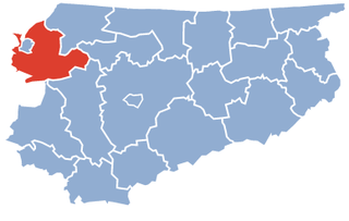
Dzierzgonka is a village in the administrative district of Gmina Markusy, within Elbląg County, Warmian-Masurian Voivodeship, in northern Poland. It lies approximately 4 kilometres (2 mi) south-east of Markusy, 7 km (4 mi) south of Elbląg, and 76 km (47 mi) west of the regional capital Olsztyn.
Jezioro is a village in the administrative district of Gmina Markusy, within Elbląg County, Warmian-Masurian Voivodeship, in northern Poland. It lies approximately 3 kilometres (2 mi) north of Markusy, 3 km (2 mi) south-west of Elbląg, and 80 km (50 mi) north-west of the regional capital Olsztyn.
Jurandowo is a village in the administrative district of Gmina Markusy, within Elbląg County, Warmian-Masurian Voivodeship, in northern Poland. It lies approximately 6 kilometres (4 mi) north-east of Markusy, 3 km (2 mi) south-east of Elbląg, and 78 km (48 mi) north-west of the regional capital Olsztyn.
Kępniewo is a village in the administrative district of Gmina Markusy, within Elbląg County, Warmian-Masurian Voivodeship, in northern Poland. It lies approximately 4 kilometres (2 mi) south of Markusy, 9 km (6 mi) south of Elbląg, and 79 km (49 mi) west of the regional capital Olsztyn.
Krzewsk is a village in the administrative district of Gmina Markusy, within Elbląg County, Warmian-Masurian Voivodeship, in northern Poland. It lies approximately 3 kilometres (2 mi) east of Markusy, 5 km (3 mi) south of Elbląg, and 77 km (48 mi) north-west of the regional capital Olsztyn.
Nowe Dolno ({{IPAc-pl|'|n|o|w|e|-|'|d|o|l|n|o); is a village in the administrative district of Gmina Markusy, within Elbląg County, Warmian-Masurian Voivodeship, in northern Poland. It lies approximately 5 kilometres (3 mi) south-east of Markusy, 8 km (5 mi) south of Elbląg, and 75 km (47 mi) west of the regional capital Olsztyn.
Nowe Kępniewo is a village in the administrative district of Gmina Markusy, within Elbląg County, Warmian-Masurian Voivodeship, in northern Poland. It lies approximately 9 kilometres (6 mi) east of Markusy, 10 km (6 mi) south-east of Elbląg, and 71 km (44 mi) north-west of the regional capital Olsztyn.
Rachowo is a village in the administrative district of Gmina Markusy, within Elbląg County, Warmian-Masurian Voivodeship, in northern Poland. It lies approximately 3 kilometres (2 mi) south of Markusy, 8 km (5 mi) south of Elbląg, and 78 km (48 mi) west of the regional capital Olsztyn.

Stalewo is a village in the administrative district of Gmina Markusy, within Elbląg County, Warmian-Masurian Voivodeship, in northern Poland. It lies approximately 8 kilometres (5 mi) west of Markusy, 12 km (7 mi) south-west of Elbląg, and 85 km (53 mi) west of the regional capital Olsztyn.
Stankowo is a village in the administrative district of Gmina Markusy, within Elbląg County, Warmian-Masurian Voivodeship, in northern Poland. It lies approximately 7 kilometres (4 mi) south-east of Markusy, 10 km (6 mi) south-east of Elbląg, and 73 km (45 mi) west of the regional capital Olsztyn.
Stare Dolno is a village in the administrative district of Gmina Markusy, within Elbląg County, Warmian-Masurian Voivodeship, in northern Poland. It lies approximately 6 kilometres (4 mi) south-east of Markusy, 11 km (7 mi) south of Elbląg, and 75 km (47 mi) west of the regional capital Olsztyn.
Topolno Małe is a village in the administrative district of Gmina Markusy, within Elbląg County, Warmian-Masurian Voivodeship, in northern Poland. It lies approximately 9 kilometres (6 mi) east of Markusy, 11 km (7 mi) south-east of Elbląg, and 71 km (44 mi) north-west of the regional capital Olsztyn.
Tynowo is a village in the administrative district of Gmina Markusy, within Elbląg County, Warmian-Masurian Voivodeship, in northern Poland. It lies approximately 3 kilometres (2 mi) north-west of Markusy, 4 km (2 mi) south-west of Elbląg, and 81 km (50 mi) north-west of the regional capital Olsztyn.
Wiśniewo is a village in the administrative district of Gmina Markusy, within Elbląg County, Warmian-Masurian Voivodeship, in northern Poland. It lies approximately 4 kilometres (2 mi) east of Markusy, 6 km (4 mi) south of Elbląg, and 76 km (47 mi) north-west of the regional capital Olsztyn.
Złotnica is a village in the administrative district of Gmina Markusy, within Elbląg County, Warmian-Masurian Voivodeship, in northern Poland. It lies approximately 5 kilometres (3 mi) west of Markusy, 8 km (5 mi) south-west of Elbląg, and 84 km (52 mi) west of the regional capital Olsztyn.
Żółwiniec is a village in the administrative district of Gmina Markusy, within Elbląg County, Warmian-Masurian Voivodeship, in northern Poland. It lies approximately 6 kilometres (4 mi) north-east of Markusy, 4 km (2 mi) east of Elbląg, and 77 km (48 mi) north-west of the regional capital Olsztyn.
Żurawiec is a village in the administrative district of Gmina Markusy, within Elbląg County, Warmian-Masurian Voivodeship, in northern Poland. It lies approximately 5 kilometres (3 mi) north of Markusy, 1 km (1 mi) south of Elbląg, and 80 km (50 mi) north-west of the regional capital Olsztyn.
Zwierzno is a village in the administrative district of Gmina Markusy, within Elbląg County, Warmian-Masurian Voivodeship, in northern Poland. It lies approximately 4 kilometres (2 mi) south-west of Markusy, 9 km (6 mi) south-west of Elbląg, and 82 km (51 mi) west of the regional capital Olsztyn.