
Route 38 is a state highway in the southern part of the U.S. state of New Jersey serving the Philadelphia metropolitan area. It extends 19.19 mi (30.88 km) from the Airport Circle, where it intersects U.S. Route 30 and US 130, in Pennsauken Township, Camden County, east to an intersection with US 206 and CR 530 in Southampton Township, Burlington County. The entire route is closely parallel to CR 537 located to the north, being only one block away at places. The route is a multilane divided highway for most of its length and passes through commercial development, residential development, and some farmland.

Route 70 is a state highway located in the U.S. state of New Jersey. It extends 59.84 mi (96.30 km) from an interchange with Route 38 in Pennsauken Township, Camden County, east to an intersection with Route 34 and Route 35 in Wall Township, Monmouth County. Route 70 cuts across the middle of the state as a two-lane highway through the Pine Barrens in Burlington and Ocean counties. A popular truck route, it provides access between Philadelphia and the surrounding Delaware Valley metropolitan area and the Jersey Shore resorts, particularly Long Beach Island by way of Route 72. It is also a congested commercial route within Philadelphia's New Jersey suburbs. The western section in Cherry Hill and Marlton is a four- to eight-lane divided highway that serves as a major suburban arterial and is locally known as Marlton Pike. The eastern section in Monmouth and Ocean counties is also a multilane divided highway that runs through suburban areas. Route 70 is officially known as the John Davison Rockefeller Memorial Highway its entire length in honor of John Davison Rockefeller.

Route 41 is a state highway in the U.S. state of New Jersey. It runs 14.08 mi (22.66 km) from the five-way intersection of Route 47, County Route 603, and CR 630, also known as Five Points, in Deptford Township, Gloucester County, north to the southern terminus of CR 611 in Maple Shade, Burlington County, just north of the Route 41's interchanges with Route 38 and Route 73. The route is a two- to four-lane suburban road that passes through several communities, including Runnemede, Haddonfield, and Cherry Hill Township. Between the intersection with Route 168 in Runnemede and Route 154 in Cherry Hill Township, Route 41 is maintained by Camden County and is also signed as County Route 573.
Route 52 is a state highway in the southern part of the U.S. state of New Jersey. The highway runs 2.74 mi (4.41 km) from 9th Street in Ocean City, Cape May County north to U.S. Route 9 in Somers Point, Atlantic County. It is composed mostly of a series of four-lane divided bridges over Great Egg Harbor Bay from Ocean City to Somers Point known as the Howard S. Stainton Memorial Causeway, also known as the Ninth Street Bridge. The remainder of the route is a surface road called MacArthur Boulevard that runs from the causeway to U.S. Route 9. This section of the route formerly included the Somers Point Circle, now a traffic light, where Route 52 intersects County Route 559 and County Route 585.

Marlton is a census-designated place (CDP) located within Evesham Township in Burlington County, in the U.S. state of New Jersey. As of the 2020 United States census, the CDP had a population of 10,594 residents, reflecting a 4.5% increase from the 10,133 enumerated at the 2010 U.S. Census, in turn a 1.2% decrease from the 10,260 counted in the 2000 census.
Evesham Township is a township in Burlington County, in the U.S. state of New Jersey. It is a suburb of Philadelphia, the nation's sixth-most populous city. As of the 2020 United States census, the township's population was 46,826, an increase of 1,288 (+2.8%) from the 2010 census count of 45,538, which in turn reflected an increase of 3,263 (+7.7%) from the 42,275 counted in the 2000 census. Colloquially, the area is referred to as Marlton, the name of a community within the township.

Route 72 is a state highway in the U.S. state of New Jersey. It runs 28.74 mi (46.25 km) from the Four Mile Circle with Route 70 in Woodland Township in Burlington County to County Route 607 in Ship Bottom on Long Beach Island in Ocean County. Route 72 travels through the Pine Barrens as a two-lane undivided road. After an interchange with the Garden State Parkway, the route becomes a four- to six-lane divided highway through built-up areas of Manhawkin and crosses the Manahawkin Bay via the Manahawkin Bay Bridge onto Long Beach Island.

Route 73 is a state highway in the southern part of the U.S. state of New Jersey. It runs 34.64 mi (55.75 km) as an outer bypass of the Camden area from an intersection with U.S. Route 322 (US 322) in Folsom, Atlantic County, north to the Tacony–Palmyra Bridge in Palmyra, Burlington County, where the road continues into Philadelphia, Pennsylvania, as Pennsylvania Route 73. South of the interchange with the Atlantic City Expressway in Winslow Township, Camden County, Route 73 is a two-lane undivided county-maintained road and is signed as County Route 561 Spur, a spur of CR 561. North of the Atlantic City Expressway, the route is maintained by the New Jersey Department of Transportation and is mostly four lanes, with the portion north of the CR 561 concurrency a divided highway. North of the US 30 interchange near Berlin, Route 73 runs through suburban areas of the Delaware Valley metropolitan area, intersecting Route 70 in Marlton, the New Jersey Turnpike and Interstate 295 (I-295) in Mount Laurel Township, Route 38 and Route 41 in Maple Shade Township, Route 90 in Cinnaminson Township, and US 130 in Pennsauken Township.

U.S. Route 130 is a U.S. Highway that is a spur route of US 30, located completely within the state of New Jersey. It is signed with north and south cardinal directions, following a general northeast–southwest diagonal path, with north corresponding to the general eastward direction and vice versa. The route runs 83.46 mi (134.32 km) from Interstate 295 (I-295) and US 40 at Deepwater in Pennsville Township, Salem County, where the road continues south as Route 49, north to US 1 in North Brunswick Township, Middlesex County, where Route 171 continues north into New Brunswick. The route briefly runs concurrent with US 30 near Camden, about one-third of the way to New Brunswick. The road runs within a close distance of I-295 south of Bordentown and a few miles from the New Jersey Turnpike for its entire length, serving as a major four- to six-lane divided local road for most of its length. US 130 passes through many towns including Penns Grove, Bridgeport, Westville, Camden, Pennsauken, Burlington, Bordentown, Hightstown, and North Brunswick.

The Atlantic City Expressway, officially numbered, but unsigned, as Route 446 and abbreviated A.C. Expressway, ACE, or ACX, and known locally as the Expressway, is a 44.19-mile (71.12 km) long toll road in the U.S. state of New Jersey, managed and operated by the South Jersey Transportation Authority (SJTA). A controlled-access highway, it serves as an extension of the freeway part of Route 42 from Turnersville southeast to Atlantic City. The Atlantic City Expressway is signed as east-west, though the mileage and exits decrease as if one is travelling north-south. It connects Philadelphia and the surrounding Delaware Valley metropolitan area with Atlantic City and other Jersey Shore resorts, and also serves other South Jersey communities, including Hammonton and Mays Landing. The expressway intersects many major roads, including Route 73 in Winslow Township, Route 54 in Hammonton, Route 50 in Hamilton Township, the Garden State Parkway in Egg Harbor Township, U.S. Route 9 (US 9) in Pleasantville, and the Atlantic City–Brigantine Connector near the eastern terminus in Atlantic City.

Route 154 is a 1.70 miles (2.74 km) long state highway in Cherry Hill Township, Camden County, New Jersey. The route begins at an intersection with County Route 561 (CR 561) in Cherry Hill, heading northward to the site of the former Ellisburg Circle, where Route 154 reaches its northern terminus at Route 41 and Route 70. The route ends concurrent with Route 41 for the short distance from the junction between the two routes. Brace Road is the local name for Route 154 for its entire length.

Interstate 676 (I-676) is an Interstate Highway that serves as a major thoroughfare through Center City Philadelphia, where it is known as the Vine Street Expressway, and Camden, New Jersey, where it is known as the northern segment of the North–South Freeway, as well as the Martin Luther King Jr. Memorial Highway in honor of civil rights leader Martin Luther King Jr. Its western terminus is at I-76 in Philadelphia near the Philadelphia Museum of Art and Fairmount Park. From there, it heads east and is then routed on surface streets near Franklin Square and Independence National Historical Park, home of the Liberty Bell, before crossing the Delaware River on the Benjamin Franklin Bridge. On the New Jersey side of the bridge, the highway heads south to its southern terminus at I-76 in Gloucester City near the Walt Whitman Bridge. Between the western terminus and downtown Camden, I-676 is concurrent with U.S. Route 30 (US 30).

The Somerville Circle is a roundabout located on the border of Bridgewater Township and Raritan, in Somerset County, New Jersey in the United States. The circle lies at the intersection of U.S. Routes 202 and 206, and New Jersey Route 28. The circle was built in the 1930s when the area was rural, but as the region became more populated the circle became notorious for being confusing for drivers and a frequent spot for traffic accidents and traffic backups. In the 1990s, a bridge was built that allowed Route 202 to bypass the circle completely. The Somerville Circle is no longer officially considered a traffic circle by the New Jersey Department of Transportation.
Roosevelt Boulevard, officially named the Theodore Roosevelt Memorial Boulevard and often referred to, chiefly by local Philadelphians, simply as "the Boulevard," is a major traffic artery through North and Northeast Philadelphia. The road begins at Interstate 76 in Fairmount Park, running as a freeway also known as the Roosevelt Boulevard Extension or the Roosevelt Expressway through North Philadelphia, then transitioning into a twelve-lane divided highway that forms the spine of Northeast Philadelphia to its end at the city line.

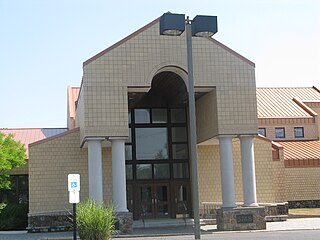
Cherokee High School is a four-year comprehensive public high school, serving students in ninth through twelfth grades as one of four high schools of the Lenape Regional High School District in Burlington County, in the U.S. state of New Jersey. The communities in the district are Evesham Township, Medford Lakes, Medford, Mount Laurel Township, Shamong Township, Southampton Township, Tabernacle Township and Woodland Township. Cherokee serves students from Evesham Township. The school, located in the Marlton section of Evesham Township, has been accredited by the Middle States Association of Colleges and Schools Commissions on Elementary and Secondary Schools since 1978 and is accredited until July 2028.
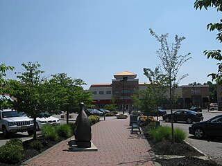
The Promenade at Sagemore is a large regional shopping mall located in the Marlton section of Evesham Township, in Burlington County, New Jersey, United States, leased by MSC. Opened in 2001, The Promenade is an open-air lifestyle center with high-end stores and a selection of casual and sit-down dining alternatives. The mall offers 1,242 parking spots and is anchored by L. L. Bean. The mall has a gross leasable area of 272,000 ft².

The Berlin Circle was a traffic circle in Berlin Township, New Jersey, United States located at the intersection of Route 73, Berlin-Cross Keys Road and Walker Avenue, and which also received traffic from nearby U.S. Route 30, and County Route 561. The New Jersey Department of Transportation (NJDOT) began replacement of the circle in August 2006. The project cost $73 million. The circle was replaced with an at-grade intersection with traffic signals. The project was completed in 2007.

Route 183 is a 2.12-mile (3.41 km) long state highway in the northern regions of New Jersey. The southern end of the route is at an interchange with Interstate 80 and U.S. Route 206 (US 206) near Netcong, while the northern end is at an interchange with US 206 in Stanhope. The route heads northward through downtown Netcong and along the shores of Lake Musconetcong and enters Sussex County, New Jersey. The route is a former alignment of US 206 bypassed in 1973.
Congregation M'kor Shalom was a Reform Jewish synagogue located at 850 Evesham Road, Cherry Hill, Camden County, New Jersey, in the United States.


