Marston Moat

Last updated
Marston Moat
Geograph 2955473 Marston Magna medieval moat.jpg
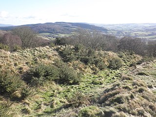
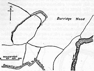
The remains of the moat
Location Trudoxhill, Somerset, England
Coordinates 51°11′35″N2°20′03″W / 51.19306°N 2.33417°W / 51.19306; -2.33417 Coordinates: 51°11′35″N2°20′03″W / 51.19306°N 2.33417°W / 51.19306; -2.33417
Official name: Marston Moat
Designated1 November 1966 [1]
Reference no.29779
Somerset UK location map.svg
Red pog.svg
Location of Marston Moat in Somerset

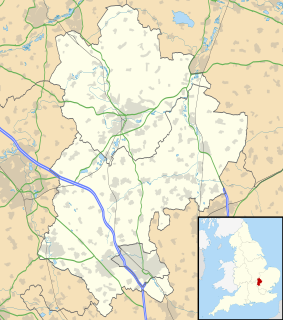
Marston Moat is the site of a fortified manor house in the parish of Trudoxhill, Somerset, England. It has been designated as a Scheduled Ancient Monument. [2] It is now on the Heritage at Risk Register due to animal burrowing. [3]

Trudoxhill village in the United Kingdom

Trudoxhill is a village and civil parish near Nunney in the Mendip district of Somerset, England.

Somerset County of England

Somerset is a county in South West England which borders Gloucestershire and Bristol to the north, Wiltshire to the east, Dorset to the south-east and Devon to the south-west. It is bounded to the north and west by the Severn Estuary and the Bristol Channel, its coastline facing southeastern Wales. Its traditional border with Gloucestershire is the River Avon. Somerset's county town is Taunton.

The 23 feet (7.0 m) wide moat which measures 108 feet (33 m) by 188 feet (57 m) has a 10 feet (3.0 m) wide and 1 foot (0.30 m) high bank on its south and east sides. [4] It is situated east of the River Frome.

River Frome, Somerset River in Somerset, United Kingdom

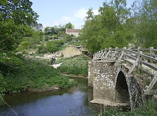
The River Frome is a river in Somerset, England. It rises near Bungalow Farm on Cannwood Lane, south-west of Witham Friary, flows north through Blatchbridge to the town of Frome, and continues in a generally northerly direction to join the Bristol Avon at Freshford, below Bradford on Avon.

The site was held by the Bigot family of Marston Bigot before 1195. There is some evidence that they fortified it without a licence to crenellate from Edward II. [5] As a result of this and an insult to the King's messenger Richard Bigot lost his titles to land, [6] which were assigned to William de Meriet and John de Meriet.

Marston Bigot village near Nunney in Somerset, England

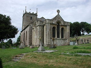
Marston Bigot is a small village near Nunney and 3 miles (5 km) south of Frome in Somerset, England.

In medieval England, Wales and the Channel Islands a licence to crenellate granted the holder permission to fortify his property. Such licences were granted by the king, and by the rulers of the counties palatine within their jurisdictions, i.e. by the Bishops of Durham, the Earls of Chester, and after 1351 by the Dukes of Lancaster.

It was leased as a farmhouse by the reign of Edward IV however none of the stone remains, [2] and no full excavation has ever been carried out. [7]

Related Research Articles

Castle Cary English town

Castle Cary is a small market town and civil parish in south Somerset, England, 5 miles (8 km) north west of Wincanton and 8 miles (12.9 km) south of Shepton Mallet, at the foot of Lodge Hill and on the River Cary, a tributary of the Parrett.

Kirby Muxloe Castle unfinished 15th century fortified manor house in Kirby Muxloe, Leicestershire, England

Kirby Muxloe Castle, also known historically as Kirby Castle, is a ruined, fortified manor house in Kirby Muxloe, Leicestershire, England. William, Lord Hastings, began work on the castle in 1480, founding it on the site of a pre-existing manor house. William was a favourite of King Edward IV and had prospered considerably during the Wars of the Roses. Work continued quickly until 1483, when William was executed during Richard, Duke of Gloucester's, seizure of the throne. His widow briefly continued the project after his death but efforts then ceased, with the castle remaining largely incomplete. Parts of the castle were inhabited for a period, before falling into ruin during the course of the 17th century. In 1912, the Commissioners of Work took over management of the site, repairing the brickwork and carrying out an archaeological survey. In the 21st century, the castle is controlled by English Heritage and open to visitors.

Codnor Castle ruins of a castle in Derbyshire, UK

Codnor Castle is a ruined 13th-century castle in Derbyshire, England. The land around Codnor came under the jurisdiction of William Peverel after the Norman conquest. Although registered as a Scheduled Ancient Monument and Grade II Listed Building the site is officially, as at 2016, a Building at Risk.

Nunney Castle medieval castle in Somerset, England

Nunney Castle is a medieval castle at Nunney in the English county of Somerset. Built in the late 14th century by Sir John Delamare on the profits of his involvement in the Hundred Years War, the moated castle's architectural style, possibly influenced by the design of French castles, has provoked considerable academic debate. Remodelled during the late 16th century, Nunney Castle was damaged during the English Civil War and is now ruined.

Christchurch Castle castle

Christchurch Castle is located in Christchurch, Dorset, England. The earliest stonework has been dated to 1160. It is a Norman motte and bailey castle. The castle's site is inside the old Saxon burh dominating the River Avon's lowest crossing.

Norham Castle partly ruined castle in Northumberland, England

Norham Castle is a castle in Northumberland, England, overlooking the River Tweed, on the border between England and Scotland. It is a Grade I listed building and a Scheduled Ancient Monument. The castle saw much action during the wars between England and Scotland.

Hartshill Castle

Hartshill Castle is a ruined castle in the village of Hartshill on the outskirts of Nuneaton, Warwickshire. It is on Historic England's Heritage at Risk Register due to erosion, structural problems and vandalism.

Taunton Castle fortified castle in Somerset, England

Taunton Castle is a castle built to defend the town of Taunton, Somerset, England. It has origins in the Anglo Saxon period and was later the site of a priory. The Normans then built a stone structured castle, which belonged to the Bishops of Winchester. The current heavily reconstructed buildings are the inner ward, which now houses the Museum of Somerset and the Somerset Military Museum. The building was designated a grade I listed building in 1952.

Castles in South Yorkshire Wikimedia list article

While there are many castles in South Yorkshire, the majority are manor houses and motte-and-bailey which were commonly found in England after the Norman Conquest.

Bury Castle, Selworthy hillfort in Somerset

Bury Castle is an Iron Age hill fort near Selworthy, Somerset, England. It has been scheduled as an ancient monument.

Oldberry Castle hillfort in Somerset

Oldberry Castle is an Iron Age hill fort north west of Dulverton, Somerset, England. It lies approximately 0.5 miles (0.80 km) north-west from Dulverton, close to the Devon border. It has been designated as a Scheduled Ancient Monument.

Enmore Castle

Enmore Castle is a historic building in the village of Enmore, Somerset, England. It is a Grade II listed building.

Bletsoe Castle

Bletsoe Castle was a late medieval fortified manor house in the village of Bletsoe, Bedfordshire.

Scheduled monuments in Mendip Wikimedia list article

Mendip is a local government district of Somerset in England. The Mendip district covers a largely rural area of 285 square miles (738 km2) ranging from the Mendip Hills through on to the Somerset Levels. It has a population of approximately 110,000. The administrative centre of the district is Shepton Mallet but the largest town is Frome.

Scheduled monuments in Somerset

There are over 670 scheduled monuments in the ceremonial county of Somerset in South West England. The county consists of a non-metropolitan county, administered by Somerset County Council, which is divided into five districts, and two unitary authorities. The districts of Somerset are West Somerset, South Somerset, Taunton Deane, Mendip and Sedgemoor. The two administratively independent unitary authorities, which were established on 1 April 1996 following the breakup of the county of Avon, are North Somerset and Bath and North East Somerset. These unitary authorities include areas that were once part of Somerset before the creation of Avon in 1974.

References

  1. Historic England. "Marston Moat (1016302)". National Heritage List for England . Retrieved 25 August 2011.
  2. 1 2 "Marston Moat". Somerset Historic Environment Record. South West Heritage Trust. Retrieved 25 August 2011.
  3. "Marston Moat". Heritage at Risk. English Heritage . Retrieved 25 August 2011.
  4. "Marston Moat". Fortified England. Retrieved 25 August 2011.
  5. "Marston Moat". Castle Facts. Archived from the original on 24 March 2012. Retrieved 25 August 2011.
  6. Dunning, Robert (1995). Somerset Castles. Tiverton: Somerset Books. p. 60. ISBN   0-86183-278-7.
  7. Historic England. "Marston Moat (202870)". PastScape. Retrieved 25 August 2011.