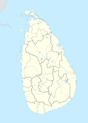
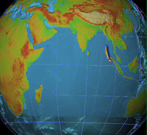
On 26 December 2004, at 07:58:53 local time (UTC+7), a major earthquake with a magnitude of 9.1–9.3 struck with an epicentre off the west coast of northern Sumatra, Indonesia. The undersea megathrust earthquake, known by the scientific community as the Sumatra–Andaman earthquake, was caused by a rupture along the fault between the Burma Plate and the Indian Plate, and reached a Mercalli intensity up to IX in some areas.
The 2004 Indian Ocean earthquake and tsunami occurred on Sunday, December 26, 2004. The earthquake itself, with a moment magnitude of around 9.1-9.3, devastated Aceh Province, Indonesia, while the tsunami affected countries all around the Indian Ocean. Nations which were affected are listed below in alphabetical order. For detailed information about each country affected by the earthquake and tsunami, see their individual articles. Countries with a smaller number of casualties, as well as those that lost citizens who were travelling abroad, are listed further on in the article.

The humanitarian response to the 2004 Indian Ocean earthquake of a magnitude of 9.1 was prompted by one of the worst natural disasters of modern times. On 26 December 2004, the earthquake, which struck off the northwest coast of the Indonesian island of Sumatra, generated a tsunami that wreaked havoc along much of the rim of the Indian Ocean. Particularly hard-hit were the countries of Indonesia, India, Sri Lanka and Thailand. About 230,000 people were killed, tens of thousands more were injured, and 1.7 million became homeless and displaced.

The 2004 Sri Lanka tsunami train wreck is the largest single rail disaster in world history by death toll, with 1,700 fatalities or more. It occurred when a crowded passenger train was destroyed on a coastal railway in Sri Lanka by a tsunami that followed the 2004 Indian Ocean earthquake. The tsunami subsequently caused over 30,000 reported deaths and billions of rupees in property damage in the coastal areas of Sri Lanka.

Sri Lanka was one of the countries struck by the tsunami resulting from the Indian Ocean earthquake on December 26, 2004. On January 3, 2005, Sri Lankan authorities reported 30,000+ confirmed deaths.

The 2005 Nias–Simeulue earthquake occurred on 28 March off the west coast of northern Sumatra, Indonesia. At least 915 people were killed, mostly on the island of Nias. The event caused panic in the region, which had already been devastated by the massive tsunami triggered by the 2004 Indian Ocean earthquake, but this earthquake generated a relatively small tsunami that caused limited damage. It was the third most powerful earthquake since 1965 in Indonesia.

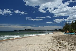
Hikkaduwa is a coastal town in south-west of Sri Lanka. It's a world famous beach holiday destination, well known for its scenic beaches, coral reef sanctuary, surfing and nightlife.
Arugam Bay, known locally as "Arugam Kudah", is situated on the Indian Ocean in the dry zone of Sri Lanka's southeast coast, and a historic settlement of the ancient Batticaloa Territory. The bay is located 117 kilometres (73 mi) south of Batticaloa, 320 kilometres (200 mi) due east of Colombo, and approximately 4 kilometres (2.5 mi) south of the market town of Pottuvil. The main settlement in the area, known locally as Ullae, is predominantly Muslim, however there is a significant Sri Lankan Tamil and Sinhala population to the south of the village, as well as a number of international expatriates, largely from Europe and Australia. While traditionally fishing has dominated the local economy, tourism has grown rapidly in the area in recent years. Arugam Kudah's literal Tamil translation is "Bay of Cynodon dactylon". Tourism in Arugam Bay is dominated by surf tourism, thanks to several quality breaks in the area, however tourists are also attracted by the local beaches, lagoons, historic temples and the nearby Kumana National Park. Much of the bay and it's neighbouring town of Pottuvil was destroyed in the 2004 Tsunami.
The 2004 Indian Ocean earthquake and tsunami, by far the worst disaster in the number of lives lost during peacetime for Finland, killed 179 Finns in Thailand and Sri Lanka, and caused widespread public debate and investigations into the actions of Finnish officials who were claimed to have failed to help their citizens in the affected areas.

Library damage resulting from the 2004 Indian Ocean earthquake has been reported in six Asian countries. On December 26, the massive 2004 Indian Ocean earthquake struck off the northwest coast of the Indonesian island of Sumatra. The resulting tsunamis killed more than 180,000 people. In addition to the loss of human lives, cultural institutions were destroyed in several Asian nations. Libraries on the Eastern coast of Sri Lanka and the northern province of Aceh on Sumatra were most severely affected by the disaster.
The 2004–05 international cricket season was from September 2004 to April 2005. There were no major tournaments played during this time. The season included the first-ever Twenty20 International match.

Beruwala is a large town in Kalutara District, Western Province, Sri Lanka, governed by an Urban Council. The town covers a total area of approximately 15 km2 (5.8 sq mi) and is located on the south-west coast of Sri Lanka, 60 km (37 mi) south of Colombo.
The Baby 81 incident was a widely reported parental identity dispute about a baby who survived the 2004 Indian Ocean earthquake and became an emblem of the effect of the disaster on the families involved. Many of the details in initial reports of the events were subsequently disputed.

In a 2005 BBC World Service Poll, 30% of Sri Lankans view American influence positively, with 20% expressing a negative view. According to the 2012 U.S. Global Leadership Report, 14% of Sri Lankans approve of U.S. leadership, with 37% disapproving and 49% uncertain.
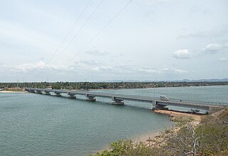
Kinniya is a town located east coast in Trincomalee District of the Eastern Province of Sri Lanka. It is located about 20 km (12 mi) from the city of Trincomalee and 240 km (150 mi) from Colombo. Located in Sri Lanka's dry zone, the Kinniya region often experiences hot and dry weather with very little precipitation. Kinniya Bridge is the Sri Lanka's longest bridge situated in kinniya, which attracts many tourists in the town. Being located on the Trincomalee Harbour, Kinniya was badly devastated by the massive tsunami that resulted from the 2004 Indian Ocean earthquake.
Although National Oceanic and Atmospheric Administration (NOAA) scientists at the Pacific Tsunami Warning Center (PTWC) in Hawaii eventually issued warnings of a possible tsunami from the large earthquake off Sumatra, the waves outran notification systems at jet speeds of 500 mph (804 km/h), catching hundreds of thousands of people unaware. The following is a timeline of the 2004 Indian Ocean earthquake. All times are Coordinated Universal Time (UTC), on Sunday, 26 December 2004.
Sahana Software Foundation is a Los Angeles, California-based non-profit organization founded to promote free and open-source software (FOSS) for disaster and emergency management. The foundation's mission statement is to "save lives by providing information management solutions that enable organizations and communities to better prepare for and respond to disasters." The foundation's Sahana family of software products includes Eden, designed for humanitarian needs management; Vesuvius, focused on the disaster preparedness needs of the medical community; and legacy earlier versions of Sahana software including Krakatoa, descended from the original Sahana code base developed following the 2004 Indian Ocean tsunami. The word "Sahana" means "relief" in Sinhalese, one of two national languages of Sri Lanka.
Peraliya is a small coastal village situated in Hikkaduwa, Galle District in the Southern Province of Sri Lanka.
2018 Northern Province floods in Sri Lanka caused from heavy rainfall in five main districts of Northern Province including Jaffna, Mannar, Mullaithivu, Vavuniya and Kilinochchi beginning around 22 December 2018 on a full moon Poya Day. As of 22 December according to Disaster Management Centre (DMC), more than 45000 people from mere nearly 14000 families were reported to have been affected. According to the reports two casualties have been reported so far due to the flash floods. The floods receded in all 5 main districts of the Northern Province with significant damages to agricultural crops.